|
The small parking area for the Cataract Falls trail was already full
when we arrived, so we had to continue on up the road until we found a suitably
large pullout. There are several pullouts, so you'll be able to find one --
but it means more uphill after the end of your hike.
Cammy, Jason, Annemarie, Dave, and I started off on the trail around
noon. The trail starts near the west end of Alpine Lake. The forecast called
for cold and a slight chance of showers, but it was quite a nice day. We did get
cold whenever we stopped, and it was partly cloudy but mostly sunny and rain never threatened.
The trail parallels the edge of the lake, which is shallow at this point
and contains several submerged dead standing trees. They are tall and smooth,
looking like large telephone poles waiting patiently in the water. The lake was
formed by a dam (completed in 1919), so that probably explains their existence.
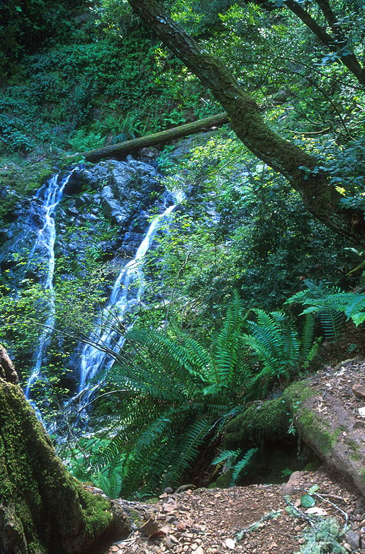
Falls
The Cataract Trail begins climbing almost immediately, and quite steeply.
Much of the climbing consists of trudging up steep wooden staircases. We crossed a
bridge and then stopped
briefly at a viewing area in front of a view of some falls, then continued on up past
another viewing area with better views of a different set of falls. This is one of the
better falls, but unfortunately I didn't get a chance to stop and take a picture
of them. If you do this hike, don't stop at the first area (even though you'll
probably want a break from the climb). Keep climbing just a little further and
stop at the next area, which will be obvious.
After about half a mile of climbing we reached a trail intersection.
The Helen Markt Trail goes off to the left. We stopped here briefly to view a small
set of falls dropping into a pool. Then we continued on up the Cataract Trail.
We'd return on the Helen Markt Trail later.
The trail was quite crowded. We came across people often on the Cataract
Trail, including a few rather large groups of hikers. However, once we got off
the Cataract Trail, the number of hikers we encountered dwindled.
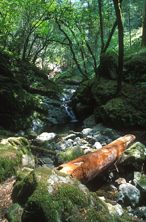
More falls
I'm not really sure what are *the* Cataract Falls. There are several falls.
We stopped for a break at some particularly nice falls shortly before reaching
the next trail intersection. We'd return to this intersection later, but for now
we continued straight on the trail to the picnic grounds at Laurel Dell.
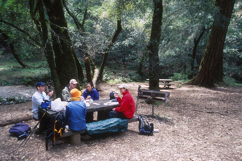
Lunch at Laurel Dell
After about 1000 feet of climbing, we reached Laurel Dell. There are
about a half dozen picnic tables here, along with an outhouse, garbage cans, and
barbecue grills. It has the appearance of being next to a parking lot, but in fact
there are no roads nearby. We parked ourselves on one of the picnic tables and settled down for lunch.
It grew quite cold as we sat there, but we started to warm up once we got moving again.
We retraced our steps back on the Cataract Trail back to the intersection and turned
right. We would encounter many unmarked trail intersections, but our motto for the next
few miles was: stay to the left. We were now basically doing a counter-clockwise loop
involving the High Marsh, Willow, Kent, and Helen Markt Trails.
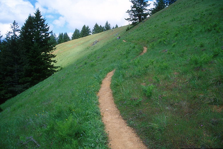
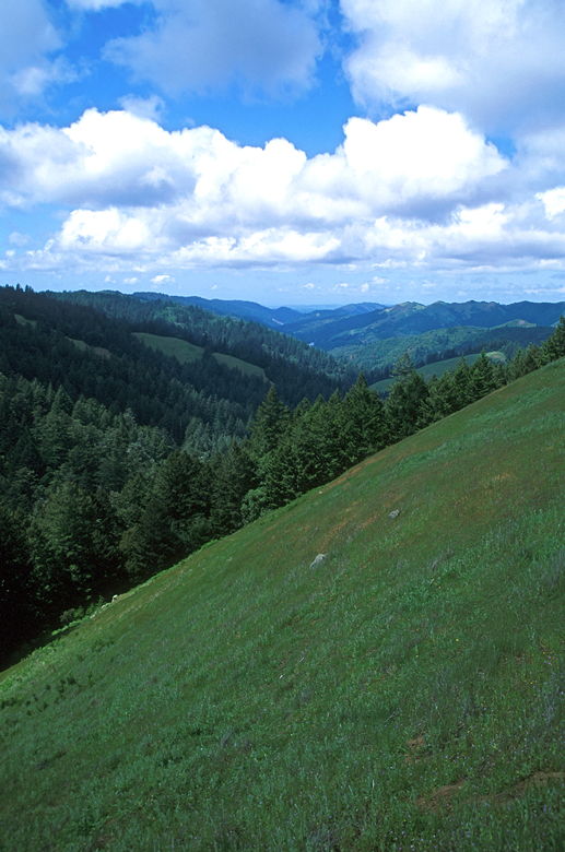
Trail leading into the green hills
We didn't have to hike long on the High Marsh Trail before we encountered
some wonderful views of the surrounding mountains and forests from a vantage point
of steep green hills. If I had to do the hike again, I might have picked this for
a lunch spot instead of Laurel Dell. We would have had great views sitting in
the sun, although it would have been very windy.
Looking north from the green hills
We passed another trail intersection (this goes back to Laurel Dell), then
re-entered the forest. After going a total of maybe 1/2 a mile from
Laurel Dell, we reached another trail intersection -- this one with a sign pointing
to Laurel Dell 75 yards away to our right. We could have saved ourselves a lot of
walking, but then we would have missed the great views from the grassy hillsides.
We continued along the relatively flat trail (with a few ups and downs).
We walked past manzanita bushes. For one brief moment we had some views of San Pablo Bay
to the east. But then the trail begins descending steeply and the views disappear.
While on the Willow Trail, we crossed what my map denotes East Fork, and then came to another unsigned
trail intersection. I stuck to my guns and went left after consulting my compass to get
a reality check. The trail follows the creek for a short time before veering off to the
right of the creek. It descends steeply through open forest and eventually comes to a
signed intersection.
We turned left onto the Kent Trail for our final descent to the lake. As we
descended, we passed through some of the nicer redwoods along the trail. Shortly the
redwoods give way to other types of vegetation, however. After a quick descent we
reached a trail intersection with a signpost saying we had 1.8 miles to go to reach
the Cataract Trail. We turned left onto the Helen Markt Trail and very shortly
stopped at the edge of Alpine Lake
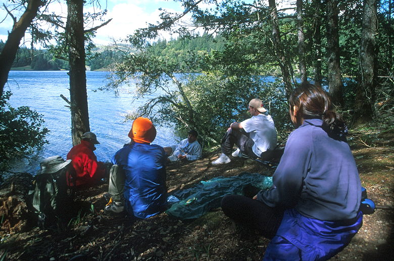
Resting next to Alpine Lake
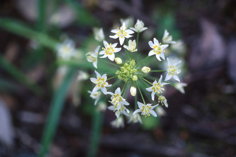
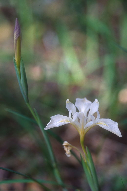
Flowers
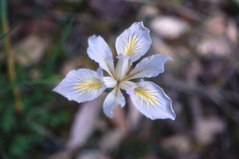
Iris
We'd been hiking almost non-stop for several miles, so we decided to take
a break by the water's edge. I don't think boats are allowed on the lake -- at least
we didn't see any, and swimming is definitely not allowed (it's a source of drinking
water). It's a nice peaceful place to stop before the final push to the finish. There
are lots of irises growing in the area -- some white, some yellow, some purple.
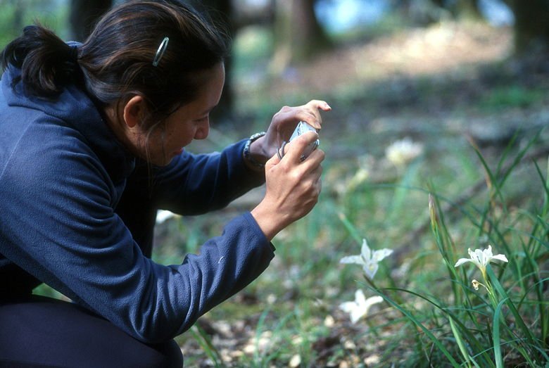
Cammy with her digital camera
Iris
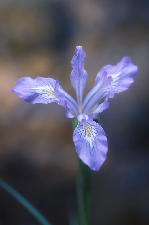
Another iris
We'd done about 1500 feet of climbing by this point. After our break we
continued along the Helen Markt Trail, which goes up and down (and up and down).
We crossed a bridge and then immediately started a steep climb. There's a surprising
amount of climbing in this part of the hike, accounting for about 600 feet of climbing!
It does, however, pass through some nice redwood forest, so that's at least some
consolation. There aren't really any views of the lake, though.
Eventually (after much complaining about the unexpected uphills) we
rejoined the Cataract Trail. We turned right for our final descent. We passed the
nice viewing area of the falls, but the late afternoon sun didn't provide good
lighting in the forested valley, so I didn't stop to take pictures.
After finishing the hike, we faced the surprisingly long uphill climb to
our cars. But after a nice hike with waterfalls, redwood forests, and great views
from green hills, we left satisfied. Still, it would be nice to return in the winter sometime
to view the falls at peak flow after a heavy rain.
| 

