|
It was a perfect 75 degrees with almost no wind. A perfect day to hike the sand dunes.
There were a handful of other cars parked nearby as we got ready for our hike. Most people
got out, walked to the nearest dune a few hundred feet away, then turned around. Our goal
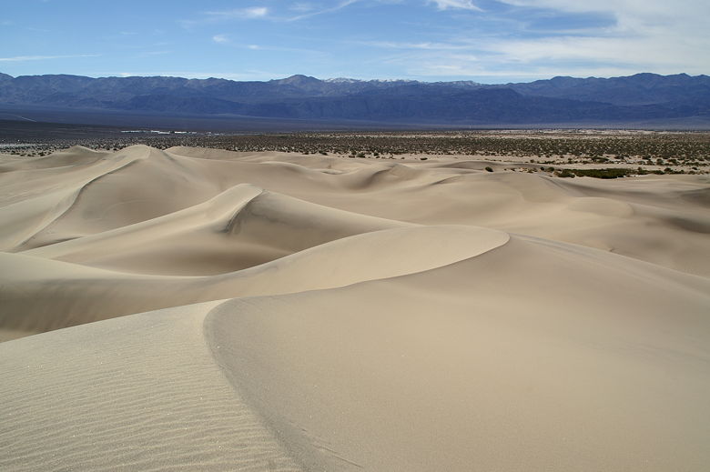
was to hike all the way to the top of the largest dune, which is clearly visible from the road.
Well, I should mention that the sand dunes constantly change due to the wind, so maybe by the time
you read this it'll be different. I get the impression the dunes don't change that quickly, though.
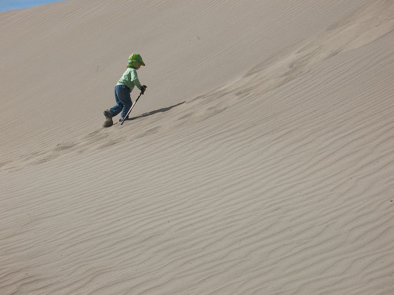
Nathan hiking up a steep dune
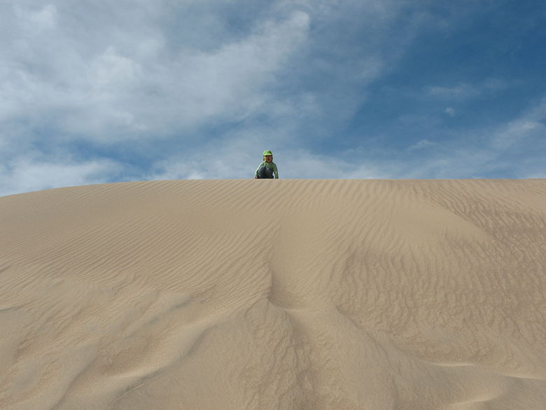
Nathan at the top of a dune
The first thing I noticed was tracks. The sand is mostly unbroken, so it's quite apparent when there
are tracks. Human footprints are the biggest tracks, of course, but there are others. I don't know
what made some of them. Maybe birds, maybe coyotes.
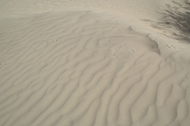
Animal tracks in the sand
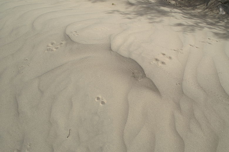
More animal tracks
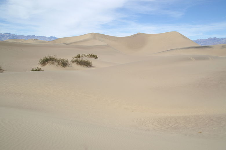
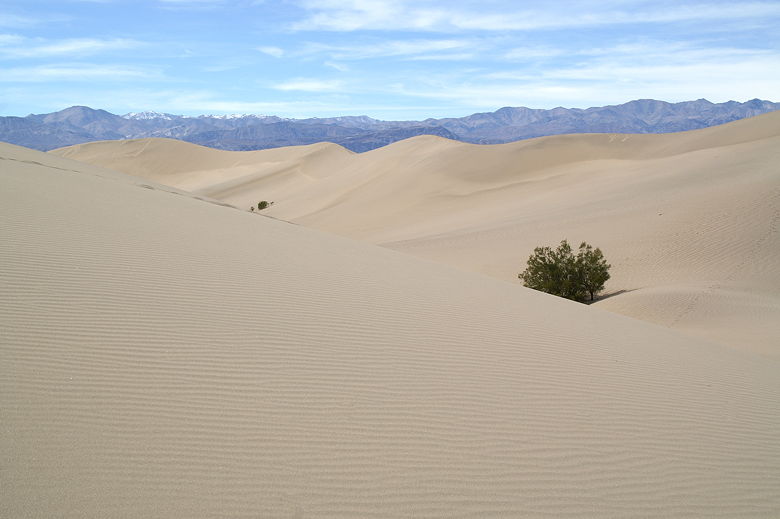
Other than sand, the only thing you'll see is some scattered bushes and some dried mud cakes. There's
no trail at all, really. Just make your own trail toward the tallest dune. There's no way to get lost;
the dunes aren't high enough to disorient you. Besides, you can always see the mountains in the
distance.
Our goal, the highest sand dunes
Our 4-year-old loved hiking in the dunes, probably because he was faster than us going uphill. Going
north toward the highest dunes, the dunes were steeper on the southern side and less steep on the northern
sides. This meant that going there required going up a few steep climbs. This is fine if you weigh less than
40 pounds. But I, carrying our two year old, sank like a stone with every step I took. I think I probably had
to take 3 times as many steps as Nathan to make it up to the top of each climb. The other nice thing about taking
kids on this hike is that you don't have to worry about them getting lost or hurt. There's nice soft sand
everywhere.
Panamint Range rising over sand dunes
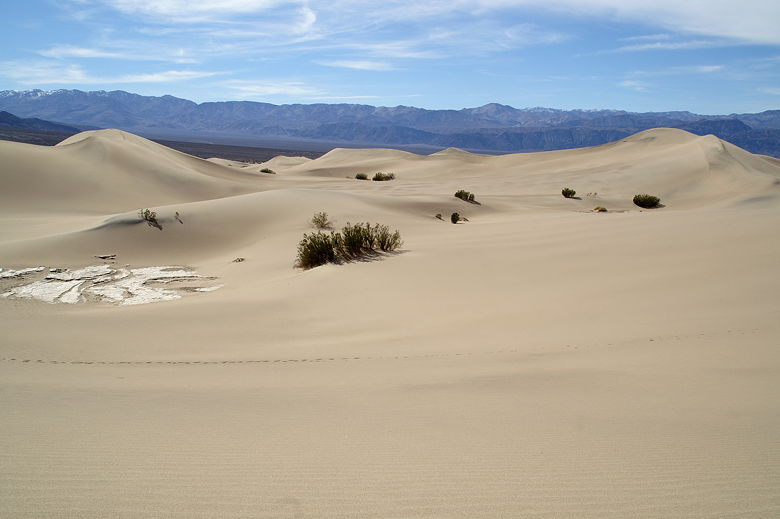
Sand dunes and dried mud
The bad thing about the hike is that there's no shade at all. To make matters worse, I hadn't packed as
much water as I usually do. (Don't get me started about how hard it is to stuff the hydration pack into
the child carrier I have.)
As we got closer to the highest dune, we noticed that we pretty much had the place to ourselves. Everyone
else had left. The only sounds we heard were the cars on the nearby highway and the jet airplanes flying
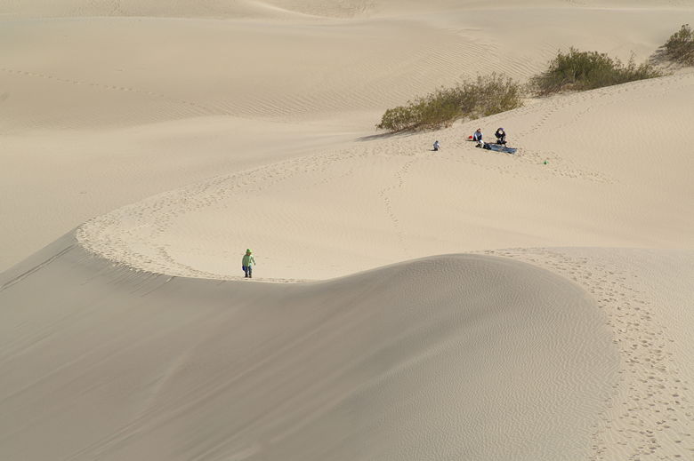
overhead (there's an Air Force base nearby). Eventually we reached a nice spot to have lunch just below the
tallest dunes. I wouldn't have thought that I'd ever have a picnic in the middle of a sand dune, but it was actually
fine, even without any shade. Just be sure to bring your hat and sunscreen. And the occasional breeze didn't
hurt, either.
Panamint Range over sand dunes
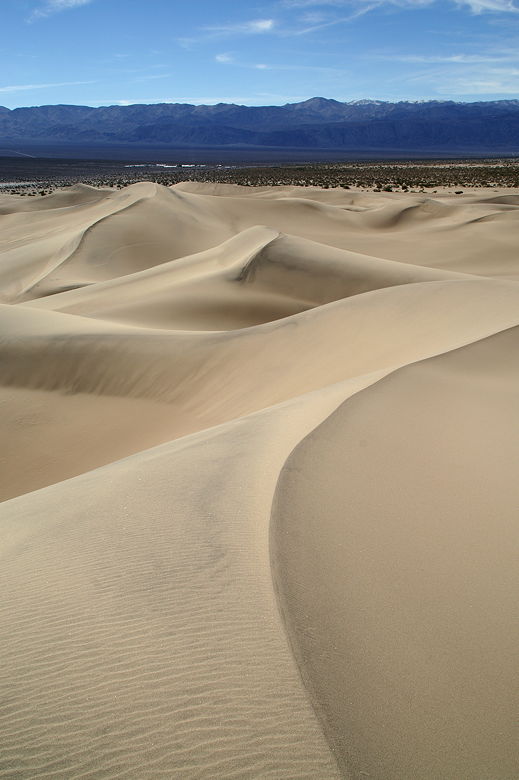
Panamint Range over sand dunes
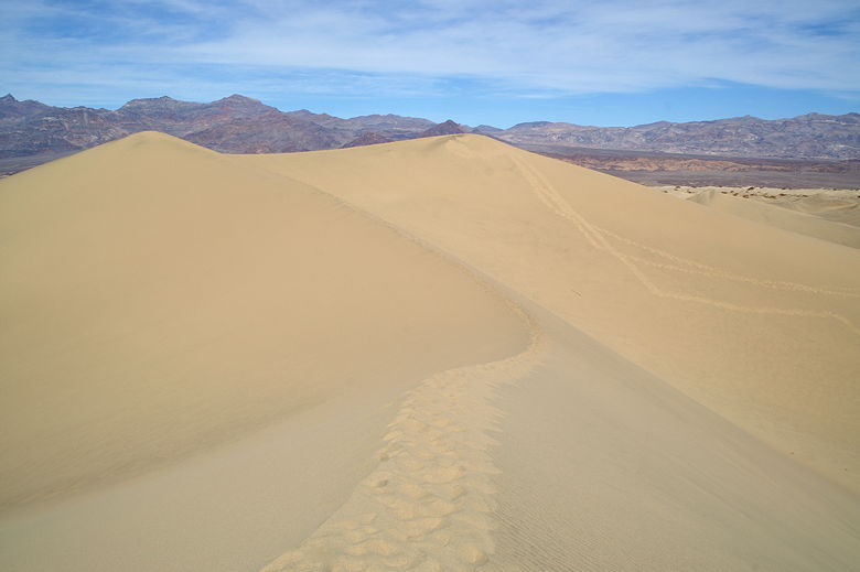
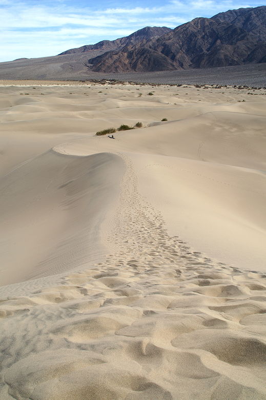
Tracks leading up to the two highest peaks
After lunch, Nathan and I climbed up a bit more. We decided not to go all the way to the tallest dune. There
were still 2 peaks that were slightly higher than us, but I figured that was good enough. I was tired of hiking
in the sand. The view from where we were was good enough.
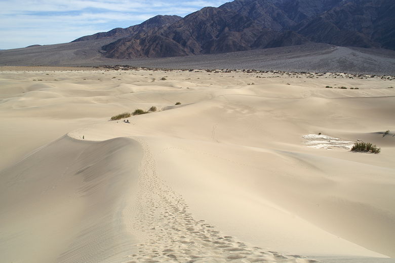
Looking back from the third highest peak
Nathan making the trek up
After enjoying the views, we started back. It was much easier heading back because the uphill portions were not
as steep. We could also follow our own tracks back so we didn't have to think about where we were going as
much. It's also a lot of fun walking down a steep sand dune. Well, except for the fact that our shoes sank
into the sand and became full of sand. Jean had to stop a couple times to empty out her shoes, and when Nathan
had trouble putting his shoe back on we discovered it was because it was full of sand.
Tracks leading up to the third highest peak
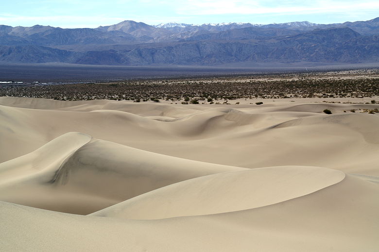
Panamint Range over sand dunes
| 

