|
The forecast for the Lake Louise area was for afternoon thunderstorms. But as we drove north
to the trailhead, the weather improved markedly. By the time we reached the large parking
lot in front near the Num-Ti-Jah Lodge, it was mostly sunny. Clouds still hovered over the mountains
to the east and south, but above us was blue sky.
If you're doing this hike, be sure to take the Num-Ti-Jah turnoff and not the Bow Lake turnoff.
Also (and I didn't realize this at the time), don't park in the main parking lot before the lodge.
Instead, drive through the parking lot, past the lodge and park in the small trailhead parking
lot on the left. We didn't know that, however, and parked in the main lot. Then we walked past
the lodge. Then we made the mistake of taking one of the shoreline trails. I saw the trailhead
sign to our right, but I figured this shoreline trail would join up with the main trail. I was
wrong.
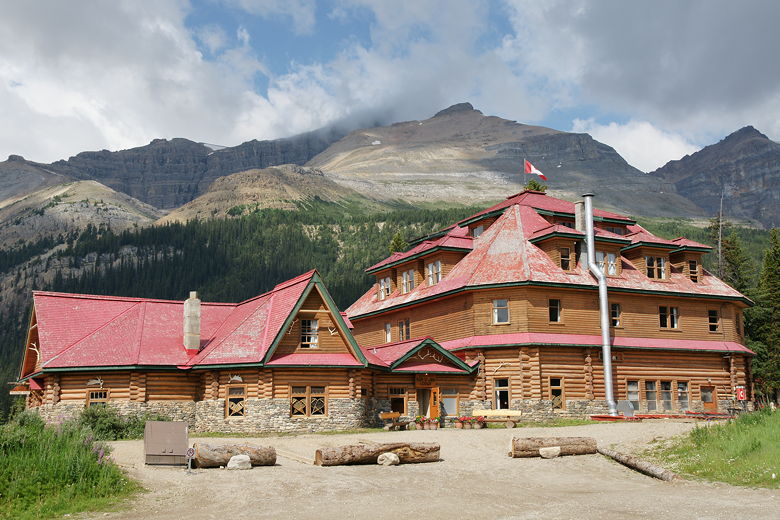
Num-Ti-Jah Lodge
We spent a few minutes trying to find a good route across the water between us and the main trail.
While we could make it, our kids would not be happy. Eventually we decided to just backtrack
to the road and go to the real trailhead. It then registered that the people who we'd seen on the
trail a few
minutes earlier had made the exact same mistake. Maybe they saw our young children and didn't
think we were doing the Bow Glacier Falls trail; otherwise, maybe they would have told us we were
going the wrong way.
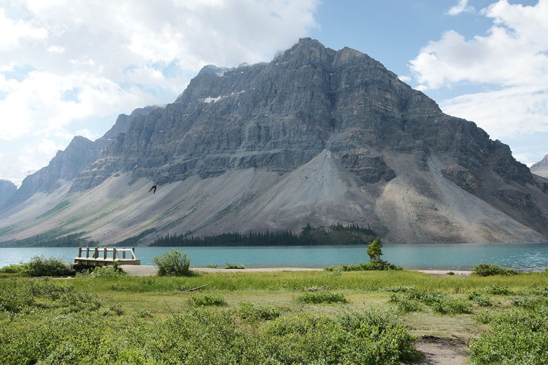
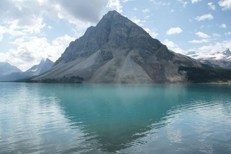
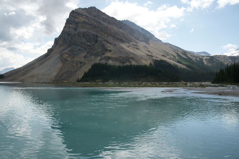
Mountain above Bow Lake
Bow Lake
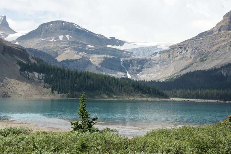
Bow Glacier and falls behind Bow lake
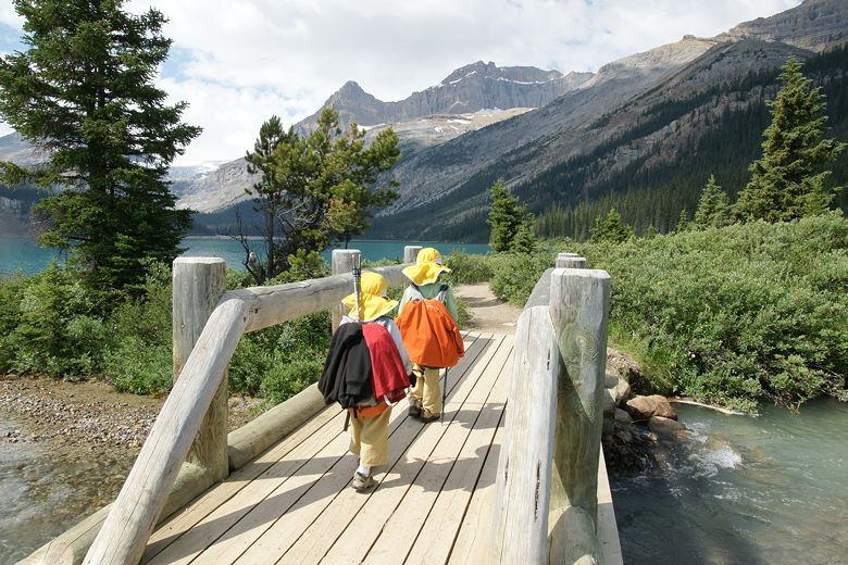
Crossing one of the bridges on the shore trail
The trail basically hugs the northern shore of Bow Lake. The lake is a beautiful greenish
blue, similar to the color of Moraine Lake. The trail side is mostly forested, but the opposite
shore has mostly bare steeply sloped mountains rising from the shore. Since this first part of
the hike hugs the shoreline, it is almost pancake flat. While on this part of the trail, I saw
a photographer with the biggest lens I've ever seen in person. I asked him if it was like 1000mm
or something. He said it was actually only a 500mm with a 1.4x teleconverter. Whatever it
was, it was huge. It makes my 500mm mirror lens look like a toy (albeit a very useful toy).
We struck up a conversation and he showed off some 5x7 prints of some of the wildlife he'd
seen, including the cute little pika - about the size of a small chipmunk but with cute little
mouse ears. He also had some nice shots of birds, bears, and other creatures. Sometimes I
wish I had the time, patience, and lenses to shoot wildlife like that, but that's just not my
thing right now. I'm opportunistic -- if I see wildlife near the trail, I'll do my best to
capture them on film, but I won't otherwise go out of my way to find them.
Bow Lake
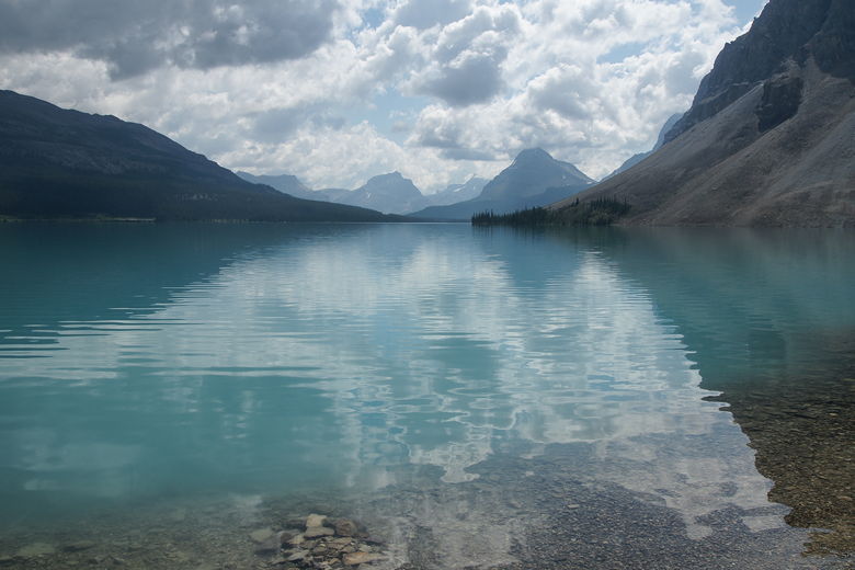
The mystical colors of Bow Lake
Bow Lake
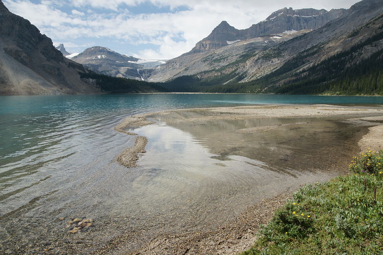
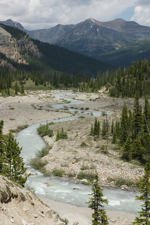
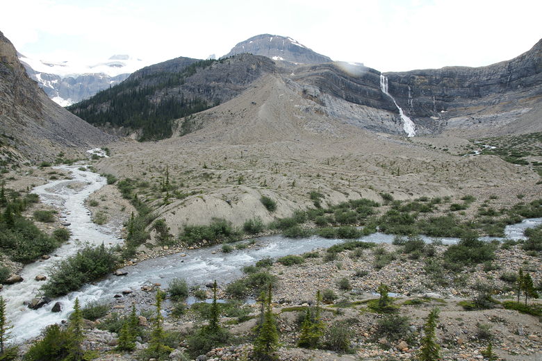
We continued along the lake shore until we finally exited the forest and came to the place
where the inlet creek diverges into several small streams which meander through a gravel area
and enters the lake. We found a large rock
and stopped here for a snack, about 1.2 miles into the hike. After our break we continued up
the trail, which is a bit hard to follow here. We had to cross over the water several times.
This wouldn't be so bad without the kids, but with the kids it was a little challenging.
Still, we managed to make it through this section without any major problems.
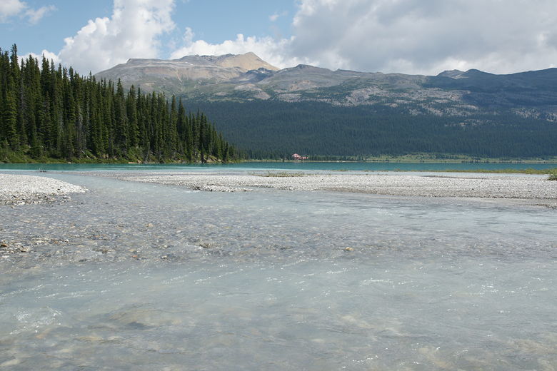
Gravel bars at end of lake; Num-Ti-Jah lodge is visible in the distance
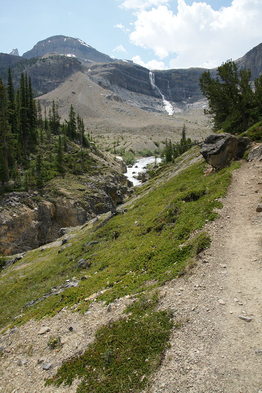
The trail then goes up and over a small ridge, across a foot bridge over a small stream, and
then across a large, wide, open gravel plain. The falls are clearly visible above the trees
in the distance, but the glacier is now hidden from view by the lip of the mountain above the
falls. The creek rushes by on the left. As we went further along, we could see the stairs
at the end of the plain -- stairs we would need to climb to reach the falls.
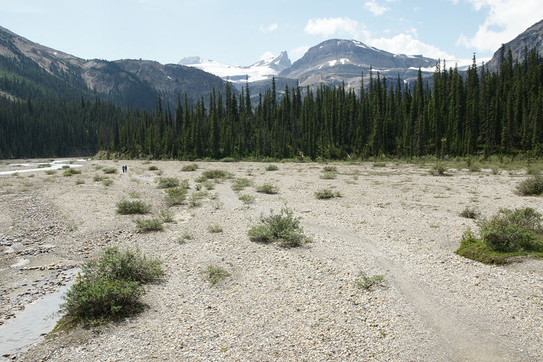
After the inlet streams come a flat gravel section
As we got close to the stairs, we encountered some hikers coming in the opposite direction.
They said that after the stairs it's about 45-50 minutes to the falls. By this time we were
getting hungry, so we decided to stop at the bottom of the stairs and have lunch. We set up
the tarp next to the creek and ate. The water rushes quite rapidly here. Every time I turned
my head I thought I heard a jet plane going by, but it was just the water making a racket.
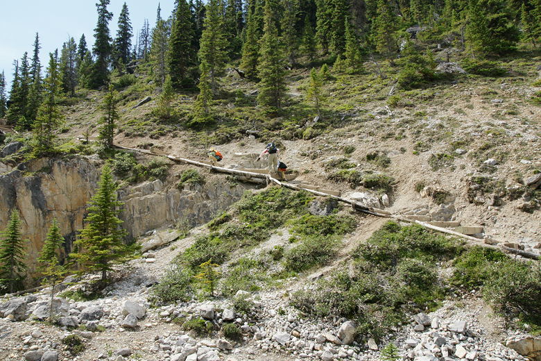
After lunch, we headed up the stairs. The wooden steps are placed unevenly up the hillside.
I counted 64 steps in all, though it's entirely possible I may have missed one or two. Before
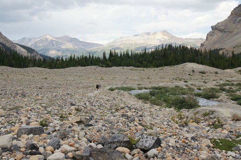
the top there's a trail leading off to the left toward Bow Hut. Don't just skip past it; take a
few steps onto this trail so that you can see the water rushing through a narrow gorge below.
A large boulder here straddles the top of the gorge, suspended 30-40 feet above the frantic
water below. It took me some time before I realized that the Bow Hut trail actually continues
up and over that boulder. Yikes. Thankfully, we weren't going that way. It actually looks perfectly
safe from above; looking at it from below makes it look more dangerous.
Heading up the wooden steps
Looking back at creek from the steps
Looking back at creek from the steps
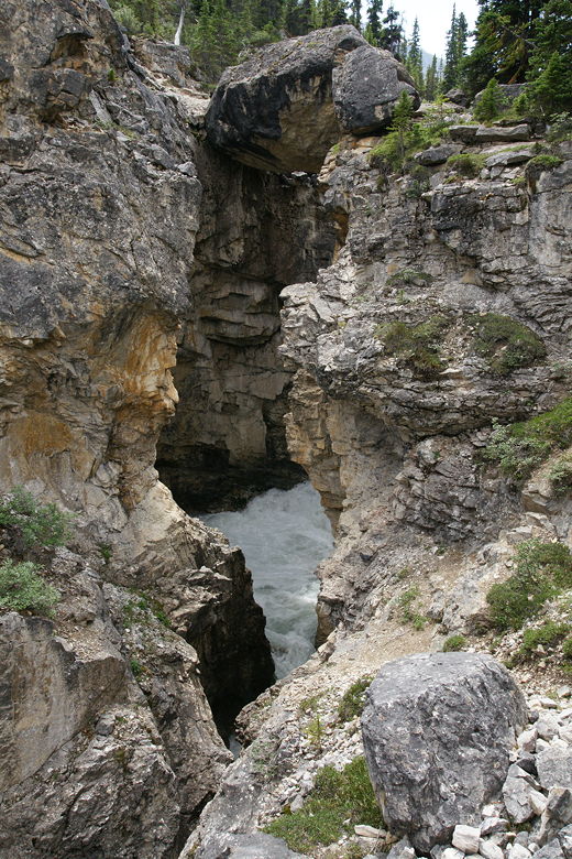
Boulder perched above gorge
Gorge next to stair section
Bow Hut trail over boulder
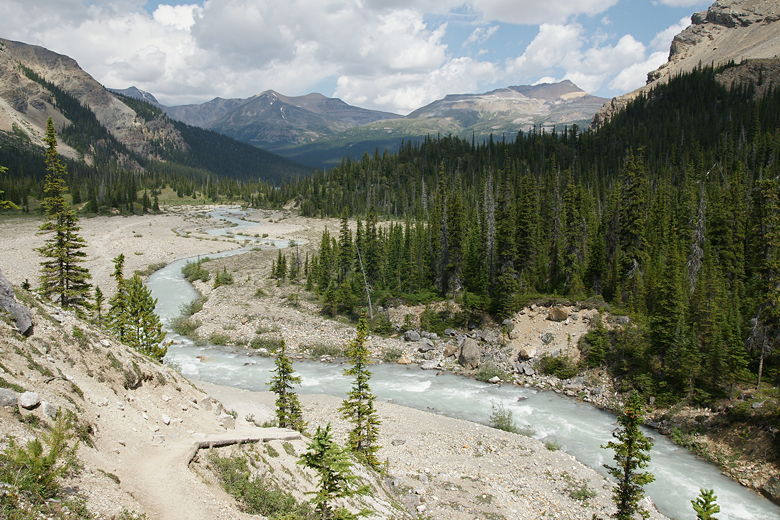
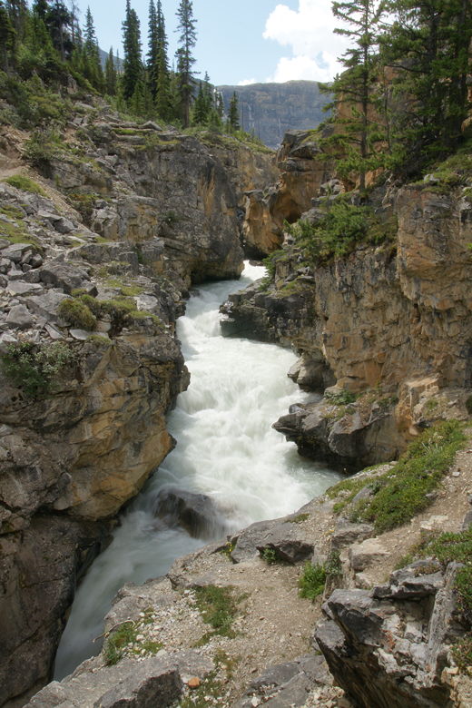
We stopped there briefly before continuing on the Bow Glacier Falls trail. We soon reached the
top of the steps and now had views of the falls in front of us. Minutes later we reached the
top of the ridge and had unobstructed views of the falls and the mountains surrounding it.
Just as we reached the ridge we saw the group of hikers we'd seen at the very start of the hike
(they were coming back). They seemed surprised that we'd come this far, but encouraging.
Trail headed toward Bow Glacier Falls
The base of the falls looked to be 20-30 minutes away still. It was already going to be a long
hike for the kids, so I didn't think we'd necessarily make it all the way to the base of the falls,
but I figured we could go part way before turning around. So we went down the other side of the
ridge and started walking up a gentle climb toward the base of the falls. As we did so, all that
blue sky we'd enjoyed earlier started to disappear. Well, the clouds had been moving in slowly
for some time, but now the clouds were winning. About halfway from the ridge to the base of the
falls, we felt the first rain drops. We immediately decided to turn around. No sense in
going any further. I didn't expect reaching the base of the falls was worth making the kids
hike any further in the rain.
Creek and falls
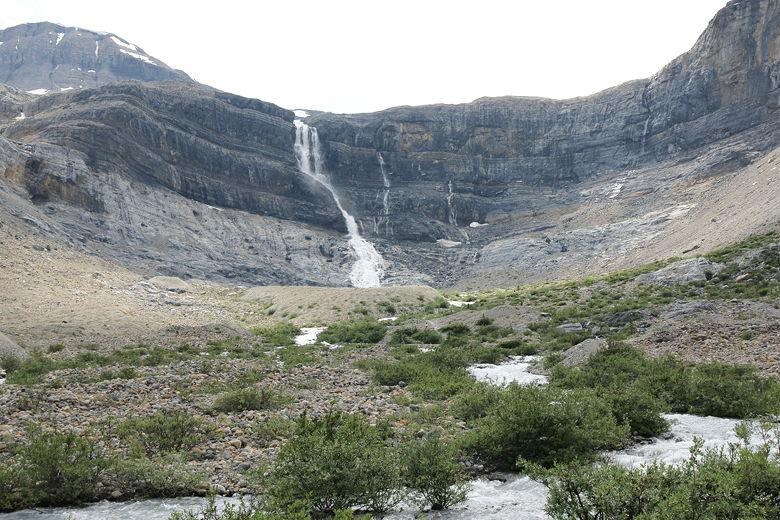
Bow Glacier Falls
Looking back at the ridge
By the time we got back to the ridge, the rain actually stopped. Unfortunately for us, that
wasn't it. When we got to the bottom of the wooden steps, the rain started again. Then it got worse.
A few steps onto the plain and we started to hear thunder. The kids were a little scared of
that, and I spent part of the time trying to get them to keep moving and part of the time
answering questions about what happens when you get hit by lightning, then
trying to explain CPR. While I was happy that we weren't on top of a mountain, the fact that
we were in a big open plain didn't please me. I'd be happy when we reached the forest at the
end of the plain.
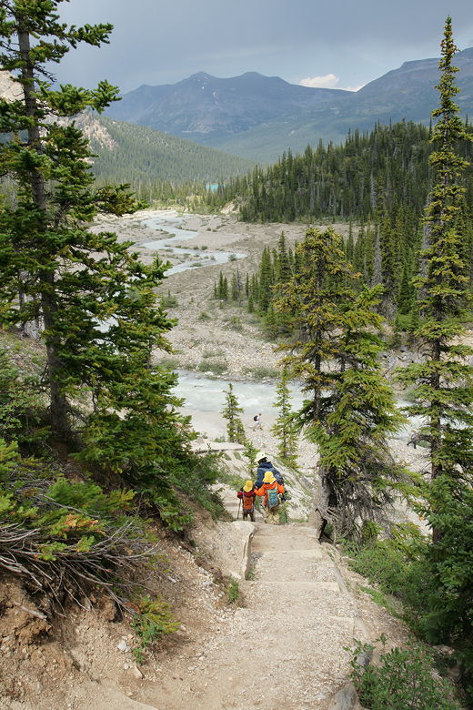
Heading quickly down the steps
We made our way quickly to the end of the plain, then to the gravel area with all the inlet
streams. We were prepared in the sense that we had our jackets and rain jackets and hats, but
our pant legs were getting soaked. Still, considering the circumstances the kids were pretty
good about it. The worst part was crossing all those inlet streams. Even though it hadn't
rained that much, I think the steep sides of the mountain had funneled a lot of the water toward
the streams, raising them just enough that crossing them was more difficult than it had been
in the opposite direction. We used our trekking poles to help us all get across without getting
too much wetter than we already were.
After that we were still soaked, but happy that the worst was over. We could see the lodge
in the distance, knowing our car was there. About halfway along the shore the rain finally
started to subside. By the time we reached the trailhead, the rain had completely stopped.
Hilariously, after getting soaked in a thunderstorm, our 3 year old started crying when he came to
the edge of a small puddle in the parking lot. I couldn't help from laughing out loud. He hates
walking in the tiniest puddle and will do anything to avoid it. Getting rained on apparently doesn't bother
him as much.
| 

