Directions:
From Joshua Tree, drive south along Park Blvd. and enter the park via the West Entrance Station.
Continue following the road past the Boy Scout Trailhead. Shortly thereafter, you'll see the
Hidden Valley parking area on the right and a sign for Barker Dam on the left. Turn left onto
the road and follow the signs to the large trailhead parking lot for Barker Dam and Wall Street Mill.
View Driving Map
The large parking lot was almost completely full when we arrived in the early afternoon. Unlike in
some other parts of the park, this feels like a typical national park -- overcrowded. There are
two restrooms here, but no water (in fact there is no running water available anywhere in the park).
People milled about, either returning from or starting on short hikes to Barker Dam or Wall Street Mill.
We were hanging out just behind our car, about to get ready for our hike. A car peeled into the parking
lot, veering left into what the driver thought was a vacant space. When he found out it wasn't, he
quickly straightened out, drove just past us, and then wheeled into a vacant space nearby. The driver
got out of the car and immediately exclaimed to his buddy, "Let's climb some rocks, dude!" With that,
he went to the trunk and pulled a crash pad out onto the pavement. Too funny.
We would not be climbing rocks. Instead, we joined the masses and started the hike to Barker Dam.
It's a flat, well-signed hike. In addition to the directional signs, there are also a few signs
explaining some of the foliage and history.
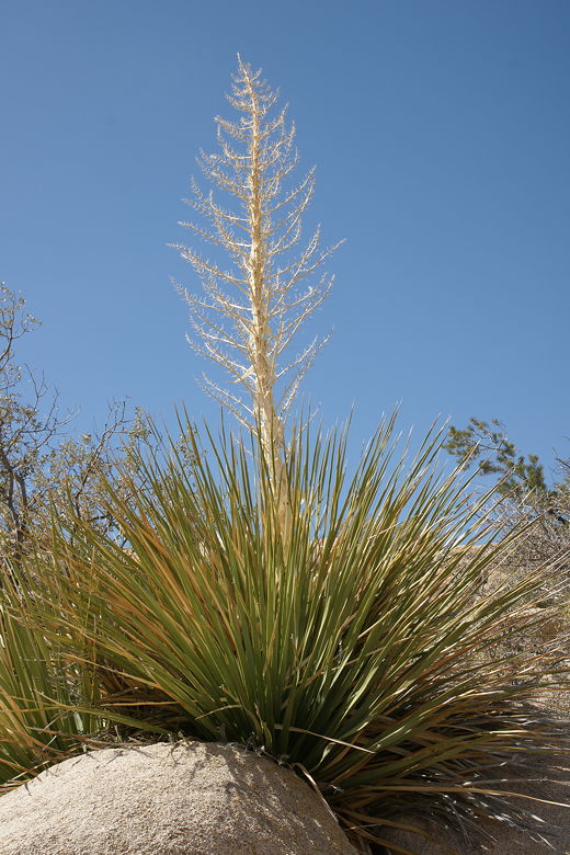
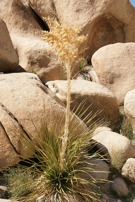
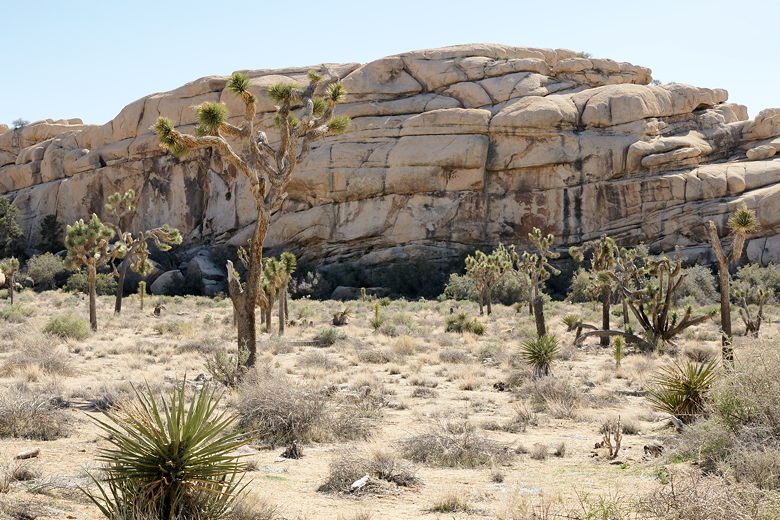
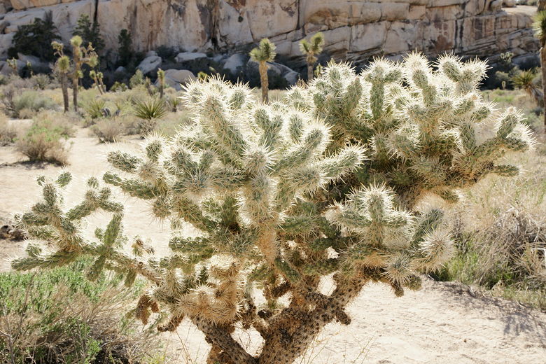
We passed the easily identifiable Parry's nolina, which the native Americans used for food. We passed
over and through granite boulders on either side of the trail. And then, soon enough, we were at
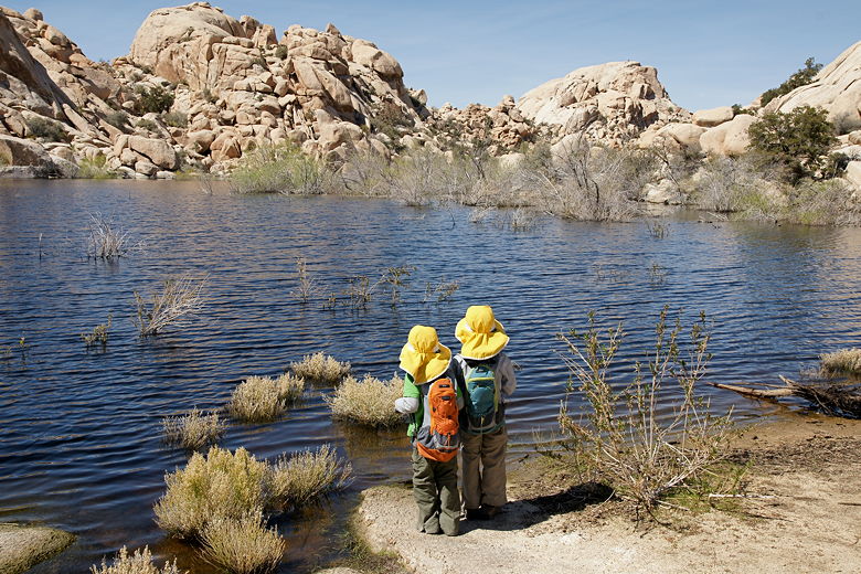
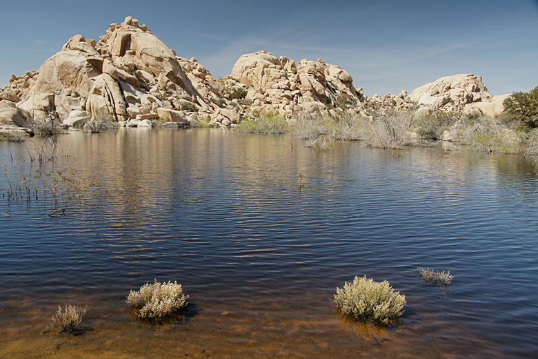
small reservoir formed behind Barker Dam. The reservoir is rain-fed and small, but surprising
for being in a desert. The dam was built around 1900 for cattle and mining use. These days it is
used by migratory birds, though we didn't see many today. Apparently bighorn sheep also use it,
though we didn't see any of those, either.
Parry's nolina
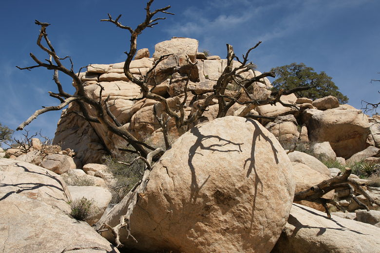
Branches and boulders
Parry's nolina
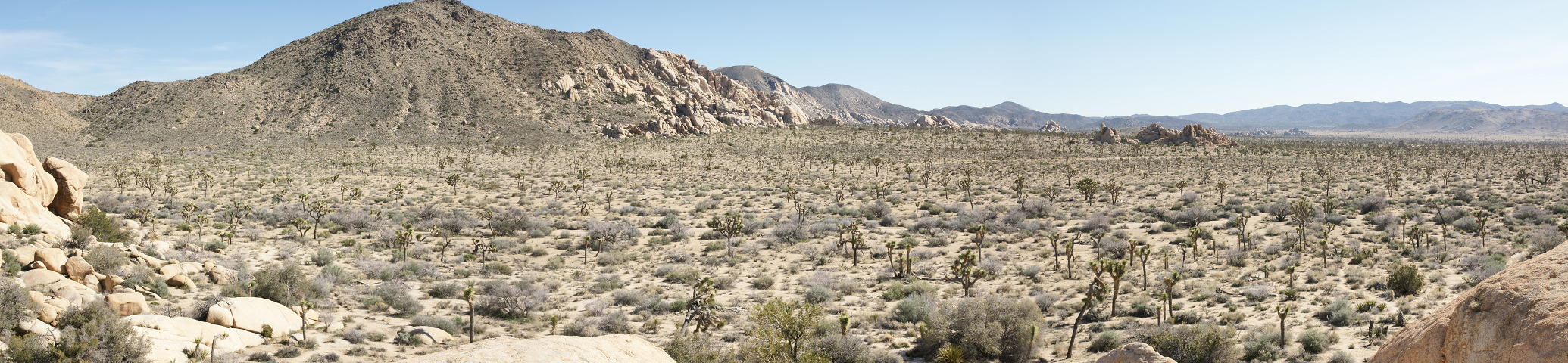
Barker Dam reservoir
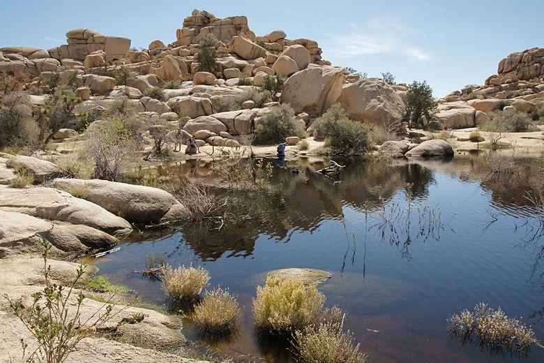
The reservoir is cool and peaceful. A duck or two floated on the surface on the far side of
the reservoir. Granite boulders rise up from the shores of the reservoir. After taking a break
by the water's edge, we continued along the main trail.
Barker Dam reservoir
Barker Dam reservoir
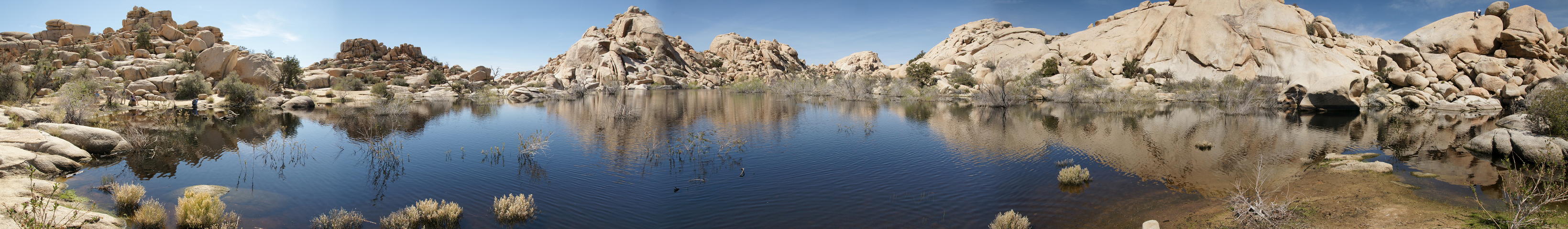
Panoramic view of Barker Dam reservoir (Click image to view full size)
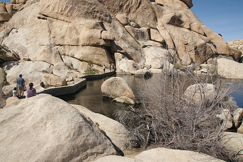
Shortly, we reached the dam itself. To our mild surprise, some hikers were walking on top of the
dam itself. It's relatively narrow and there's a steep drop-off on one side (the side without water).
The souvenir picture of them standing on top of the dam didn't seem worth the admittedly minor risk.
But maybe I just feel that way having recently read Death in Yosemite.
Hikers on Barker Dam
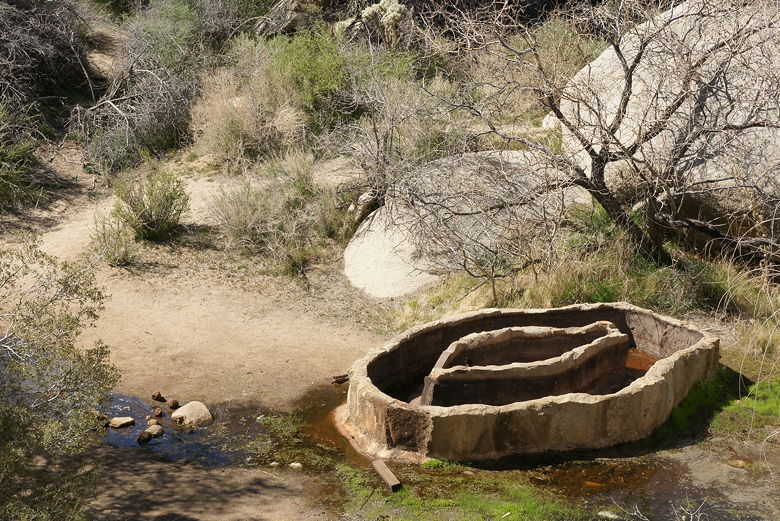
We continued along the trail past the dam. Just below the dam is a catch basin, built to catch some
of the
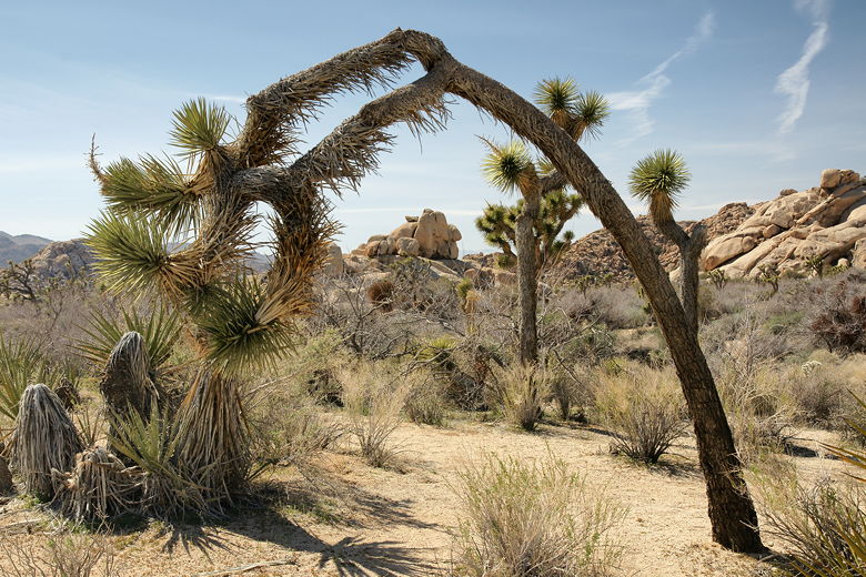
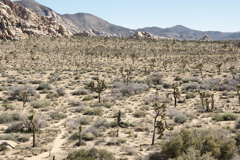
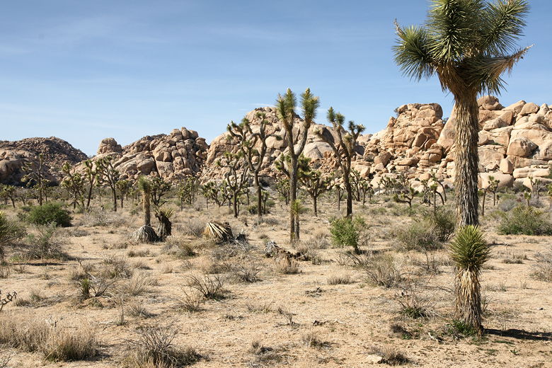
water that escaped the dam. After that, we left the boulders behind and came out into a field of
Joshua trees. It's a neat experience walking through that field, U2 songs invariably running
through your head. Or at least mine.
Catch basin below Barker Dam
Leaning Joshua tree
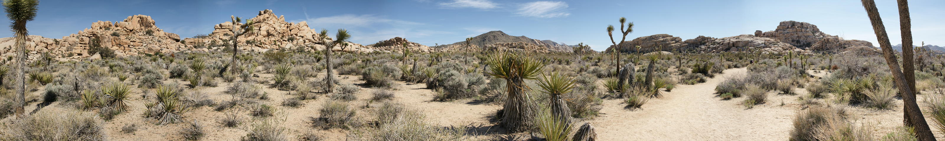
Panoramic view of Joshua trees (Click image to view full size)
Joshua Trees
Joshua Trees
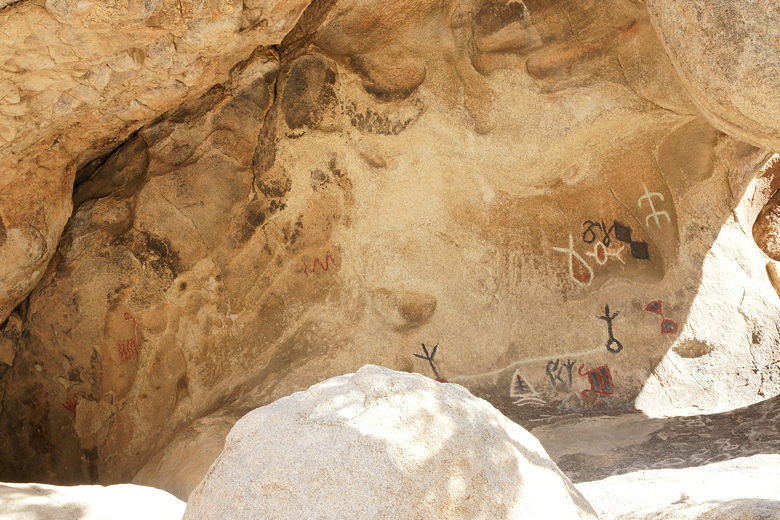
We next came to a trail intersection, with the right fork immediately leading to some petroglyphs.
Unfortunately these petroglyphs had been vandalized by a movie crew many years ago. Apparently they
wanted them to stand out better on film and had painted them in brighter colors. I had read,
however, that there were some unaltered petroglyphs to the southeast. So we quickly skipped
past the vandalized petroglyphs in search of the "pure" ones.
Unfortunately we ended up going more
south than east, and I think what we were looking for was more east than south. We scrambled up
and over rocks, looking behind bushes, squinting our eyes at rocks to see if maybe that scratch
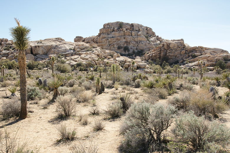
we saw was an ancient petroglyph. We did get one obvious payoff -- a great view of the Joshua
trees stretching out to the south, beyond the trailhead road. And we did eventually spot what
I'm pretty sure are ancient petroglyphs. They were so faded that it's hard to be sure,
though.
Looking out at Joshua trees to the south
Ancient petroglyphs?
Looking out at Joshua trees to the south (Click image to view full size)
We then made our way back to the vandalized petroglyphs, and took the trail heading back to the
trailhead. We shortly passed the petroglyphs that the book I had read was probably referring
to. I have no regrets about taking the little detour we did, though. Soon enough we reached the
end of the loop, and then followed the trail back to the parking lot.