Directions:
From Mammoth Lakes, take Highway 395 south to Bishop. Turn right onto Highway 168 up into the
mountains. Follow it all the way to the end, following the signs to Lake Sabrina. The trailhead
is just before the dam on the left. There is limited roadside parking near the trailhead. There
is a parking lot at the boat ramp at the end of the road, and a parking lot back on Highway 168
at North Lake Road (a half mile back). Your best bet is probably to come early enough so that you can
park closer to the trailhead. Note that there is no overnight parking by the lake; for that,
you'll need to park back by North Lake Road. Also note that if you're
coming from the north, you can save yourself some time by turning right onto Ed Powers Road from
Highway 395, taking it for a few miles before turning right onto Highway 168. This will save
you some distance and avoid the traffic of Bishop.
View Driving Map
There were still several spaces along the road next to the trailhead when we arrived at 10am.
I would guess that it might be hard to find space here during the summer, in which case you might
need to arrive earlier or park in one of the two parking lots further away. Luckily for us, we
didn't have to deal with that.
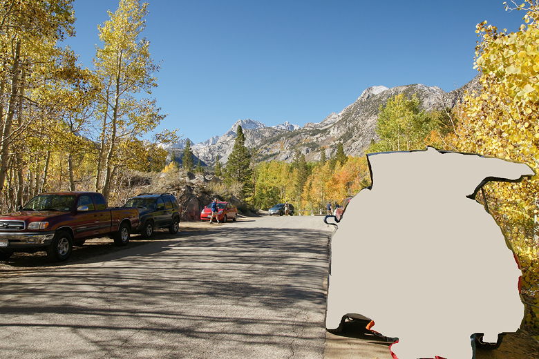
It was cool, as the parking area was still shaded. However, it quickly warmed up as the sun rose
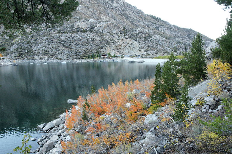
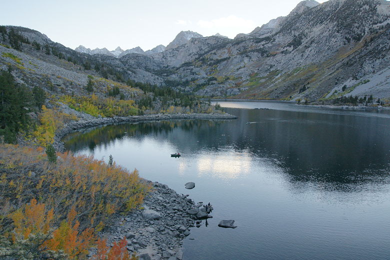
over the mountains. We prepped by our car, enjoying the site of fall colors near the parking area,
leading up to Lake Sabrina a bit further down the road. An outlet stream gurgled past, parallel
to the road. Photographers milled about, mostly heading toward the dam at the northeast corner
of the lake.
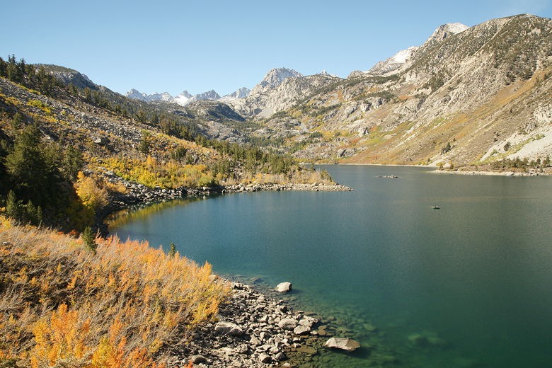
This was meant as a throwaway parking lot picture, but it shows off a lot of the color
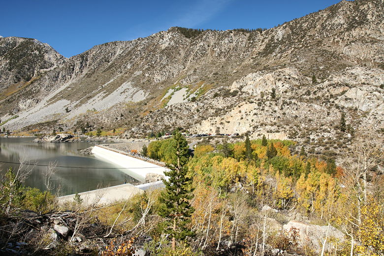
We headed over to the trailhead at 10:30am, then immediately started climbing. Soon we had a view
of the dam, on which people walked back and forth. Further away, near the far end of the dam,
was the boat ramp, with a large parking area. After reaching a view of the dam, the trail levels
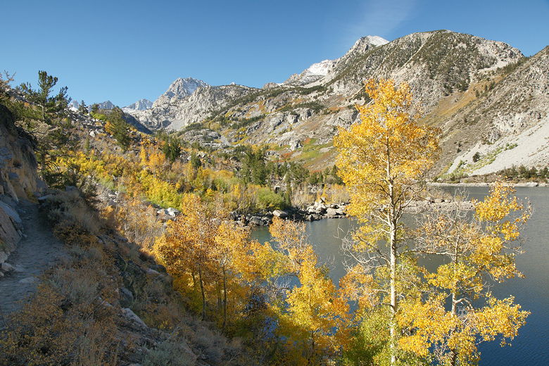
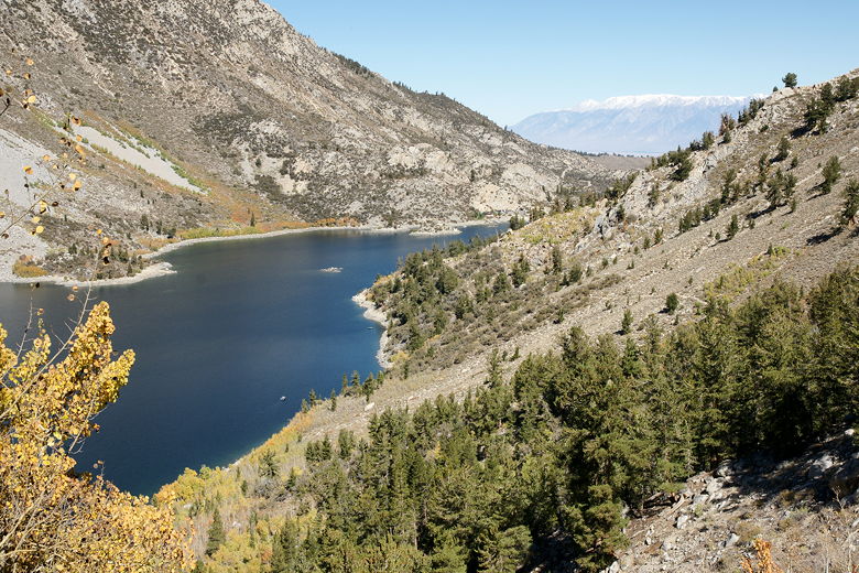
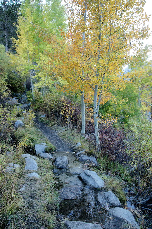
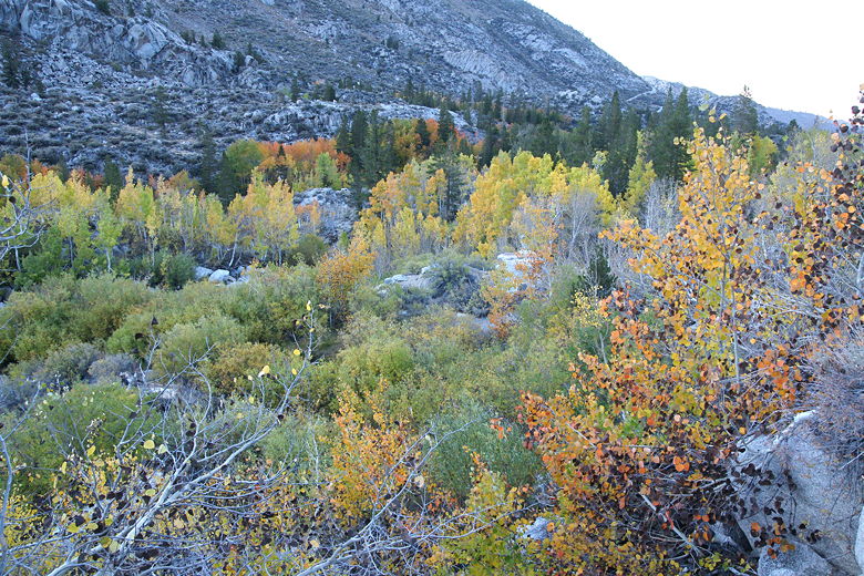
out for the most part, hugging the shoreline of Lake Sabrina's southeastern shore. Along the way
were some fall colors and some increasingly beautiful views of the lake, the trees, and the
mountains behind the lake.
View of the dam
Color along the trail
Lake Sabrina Dam
Looking west along Lake Sabrina
More color at Lake Sabrina
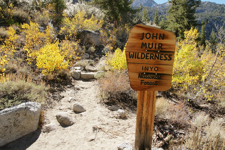
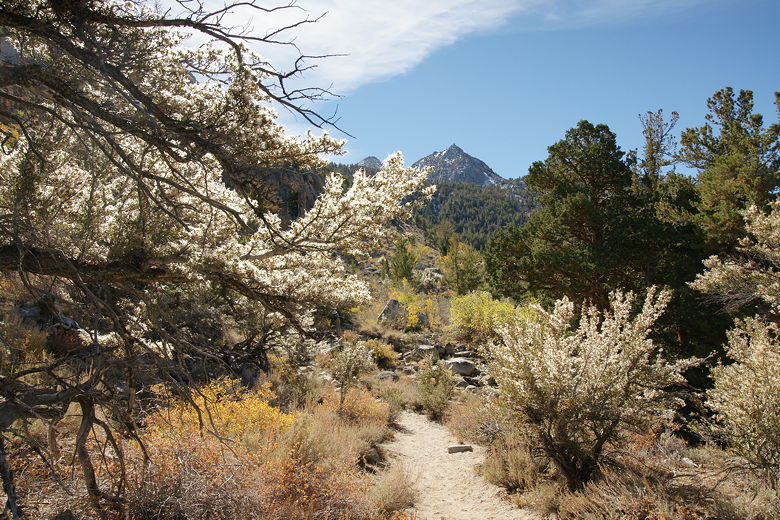
Entering the wilderness
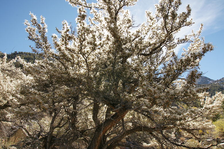
At this point a couple and their dog passed us; I mention this mainly because we'd see them later.
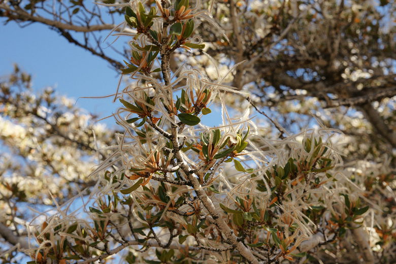
The woman marveled at some backlit white things on the trees in front of us. I was hoping she knew
what they were, but she didn't. Maybe one of you dear readers can enlighten me.
Not sure what all these little white things are, but they look great backlit
More backlit white things
A closer look at the trees. They look like some sort of tentacles.
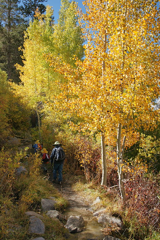
We saw a fair number of hikers on the trail, along with a lot of dogs. However, I would have to
guess that we actually saw more backpackers than day hikers on this hike. It may have been close
to mid-October, but the weather was fine and the scenery was great. Blue Lake or Hungry Packer
Lake beyond probably make good first-day camping destinations.
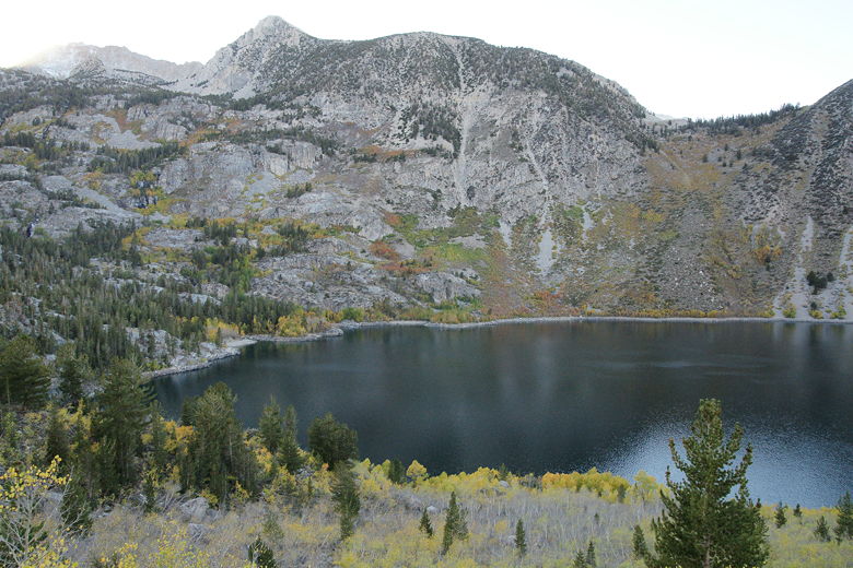
West end of Lake Sabrina
There wasn't as much snow on this hike as at North Lake the previous day. There were a few places
where the trail was muddy or overrun with water, but nothing we couldn't easily get around.
After about a mile, the trail starts to climb again and veer away from the shore.
About 1.3 miles from the trailhead, we passed
a trail intersection. The trail to George Lake heads uphill to the left. Instead of taking that
trail, we continued straight ahead toward Blue Lake.
At this point we decided we wanted a break, and we found shade at the start of a conifer forest.
Up until now we had spent much of the hike exposed to the warm October sun. As we started to
find a spot to sit down, a couple came by in the opposite direction. They asked if we had been
to Grass Lake yesterday, and I confirmed that we had. Apparently they'd seen us there. They
then told us that we should go around the corner a little further, as there was a nice spot
by a waterfall with some fall colors where we could stop for a break.
We followed their advice and it did not disappoint. A thin waterfall tumbled down from the left,
crossing right over the trail (we'd easily rock hop across it later). Framing it was a beautiful
cluster of yellow fall foliage on either side of the trail. We stopped here to enjoy the
surroundings and for a snack.
Color right in front of a waterfall
After our break, we hopped over the water and started a short series of long switchbacks in the
forest. Following this was a series of short switchbacks, many of them with rock steps and/or
rock walls. At the top of this is a tree with a sign telling people not to cut the switchbacks,
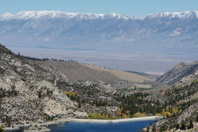
along with a nice viewpoint looking out toward Lake Sabrina. In addition to the lake, we could
now see across the Owens Valley to the snow-capped White Mountains.
Looking back at Lake Sabrina
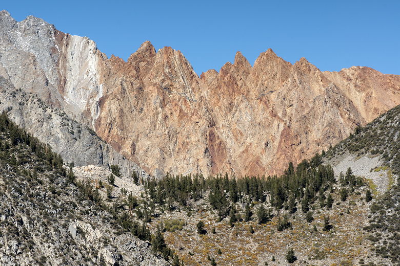
Telephoto shot of Piute Crags (same mountains seen at Grass Lake)
Looking across the Owens Valley to the White Mountains
Panoramic shot of the White Mountains (Click image to view full size)
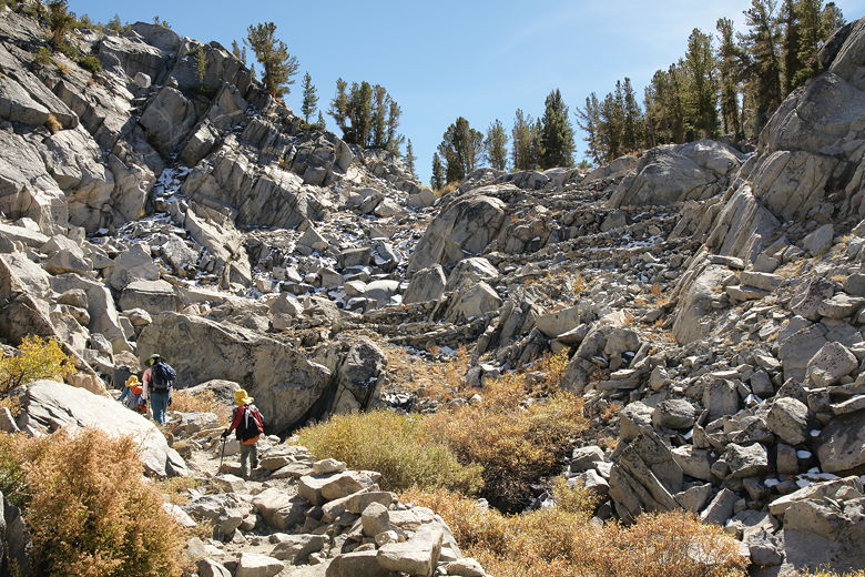
As we climbed further still, we exited the dense forest and were rewarded with even better views
of the lake below. The trail eventually veers left and heads toward a wall of switchbacks lined
with rock steps of various sizes. There were more snow patches here, as it was higher and
north-facing. The elevation, now over 10,000 feet, was starting to get to me. We hadn't had a lot
of time to acclimatize on this short trip (we'd slept two nights at a bit over 6000 feet), so
we just had to take it slow. If we were going to
go backpacking here, or go any higher, I definitely would have taken some extra time to acclimatize.
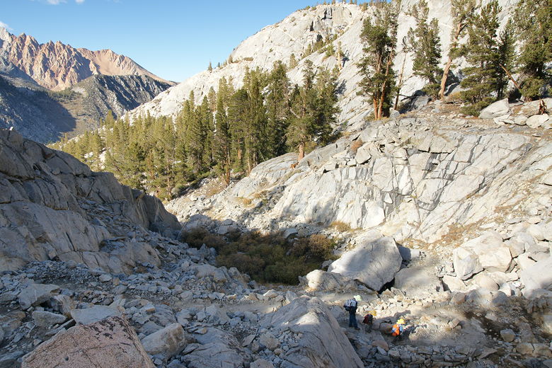
Heading up the rocky switchbacks
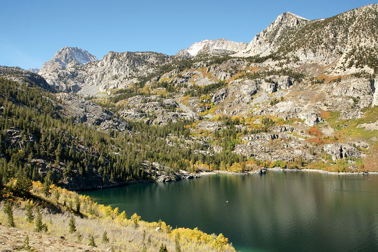
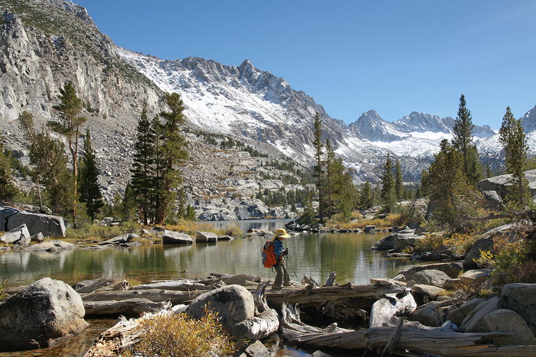
We made it up the switchbacks, and almost immediately reached the outlet stream for Blue Lake. Here we had
a nice view of part of the lake and the mountains behind it. We walked across some logs to the other
side of the outlet stream, then walked along the trail up the shore to find a spot to break for
lunch.
Nathan crossing logs near the outlet stream to Blue Lake
We found a great spot close to the water about a third of the way up the shore, but it was already
occupied. As it happened, though, it was the couple with the dog we'd run into earlier, and they
were just leaving. They'd spent their lunch break at the lake, including some time fishing (they
said they'd caught some). They finished packing up their stuff and left it to us.
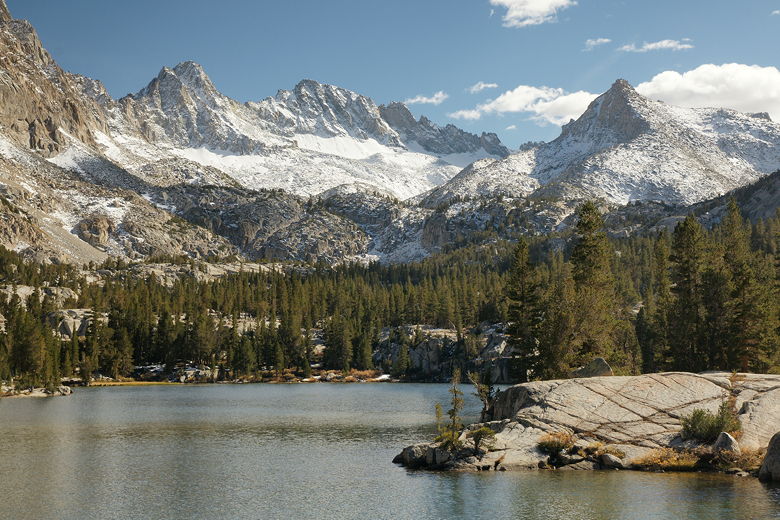
Blue Lake
It was a bit past 2pm by the time we sat down on the granite to have lunch. I had earlier set
a turnaround time of 3:30pm so that we'd get back well in advance of darkness. That gave us plenty
of time to enjoy the area. After lunch the kids threw rocks in the water and I was able to head
further up the shore and take some more pictures of the snow-flecked mountains and lake. Despite
having seen so many people on the trail, we hardly saw anyone else at the lake. That's not to say
there wasn't anyone else there, but it's a big lake (much bigger than Grass Lake and
probably bigger than North Lake), so there wasn't
as much chance of running into someone else. On the other hand, the eastern shore of the lake
is relatively steep, so I would guess that most people spend their time on the western side, like we did.
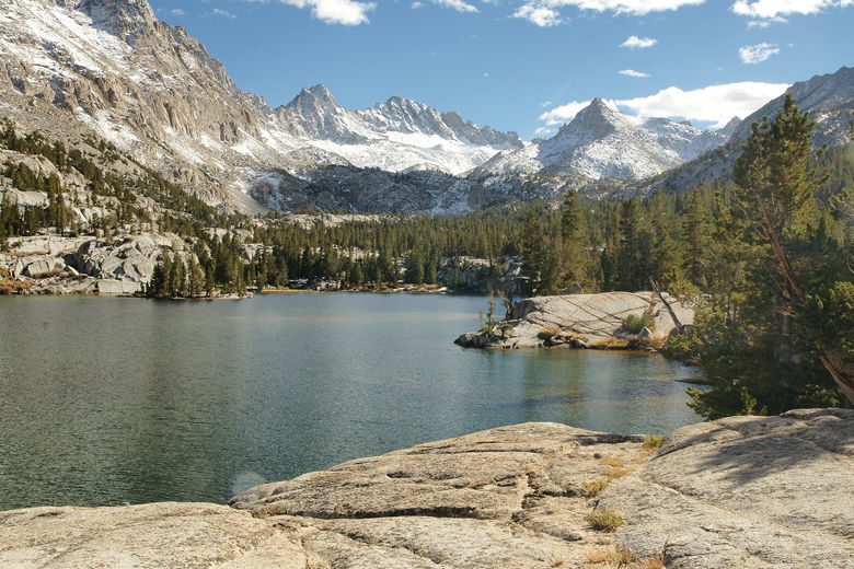
Thompson Ridge above Blue Lake
Thompson Ridge above Blue Lake
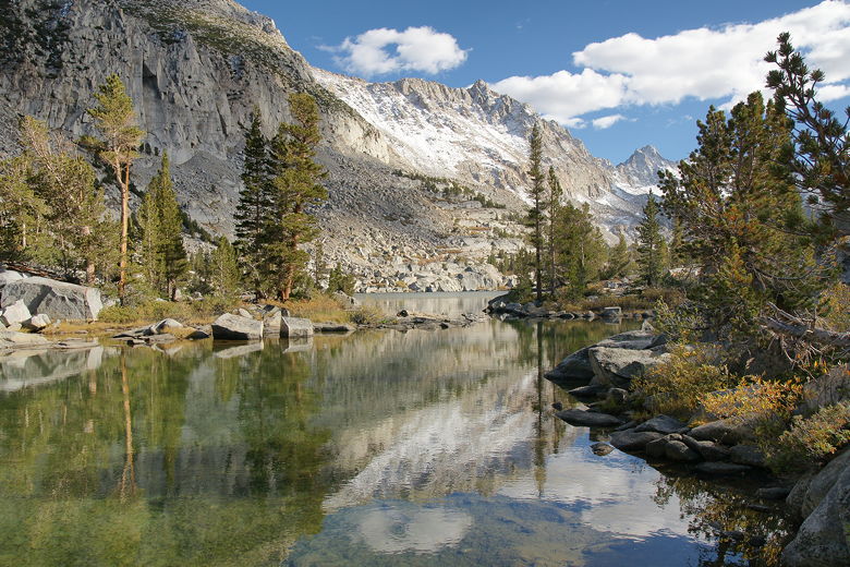
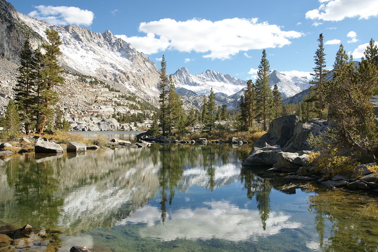
Blue Lake near the outlet stream
Blue Lake reflection near the outlet stream
At almost precisely 3:30pm, we started the hike back. We retraced our steps back to the outlet stream
crossing. Now, though, the afternoon light created some perfect reflections in the water. I stopped
for several pictures before we resumed our descent. We saw much fewer people on the descent, probably
because it was later in the day.
Descending the rocky switchbacks
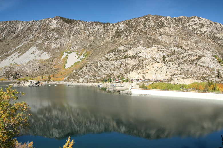
Lake Sabrina was mostly shaded by the time we saw it again. A few people in boats were still
fishing, while others fished from the shore. The boat ramp parking lot was still mostly full.
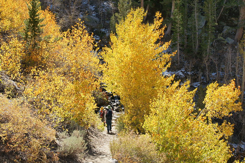
As we neared the end of the hike, we saw several backpackers headed up the trail. It seemed rather late
in the day to start a backpacking trip, but I suppose they could make it to Blue Lake before it got
too dark.
Sabrina Lake after the sun went down behind the mountains
Peering across the lake at the boat ramp parking lot
Late afternoon fishing on a boat on Lake Sabrina
We could see some really nice colors on our approach to the dam area. This area, between the dam
and the trailhead, probably had the best color on the hike. We reached the trailhead at 6pm, with
plenty of daylight to spare. Photographers still milled about, enjoying the sights of fall
in the Eastern Sierra.
An afternoon look at the same color we saw in the morning