|
The huge parking lot at Jenny Lake appeared to be mostly full when we arrived in late morning.
We had debated whether to start at String Lake, or the main Jenny Lake area, and whether to hike
around the lake clockwise or counterclockwise. We also considered taking the boat across and
hiking back, including a side trip to the moose ponds. Eventually we decided to start at the
main Jenny Lake area and hike counterclockwise. I preferred this instead of starting at
String Lake and ending up in a developed area (the south Jenny Lake area) for lunch. I wasn't
sure how long we'd have to wait for a boat ride, and I thought the views along the western shore
of Jenny Lake would probably be better than the other side, because of the direction of the sun.
So, off we started around 11:30am. The area has a campground, a store, and a visitor center.
There were people everywhere, and a maze of paved paths here, but we found a path
that directed us toward the Lakeshore Trail heading north, and took it. We shortly took a few
stairs down to a beach looking out on the lake.
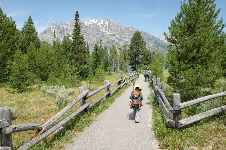
Paved trail at the start of the hike
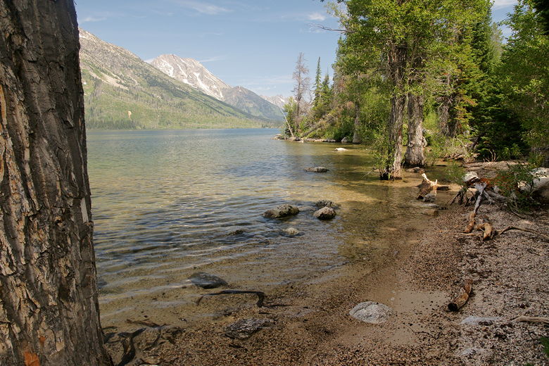
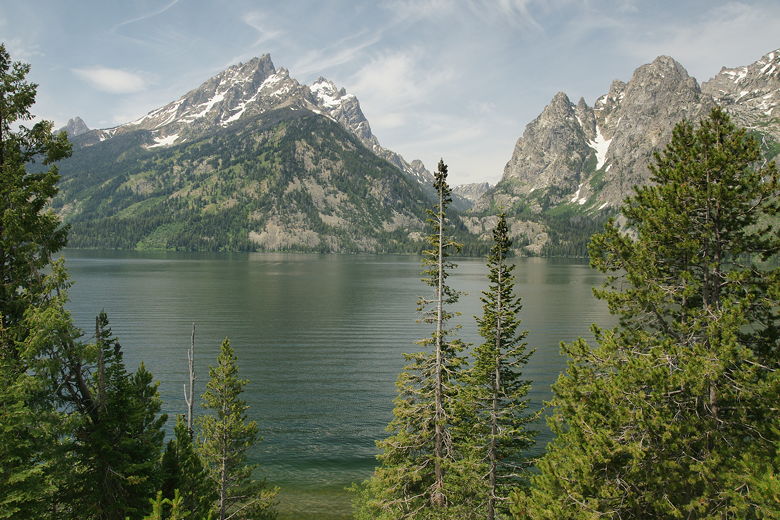
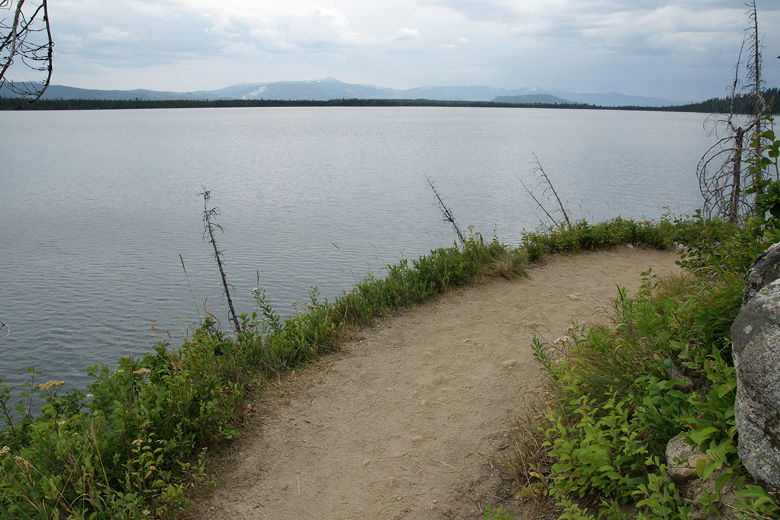
First look at Jenny Lake
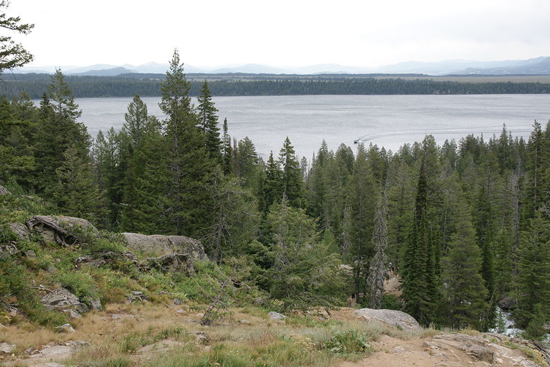
Considering how popular I'd heard Jenny Lake was, I expected it to be prettier than it actually
was. It was pretty, but not really any different than Leigh Lake the day before, and nothing
compared to the beautiful colors in Banff National Park.
Jenny Lake
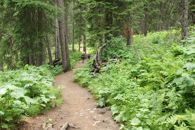
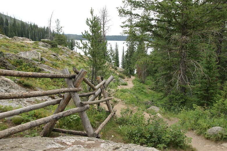
We left the beach behind and continued, up some stairs and then left the pavement behind.
We also left most of the people behind, as this part of the trail was strangely devoid of
other people. We followed the narrow dirt trail as it headed north high above the shore
of Jenny Lake. Occasional spur trails led down to the water's edge, but we didn't take
any of them.
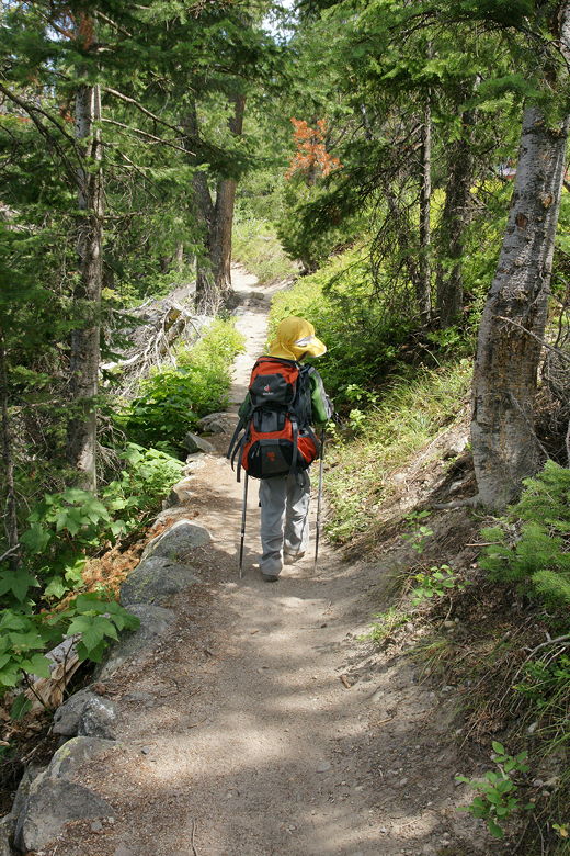
Hiking on the narrow trail
After about 1.25 miles, we started to see more people. Soon we found out why.
The trail skirts the Jenny Lake Loop Road, and just off the road was a scenic overlook,
with a parking lot for about 10 cars. People milled about here, taking in the view of the lake
through the tree tops. The sight of our kids with their hats, backpacks, and trekking
poles proved irresistible
to one tourist, who I saw snap a picture of their backs as they continued heading north. Sometimes
I feel like we're like animals in a zoo, or large wildlife in a national park that people need to
stop and stare at. One person said to me, "That's quite an expedition you've got there."
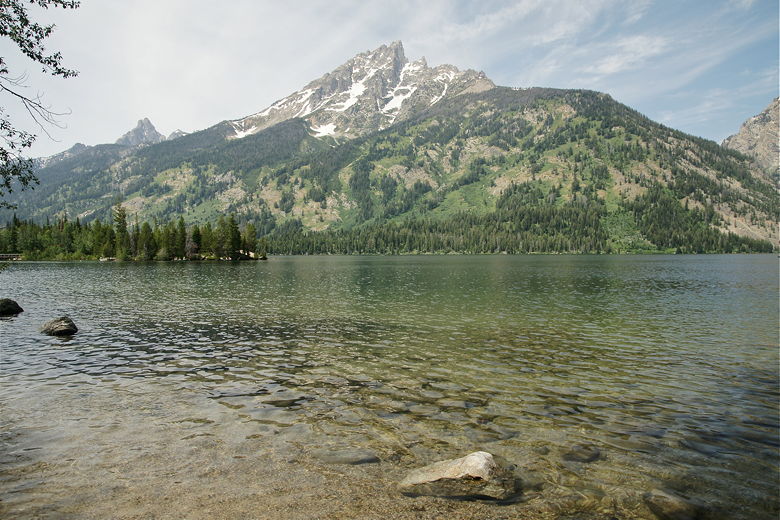
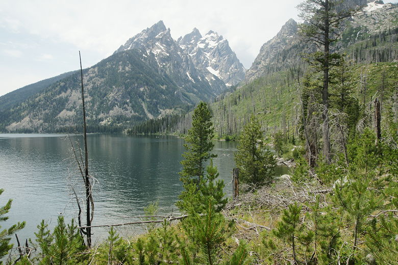
Jenny Lake as viewed from near the overlook
We left the tourists behind, continuing along the trail, which continues to hug the shoreline.
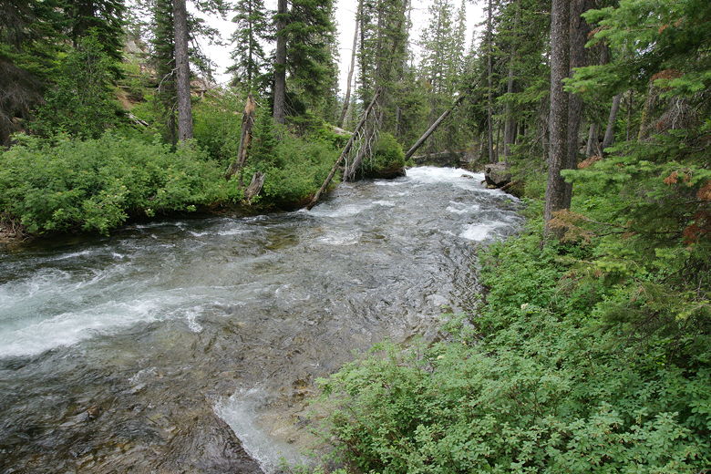
After a little more than 2 miles, it follows the creek between Jenny Lake and String Lake.
I kept looking
for the bridge that we would cross it with, but it didn't come for quite some time. We just
continued to follow the fast-moving water. At this point a couple hikers came up behind us
and asked
if they were on the right track toward Hidden Falls. I assured them they were, although they
could have taken the shorter clockwise route if that's all they were interested in.
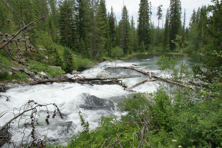
View from close to the inlet stream
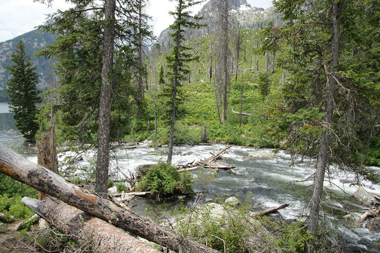
Inlet stream
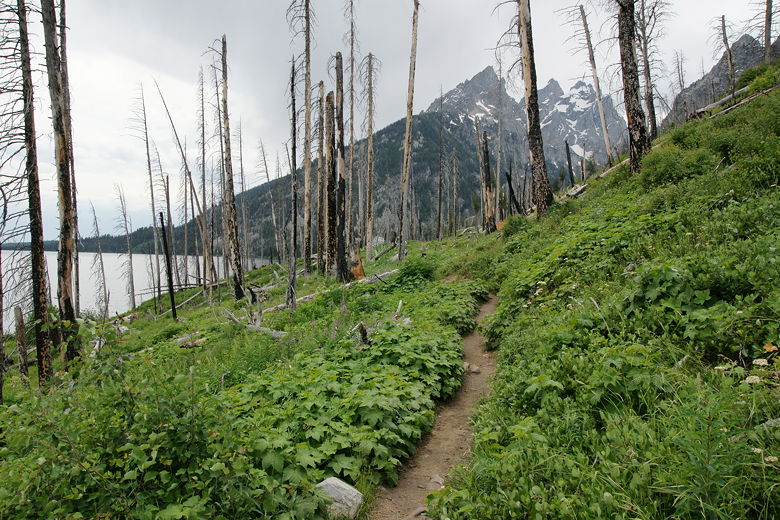
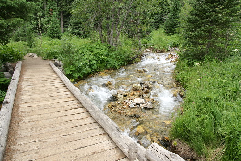
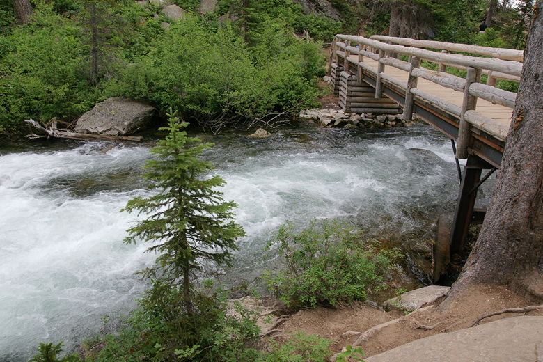
Finally, after about 2.8 miles, we crossed over a bridge over the creek, close to the first of
3 parking lots off String Lake Road. After crossing the bridge, we passed through a burned-out
forest and wondered where to stop for lunch. We followed the creek on the other side as it
went back toward Jenny Lake. Unfortunately all the good lunch spots by the creek were
already taken. We eventually stopped at a point high above the lake for lunch.
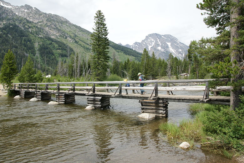
Bridge crossing the inlet stream
On the other side of the inlet stream
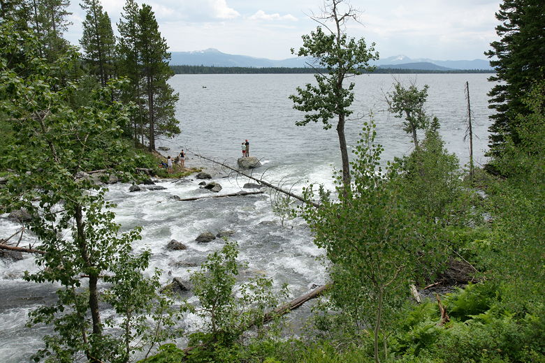
Stream flowing into Jenny Lake
As we had lunch, the clouds began to move in. The sun was all but gone after our short lunch
break. After lunch, we continued to follow the trail as it follows the western shore of the
lake. Tiny waterfalls trickled down from the right, as we passed nice displays of wildflowers.
It felt like a rainforest at times.
Trail near our lunch stop
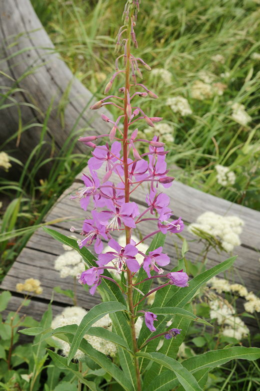
Flower next to the trail
Jenny Lake Trail
Into the lush section of trail
Filled with little streams coming down from the right
We now approached the boat dock, where boats from the south Jenny Lake area would land with boatloads
of visitors. Before reaching it, we turned right, toward Hidden Falls. Now we saw tons of people
on the trail. The trail climbs up past a series of cascades below the falls. We continued
up the trail, stopping for a brief rest after crossing a large bridge over the cascades.
Then we turned right, continuing on toward Hidden Falls.
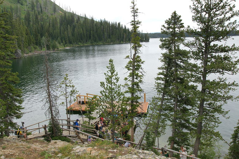
Boat dock
Looking down past the barricades toward the lake
Cascade Creek
Bridge over Cascade Creek
Shortly, we turned left onto a spur trail and reached the Hidden Falls viewpoint, near the base of
the falls. The falls were impressive, crashing down in a torrent, then twisting further downstream.
After taking in the view, we returned to the main trail, then continued up toward Inspiration
Point. We soon reached an overlook with nice views of most of the lake. However, the skies were
now completely gray, and we could see rain developing in the east. While the views from
further up the trail are supposed to be even better, we decided to turn around at this point.
I figured the gray skies wouldn't make for very good pictures, anyway.
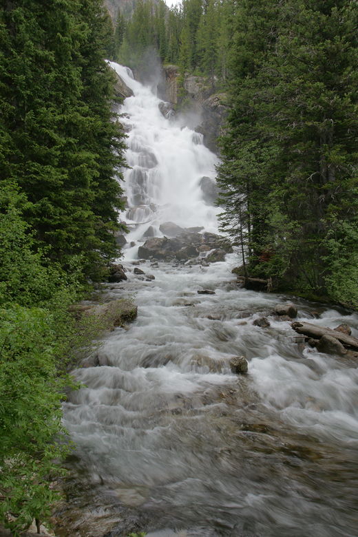
Hidden Falls
Jenny Lake from viewpoint on way to Inspiration Point
We backtracked down the trail, then took the right fork to head toward the south Jenny Lake area
instead of turning left to return to the boat dock, where most other people were going. The trail
now descends steeply on the other side of the cascades, although not as close. We started to feel
the first raindrops as the trail reached the shores of Jenny Lake. This was probably the closest
we'd been to the shoreline all hike.
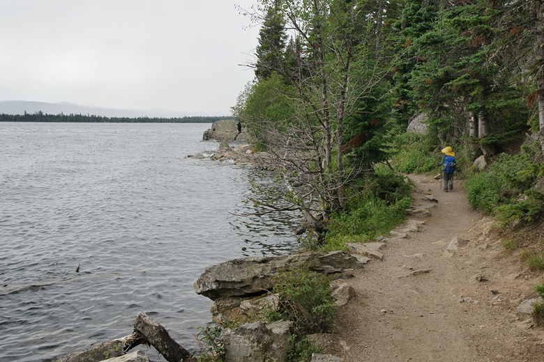
Trail next to the water's edge
The trail continues to hug the shoreline for some time before finally veering inland. And then the
rain started. It was a light rain, but rain nonetheless. It actually felt good, since it had
been relatively hot earlier. We never even put on our rain jackets, although I did put my camera
away temporarily. The rain eventually stopped and I was able to take it out again.
We passed the Moose Ponds trail to our right, continuing on the main trail. Next we passed the boat
launch area, then crossed Cottonwood Creek and passed the boat dock, just as a boatload of hikers
was returning. Then it was back onto the pavement, back up to the store, where we enjoyed some
ice cream after the longest hike ever for the boys so far, 7.8 miles.
| 

