|
Brenda, Jean, Jenny, Howard, Tom, and I went to Henry Cowell Redwoods State Park for
a hike amongst the redwoods on a warm summer day.
After negotiating the winding Santa Cruz mountain roads, we found ourselves at the huge
Henry Cowell parking lot at about 11:30am. I stopped in the gift shop to get a park
map for $2 and then off we went. We started our journey on Redwood Grove Loop Trail,
a short, paved nature trail with signposts to accompany a 25 cent brochure (which I hadn't
purchased from the gift shop). Redwoods toward 50 feet and more above us. There was
a typical display with a cross-section of a tree so you could count the rings of one of
the felled redwoods.
The loop is lined with wooden litter boxes, and at the far end is a bathroom. After that,
the pavement ends...for a short while. We crossed the Pipeline Road, which is paved, to
reach the River Trail, which runs right next to the Pipeline Road. We soon found that we'd
be sharing the trail with horses. We stepped to the side of the trail to let 5 or 6 horses
pass us in the opposite direction. Signs of horses were present throughout our hike, and
we ran into horses frequently -- perhaps 20 or 30 horses during the day.
After criss-crossing the Pipeline Road a couple times, the River Trail hugs the river
while the Pipeline Road veers upward. We enjoyed the shade next to the San Lorenzo
River, then turned left and started the climb up the Eagle Creek Trail. We crossed the
Pipeline Road yet again on our climb. We crossed a bridge over Eagle Creek and then
stopped for a short break. Then, after having passed through redwood groves for the first
part of the hike, the terrain suddenly changed. Instead of redwoods, we saw trees more
reminiscent of Henry Coe State Park, to the much drier southeast.
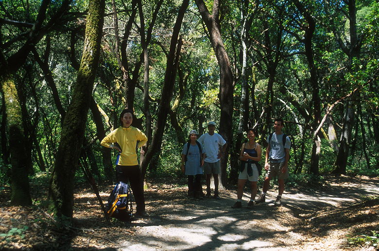
Resting in the forest
At the trail intersection we turned right (going straight would have taken us to a
campground) onto the Pine Trail. Again the terrain changed. The friendly shade disappeared
and the sun beat down on us as we trudged over thick sand. We would later learn that the area is
part of an ancient seabed, submerged perhaps 4 million years ago, and that we were in
a "sand hill chaparral" environment. Knobcone and ponderosa pines were prevalent in the
area.
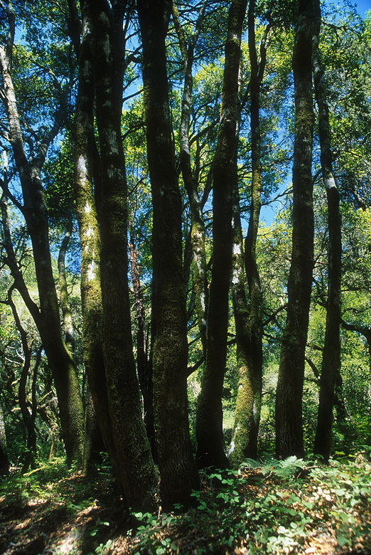
Closer look at some trees
Soon after the change in environment, we reached the observation deck. This square
structure, about 25 feet per side, sits at the top of a hill. We climbed the steps to the
top (about 15 feet above the ground), moved a picnic bench into the shade, a settled down
for a picnic lunch. From the deck, Monterey Bay was visible through the haze. There are
somewhat obstructed views from this perch, only about 800 feet above sea level. While
decent, this certainly isn't the highlight of this hike, which would come later.
While we ate, a couple of park rangers drove up to check out the deck. They opened a
hatch and looked down. Apparently there's a pump which fills the area under the deck with
water to be used by the campground we'd passed. Note: there is a water fountain at the
observation deck in case you need to refill.
After lunch we continued down the Pine Trail. The redwoods eventually returned.
We turned right and continued the descent on the Powder Mill Fire Road. We crossed our old
friend the Pipeline Road and descended the Buckeye Trail.
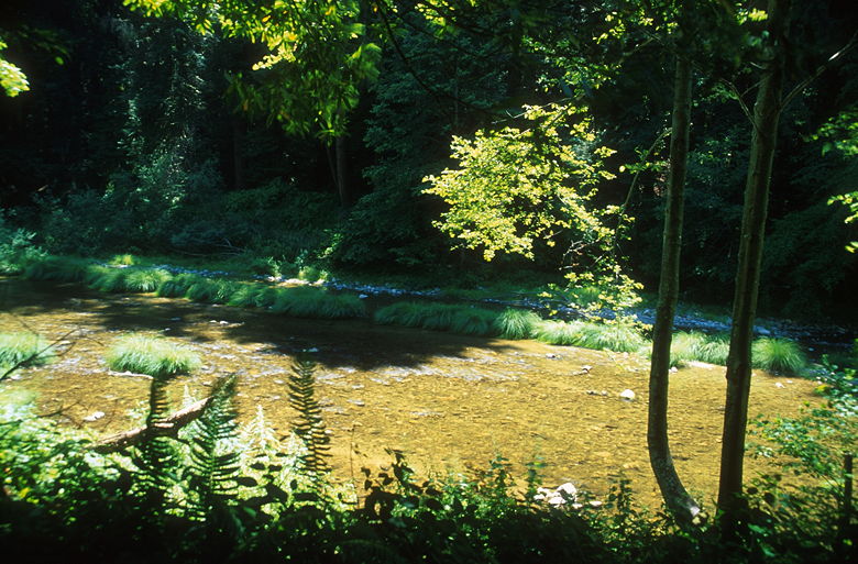
San Lorenzo River
The most remarkable thing about the Buckeye Trail is where is intersects the San Lorenzo
River. The river is lined with tall green trees on either side. At this time of year,
after a relatively dry winter, the water was running shallow, no more than a foot or two in
most places. It's quite beautiful.
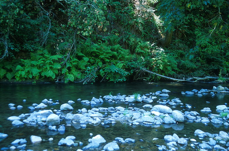
Rocks in the San Lorenzo River
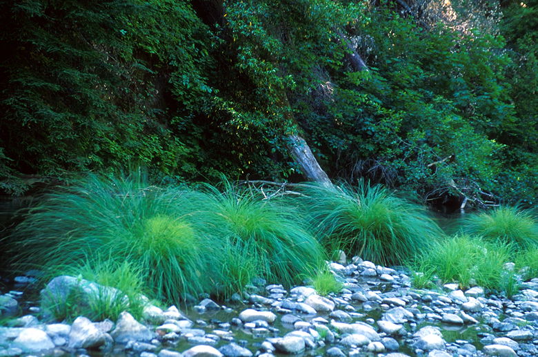
Green plants next to the river
The river is about 20-30 feet wide in the place we crossed. There are no foot bridges.
After crossing over some rocks to a gravel bar, we came to the main crossing, which couldn't
be attempted by rocks along. A man and his two kids came and waded through the water to the
other side while we decided what to do. Eventually we gave up on coming up with a dry
crossing. I took off my shoes and socks, tied my shoes, and slung them over the back of
my neck. Then I went right into the water. It was quite comfortable, I thought. A treat
after a long hike on hot day. I reached a spot on the other side where I saw a man exit.
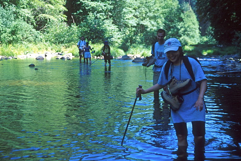
Fording the river
Tom didn't think it was so comfortable, as he ended up getting a small cut from the
rocks under the water. Brenda complained that the difference between the trail and the
river was that you could see the horse shit on the trail. Jean had water up above her
knees. But in the end everyone made it across safely. We dried ourselves off, put on
our socks and shoes, and continued up the trail.
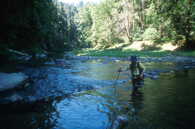
We had one more river crossing to go, and we didn't have to wait long before we reached it.
This crossing looked better, for the most part, as rocks lined most of the route. There
was a short 10-foot long section without rocks which we would have to navigate. I figured
we might be able to cross it with our shoes on if the water was shallow enough there. So I
led the way, followed by Howard, as we followed each other single file. When I reached
the critical section, I stuck my trekking pole in the water to measure the depth and force
of the current. I dipped my toe in and realized the current was actually relatively strong.
Strong enough that quickly stepping on the shallow rocks to get across would probably be
impossible, especially considering the right side fell off into rapids.
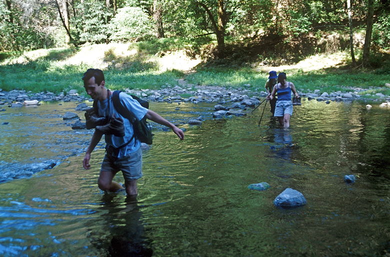
Tom making his way across the river
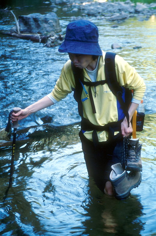
Perhaps I was suffering from low blood sugar. Whatever the reason, despite my better
judgment, I took that fateful first step into the water. I quickly determined the current
was too strong and I had to veer to the left, into the deep water. Having done this, I
figured it was hopeless, and I just kept going, trudging the last 10 feet even though my
shoes were completely submerged. I reached the other side, safely, but with soaking feet.
Howard, standing behind me, saw all this happen in front of him. And yet he, too, followed
me into the water and ended up with wet shoes and socks. That was enough for the rest, who
went back to take off their shoes and socks.
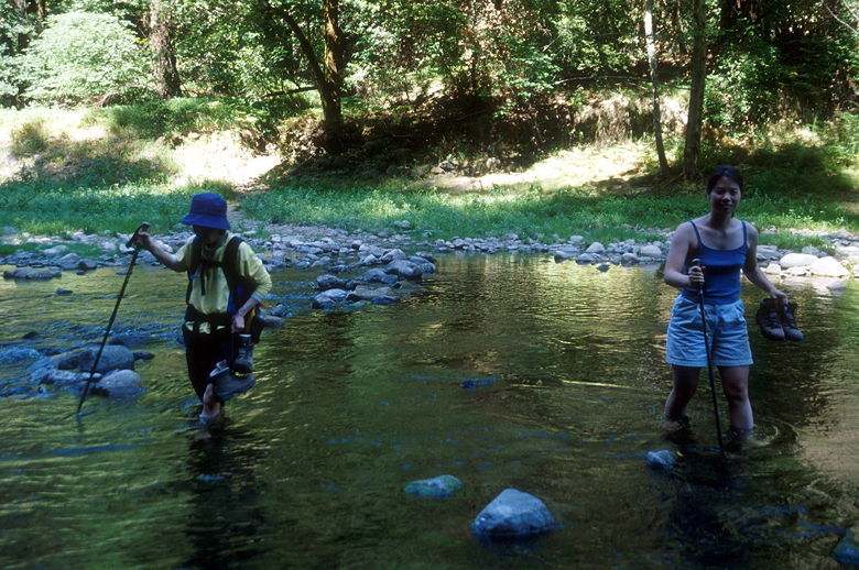
Jean and Jenny fording the river
Gore-tex boots don't help much when you're up to your knees in water. I wrung out my socks
as best I could. Still, the rest of the day's hike would be a bit squishy for me. As we
were drying ourselves off, we watched a family of ducks (a mother and a half dozen baby ducks)
swimming close to where we'd crossed. They didn't have to worry about keeping their socks dry.
Jean making her way across the critical section
Knee deep!
Eventually we continued on the trail. We passed what looked like a trail heading up away from
the beach. However, we soon found ourselves staring another river crossing in the face. We
turned around and took that trail we'd passed. It turned out to be the right trail.
We continued on the Big Rock Hole Trail, which took us up and away from Big Rock Hole, which
was filled with people swimming and sunbathing. The trail now climbed and climbed, through
the redwoods and up to Rincon Fire Road, where we turned right. Somewhere along the path
three mountain bikers stopped us and asked Brenda to take their picture. This is one of
the rare hikes where we saw more horses than mountain bikes.
Soon we found ourselves back on the familiar River Trail. We then took the Pipeline Road
back. We somehow missed the turnoff onto the Redwood Grove Loop trail and ended up taking
the Pipeline Road all the way back to the parking lot.
The redwood groves are of course a big part of the treat of this trail. The observation
deck supplies some views, though certainly not anything worthy of high ratings. The best
part of this hike, for me, is the San Lorenzo River. Catch it at the right time of day
and season, and it's what makes the hike worth it.
| 

