|
The Lassen Peak Trail parking area is a huge lot, and I was the
only car there. I wanted to get an early start on the hike to
avoid possible afternoon thunderstorms, and no one else seemed
to want to get started at 7:30am.
I started to prepare for the hike. As I did so, an RV pulled in
-- one I'd seen pull out of the Summit Lake campground earlier
that morning. A man came out and asked me if I was getting ready
to climb to the top. I assured him that I was. He walked up the
trail a short way before returning -- just scoping it out. He
drove away.
As I was setting up my tripod to prepare to take a self-portrait
with the mountain in the background, another car parked near mine.
Three men came out -- as I would learn, a 53 year old man (who
last hiked to the top 43 years ago) and what I assume are his
two 20-something sons. They'd be hiking to the top, as well. While
I felt safer knowing that I wouldn't be the only one, there is
something to be said for solitude.
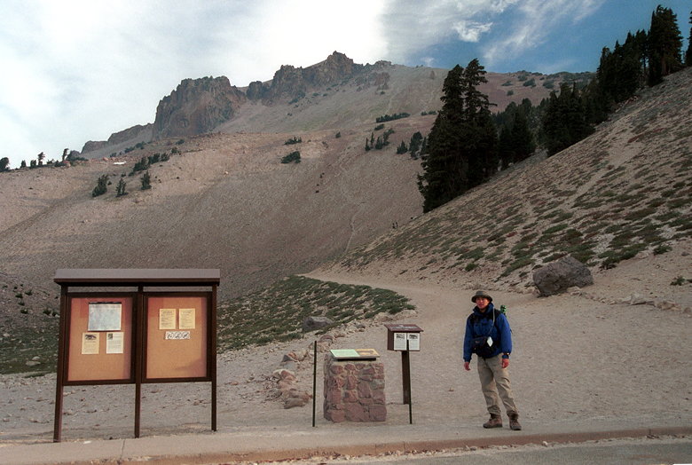
The Lassen Peak trailhead
I started out in full armor -- long underwear, convertible pants,
long-sleeve shirt, heavy fleece jacket, rainjacket, and gloves.
At 8500 feet elevation, it was cold, and it didn't figure to be
much warmer later in the day at 10,457 feet. I brought along my
light fleece, too, just in case.
We started out at 7:45am. I leapfrogged the other hikers for the
first part of the climb, as I stopped to take pictures and they
stopped to rest. Well, most of them -- one of the sons kept going
far ahead of the others until he finally waited for them to catch
up and went with them the rest of the way.
The trail is, for the most part, barren. There are some trees
hugging the trail near the bottom. Isolated patches of wildflowers
are precious and few. A family of deer trotted up the hill just
ahead of us. Other than that, the only wildlife I saw was the
occasional chipmunk scurrying away.
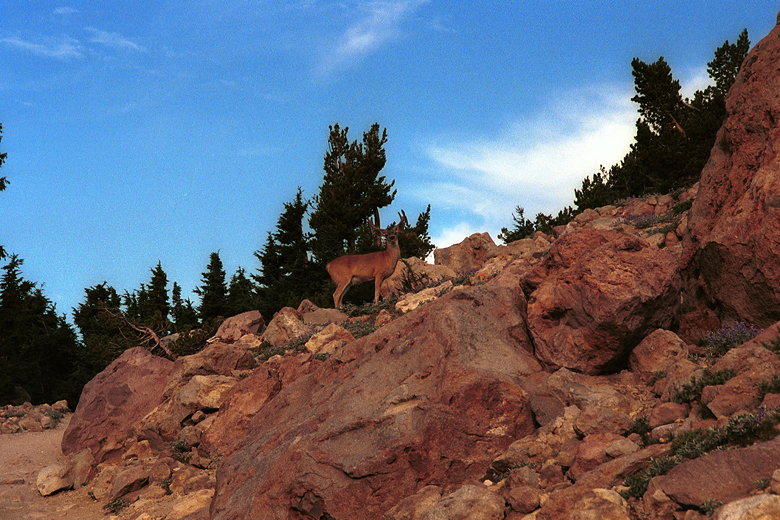
Deer on the lower slopes of Lassen
The trail is only 2.5 miles, with about 2000 feet of climbing.
This means the average grade is over 15%. It really isn't bad,
however, because the grade is pretty constant throughout. It's
easy enough to just pick a reasonable pace that you can keep up,
and then just go. It's over before you know it.
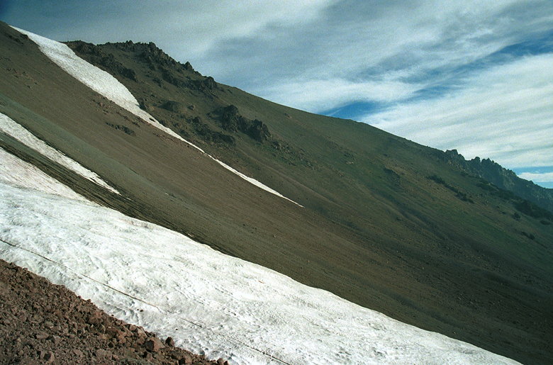
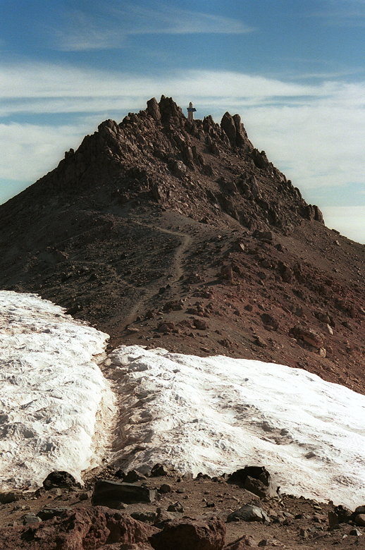
The barren slopes of Lassen Peak
There are plaques placed at various points along the trail, describing
various aspects of Lassen Peak, volcanism, and Mt. Tehama (the
larger precursor to Lassen). There are also lots of signs warning
hikers not to stray off trail, as this damages the fragile environment
here. As it is, life hangs precariously to the rocks. Some of
the rocks are noticeably similar to the ones found at the top
of Round Top near Lake Tahoe, which was also formed by volcanic action.
It's impossible to get lost. There's only one trail. As we hiked
higher, I noticed the mist creeping in from the east. I'd waited,
hoping to get better light to take a picture of Reading Peak.
But a few switchbacks later and I was disappointed to find it
enshrouded in mist. It got worse.
While the sky above was almost completely clear, there appeared
to be a second horizon -- a sharp layer of fog/haze/smog at perhaps
the 8000-9000 foot level, hiding or blurring everything below
it. Brokeoff Mountain, which I'd climbed the day before, now looked
mystical, even somewhat foreboding.
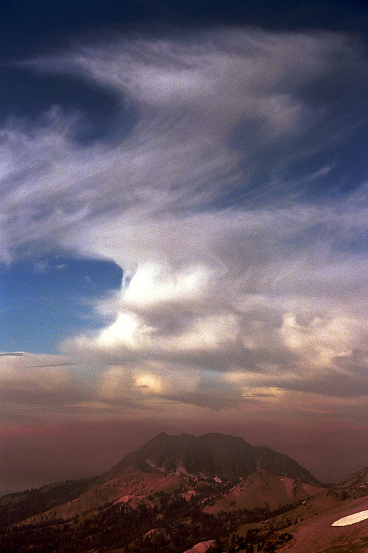
Brokeoff Mountain under a sea of smog
For the last half of the climb, the goal is clearly visible --
a solar-powered communications station and seismograph lies at
the summit. The solar panels are obvious, and the communications
station looks like a giant white outhouse.
There's a sign that there's only 1/2 mile to go. That means just
under 500 feet of climbing remains. Soon I was on the false summit.
There's a plaque here which describes the summit shack built in
1913. Of course it's no longer there, since the volcano started
erupting in 1915 and didn't quiet down until 1921.
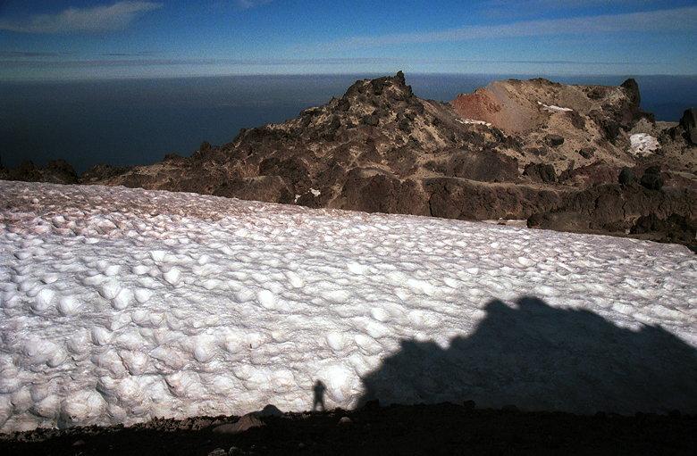
The crater is clearly visible here, with large snow patches clinging
to its sides. The crater might be a quarter mile wide, basically
circular. Mt. Shasta is clearly visible above the haze line to
the northwest.
The final path to the summit (weather station clearly visible)
The path now leads down a few feet and through a snow bank. Fortunately,
the snow has been melted, cut, or beaten down, all the way to
the ground. The snow rises about 3 feet on either side. After
the snow, it's hard to follow the trail as it winds its way up
the rocks. It's not like Mt. Dana or Tinker Knob, but it's no
Bumpass Hell boardwalk, either. It's short, though, and soon I
was standing on top.
The summit crater
I reached the top of Lassen Peak, elevation 10,457 and the Shasta
County highpoint, at 9:30am. I signed the register (such as it
is -- a metal tube stuffed with scraps of paper) near the communications
station. As I stood there taking pictures and pondering the haze,
I heard a rumbling. I couldn't quite figure it out at first. Eventually,
I decided it must be a small rockfall (it was very steep on that
face), and not the volcanic grumblings of the mountain.
I admit to being very disappointed with the view. Granted, the
haze is probably an exception, and the view is probably normally
great. But, even so, the geography of the summit doesn't really
allow the great summit experience of Brokeoff Mountain, or Mount
Dana, or Mt. Tallac. There, you can feel like you're on top of
the world. Here, you can feel like you're on top of half the world.
Or a quarter. Your view is always blocked by something. Sure,
you can walk some distance and get a better view, but there's
no all-encompassing 360-degree view. It's just not the same. That's
the problem with having a quarter-mile-wide crater in the middle.
The true summit is on the rim of the crater, on the southeastern
side.
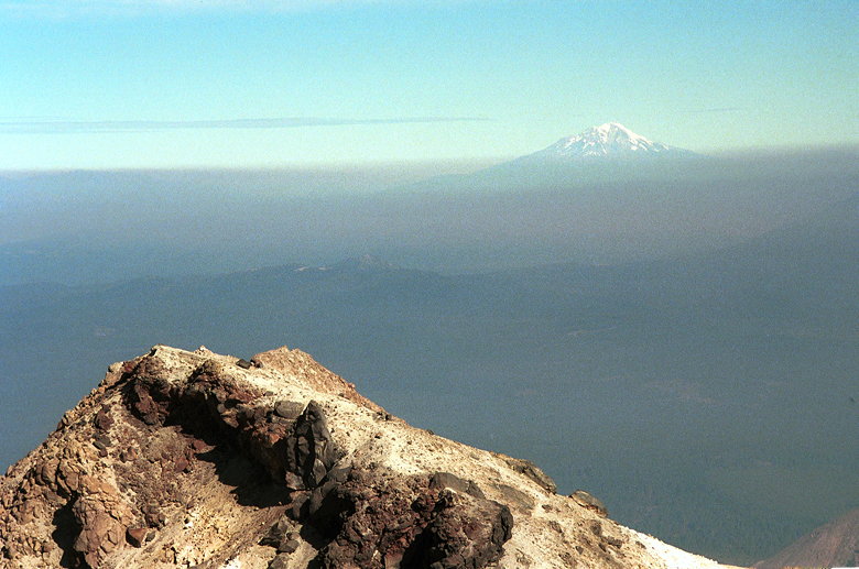
Mt. Shasta pushing through the smog
The other three hikers joined me at the summit about 15 minutes
later. While they sat on rocks, I whipped out my chair, which
I was very glad to have. There weren't a lot of large rocks to
sit on -- mostly sharp small ones which didn't look too comfortable.
I took out the weather radio and listened to make sure there weren't
any rogue thunderstorm warnings. I felt safe since there weren't
any menacing clouds, but I just wanted to be sure.
Shortly, after I took a picture of them, the others left the summit.
I started down after them a few minutes later, at 10:05am. On
the way down, the view appeared to get better, but this was only
because I was actually in the haze now and didn't have to look
through as much of it.
I passed several people who were headed up the trail. In all,
I encountered 20 other people on the trail, about a half dozen
of whom were CCC volunteers doing trail maintenance (mostly rock wall
work). I assume CCC = Civilian Conservation Corps. I must admit
the trail is in pretty good shape. Lassen itself is very steep
-- much steeper than 15% -- and the easily switchbacked trail
tames the mountain.
There was nothing to slow me down on the descent except my trekking
poles. I made it back to my car a bit before 11:15am.
As I drove away, I thought to myself that it's more fun to take
great pictures than it is to hike hazy summits alone. Now, back
at home, I'd agree that it's more fun with someone else. But perhaps
what I'm essentially saying is that it's more fun to take great
pictures than to take lousy, haze-filled ones.
Return to Lassen Volcanic NP trip report.
| 

