Directions:
From downtown San Francisco, take 280 south. Exit at Monterey Blvd. Turn right on
Foerster St., left on Los Palmos Dr., right on Bella Vista Way, left onto
Molimo Drive, and left onto Myra Way. Park near the intersection with Dalewood Way.
From the peninsula, take 280 north and exit onto
19th Ave. Turn right on Sloat Blvd., left onto Portola Drive, right onto Miraloma Drive,
left onto Marne Ave., right onto Juanita Way, and left onto Dalewood Way. Park near the
intersection with Myra Way.
View Driving Map
I parked my car on Dalewood, near the intersection of Myra Way,
Sherwood Court, and Landsdale Ave. After struggling with directions
(I was supposed to get off of 280 at Monterey, but there is no
such exit going north!), I was happy to get out of the car.
This really isn't so much of a hike as a walk in the park. There's
a sign at the bottom which mentions the top isn't actually owned
by the city. It's private property. The city sold it because there's
a huge cross standing on the top, and people were concerned about
the city owning such a symbol.
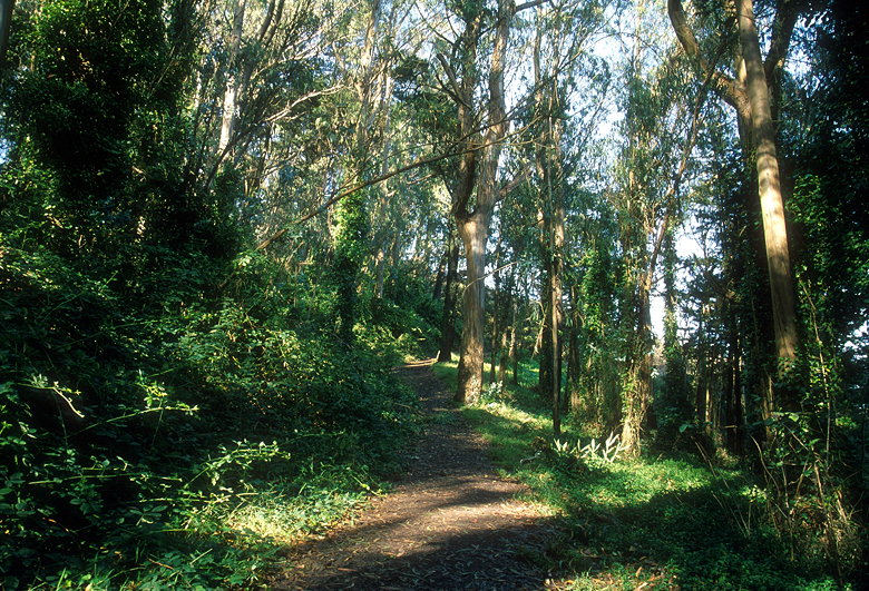
The lush green forest of Mount Davidson
The hike starts out through a lush green forest before quickly
giving way to bare hillside and views looking south and east toward
downtown. Twin Peaks and Sutro Tower are clearly visible close by
to the northeast.
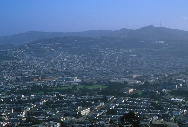
Rows of houses visible toward the south
The top is completely flat. To the west, views are blocked by
trees and the aforementioned cross, which towers 103 feet above
the ground.
View from the top
At 927 feet high, Mount Davidson is the highest point in San Francisco
County, and that's pretty much the only reason I walked to the
top.