Ohlone Wilderness Trail |
Day 2 of 3
At 3am, it was cold and Jean and I couldn't sleep. We started
playing Tangoes for a half hour before we ran into a puzzle we
couldn't solve, and tried to go back to sleep.
The wind started to pick up in the morning. By 6am, gusts were
buffeting my tent. I looked outside and, as the wind picked the
rain fly off the ground, saw Jennie's tarp (which she had placed
over her sleeping bag) lying on the ground, about 20 feet from
Jennie. I grudgingly put my clothes on and went outside to retrieve
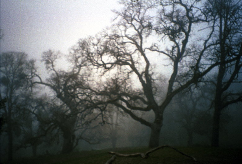
it. Mist descends on Stewart's Camp in the morning
When I went outside the tent, I found that a heavy mist had descended
onto our campsite. The sky was completely overcast. It added that
mystical quality that I'd missed from last year. The forecast
had called for mostly sunny all three days of our trip. While
I was a bit concerned, I figured it was just your typical Bay
Area fog and that it would lift.
Still, that didn't prevent me from shivering while starting up
the stove for breakfast. According to Kane's thermometer, it was
36 degrees. But with the wind chill it was probably at or below
freezing. I made oatmeal and hot chocolate for myself. I made
Jennie's breakfast while she stayed in her sleeping bag, handing
me her cup, too cold to venture out of her cocoon.
After breakfast, I suffered some sort of brain lock. I had gloves
on because it was so cold. I turned my stove off, then started
to separate the stove from the fuel. It took me several seconds
before it registered that the stove was melting my glove. Luckily,
it was easy to notice that my hand was getting warm while the
rest of my body was freezing. I stopped after it'd melted the
outer lining of a section of one glove finger.
While we were breaking camp, some runners wearing shorts and t-shirts
came by and refilled their water bottles. I asked them how long
it'd taken them to get here, and they replied about 1 hour 20
minutes from Del Valle. They said they were halfway to their destination
(I assume it was Rose Peak). I was impressed, but not all that
impressed with their attire.
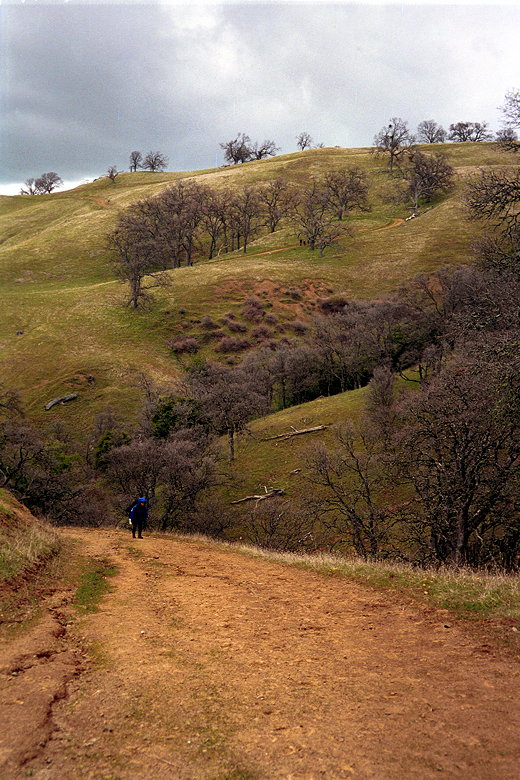
Around 9am we were ready to hit the trail.
The fog did start to lift as we started up the trail. We could
see patches of blue here and there. But it was still cold. We
passed a lot of large pine cones along the way. The trail was,
as usual, a fire trail, though it was very muddy in places and
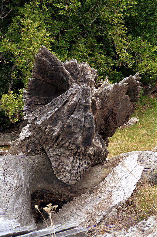
we had to pick our way carefully. Is it a tree or a petrified monster?
Near the 3600 foot level we saw small patches of snow by the side
of the trail. I knew that it'd snowed on top of Mt. Hamilton a
few days before, so I wasn't too surprised. Still, it was interesting
to see snow in the Bay Area in April. Jean wearing her biohazard suit; Jennie (far left) and Kane head
uphill
We passed some backpackers going in the opposite direction. We
were continually running into runners on the trail who were ill-equipped
for the cold weather. I had my gloves and balaclava on -- full
snowshoeing gear. And I was still a bit chilly. I had meant to
keep my long underwear clean for sleeping in, but it was so cold
I'd decided to wear it while hiking anyway. Near the bottom of our descent
After reaching over 3600 feet in elevation, walked alongside a
fence for a mile before descending yet again -- back down to 3200
feet. Up and down -- it may not seem like much, but it adds up,
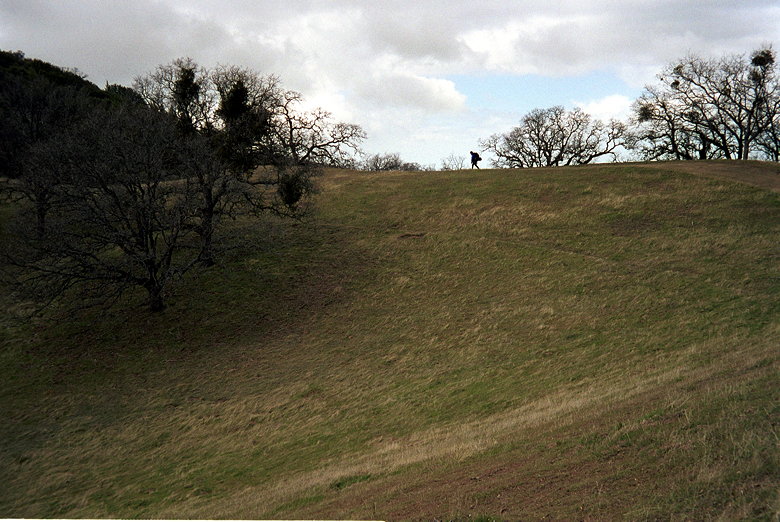
and it's a psychological thing, as well. Jean hiking along the horizon
Soon we were standing on top of Rose Peak, 3817 feet, the highest
point in Alameda County (technically, it's not, but Discovery
Peak, a mile away and 20-25 feet higher is on private property).
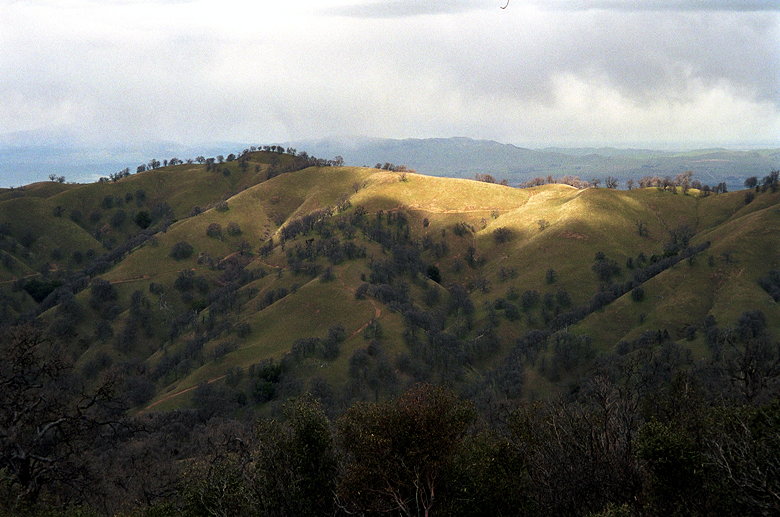
From here we could see far in every direction. Mt. Diablo was
enveloped in clouds. Altamont Pass and its windmills. Rain was
hammering the land in the distant east. Sunlight bathed the San
Francisco Bay region. I figured the clouds would pass and we'd
have our sunny weather back within a couple hours.
We started down from Rose Peak. After hiking 4 miles, we still
had another 6 to go. A day hiker coming up to the peak from the
opposite direction told us of snow flurries he'd been through
earlier in the day. Shortly after that, we ran into some backpackers.
It turns out that they were headed to Stewart's Camp; they'd stayed
at Eagle's Aerie the night before, so they were doing the exact
opposite trip we were. In fact, when I'd called a month earlier
to make reservations, I'd wanted to go the opposite direction.
I had a feeling that on the trail I'd meet the people who'd prevented
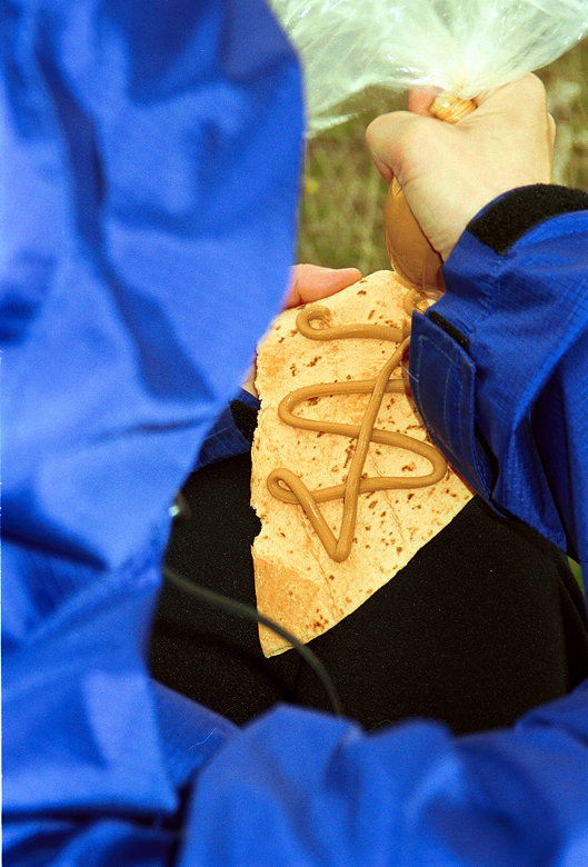
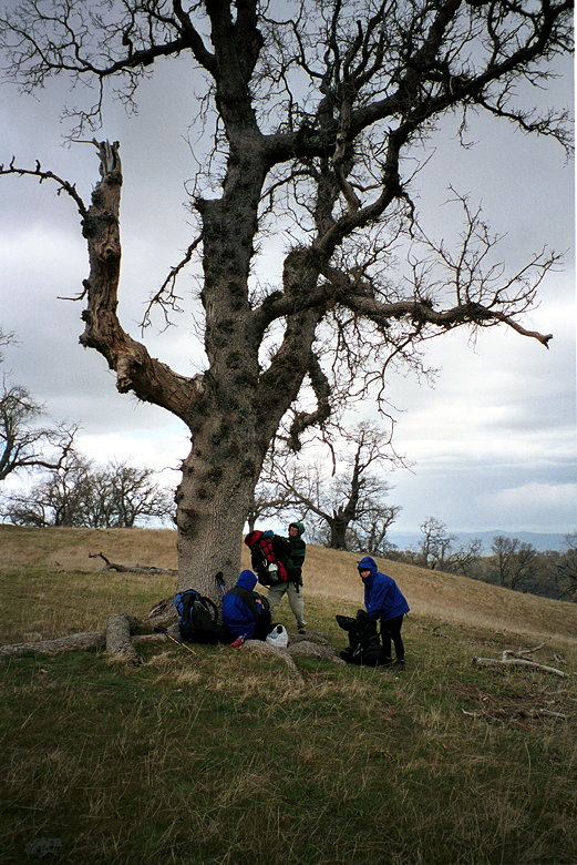
me from doing so. Fancy designs in peanut butter
After descending a bit, we stopped for lunch. It was windy, but
we found the protection of a tree. Jean squirted out peanut butter
onto tortillas for a great lunch for the two of us. After a quick
lunch, we decided it was too cold and we wanted to get moving
again. Packing up after lunch
So it was back to the fire trail. I looked to the right and saw
the sun breaking through the clouds onto the hills below. The
clouds were lifting from Mt. Diablo. Everything was falling into
place. Here comes the sun...we hope
As we made another descent down toward the South Fork of Indian
Creek (2800 feet), we were passed in the opposite direction by
a group of 3 galloping horses. Their riders smiled at us as they
passed. A few minutes later, they were galloping past us again
from behind. Jean heading up toward signpost 25
Then it was up again, to signpost 25. At this point, Kane was
a bit ahead of us. Jean followed him as Jennie and I tended to
our packs. I made some more adjustments and then found Jennie
waiting for me. There were a couple dozen cows near the trail
in front of us, and she wanted to wait for me before continuing.
Jean was already going through the gate.
I led Jennie through the cows, and we closed the gate behind us.
Then we continued on the trail toward Jean. Little did we know,
but Kane was waiting for us...near signpost 24. But we never got
there. We were distracted by the cows and never saw the sign for
the turn to the left. Instead, we went on the Valpe Ridge Road
trail. This eventually ends up at the same place, but this caused
some confusion.
The day hiker we'd seen passed us. He said he was doing the hike
from Sunol HQ to Rose Peak and back, but that he'd be taking a
different route back. He continued on past us as we struggled
under the weight of our packs. The weather got a little strange
around this time. Suddenly, there were snow flurries. The light
fluffy stuff went by us horizontally as the wind picked it up.
It was kind of fun to watch.
At the end of the Valpe Ridge Road trail, we came upon a fork.
There was a trail leading to the left, and a locked gate in front
of us. We saw the day hiker beyond the locked gate, so figured
we had to jump the gate. Since we'd missed signpost 24, we were
confused about where we were, and went down to the next trail
intersection before deciding what to do. At this point, however,
the snow had turned to hail, and was pelting us mercilessly. We
were somewhat lost, cold, and it could have gotten dangerous if
we'd made a wrong turn here.
I thought that the gate was at signpost 22, and we had to turn
left. After some discussion, I convinced the others to head back
up over the locked gate, and down that trail. Shortly thereafter,
we reached a familiar red Ohlone Wilderness Trail signpost. But
it was signpost 22. It wasn't until much later, after talking
with Kane, that I figured out what had happened. In any case,
we continued along the trail, finally safe in the knowledge that
we were on the right track.
Kane, meanwhile, had waited and waited. When we didn't show up,
he correctly guessed that we'd gone straight past signpost 24,
which is a shortcut in terms of distance. So he sprinted over
to signpost 22 to try to get there before we did. But when he
got there, that's when the hailstorm started. So he continued
along the trail. Eventually, we met up with him again shortly
after signpost 20. The calm after the storm
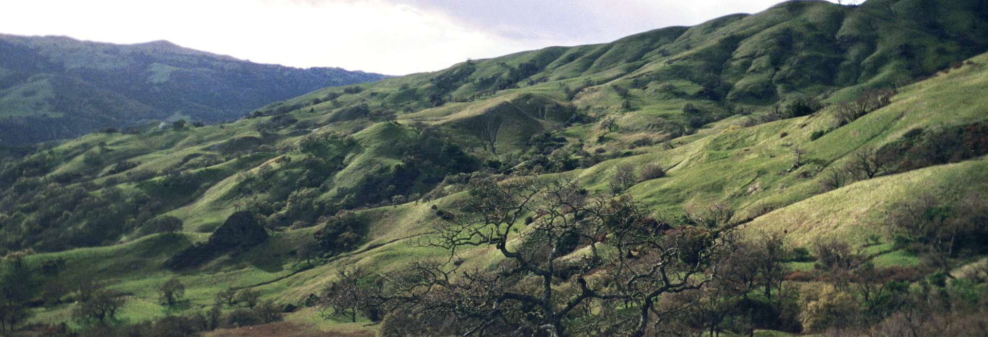
Now the skies had cleared a little. The sun was starting to come
out, finally. The trail was no longer a fire trail -- singletrack
through rolling hills. Grasslands and canyons. At some point my
mind wandered and I twisted my left ankle. I think my hiking boots
saved me.
Saturday, April 3rd
Stewart's Camp to Eagle's Aerie
9.8 miles
1800 vertical feet (ascent)
6:33
Panoramic view of our gorgeous canyon
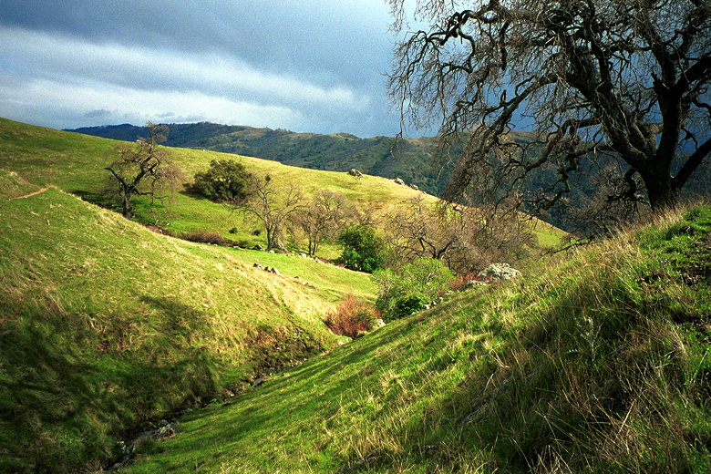
Then the valley opened up before us and it was absolutely gorgeous.
And then, just as suddenly, we were at our amazing campsite, with
that glorious view ours to be had for hours.
Jennie was still concerned about the weather. There were clouds
on the horizon, and she wasn't sure if she wanted to be outside
if it rained. But we convinced her to stay; she could always slip
into our tent if it did start to rain. As luck would have it,
the skies would clear up and it would be crystal-clear all the
way to the finish. View toward Sky Camp from Eagles Aerie Camp
For once, we arrived at camp with plenty of sunlight left. I looked
forward to a great sunset. I was glad I'd brought my tripod. Our
camp was situated above the other 3 camps. There was Sky Camp
-- a long walk up and along a ridge, then down to our left to
a perch sitting precariously over the valley. A great looking
camp, but far away from the water and outhouse. The water was
below us, just above the Hawk's Nest camp. Below that was the
outhouse, and Star's Rest camp near that.
Ours was the camp with arguably the best view, and fairly close
proximity to water and outhouse (though it did involve a reasonably
tough climb back up afterwards). It was a bit exposed, but there
were some rocks on the edge of our camp to help shelter us from
the wind a little.
Behind us were rolling green hills. We sat at the bottom of a
half-bowl, with one large tree sitting halfway up the bowl. At
our camp, a beautiful tree spread its branches over our camp,
rooted just behind the rocks. On the horizon to the west, the
sun shone over Mission Peak. Only a transmission tower on a peak
in the distance tainted our view.
On the picnic table we prepared our dinner well before the sun
set. I had another backpacker's meal -- honey mustard chicken
(but it tasted just like the teriyaki chicken I'd had the night
before). Kane raved about his Thai noodles dinner, however, so
I think I'll have to try that next time. Jean again had her rice,
and Jennie her noodle soup.
As we were having our dinner, the people from Hawk's Nest came
through our camp to visit Sky Camp, since it was unoccupied. They
stayed for a bit before returning before sunset. I was thinking
about checking out Sky Camp, but the return climb discouraged
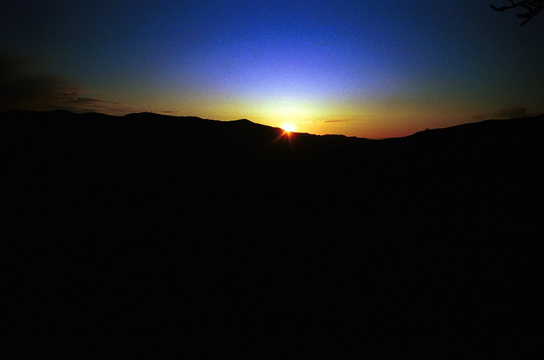
me. Instead, we all enjoyed a beautiful sunset from our camp. Sunset from Eagle's Aerie Camp
We adjusted our watches for Daylight Savings Time and all went
into our sleeping bags at around 8pm. Jean, who'd gone in a few
minutes before me, was already asleep by the time I entered the
tent.
Around midnight Jean and I awoke. We could hear Jennie adjusting
herself to try to get warm. Jean and I had to answer nature's
call, so we forced ourselves, shivering, to put on some clothes
and go outside. Jean helped Jennie with her sleeping bag and tarp.
I went outside and saw that the moon was brightly illuminating
our campsite. The sky was completely clear, and I started to put
my camera in the tripod to take some pictures. While I was doing
so, Jennie saw several shooting stars. Unfortunately, I never
saw any. I did take several pictures of the horizon, the moon,
the stars, and our camp. Later I would find out, much to my chagrin,
none of the pictures turned out.
While I was out there, I somehow managed to lose one of the feet
on my tripod. I also made the mistake of pushing that leg in so
that it was now impossible to extend it back out. But then I remembered
my Leatherman tool had a pliers, so I could fix it in the morning.
I hoped to find the foot in the morning, as well. So I went back
into the tent to try to sleep.
During the night, gusts of wind buffeted our tent for a few minutes,
then would relent for a few minutes. In the distance we could
hear cows mooing in the night. Jennie's fear of cows had entered
my head, and every other gust of wind flapping our tent had me
hearing an imaginary cow stamping its hooves next to our tent.
But of course there was nothing.
(Click image to view full size)
Related Pages:


|

|