|
The large parking lot was nearly empty, and most of the people there
only went as far as across the street. They stopped, took their pictures, and
left. Only a handful started up the trail. On the other hand, we ran into quite
a few more people on this hike than we would expect -- all at the same time. But
I'll get to that.
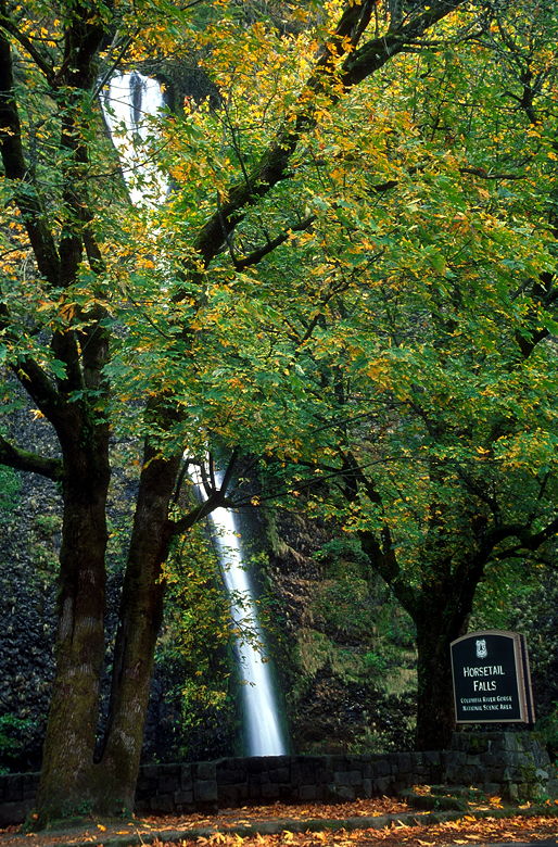
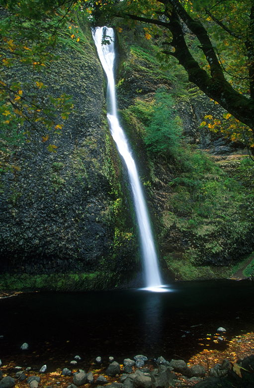
Horsetail Falls
There were some fall colors visible from the parking lot, and we'd see a bit more
later. Horsetail Falls flows into a pool just on the other side of the road from
the parking lot. It's a narrow fall, and was still gushing even though it was late
in the year. During spring runoff it must be quite powerful.
The trail switchbacks up the mountain to the left of the falls. After a climb of
perhaps 150-200 feet, it makes a left turn and flattens out somewhat. We
continued on the trail under overcast skies until we saw Ponytail Falls in front
of us. The falls gush into a pool, and the trail actually curves around the pool,
going behind the falls! It's a unique experience.
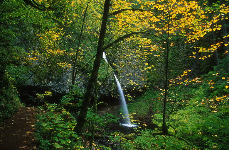
Pony Falls
While I was taking pictures of this beautiful sight, a large group came up behind us.
Keep in mind this was Friday -- a school day. Coming up the trail was a group of
about 60 kids and a handful of adult chaperones. I hurriedly picked up my tripod
and walked around the pool as the kids came up behind me. They stopped just behind
the falls, apparently for a lunch stop. Jean and I continued on the trail, heading
for some peace and solitude.
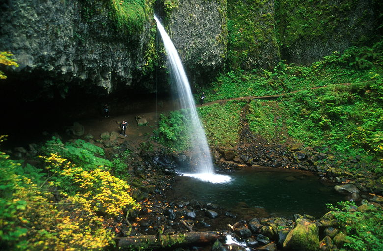
Hikers behind Pony Falls
At an overlook of the Columbia River, there was a memorial plaque in memory of a 14
year old boy who had slipped and fallen to his death back in the 1980's. In fact the
overlook has a sheer drop, and we soon made our way back to the main trail. Be careful!
The trail is relatively flat as it meanders over to Oneonta Falls. These falls are
tucked away in a corner, and they're not as impressive to look at as Horsetail or Ponytail
Falls. It has a kind of cramped feeling. A foot bridge crosses Oneonta Creek below
the falls, and the trail continues climbing on the other side.
Soon after crossing the bridge, we met a trail intersection. We turned left to head
up toward Triple Falls. The trail climbs past green trees thick with moss. It's similar
to the Hoh Rain Forest in places. Lush is the first word that comes to mind.
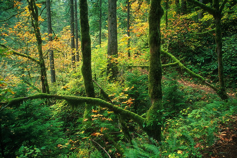
Mossy branches next to the trail
The trail lies high above Oneonta Creek, which lies below to the left. We didn't run
into any else on the trail all the way up to Silver Falls. There's a small patch of
almost-level ground with a great view of the falls. I went ahead a little bit, trying
to see if there were any other good spots to rest. I went all the way to the top of the
falls, but couldn't find any better spot, so I returned to the original viewing area.
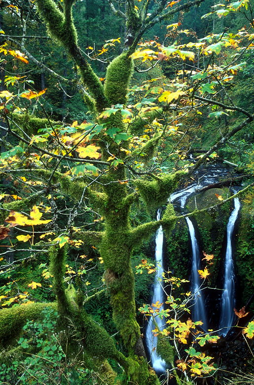
Triple Falls
The ground slopes downward a bit, and there's a sheer drop after that. We were very
careful here as we sat down to eat and enjoy the view. The ground is about the same height as
the top of the falls, which drop into a pool below. It's called Triple Falls for an obvious
reason -- the river has carved three slots into the rock at the top of the falls, resulting
in three distinct falls flowing side by side.
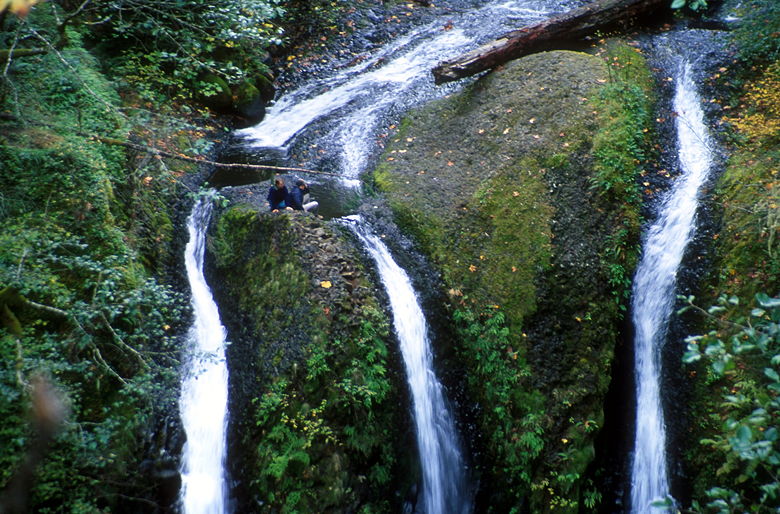
Hikers at the top of Triple Falls
While we were there, another pair of hikers made their way to the top of the falls themselves.
We considered them crazy, as they jumped onto some rock between two of the falls. They
somehow managed to avoid sure death.
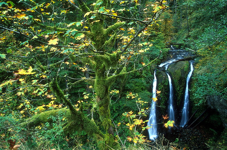
Another view of Triple Falls
We packed up to go, just as three hikers with big tripods came to the area we were resting.
After packing up, we started back down the trail. The return trip was uneventful. We passed
the intersection we'd passed earlier; instead of turning right and returning the way we came,
we continued straight to complete a loop hike. There's not much to see here. Also, one problem
with doing many hikes (including this one) in the Columbia Gorge area is that it's hard to
get a sense of being out in the wilderness. As we returned toward the roadway, a freight train
came roaring by, less than half a mile away from us.
The trail makes its way down to the Historic Columbia River Highway. We turned right to
return to our cars. There's no trail here, though the route is suggested on local maps.
Instead, hikers must walk on the side of the road, as cars race by at 40 or 50 miles per
hour. There's a reasonable amount of shoulder, but it's not the safest route to take. If I
had to do it again, I would have made it and out-and-back trip, returning via Ponytail Falls.
That would have been safer, prettier, and more enjoyable.
We stopped briefly to take a glimpse at Oneonta Gorge. It's a narrow gorge which is
supposedly a botanist's playground. It was still overcast, however, so it was dark in the
gorge. There also were several people already down there, so we didn't venture inside. Instead,
we simply continued along the road back to the Horsetail Falls parking lot.
Horsetail Falls
Return to Portland trip report.
| 

