|
Jean, Jennie, Reza, Weihaw and I woke up at 1am in the Whitney
Portal family campground. Well, at least they may have woken up
-- I don't think I ever fell asleep that night.
We packed up and drove the short distance to the trailhead, where
we placed our scented items (food, toothpaste, etc.) in a bear-safe
locker (they're free to use, but crowded).
At 2:46am, under a three-quarters full moon, we started out up
the trail. The trailhead lies at 8361 feet, and starts climbing
immediately. Our headlights led the way as we climbed up the switchbacks.
The moon provided us some light to enjoy the surrounding scenery,
but wasn't enough to walk by.
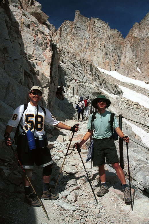
Despite the early hour, there were other hikers along the trail.
We could see their headlights bobbing up and down either above
or below us. We stopped for a break at the Lone Pine Lake turnoff,
about 2 hours and 2 1/2 miles into the hike. Reza whipped out
his handy 2-pound chair and made us all envious (I am definitely
going to buy one!). While waiting, another large group (about
8-10 people) would pass us. We would leapfrog each other for the
next few hours.
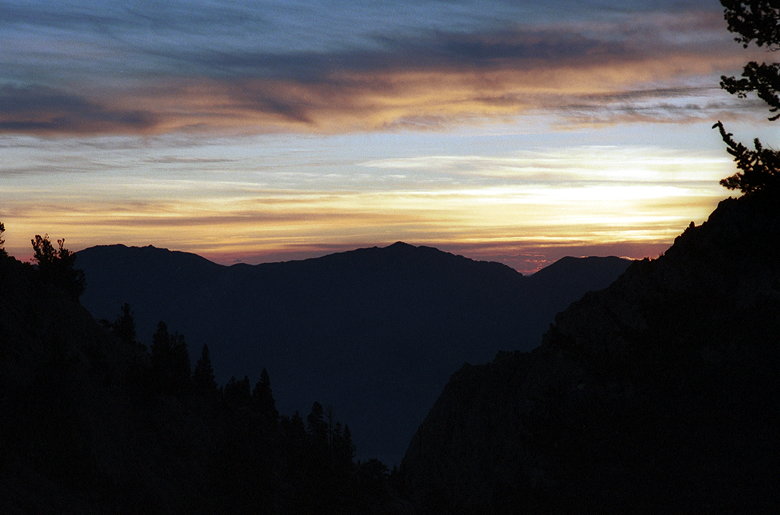
Sunrise. You can see the city lights of Lone Pine at right center
The light from the rising sun began to light up the way as we
approached Outpost Camp. There's a solar toilet here, and a few
campers. The sun itself was rising as we approached Mirror Lake.
Despite the early hour, the sun was strong and we stopped to apply
sunscreen. At high elevations, the sun can burn quickly.
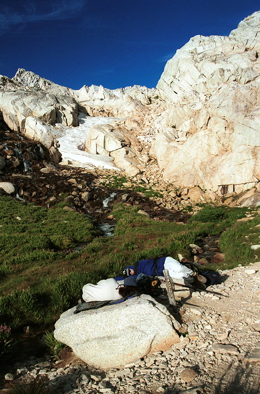
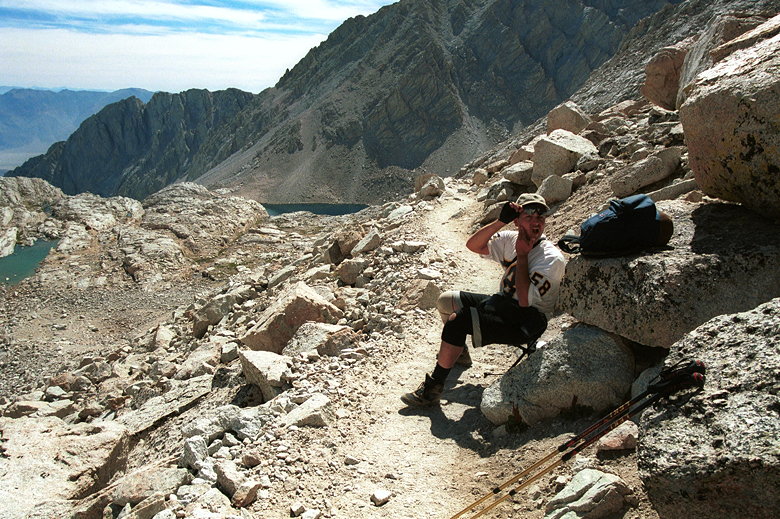
Jean and Jennie zonked out at Trailside Meadows
At Trailside Meadows, 5 miles into the hike, Jean and Jennie needed
a break. Reza stayed with them while Weihaw and I went up ahead
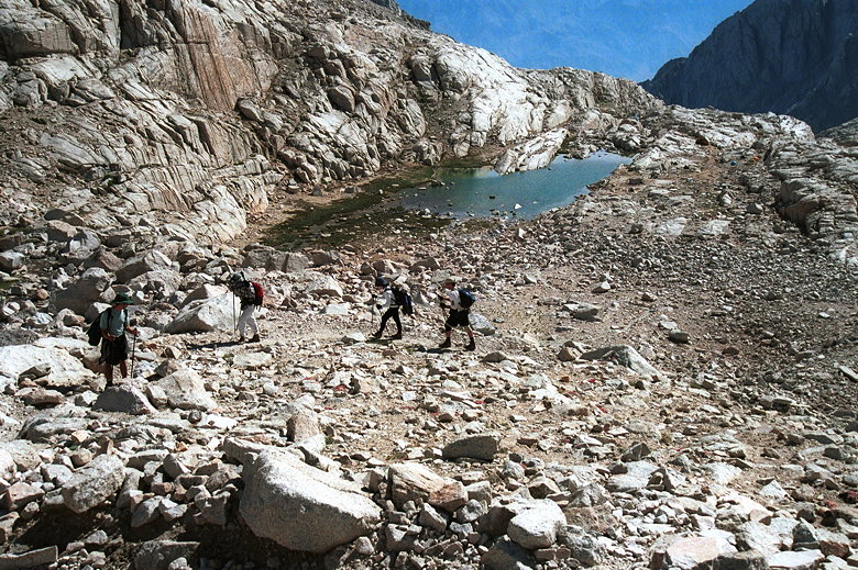
to start filtering water. We stopped at a creek near Consultation
Lake and started filtering. The rest of the group joined us a
few minutes later. One by one we refilled our water packs as we
ate lunch. Jennie filled her water pack and then went on up to
Trail Camp and the solar toilet. Then Jean and Reza. Finally,
Weihaw and I headed up after the others.
The climb above Trailside Meadows
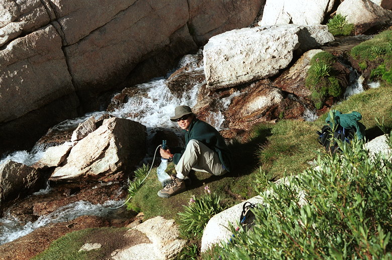
Filtering water near Consultation Lake
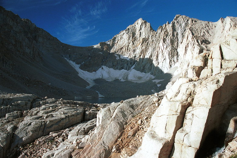
Consultation Lake
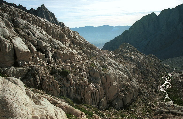
After a short climb, we reached Trail Camp, about 6 miles into
the hike. I was envious of all the backpackers who'd gotten permits
and had set up camp here. There were tents everywhere. The 99
(or 96 or 97?) switchbacks led up to Trail Crest from here. Although
it was impossible to see the trail from below unless you saw people
on it.
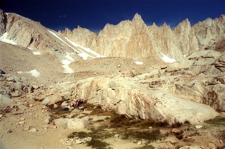
The view from Trail Camp
Bags were hung from rocks to keep them from the numerous and hungry
marmots and chipmunks. There's a small lake there which could
be used for filtering, but I think I prefer the rushing creek
we used.
The solar toilet has the unexpected warning that you're not supposed
to urinate in it. Basically, it's a shit-only toilet. Not really
sure why, but it has something to do with the chemical process.
With tens of thousands of people hiking the mountain every year,
shit is a serious problem. They used to helicopter it out once
a year. Not sure exactly what their waste management process is
now.
Mt. Whitney isn't actually visible from Trail Camp. The Trail
Crest is. From there, Mt. Whitney is a 2 1/2 mile hike behind
the mountains visible from Trail Camp. We started off on the infamous
switchbacks a little after 9am. Still time to summit and start
heading down by 3pm (preferably earlier).
There was to be possible trail maintenance in August and September,
from 10am to 3pm. This would lead to possible delays of up to
1 1/2 hours each way. But we heard the good news from someone
at Trail Camp that the construction hadn't started yet, and wouldn't
for a few days. We were in luck -- the path to the top was all
clear.
The lower section of the switchbacks has water (from melting snow)
running through it. We had to pick our way through, but it wasn't
enough to get our boots wet. Much of the switchbacks is very rocky
and dicey in places. If you're not careful, you'll fall a long
way down, and get hacked up by the rocks in the process. But if
you ascend or descend them in daylight, there shouldn't be any
problem.
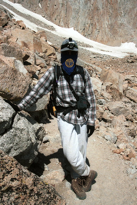
Heading up the switchbacks
Part of the reason no one can seem to agree on how many switchbacks
there are is that it's hard to tell when they start. We started
counting but soon gave up. We were joined by dozens of people,
pretty much all of them going up at this relatively early hour.
Jean at the cabled section
Reza and Weihaw ready to hike after a rest
We stopped at the short cabled section of the switchbacks. This
isn't nearly as steep as the cabled section of granite on Half
Dome. Psychologically, it's nice to have the cables here, though,
because there's a steep, smooth granite drop-off from here. Reza
complained about being cold, and then I pointed out to him that
he was sitting next to a big chunk of ice (leftover from the winter
storms, it hadn't melted yet). It was like sitting next to an
open refrigerator.
Reza reapplying sunscreen to defend against the vicious sun
At switchback 58, someone descending told us that we were at switchback
58. Encouraged, we started counting up from there. The switchbacks
up to 80 or so are fairly short, and we made good progress. My
complaint in general is that the switchbacks are too switchbacked.
The trail is much too long and not steep enough. It may sound
strange to complain about the trail not being steep enough, but
I'd much rather have a shorter trail. The grade was excessively
gentle.
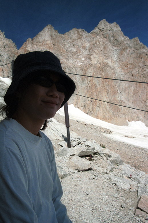
Ninja girl, aka Jennie, with her own protection from the sun
The last few switchbacks are really long. Around switchback 94
or 95, Jean had to stop. She complained of on-and-off headaches,
and the urge to vomit. This wasn't good. We were now at about
13,500 feet. It would only get worse, but we were so close now.
We decided to stop and rest and see how she felt. Jennie said
she would turn around and descend with her, but after a rest Jean
decided she felt fine and we would keep going.
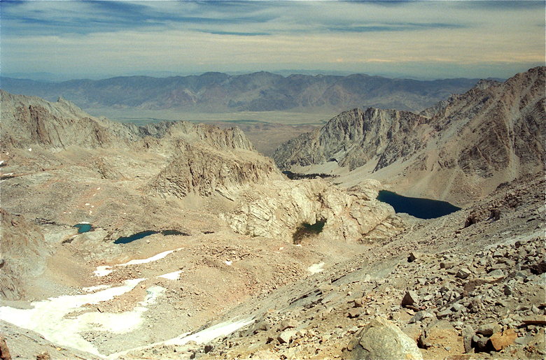
View from the switchbacks. That's the Owens Valley, elevation
4000 feet, and then another mountain range in the background
Jean led a slow but steady pace up the remaining switchbacks and
we soon found ourselves at Trail Crest, 13,777 feet above sea
level, about 12:30pm. Only 722 vertical feet below the summit.
The view was amazing. The mountain dropped off almost vertically
on the western side.
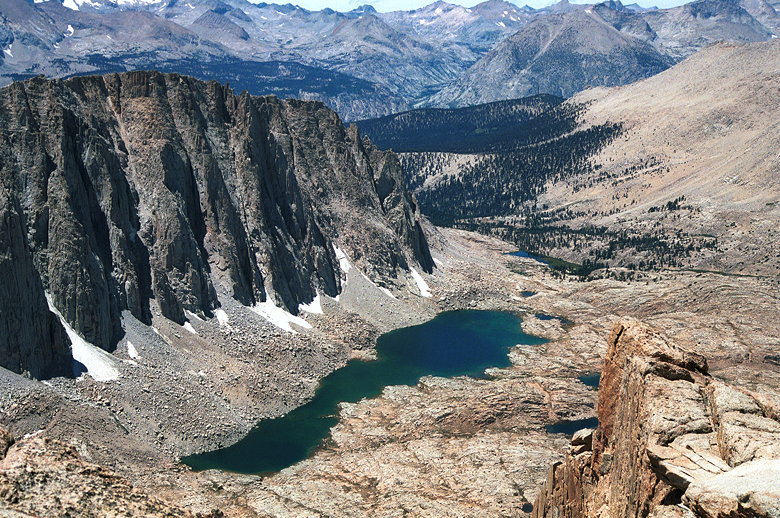
View of Hitchcock Lake (elevation roughly 11700 feet) from Trail
Crest
Unfortunately, Jean was getting worse. She threw up her lunch.
At this point, we knew we had to descend. Sure, we wanted to get
to the top. I'd been planning on summitting Whitney for 2 years.
Jennie had passed up a free Alaskan cruise to do this hike. Rez
was...well, out of shape but doing amazingly well considering.
I felt great and I was proud of everyone for making it this far.
But as Jennie would say, "the mountain will always be here." We
knew we had to get Jean down. That's the only thing that would
make her recover from the altitude sickness she was suffering.
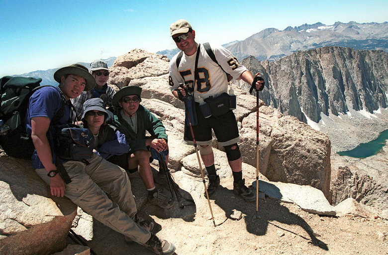
Group shot at Trail Crest, just before descending
After a brief stay at Trail Crest and a mandatory group photo,
we started our descent. Trekking poles made the descent much easier
than it would have without them. But the trail is still so long
down to Trail Camp. It seemed to take an eternity to descend.
Indeed, we didn't make it back down to Trail Camp until about
4:30pm.
Reza, trying not to damage his knees (which were encased in two
knee braces), took an even slower pace and arrived a bit later.
We filtered water for the trip down while Jean rested up. It was
nearly 6pm by the time we continued our descent.
One of the amazing things about this hike was how many people
were unprepared. We saw so many people with little food or water,
inadequate clothing...basically no respect for the mountain. As
it grew darker, two women came down the trail and asked us if
they could borrow a lighter. A lighter? They really needed a flashlight
but were too stupid to ask. The frustrating and ironic thing is
that these people made it to the top and we didn't. We spent the
rest of the way helping light the way for them, slowing our progress
considerably.
The moon, which was high in the sky at the beginning of the hike,
was now nowhere to be found. After the sun set, the darkness was
complete, and our headlights were the only things keeping us from
falling off the trail into oblivion. Okay, I might be a little
bit overly dramatic here. But the dangers are real. People have
died on Mt. Whitney. Others have wandered around in cold and darkness,
trying to find their way back. With no light and no moon, it would
be almost impossible to find your way back in the dark. Too many
people don't understand the dangers. The problem is, similar to
Everest, when you a climb a mountain, you're not climbing it alone.
There's a decent chance you may have to assist others who are
less prepared or less experienced.
On the other hand, if you do get into trouble on the mountain,
there are lots of people to help you. There were many people on
the switchbacks who noticed Jean's illness and asked if there
was anything they could do to help. Despite my contempt at ill-prepared
people, I am happy to say the number of helpful, prepared people
probably outnumber them.
After the hike we returned to our cars, got the food from the
bear-safe locker, and made the half-hour drive back down to the
motel. I was so happy to sleep in a nice warm bed after all those
days of camping.
I don't think I'll ever attempt Mt. Whitney as a day hike again.
The chance that someone will get altitude sickness is too great.
And there's also the chance that a storm will come in and ruin
your chances of summitting. I know it's seemingly impossible to
get lucky and get an overnight permit for Mt. Whitney, but I will
try. Staying at Trail Camp (12,000 feet) to acclimatize and attempting
the summit from there seems like the most reasonable idea.
Another day, then. The mountain will always be there.
Addendum: The permit process for Whitney has changed since my hike. They are
now done by lottery, which is a much saner approach; when I tried I had to call every
morning at 8am and the phones were always jammed. Also, they have removed the
outhouses on the trail. You now have to pack out all waste.
Return to Mount Whitney trip report.
| 

