|
It was spring, perfect time for a trip to Sunol Regional Wilderness -- one
of my favorite parks in the Bay Area. In spring, anyway. In the summer it becomes hot
and the hills turn from green to brown. Now, though it was beautiful rolling green hills
everywhere.
Having been to the park several times, I wanted something different. I decided to pick
the Maguire Peaks Loop, since it's outside
the main area of the park. When we got to Welch Creek Road we saw a sign which says you
need to get a parking permit from the park entrance. So we went along Geary Road to the
park entrance where we paid our $4 per vehicle and then backtracked to Welch Creek Road.
Welch Creek Road is narrow -- only big enough for one car in places -- but it is paved.
At the 0.72 mile marker we parked in the small lot. There's space for about 5 or 6 cars,
carefully parked. There was only one other car there.
Brenda, Howard, Cammy, Jason, Jean
and I walked through the gate to start our hike. The weather was absolutely perfect --
clear skies, with just a few clouds on the horizon. Since it was such a short hike, we
were starting in the afternoon instead of the morning. Though the sun was shining, it
wasn't hot at all. There were nice cool breezes throughout the hike.
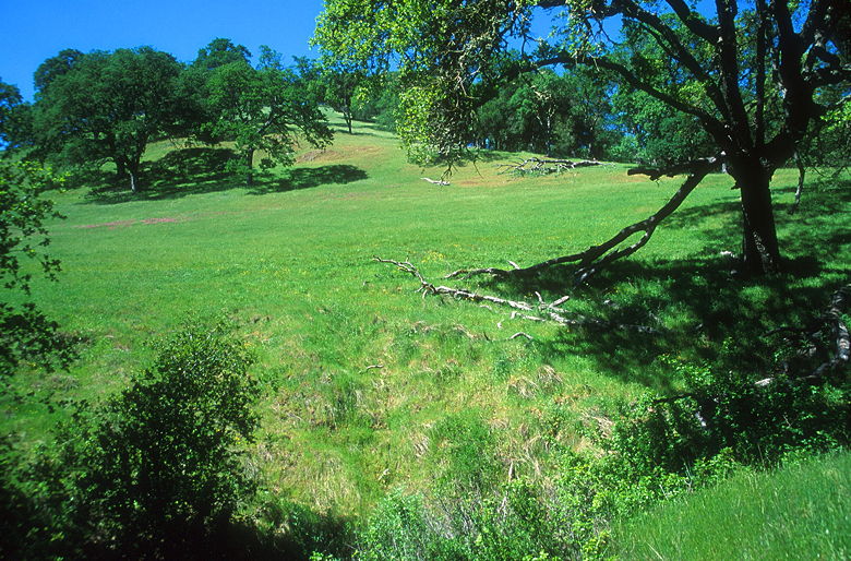
View of the hillside
The trail begins climbing steadily from the start, going up a gully. We soon came upon
a large group of cows lounging around underneath some trees next to a clearing. There
were cows on either side of the trail, but most of them moved to our right by the time
we passed. As we passed we made sure not to step in the numerous cow pies, some of them
unfortunately rather fresh.
This part of the trail is shaded, but it then breaks out into the open. There are simple
metal trail signs with arrows (no words or numbers, just arrows). We turned right to
head uphill to join the Maguire Peaks Loop fire road. We then turned left and started the
loop portion of the hike. We were immediately rewarded with great views of rolling green hills
to the southeast, with oak trees glistening in the afternoon sun. Above us to the north were
the obvious forms of Maguire Peaks. Soaring above us were birds, perhaps turkey vultures.
Closer to hand were fields of wildflowers. There were orange poppies, blue lupine, and some
kind of yellow flower.
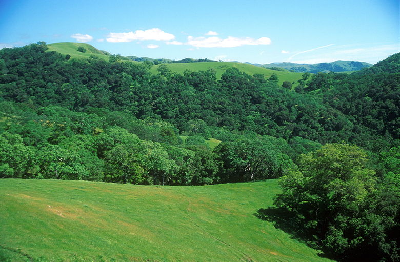
Typical rolling green hills
We rounded a corner to our right, the trail leveling off for a bit. We followed the
contours of the hillsides for a bit before the trail heads uphill again, topping out on a
ridge with great views to the north. We were now on the other side of the Maguire Peaks,
looking out at Mount Diablo perhaps 15 miles to the north. Closer, about 2 miles below us,
were the blue waters of San Antonio Reservoir. It was also quite windy as we took a break
amidst the rocks. We watched as four other hikers descended from Maguire Peaks.
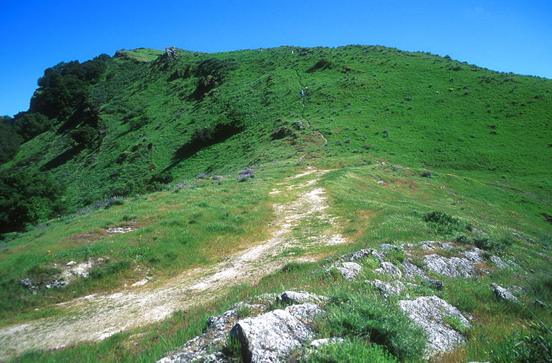
Looking up at Maguire Peaks
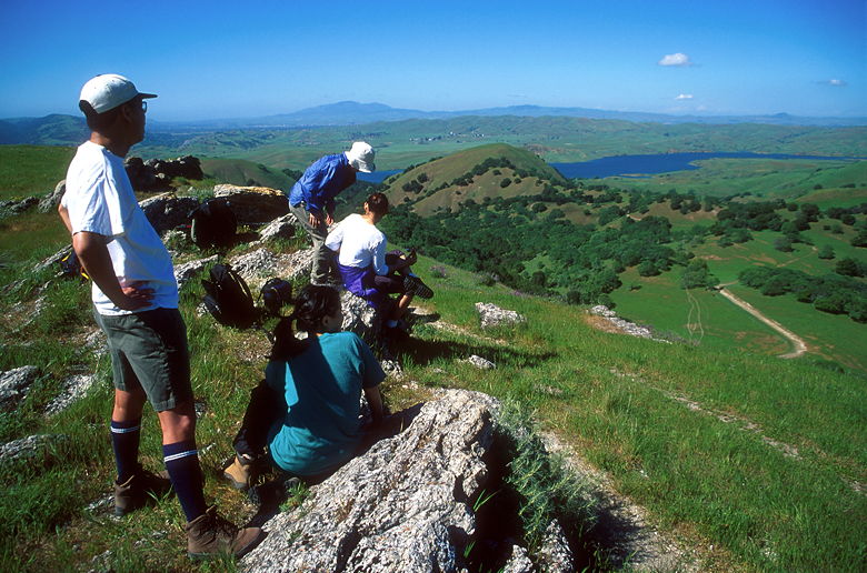
Hanging out by the rocks
There's a small use trail heading up to the peaks themselves. We decided to at least head
up the trail to the ridge, but probably not the peaks. The trail is quite steep and
narrow, but very brief. After about 5 minutes we gained the ridge, passed a few clumps of
wild flowers, and came to a rest amongst some more rocks. The view from here wasn't
much different than where we'd just come from. We could probably get better views from
the peaks above, but we didn't feel up to a long hike today. And it would take more than
5 minutes to reach them. So we turned back, taking care on the steep descent back to
the main trail.
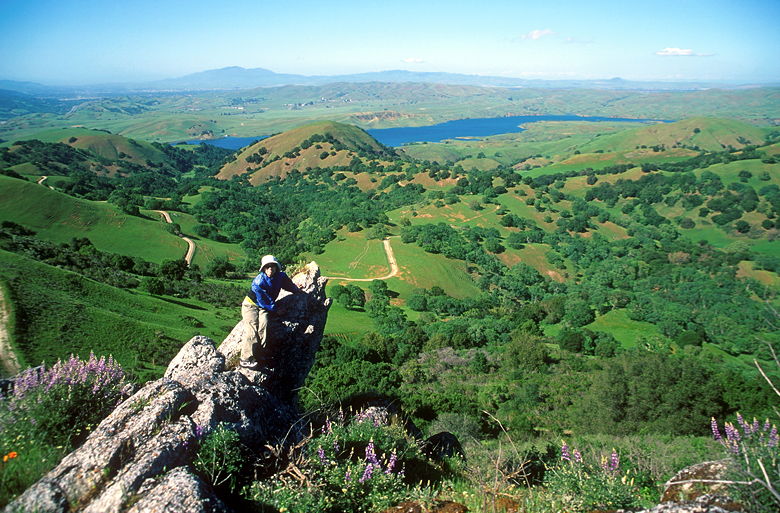
Jean perched on a rock
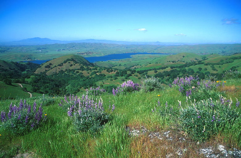
Lupine on the ridge. San Antonio Reservoir and Mt. Diablo are clearly visible.
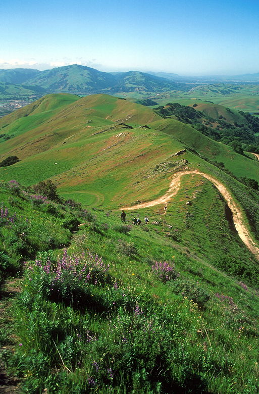
Descending back to the main trail
The trail continues along, starting a clockwise descent around the Maguire Peaks. The scenery
doesn't change much on this hike. Rolling green hills and oak trees pretty much sums it up.
This part of the hike was pretty much more of the same. The nice thing about this hike is that
you're not likely to see many people, especially compared to the hordes of people you'd see
in the main part of the park. In this part, you're almost guaranteed to see many more cows
than people.
We reached a trail intersection and turned to the right. We soon reached another trail
intersection, this one with a prominent wood sign declaring "Maguire Peaks Loop." A
trail pointed the way along a fire road to Welch Creek Road, but that would take us to the
road a mile away from our cars. So we continued to the right, along the loop trail.
We eventually reached the intersection where we'd first joined the loop trail. We turned left
to return the way we'd come. We noticed the cows that we'd seen earlier had now moved here.
One of them started to run at us, which was a rather scary sight. I'm sure you think of cows
as all being fat, but this cow running toward us was fat. Fat for a cow, even -- not big
and muscular, but bulging out sideways. You'll have to take my word for it. Anyway, it
eventually stopped and watched as we continued our descent down the singletrack.
We made it back to our cars and enjoyed the light afternoon breezes underneath the shade of
trees. I wondered where Welch Creek Road leads to, since we weren't at the end. A later
look at the map revealed that it leads to more trail heads into the main part of the park.
Something more to explore -- perhaps next spring.
| 

