| Hike | Miles | Vertical | Time | Rating |
|---|
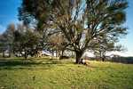
| Walnut Creek Area |
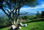
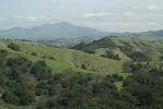
 | Pleasanton Ridge North
[Pleasanton Ridge Regional Park] |
9.5 |
1880 |
4:13 |
7 |
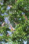
| Lollipop loop with steep climbs and rolling green hills with some nice views.
|
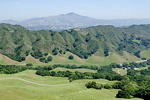
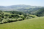
 | Briones Western Loop
[Briones Regional Park] |
8.0 |
1440 |
3:42 |
7 |
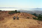
| Moderate loop on top of poppy and lupine-covered rolling green hills with great views of
the Carquinez Strait and Mount Diablo.
|
 | Black Diamond Mines
[Black Diamond Mines Regional Preserve] |
8.2 |
1513 |
3:28 |
7 |
| Moderate loop among rolling hills with nice views of Suisun Bay and the surrounding area.
|
 | Rocky Ridge
[Las Trampas Regional Wilderness] |
6.6 |
2040 |
5:12 |
7 |
| Loop hike climbing up and over Rocky Ridge twice (with some very steep portions),
and great raptor viewing.
|
 | Briones Peak
[Briones Regional Park] |
8.4 |
1975 |
4:57 |
7 |
| A nice hike with great views of Mt. Diablo and the surrounding area,
and a great place to view raptors soaring above the park. |
 | Giant Loop
[Mount Diablo State Park] |
8.6 |
2000 |
4:45 |
7 |
 | Las Trampas Ridge
[Las Trampas Regional Wilderness] |
7.0 |
2425 |
5:40 |
6 |
| Another hike amongst green hills across from Mt. Diablo.
More wildflowers than in Briones, and fewer people |
 | Pleasanton Ridge
[Pleasanton Ridge Regional Park] |
6.8 |
1470 |
4:09 |
6 |
| Moderate loop hike along ridge near Interstate 680, with views of the Diablo Range
and rolling green hills (in the spring at least).
|
 | Mount Diablo
[Mount Diablo State Park] |
14.0 |
3800 |
8:15 |
6 |
| Berkeley/Oakland |
 | Nimitz Way
[Tilden Regional Park and Wildcat Canyon Regional Park] |
10.0 |
1530 |
5:38 |
7 |
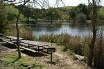
 | Lake Chabot
[Anthony Chabot Regional Park
] |
2.0 |
410 |
2:42 |
6 |
| A short hike down to the Lake Chabot shore, and then back to the eucalyptus forests.
|
 | Redwood Park
[Redwood Regional Park] |
6.1 |
865 |
3:08 |
6 |
 | Huckleberry Botanic Preserve
|
1.7 |
420 |
1:44 |
5 |
| A short hike with some views of the Berkeley hills.
|
 | Sibley Volcanic Regional Preserve
|
2.4 |
500 |
2:30 |
5 |
| A short hike through forest and typical East Bay rolling green hills. Lots
of dogs and people, and some nice views.
|
 | Lake Chabot Trip 2009
[trip report] |
| A short 2-day camping trip to a nice local lake just over the ridge from civilization.
|
| Fremont/Livermore Area |
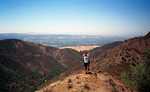
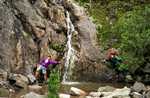 | Murietta Falls
[Del Valle Regional Park] |
11.0 |
4490 |
6:52 |
8 |
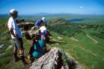
 | Ohlone Wilderness Trail
[Ohlone Wilderness] |
28.3 |
8270 |
19:08 |
8 |
| A great Bay Area 3-day backpacking trip. Lots of climbing, but the
views are all worth it.
|
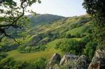
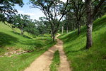
 | Maguire Peaks Loop
[Sunol Regional Wilderness] |
4.0 |
1200 |
2:39 |
7 |
| A short hike though the rolling green hillsides of Sunol Regional Wilderness.
|
 | Sunol Backpacking Trip
[Sunol Regional Wilderness] |
7.6 |
1750 |
4:39 |
7 |
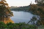
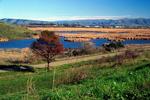
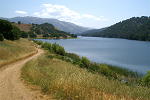 | East Shore Trail
[Del Valle Regional Park
] |
1.4 |
140 |
1:39 |
6 |
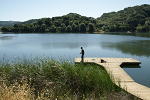
| An easy flat hike along the shore of Lake Del Valle. Hike as far as short or long as you
want and turn around.
|
 | Mission Peak
[Mission Peak Regional Park] |
7.0 |
2120 |
4:41 |
6 |
 | Monument Peak
[Ed R. Levin County Park, Santa Clara County] |
8.0 |
2365 |
6:04 |
6 |
 | Ridgeline Trail
[Del Valle Regional Park
] |
2.2 |
640 |
3:09 |
6 |
| A short loop hike with steep climbs/descents and nice views of the hills and Lake Del Valle.
|
 | Sunol Loop
[Sunol Regional Wilderness] |
4.8 |
700 |
3:07 |
6 |
 | Garin/Dry Creek Pioneer Regional Park
|
2.5 |
430 |
3:07 |
6 |
| A hike next to Dry Creek and along flower-covered hills above Hayward.
|
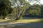 | Del Valle Regional Park 2008 Trip
[trip report] |
| A 2-night car-camping trip in Del Valle Regional Park near Livermore, including two short
hikes.
|
| Other |
 | Coyote Hills
[Coyote Hills Regional Park] |
3.7 |
500 |
2:36 |
7 |
 | Round Valley
[Round Valley Regional Preserve] |
9.0 |
950 |
4:18 |
6 |
| Moderate, flat hike through rolling green hills and oak trees.
|
 | Cogswell Marsh
[Hayward Regional Shoreline] |
6.1 |
10 |
2:24 |
6 |
| Flat, easy walk past marsh and bay with lots of birds.
|


