|
It was quite foggy in San Francisco as we drove toward the Golden Gate Bridge.
In fact, when we crossed the bridge we didn't have any hope of seeing the top of it. But
somewhere around San Anselmo, the fog and clouds began to disappear. By the time we reached
the trailhead around 12:30pm, there wasn't a cloud to be seen.
We parked in the large dirt lot across the road from the Devil's Gulch Horse
Camp, right off of Sir Francis Drake Boulevard a mile past the Samuel P. Taylor State Park
entrance. Jennie, Olivier, Jean, and I then crossed the road (watching out for fast cars coming
around the corners) and started up the paved road
Shortly, we came to a sign saying "Trail," pointing down to the right. We got off
the road and started on the trail proper, which follows Devil's Gulch Creek. Very soon we came
to a large redwood tree, supposedly the only one in the area. The grassy hill to our left
had a clearing on top with a few tents set up. That must be Devil's Gulch Horse Camp itself.
To our right was a bridge crossing the creek. In front of the bridge was an empty metal frame
which looks like it was recently installed in preparation for a display of some kind. We saw
a few of these on the day.
The bridge has colorful red wooden salmon attached to it, with the words "salmon
crossing". I assume that means salmon come here to spawn, but the creek was too shallow at
this time to allow that. Perhaps in March. We crossed the bridge and turned left. We'd
return on a loop from the right side.
We were now on Bill's Trail, heading up toward Barnabe Peak. The trail starts
climbing immediately through fern-filled forests. This trail up to the summit spur trail is
almost completely shaded. We came to a spur trail for Stairstep Falls. It's only a 5 or 10
minute side trip, so we took it. The trail is pretty flat and leads to a very high set of
falls, 40 or 50 feet. Unfortunately it was now summer and the falls were almost completely
dried up -- barely a trickle. We stopped briefly and returned to the main trail.
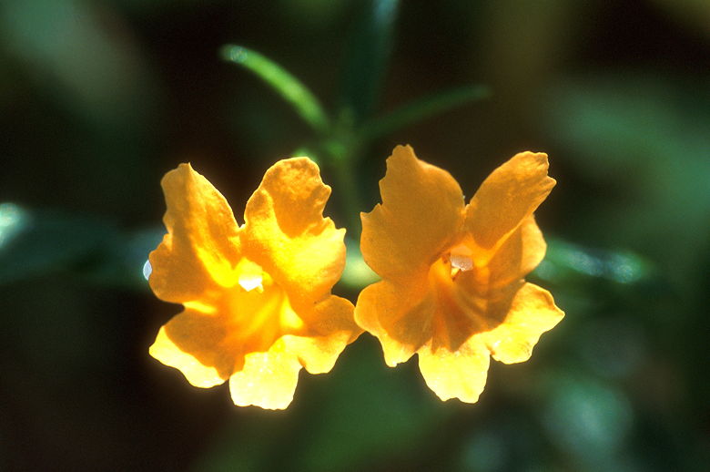
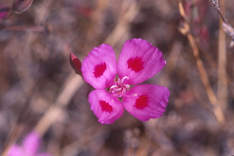
Flowers
There's a large variety of wildflowers on this hike. I saw a few species I'd never
seen before, and all sorts of colors ranging from yellow to orange to blue to red. I'll let
my pictures do the talking. I did identify lots of poppies and exactly one flower of a species
I remembered at the time but whose name escapes me at the moment -- tall with lots of hanging
upside-down horns and dual-colored interiors. The trail near Stairstep Falls is filled with
lots of tiny blue wildflowers.
After the falls we continued up the switchbacks through some beautiful forest.
Once in a while we had obstructed views of the hills through the trees. Mostly, though it
was just forest. The switchbacks, in my opinion, are too conservatively graded. You walk
for miles and hardly gain any elevation. It does allow you to enjoy the forest more, but at
the moment I was getting increasingly hungry and it was getting frustrating (it was past 2pm
and we weren't planning to eat lunch until we reached the top).
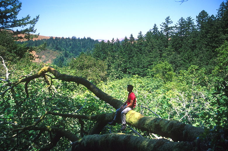
Olivier looking at the view
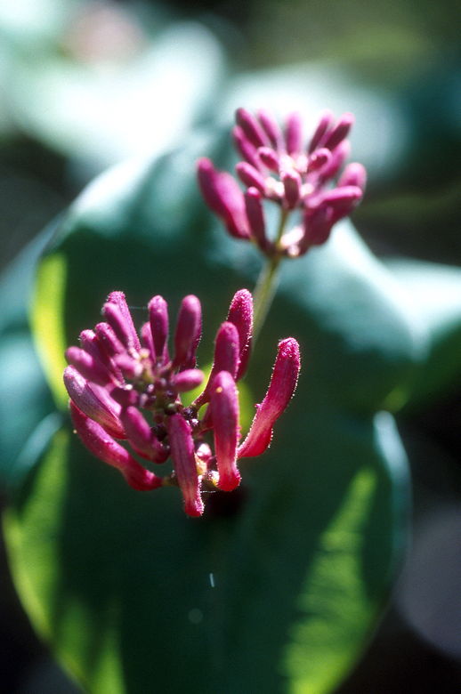
Flowers on a tree
We slowly zig-zagged our way up toward the top. Along the way we crossed several
small foot bridges. The first one we'd passed (the salmon crossing) had been labeled with the
number 1. The last bridge we crossed before we reached the top was numbered either 7 or 8.
Something to look for as you ascend.
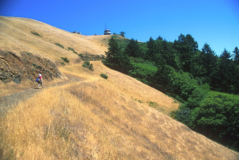
Final hike up toward the tower
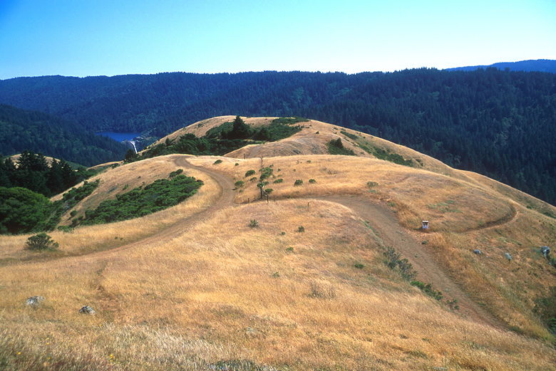
After what seemed an eternity, we broke out of the forest, out to views from the
ridge, and reached the summit spur trail. We turned left and headed up the fire road under
full sun. Whereas the trail so far had been not steep enough, the fire road is mercilessly
steep. It is a fairly short climb to the top from here, though, and you can see the lookout
tower on top almost the whole time.
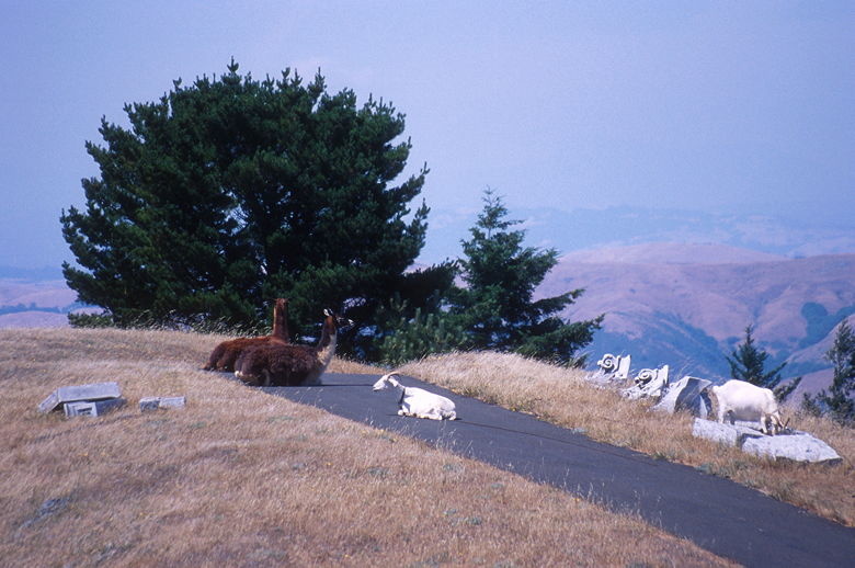
Llamas and goats
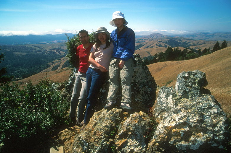
We climbed the final feet to the top just as a couple was descending -- I believe
these were the only two hikers we'd seen so far. There's a wooden plank set up on some rocks
next to the lookout. The lookout is closed to the public, so the plank will have to do, and it
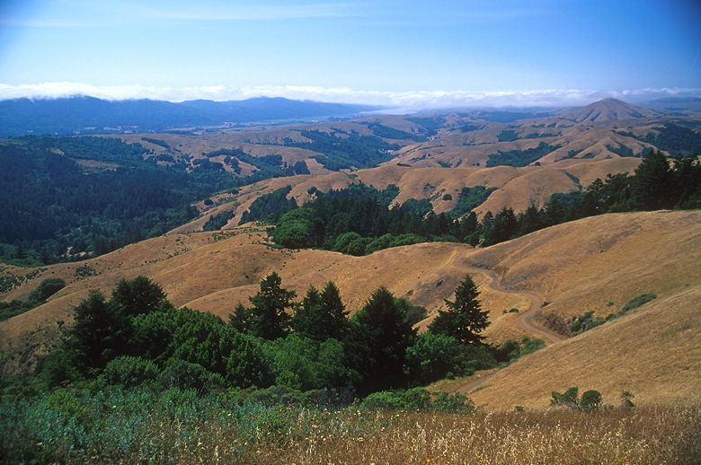
does nicely. Sitting there, you can see dammed Kent Lake far below. If you get up and walk to the
other side of the rocks, you'll see rolling hills as far as the eye can see -- well, up to where
the afternoon fog is rolling in from the ocean. If you walk around to the other side of the
lookout tower, you'll see the town of Lagunitas in the hills below. The views are nice, especially
toward the ocean, but you won't get a 360-degree view from the bench because the lookout tower
will be in your way. That, to me, ruins what would otherwise be a great view.
Looking southwest toward the fog rolling in from the ocean
The fire road itself leads to a private residence (fenced off). On the other side
of the fence we saw two huge llamas and, later, a couple of goats as well. We had lunch and enjoyed
the views. As we were getting ready to leave, the wind started picking up. I'm sure the wind is
probably a daily occurrence.
Looking out toward Kent Lake
On the summit
We descended the fire road and then turned left to continue the fire road all the way down.
It's quite steep all the way down. The return trip is only 2 miles, whereas the trip up the other trail is 4
miles. If I were to do this hike again, I'd opt to do it in the reverse direction. Either that or have a
larger breakfast before starting! In case you're wondering, there really aren't any good places
to each lunch along the trail except at the top.
Close-up of a flower
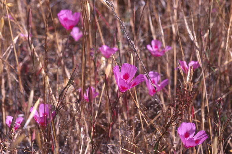
Flowers seen on the descent
There is a brief section of uphill on the way back, but it's short. It's all
exposed fire road, completely different than the other trail up. Near the bottom there's
a small section of ground with a white picket fence -- apparently it's Samuel P. Taylor's
grave site. Shortly after passing it you'll re-enter the forest and a few minutes later
reach the salmon crossing bridge. We crossed the bridge and returned to our cars.
| 

