|
When we arrived at the large parking lot it was about half full. We started
off on the hike just past 3pm. At the start of the hike is a box with a stack of
interpretive pamphlets which are available for 50 cents. It is well worth it.
We immediately came to a display with names of donors. Apparently (as the
pamphlet explains), the south grove was purchased for $2.8 million, with half of that
money coming from private donors.
We crossed a memorial bridge over Beaver Creek. Each of the wooden planks of
the bridge has a name plate on either end. We then began a climb of about 200 or 300 feet.
Along the way we passed through forest and crossed a fire road just as we passed another
group of hikers. Apparently you can hike off-trail inside the South Grove Natural Preserve
area, and you can hike on any of the fire roads as well.
We simply crossed the fire road and continued on the trail on the other side.
The group we'd just passed stayed just behind us. So when we reached the start of the
loop section of the trail, we let them continue on in front of us. When they took the
right fork (which is the more common direction), we took the left fork of the loop.
We now started to see a few scattered sequoias. We passed what I believe is
the Kansas Group, three sequoias to the right of the trail. They were all very
different in appearance, but were all sequoias.
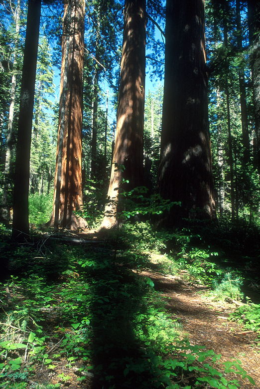
Kansas Group
There are about 1000 large sequoias in the South Grove, but you won't see most
of them on this trail. Or at least I didn't. The trail runs through just a small portion
of the grove and leaves much to be explored. Also, the density of sequoias is much less
here than in typical groves in Sequoia and Kings Canyon National Parks. It is also much
less dense than in the nearby North Grove. This is not to say the forest itself is less
dense; quite the contrary -- the forest is filled with many trees of other species, most
notably mountain dogwood.
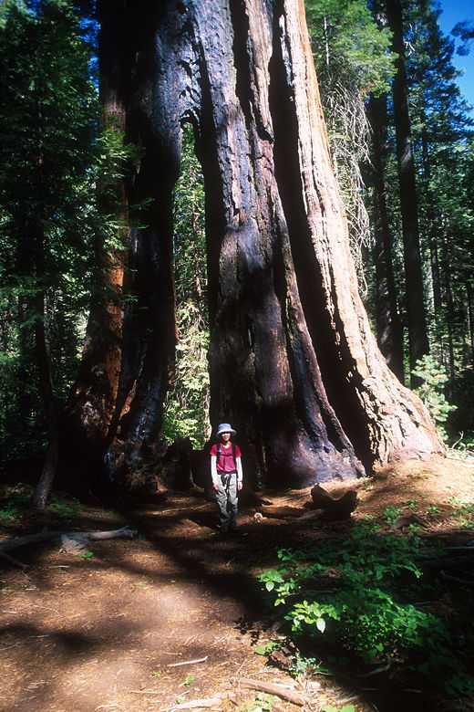
Large sequoia with a crack
We reached a trail intersection and took the spur trail to our left (actually
straight ahead). We soon came upon two towering trees with metal collars near their bases.
On one of them, a rope led up from the collar into the higher reaches of the tree. They
both looked like perfectly healthy trees, and we couldn't figure out what the collars and
rope were for. A man walked by just now and we asked him if he knew. He said he'd been
here a year earlier and the devices hadn't been there; he didn't know what they were for.
He did tell us that they were Ponderosa pine trees.
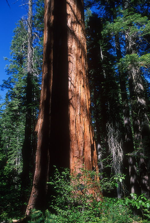
Shadow of a "normal-sized tree" on a sequoia
We continued along the trail. We'd run into several scattered pairs of hikers
so far, but it would begin to thin out as the afternoon grew later. The foot traffic is
perfectly tolerable in late afternoon, and probably morning as well. I would probably
stay away during the middle part of the day on a weekend, though.
We squeezed past two large sequoias standing next to each other. I made a note
to take a picture of them on the way back. We soon came to a large sequoia with a sign
labeled "Palace Hotel." As we rounded the corner and saw the other side, we of course
saw that the base was hollowed out. You could probably put 30 or 40 people into the base
very comfortably. The Palace Hotel tree and the Aggasiz tree, which we would soon see,
are the two largest in the park.
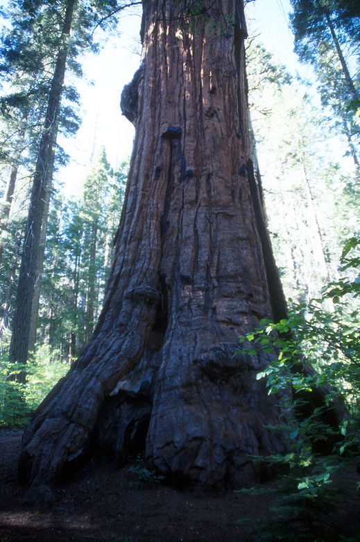
Agassiz Tree
We reached the end of the trail and the signed Agassiz tree. The largest in
the park, it's one of the 10 largest in the world. It's 250 feet tall and 25 feet in
diameter 6 feet above the ground. Unfortunately when you see it you're practically right
on top of it, so you can't really back up and get a good look at it. The color on
the "front" side wasn't too impressive, so we walked around to the back to take a look.
Maybe it was just the lighting, but it looked much better from this side. We stood
there among the mountain dogwoods next to the Big Trees Creek.
We stopped to eat something, but the bugs in the area chased us off soon
enough. The trail sign here says it's the end of the maintained trail. The pamphlet
says you can continue past the sign (if you're adventurous and know what you're doing)
and see several other prominent sequoias, including the relatively close Moody Group.
If I did this hike again, I would definitely try to find them.
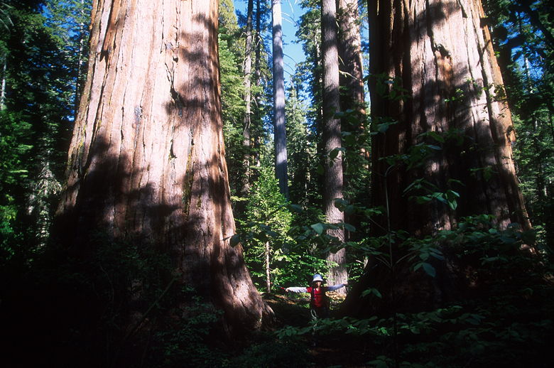
Jean between two large sequoias
On our return I took pictures of the two side-by-side sequoias. One thing
I noticed is that there aren't a lot of large stands of sequoias -- not like Sequoia
National Park, where you'll see 4, 6, 8 or more sequoias standing right near each other.
Perhaps the reason the sequoias do not dominate here is that there is so much
competition. The forest of other species is much thicker than in Sequoia NP. Pine,
oak, cedar, fir, and mountain dogwood all live here. It's rare that you'll get an
unencumbered look at a sequoia base from any appreciable distance here.
On our way in I had seen a perfectly symmetrical mountain dogwood tree, it's
upper branches pointed up at 45 degree angles, with clearly visible layers of branches.
I meant to photograph it on the way out but unfortunately I managed to walk by it
without noticing. So the rest of the hike I kept looking for good dogwood trees.
We turned left to continue the loop trail. We would not see anyone on the rest
of the hike. This half of the loop contains some more concentrated sections of sequoias.
One notable section of the trail goes trail through the hollowed-out interior of a fallen
sequoia. The trail then climbs briefly, then begins to descend. We noticed some small
flowers next to the trail which Jean identified as a relative of the rose. The dogwood
trees also had a few white flowers here and there. Apparently, the dogwoods turn color in
the fall; that would be a nice sight to see.
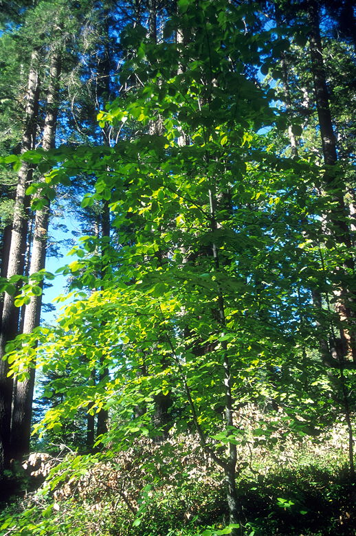
Dogwood tree
The trail descends down to a foot bridge over Big Trees Creek just
before coming to the trail intersection where we'd started the loop. We retraced our
steps, quickly descending back to the now-empty parking lot.
If you'd like more information, you can currently download the 50-cent
pamphlet for free from the official California State Parks page.
Return to Calaveras Big Trees trip report.
| 


