|
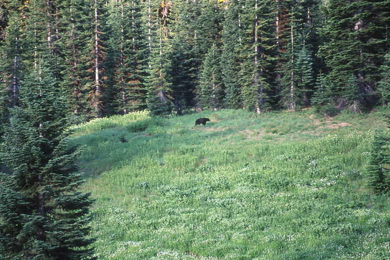
Bear foraging up the hill
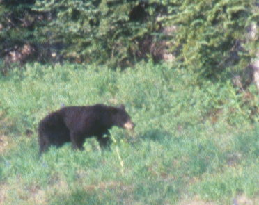
Close-up of the bear
Since this was our last day, we wanted to get an early start in anticipation of the long drive home.
I set my alarm for 5:30am, but didn't get up until just past 6am. It had been quite warm on the first
night, but the second night was a little colder and made it hard to wake up in the morning. Again, I took
advantage of the early morning light and went out with tripod and camera in hand.
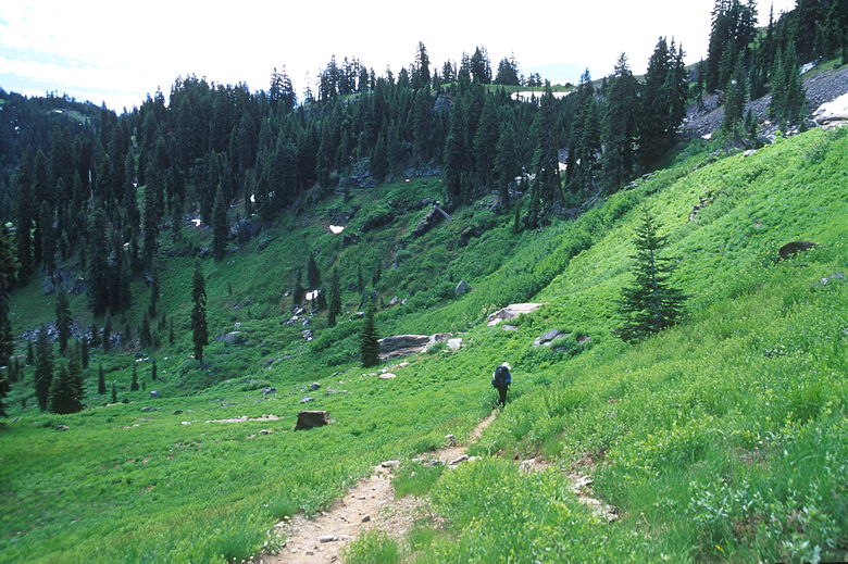
Trail through the meadow up the hill (toward Spirit Lake)
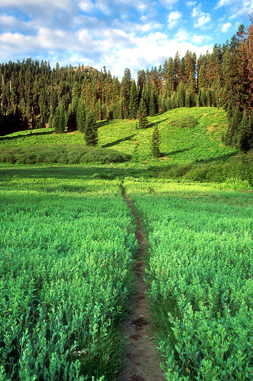
Trail through the meadow up the hill
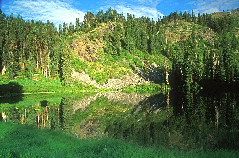
Big Elk Lake
I went out to the meadow on the south shore of the lake, hoping to take a picture of the lake from
that angle. When I arrived, I looked up at the hill we'd climbed yesterday and saw a deer foraging. Then
I saw a black form, did a double-take, and realized I was looking at a bear. It was about 300 feet away,
having its morning meal. I was unprepared; I took a brief shot with my 105mm lens and 50-speed film, knowing
full well it wouldn't turn out well. I then dropped everything and ran back to the tent to get my
other equipment. When I went back to the meadow and looked up at the hill, however, I could no longer
see the bear. I went about taking some landscape photos before I saw the bear come into view again.
I started clicking with my 300mm lens and 400-speed film. Still, there wasn't a lot of ambient light so
I'm not sure how well the pictures will turn out. Too, I was so far away; I would have walked up the hill
a bit, but it was clear he was heading into the forest. After taking a brief look at me, he continued
walking up the hill, into the forest; I never saw him again.

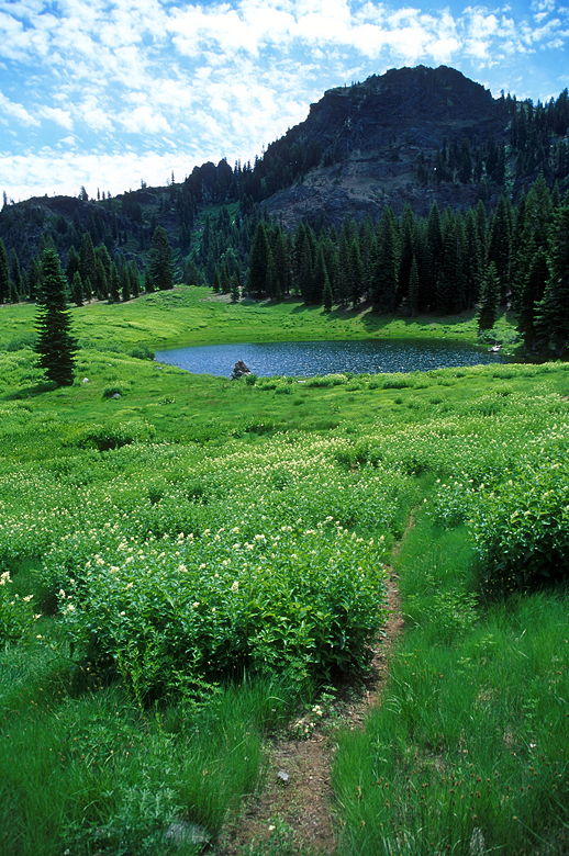
Lupine near Big Elk Lake
We broke camp and left shortly after 9am. The wildflowers we'd passed through on the way in were now in
good lighting, so I took some pictures with the mountains in the background. We then trudged down the trail,
then labored slowly up that steep 550-600 foot climb back up to the 6232-foot saddle. At the top, we
saw that the morning light
was much better than the afternoon light two days ago. The views were tremendous, mountains all around.
There was a couple from Santa Cruz resting at the intersection. We chatted a bit as we rested. They highly recommended a Mexican restaurant in
Red Bluff. Apparently there's only one.

View of the trail toward Marble Valley
The couple were spending a week in the wilderness; they were halfway through. We talked about fishing,
backpacking food, and other parks. It's fun to share tips and tricks from like-minded people. They headed
up onto the Marble Rim trail while we prepared to head the opposite direction towards Sky High Lakes.
Just before we were about to leave, a couple of hikers came up from Marble Valley. They mentioned it had
been crowded there the night before. They looked like day-hikers, with their tiny packs, but they said they
were backpacking for several days. Must sleep out under the stars and hang their food. I wonder if they
snickered to themselves when they saw how big our packs were, but I like the comforts we bring with us (and the
11 pounds of photography equipment). Of course, that approach isn't for everyone.
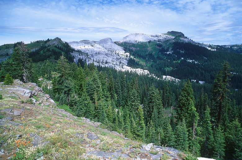
View of the Marble Mountains
We headed up the trail, past some snow patches. We then turned left at an unmarked intersection.
The trail to the right simple rejoins the trail we'd just left. The trail then descends for about a
mile to Frying Pan Lake. Along the way we got great views of Frying Pan, Upper Sky High, and Lower Sky High
Lakes. The lakes are backed by a mountain to the southeast, with meadows all along the descent to the lakes.
It's an absolutely beautiful sight. The approach from above is much more impressive than the approach from
below.
Jean descending towards Sky High Valley

Frying Pan Lake is front left, Lower Sky High Lake in the back and Upper Sky High Lake on the right
We wound our way through the meadows on the descent and passed through a camp site under a stand of trees before
settling down in front of Frying Pan Lake. Amazingly, we had it all to ourselves. In fact, we didn't see
anyone in the Sky High Valley. I say amazing because I'd read that the valley gets extremely high use -- and
this was July 4th weekend. However, it was Sunday and anyone who had camped there the previous night would
have been gone (it was now close to noon), and anyone camping here tonight wouldn't have yet arrived. Still,
it was really peaceful and we enjoyed the lake while we rested before the final push to the end.
Descending toward Frying Pan Lake
Resting on the tranquil shores of Frying Pan Lake

Looking out at the handle of Frying Pan Lake
After lunch, we continued through the confusing array of trails and side trails. We passed through more camp
sites next to Frying Pan Lake, passing over a hill and then down through a meadow toward some aspen trees.
The leaves were green, of course, since it was July; they must add a nice splash of yellow in the fall. The
wind rustled their leaves as we turned left and took the trail heading out of the valley. After passing through
another meadow, we entered the forest.
After descending through the forest a short ways, we began to alternate between forest and meadow, with mostly
lupine wildflowers and a few scattered patches of aspen trees. It's mostly downhill, but there is some climbing;
we crested a particularly steep short climb and got a view of a heretofore unseen lake just as a group of
horse-packers approached us from behind. I'm guessing the lake is tiny Gate Lake. No camping or easy access --
just pretty to look at. The horse-packers were 5 or 6 people, a dozen horses, and 2 dogs. We let them pass
before we continued our descent.
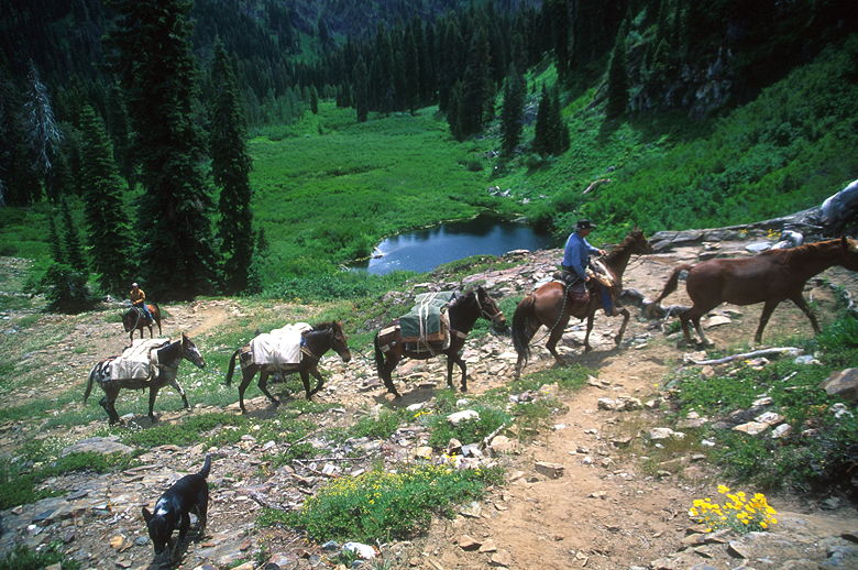
Horses climbing above Gate Lake
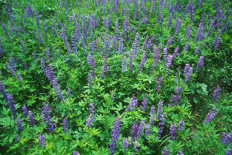
Lupine
It's about 2 miles from Frying Pan Lake back to the Canyon Creek Trail. We stopped to rest at a fork; both forks
rejoin the Canyon Creek Trail, but in two different places. The right fork is the one toward Lovers Camp, and we
took it. Shortly we crossed a creek and then came to the intersection with the Canyon Creek Trail. We then
descended back toward Lovers Camp the way we'd come the first day. Unfortunately, it's not all downhill. There
are several small uphills -- most not worthy of mentioning, but there is one climb of about 70 feet. Mostly,
it's downhill, including the steep descent of the steps.
We saw several hikers -- perhaps 10 or 12, all walking slowly up the trail. We saw a few horse-packers coming up
the trail, as well. They were all probably headed toward
Marble Valley or Sky High Lakes for the trail. Despite the fact that we hadn't seen anyone in Sky High Valley,
it probably would end up being crowded that night.
We slogged on and on. These 4.1 miles of trail between Lovers Camp and the Sky High Trail intersection are the
least interesting of the hike (some would say boring), in either direction. But what lies beyond those trail
miles is what makes this a wonderful wilderness experience. The lakes, the views, the wildflowers, and more --
all add up to a satisfying trip.
When we returned to the parking lot, it was two-thirds full. The bus was still there. We rinsed off under the
hot sun and drove back to Yreka, where we ate at Casa Ramos. It was open this time, and I definitely recommend
it. El Jardin in Sonora is better, but Casa Ramos is still very good and not as expensive, either. It wasn't
until I went to the bathroom after eating that I noticed how bad my hair was. I wonder what people who saw me
must have thought! Anyway, we began the long drive back to the Bay Area, only to get stuck in traffic. In fact,
we suffered through 1 hour, 20 minutes of delays heading into Dunsmuir, where southbound I-5 is reduced to 1 lane.
Apparently it will be this way until October 2002, so keep that in mind if you decide to head up to the Marble
Mountain Wilderness before then. You'll want to avoid this stretch on Sunday (or perhaps Labor Day). One
alternative is to take Highway 3, bypassing this stretch of I-5. Of course, then you won't be able to enjoy Casa
Ramos.
| 

