|
Butano State Park is just about 15 miles south of Half Moon Bay,
We'd tried to hike at Butano State Park back in May or June, but were rained
out. Today was bright and sunny and a completely different feeling.
We got a late start but didn't run into nearly as much traffic as
at Muir Woods. In fact, when we got to the park it seemed very quiet. There
were other cars in the lot near the entrance, but it's a small lot -- perhaps
10 cars.
Jean and I started off on the hike around 1:20pm. We crossed the
road and started up the Ano Nuevo Trail. It starts climbing almost immediately,
steeply in places. The hike starts out through knee-to-waist level brush.
I admit to fiddling with my GPS contraption and not paying too much attention
for the first 5-10 minutes. This was the first time I brought it along and I
have to admit I was disappointed with the results. It grossly miscalculated
the distance, clocking in at about 4.5 miles. I know it was wrong because there
were several stints where I would walk for several minutes and it didn't think
I'd moved at all (and it was measuring down to 0.01 miles, or about 53 feet).
So, I'll have to figure out what the problem is before I bring it along again.
Back on the trail, it grows steeper and steeper, with a few wooden
steps in some places. After climbing about 400 feet, much of it on very short,
steep switchbacks, we reached a small bench
where we sat down, rested, and enjoyed the view. We could see through the
trees and out to the ocean. The view is partially obstructed but, as I
learned on the way back, if you walk up about 20-30 feet and turn around, you'll
get a pretty much unobstructed view.
Enjoy the break, because the trail just keeps climbing. After another
350-400 feet of climbing, we reached a side trail to another bench. This one,
while being at the top, doesn't have nearly as good views, however. The trail
levels off somewhat, descending slowly before shortly dropping out of the forest
and onto the Olmo Fire Road.
We turned right and shortly made a short steep descent and turned
left onto the Goat Hill Trail connector. There are a series of trail intersections
so you'll have to pay attention here. At this point we weren't actually on
Goat Hill Trail itself -- just a connector. Just a minute or two down the trail,
though, we ran into a trail intersection. Here, we ran into the first hikers we'd seen
all day. They were a little disoriented and asked us where we'd come from. After
setting them straight, we turned left onto the Goat Hill Trail proper. At
the next intersection we turned left to stay on Goat Hill, rather than take another
connector trail back to the Olmo Fire Road.
After a short time on the Goat Hill Trail, we turned right onto the
Doe Ridge Trail. We shortly stopped at a small clearing underneath a large
tree to have lunch. Most of the trail is shaded, running through pleasant forest,
but this was one of the few clearings.
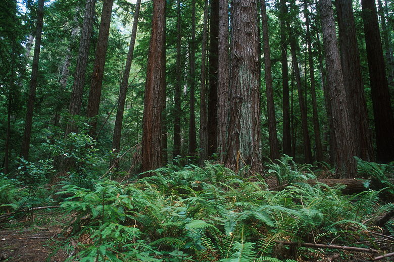
Redwood forest
After lunch we continued along the Doe Ridge Trail. This is my
favorite part of the hike, as it passes through one of the nicest redwood groves
I've visited in the Bay Area. In fact, some of the redwoods here are some of
the largest I've seen, which is surprising considering most of the old growth
redwoods in the area were logged long ago. Some of the trees are also much
wider than you come to expect from coast redwoods. I took several pictures here
as another pair of hikers passed us in the opposite direction. I noticed one
particular redwood tree with soft-edged limbs. It has many of these limbs which
are visible from the opposite side (you'll see it as you continue along the trail).
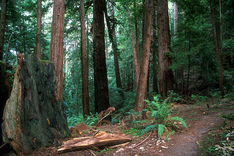
That little sliver on the old trunk on the left is a banana slug
A rather loud group of 4 hikers was slowly approaching us from behind,
so we continued on down the trail. The redwoods continue for some time, but I
think the section closest to the Goat Hill Trail side is one of the best areas.
I'll probably return in the future for more photography here.
I happened to notice one banana slug while taking my pictures, and later
another one on the trail. I was a little surprised to see them because the ground
was actually very dry (this being mid-September). They usually prefer moister
habitats; perhaps that explains why I didn't see very many. We saw many more
when we briefly visited the park back in May or June.
Most of the Goat Hill and Doe Ridge Trails is relatively flat.
Eventually we popped out onto the Olmo Fire Road again, and turned right to
head back. The fire road rolls up and down, very steeply in places. In that
regard, it reminds me of the trails in Henry Coe State Park. We shortly
passed a sign which said private property (some christmas tree farm), no
trespassing, but I think that's for the benefit of vehicles. Looking at a park
map, pars of the fire road are actually outside the park boundaries. But it
shouldn't be a problem. Just stay on the trail.
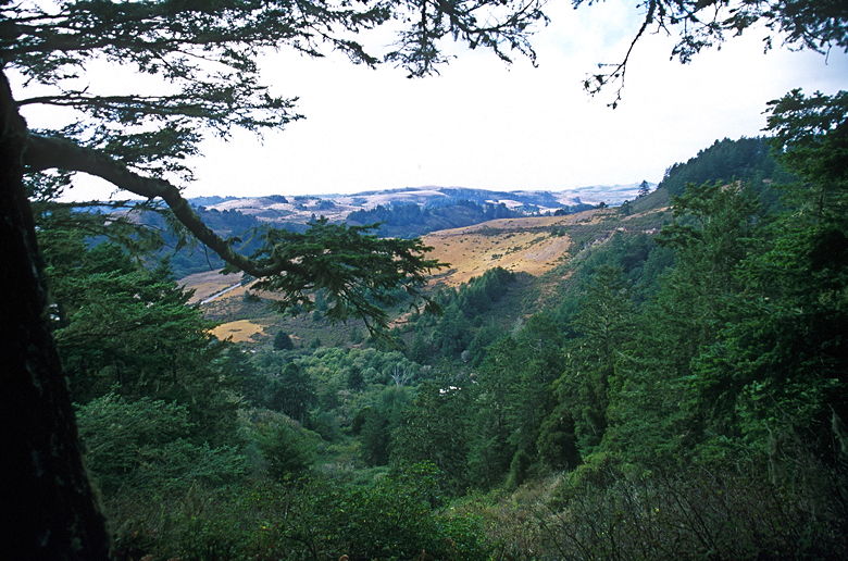
View from the trail
We saw tire tracks on the fire road, but we didn't see any mountain
bikers while we were there. There's nice enough forest on either side of the road,
but the real gem of this hike is the redwood forest on the Doe Ridge Trail.
That's the real reason to do this hike. Eventually we reached the section of the
Olmo Fire Road we'd been on earlier, then turned left and descended the steep
Ano Nuevo Trail, back to the parking lot. It was 5:25pm by the time we got back,
and the parking lot was empty. There are quite a few other trails in the park
which bear exploring, so I'll probably return to this park in the future.
There's even a trail camp in the park for those of you interested in backpacking
in the Bay Area.
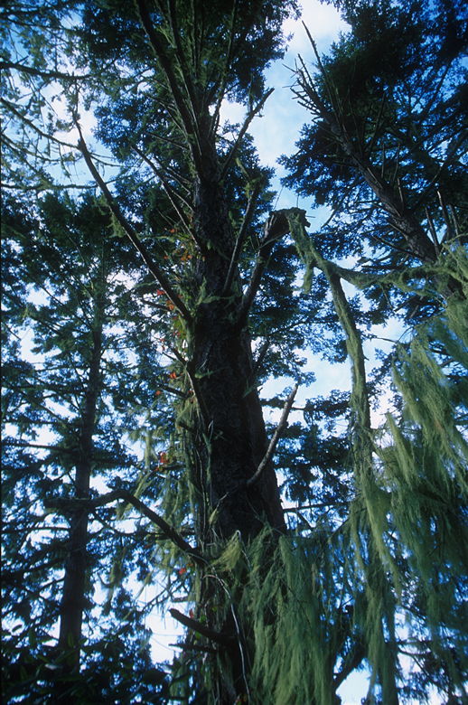
Lichen growing on the trees
| 

