|
I usually try to stay away from over-crowded places on holiday weekends.
However, we were going to be up in San Francisco anyway, so I thought we would take the
opportunity to head up to Muir Woods on this Sunday before Labor Day. As you might
expect, we ran into our fair share of crowds.
It took us nearly two hours to drive from San Francisco to Muir Woods, much
of the delay coming from a backup into the Golden Gate Bridge parking lot (which was full,
which meant cars were backed up onto the bridge). Once we got to Muir Woods, the parking
lots were full (of course), so we had to park along the roadside just like everyone else.
We then walked 15 minutes back to the park entrance, where we finally got started on our
hike at 3:20pm.
It was very crowded as we headed down the paved trail toward Cathedral Grove.
Families walked beneath the towering redwoods. Normally I would have taken some pictures
here, but it was so crowded and we got such a late start that we wanted to keep going and
get away from the crowds. I will say that I like the color of sequoias better than coast
redwoods, but that's my personal preference. Maybe I've been spoiled by too many trips
to Sequoia and Kings Canyon.
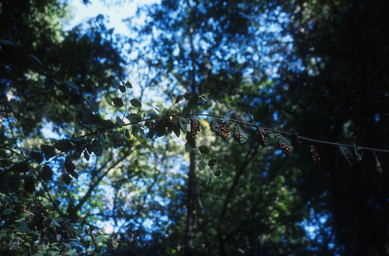
Lady Bugs
We walked past four bridges which cross Redwood Creek, and started off on the
Bootjack Trail at the fourth bridge. Here the pavement ends and the crowds begin to
dissipate rapidly. The trail also heads uphill, steadily and somewhat steeply. After
trudging uphill for about 300-400 feet, we stopped at a bench. Jean noticed lady bugs
on the branches above us; I would have walked right by without noticing. I thought they
were just berries or something. A closer look revealed thousands upon thousands of
ladybugs crammed together on the leaves and branches. I've never seen a larger congregation
of living things in my life. The butterflies at the top of Mt. Rose surpass it for sheer
wow factor, but there were far more lady bugs here.
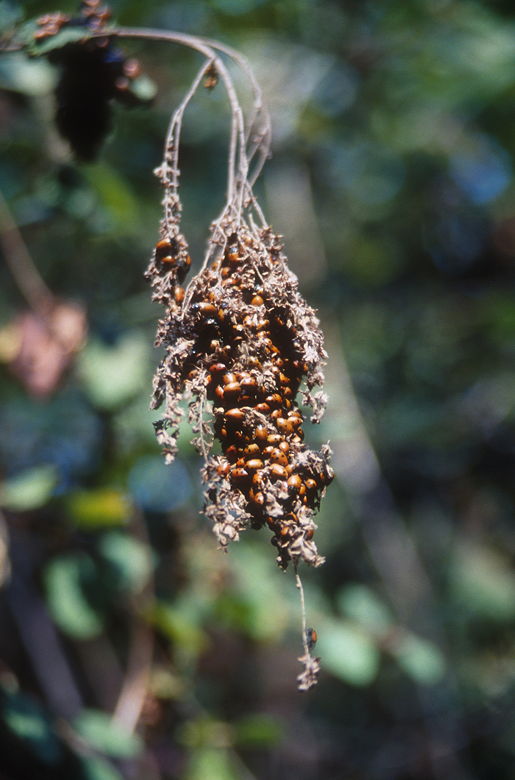
More Lady Bugs
While we were stopped here (I had to take the opportunity to take pictures),
a few other hikers walked by. We pointed out the lady bugs to them; they too would have
walked by if we hadn't pointed them out. Quite an amazing sight, and I have to say I
don't think I saw another lady bug the rest of the hike.
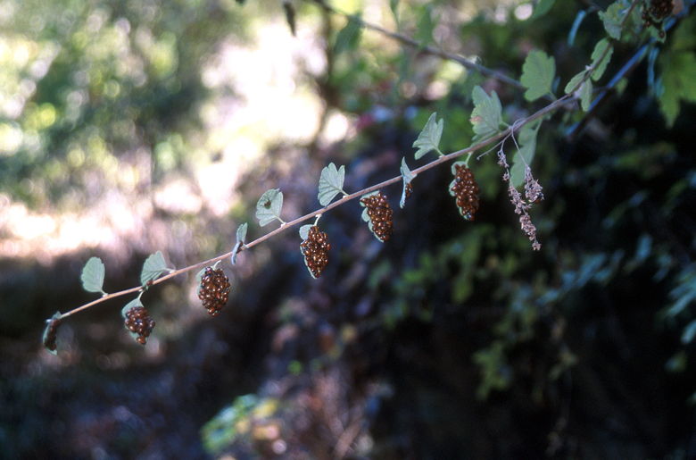
Still more Lady bugs
Continuing the climb, the trail grew darker as the late afternoon sun sank below
the hill tops. It was quite dark on the Bootjack Trail as we climbed alongside Redwood Creek.
Some parts of the trail include wooden steps. Soon after a series of these we topped out
at Van Wyck meadow. The meadow is a small flat area about the size of a football field (just
the field, not the stands), with a big rock in the middle. Not much to see. There is an
amusing sign which ways "Van Wyck Meadow -- population 3 Stellar Jays".
We turned left onto the TCC trail, plunging back into the darkness. This trail
is relatively flat, climbing ever so slightly. It crosses Redwood Creek on a foot bridge
and follows the contours of the hills. 3.6 miles from the trailhead, we reached a major
trail intersection. On the other side of a small bridge is a bench and the intersection
with the Stapelveldt Trail. A trail continues straight up to Pantoll, but we would be
turning left. But first, lunch. Yes, by this time it was 5pm and I hadn't eaten my
sandwich yet!
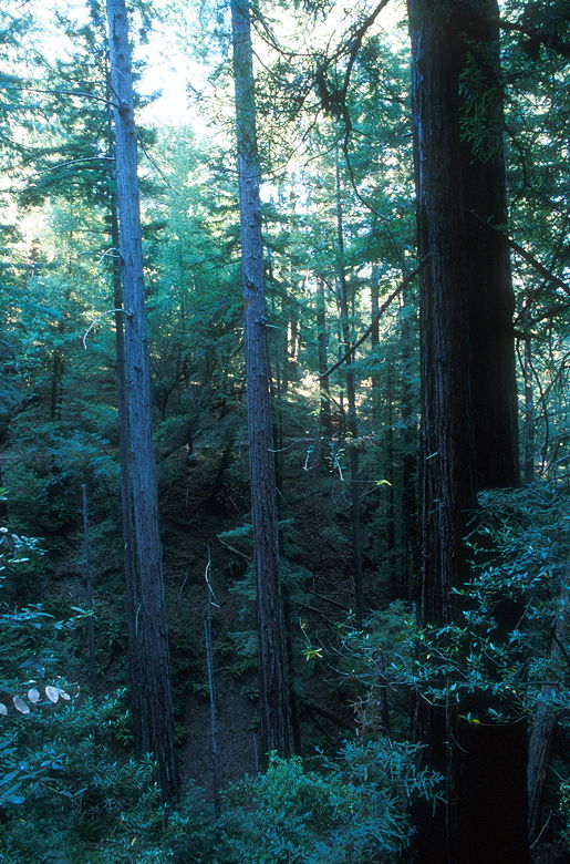
View of the forest
After a nice break we started our descent down the Stapelveldt Trail, which
switchbacks down to the Ben Johnson Trail. Though the Bootjack, TCC, Stapelveldt, and
Ben Johnson Trails are mostly unspectacular in comparison to the towering redwoods at
the start of the hike, they do have the admirable quality of being much less crowded.
The Ben Johnson Trail also has the unique feature of including a couple of rather large
bridges made from trees sawed in half, lengthwise. The trail continues directly
on top of these trees.
Soon enough we were back to civilization, so to speak. We reached the trail near
the fourth bridge. Instead of taking the bridge and returning the way we came, we turned
right before the bridge, onto the Hillside Trail. This trail traverses the hillsides above
Redwood Creek on the other side of the creek from the paved trail. In my mind, this is
some of the best scenery on the hike. I would say you get a bird's eye view of the redwoods,
but that's not entirely true. Even though you are perhaps 50 feet above the paved trail
below, the redwoods still tower above you. It's an impressive sight. It would have been
better in noon-time light. Unfortunately, it was 6pm and there wasn't enough light to justify
stopping for a picture. You'll have to take my word for it and go there yourself. I'd
also recommend getting there early to avoid the traffic, the parking hassles, and to get
better light than I did. You probably can't avoid the crowds completely unless you go
mid-week.
Soon we reached the second bridge. We returned to the paved trail and finished
out the last three-tenths of a mile back to the main parking lot. Unfortunately
that meant we still had another 15 minutes to go to reach our car.
| 

