|
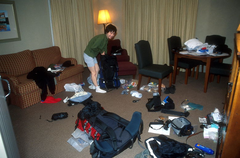
Packing the night before
We woke up at 6:20am, finished packing, had breakfast, and walked down from our hotel to Bumbles, where
we waited for the Backpackers Express to pick us up. It was supposed to pick us up at 7:55am,
so when 8:00am came and went and there was still no bus, we were a bit nervous. However, there
were four men waiting for the bus, as well -- we'd seen them in their room in Bumbles,
frantically doing some last-minute packing.
See what's in our packs.
The bus eventually came about 10 minutes late. It was partly cloudy, so we hoped to be able to
do at least some of the hike without rain. The bus took a scenic winding road for about an hour
until it reached the small town of Glenorchy. It was a packed little bus of about 20 trampers,
with a trailer attached with all our packs.
Once in Glenorchy, we stopped for about half an hour. When I had made the bus reservation
over the phone, the woman had said the bus would leave on Sunday at 2pm. However, the driver
assured me that it wouldn't come until 3:45, probably 4pm. That also matched what I'd seen
on their web site. Good to know.
From Glenorchy, it's another half hour drive to the start of the Routeburn track. We all
unloaded our packs from the trailer and started preparing for the day's hike. Sitting next
to us on the grass was a couple who happened to be from Moss Beach, not too far from where
we live. They, however, would not be using the huts -- they would be tent camping instead.
While the Milford Track prohibits tent camping, the Routeburn does not -- it allows it
in only two places -- Routeburn Flats and Lake Mackenzie. We saw the couple from Moss Beach early
on in the hike, but never saw them again. I wonder if they turned back because of bad
weather.
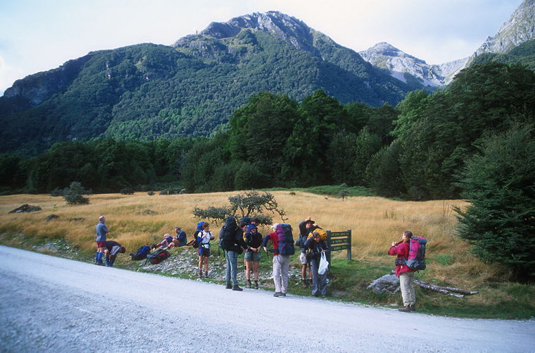
Trampers from our bus, preparing for the hike
There's a bathroom at the shelter, but it's a full 200 meters away from the start of the track,
so it's like having a warm-up hike before the real thing. After prepping our packs, we started
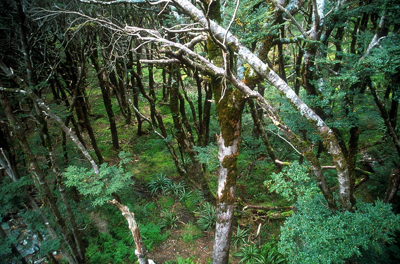
off across a large swing bridge -- one of several we would cross today. We then walked through
beech forest, gradually climbing. There's not much in the way of views here, with just an
occasional obstructed view of the surrounding mountains.
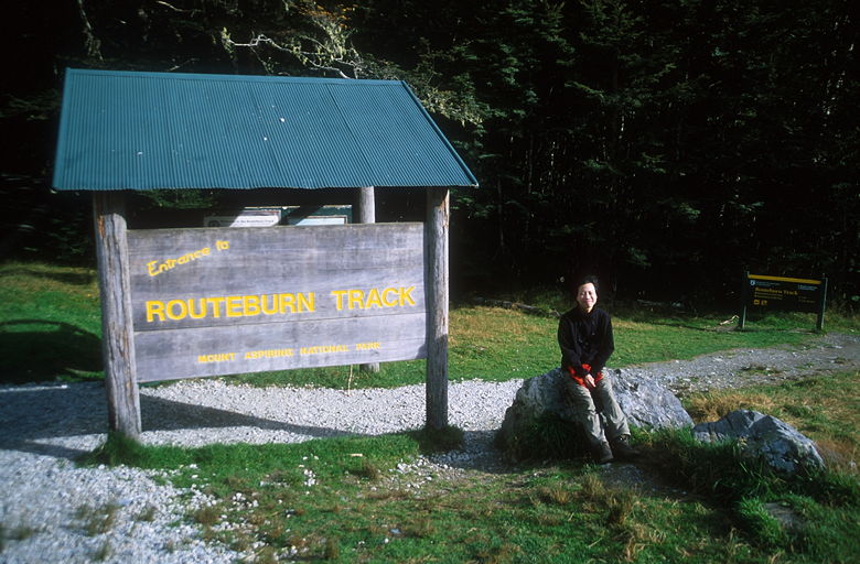
Start of the Routeburn Track
We crossed a wooden bridge and passed a group of a dozen people standing around, either preparing
for something, or finishing up something. I'm not sure what they
were doing, but they might have been spelunkers. Just a guess.
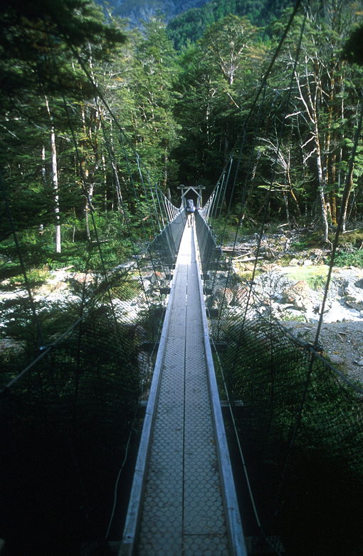
The first of many bridges
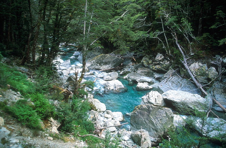
Creek next to the trail
After just an hour into the hike, we were hungry (probably from getting up so early). So we
stopped on the side of the trail to have lunch. We'd brought our standard backpacking fare,
similar to what we'd brought on the Rae Lakes trip. We didn't have to carry a bear canister,
tent, or stove -- but I made up for part of that by carrying more photography equipment. I
was carrying my full complement of two camera bodies, three lenses, flash, tripod, filters, and
film. I probably wouldn't use it all, but I figured it wouldn't hurt to carry -- I was still
nowhere near the 58 1/2 pounds I'd carried on the Rae Lakes trip.
After lunch we continued on the trail and shortly arrived at Forge Flat. A large group of
people were there, having lunch. Looked like some sort of guided walk. The flat is
dominated by a large layer of small white rocks next to the Route Burn river. A nice place
to have lunch on a sunny day. Unfortunately for us, it wasn't sunny. In fact it was now
almost completely overcast, so we soon put our rain jackets on.
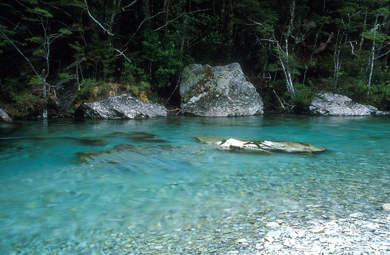
Water at Forge Flat
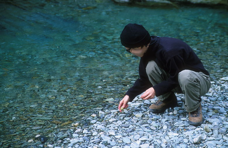
Jean checking out the waters at Forge Flat
It never really rained on us today -- just a few sprinkles here and there. We left Forge
Flat and walked through more beech forest, past ferns and over bridges. We ran into a lot
of day hikers going in both directions. Many of them probably go to either the Routeburn
Flats Hut or the Routeburn Falls Hut before turning around.
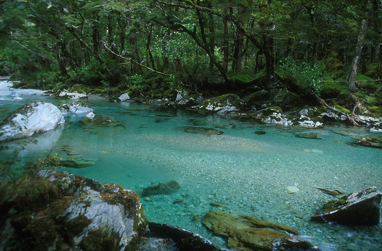
Creek next to the trail
After about 3 hours (including several breaks), we reached the Routeburn Flats Hut, elevation
700 meters. The hut looked remarkably clean from the outside (we didn't go in with our
dirty boots), and included some pretty nice flush toilets outside, which we did use. We stood
in a large meadow in front of the hut and looked
out onto the North Branch of the Route Burn River. After a short break we doubled back and
turned right, up the trail toward the Routeburn Falls Hut.
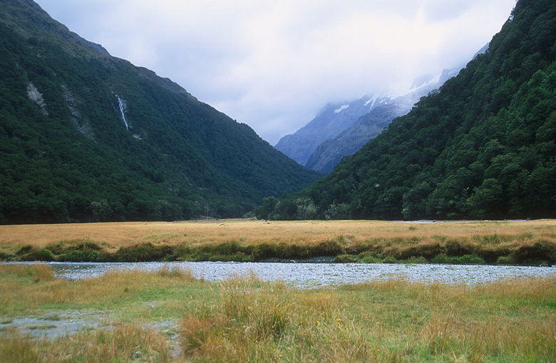
Routeburn Flats
It's only 2.3 kilometers between the two huts, but it's a steep 2.3 kilometers -- about
a thousand feet of climbing. Along the way we passed Israeli Creek and Phoenix Bluff. We
then came across a huge section of forest which had been wiped out. Apparently there'd
been a slide back in January 1994 which took down a swath of trees about 200 feet wide.
The nice thing about the slide is that it provided us with some of our only views on this part
of the hike. We had full views of the mountains north of us.
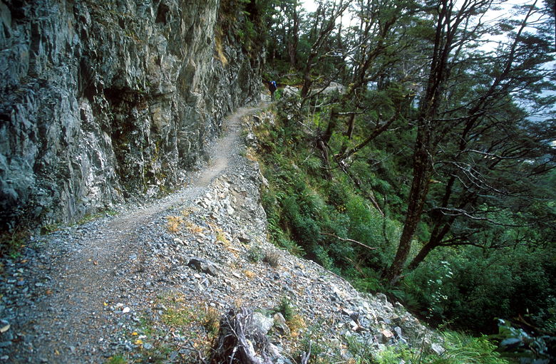
Trail at Phoenix Bluff
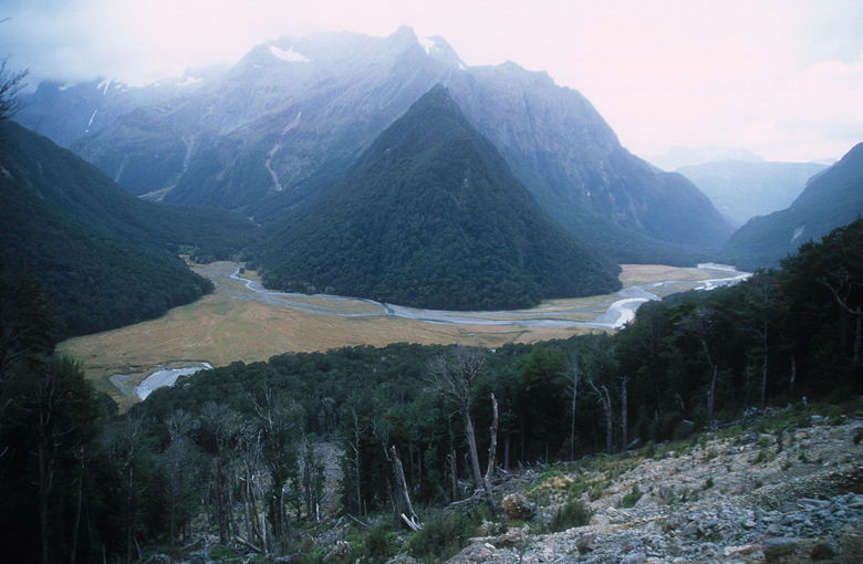
View at the 1994 slide
After taking a break to enjoy the views, we continued on the trail. When I saw a wheelbarrow
I figured we were close. Soon enough, we saw the hut (elevation 1000 meters). It's an impressive structure, built on
stilts amidst the beech forest. It's inconspicuous, as you can't really tell it's there until
you turn the corner and are facing it. The platform on the stilts contains two bathrooms,
two bunk rooms, and a common kitchen area. It all looks like it was built within the past
few years. A separate platform contains the private quarters of the hut warden. On the
hill above the hut is another hut which is only available for guided walkers. Apparently they
get private rooms and meals cooked for them.
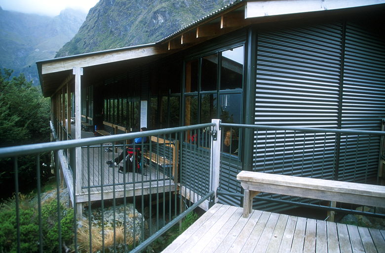
Routeburn Falls Hut
We took our boots off and placed them beneath the bench, then went inside the bunk rooms to
search for two free bunks. The rooms are nicely divided with 6 subdivisions in each room,
with each subdivision containing 4 bunks (two upper, two lower), for a total of 48 beds. We
found two upper bunks next to each other and brought our packs in. There were plenty of
empty bunks when we arrived, but most of the bunks would become full by dinner time, as
many trampers were doing the long hike from the opposite direction.
Forest next to the hut
We went over to the kitchen to have an early dinner. There are built-in gas stoves with
fuel provided, along with cold running water in the sinks. A few people were gathered around
the coal-burning fire to keep warm. All of the materials had apparently been helicoptered in,
and there was a helicopter pad outside so they could bring more fuel and take away sewage.
You have to take your trash, though.
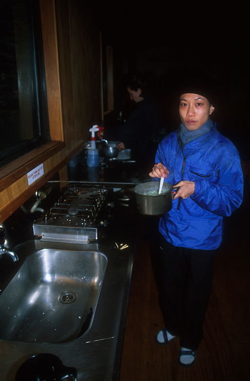
Jean cooking
Having never stayed in huts before, we were a bit hesitant at first. It seemed like cheating,
staying in such a place. But when the rain started, we didn't feel so bad anymore. Besides,
the area really couldn't sustain tent camp sites for 48 trampers. The huts provide the
least amount of impact on the environment for the number of people they support. On the other
hand, you lose a lot in terms of wilderness feel. There's also something pleasing about
pitching a tent and then removing it the next morning, leaving the area exactly as you left it --
there's no permanence to your camp site. Back on the other hand, imagine 48 people digging
holes in the ground for their morning deposit. Every single day, year after year. Something
to think about. I think I much prefer tent camping, except in wet weather -- not from a
philosophical or ecological point of view, but simply from an enjoyment point of view.
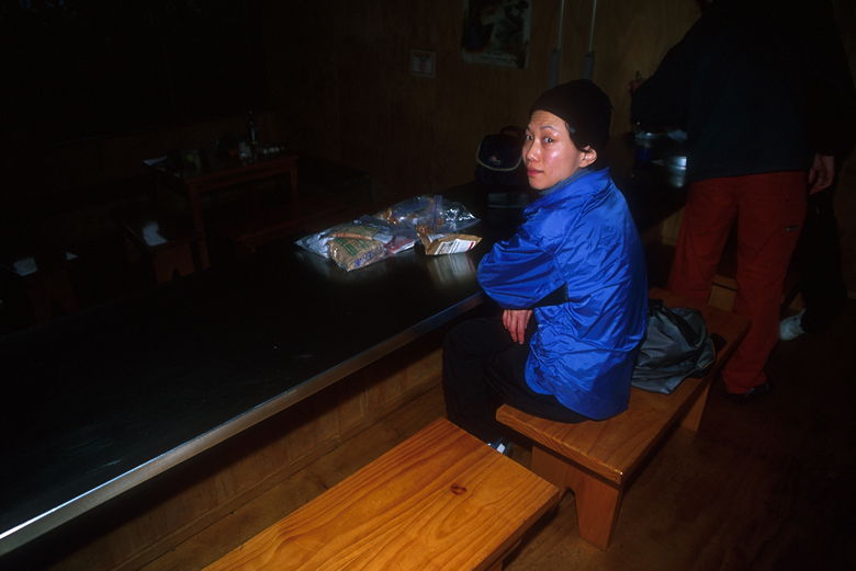
Waiting for dinner
After dinner we got tucked into our sleeping bags early, around 6pm. The ranger came by and
asked us for our hut tickets, which we presented to him. He was a little eccentric, standing
next to our bunks, continuing to chit-chat even though it was clear we wanted to sleep.
He went on about how New Zealanders don't wear hiking pants -- they wear shorts and gaiters,
even when it's raining. He kept talking about clothing until he finally left when we stopped
responding.
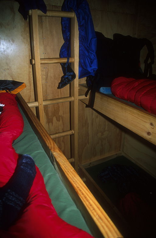
Bunk beds in the hut
As I lay there resting, the rain started to come down, harder and harder. The winds started
gusting. I was glad to be inside a hut tonight.
| 

