|
I've biked along Bear Creek Road and Happy Valley Road, which border
Briones Regional Park. So I know it can get quite hot and dry during
the summer. In the spring, however, the hills are still green.
So on a beautiful late winter day which felt more like spring, Cammy,
Jean, and I set off on a loop hike in Briones.
We started off at the Alhambra Creek staging area. We arrived at the
huge parking lot at around 11:30am, but there was plenty of space.
The lot would be a bit fuller when we returned 5 hours later.
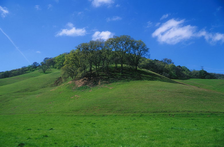
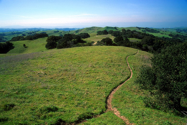
Great view a few steps into the hike
The Alhambra Creek trail starts right from the parking lot. We followed
the wide dirt road, with glowing green hills on the right and the small
creek parallel on the left. Oak trees dotted the hills. It's a typical
East Bay hike, with cows, green hills (in the spring), and oak trees. The
trail starts out fairly level, but then gradually starts to climb.
There's a single-track which parallels the trail on the opposite side of
the creek, under shade of tree. In retrospect, we could have taken that
route instead, as it eventually meets up with the main trail before the
first intersection. As we climbed, we ran into occasional hikers, joggers,
and mountain bikers. Even though mountain bikers are allowed and can go
quite fast down some of the steep trails, they're not much of a problem
because the trails are so wide and there are not a lot of blind corners.
After about a mile we turned right onto the Spengler Trail. After about 0.7
miles later, we passed through a cattle gate and came to one of two adjacent
ponds. We could only really see one of the ponds from this vantage
point, but we'd see the other as
we climbed higher. The ponds (called the Maricich Lagoons)
are fenced off and gated to restrict access for
the cows that graze nearby.
There were quite a few people in this area, some of them coming from the Toyon
Canyon Trail. We turned left onto the Old Briones Road Trail and
climbed up a large green amphitheater. A couple of dogs ran around us
played with their owners nearby. Dogs are allowed off-leash in most places in
the park, except where posted. I get a lot of questions about what hikes
are dog-friendly, and this is one of them.
We continued climbing, gaining views of the Benicia-Martinez Bridge and
surrounding area. We reached another gate attached to a barbed-wire fence.
On the opposite side of the fence is a great view of rolling green hills
and trees. We turned left and continued yet more climbing, now on the
Briones Crest Trail.
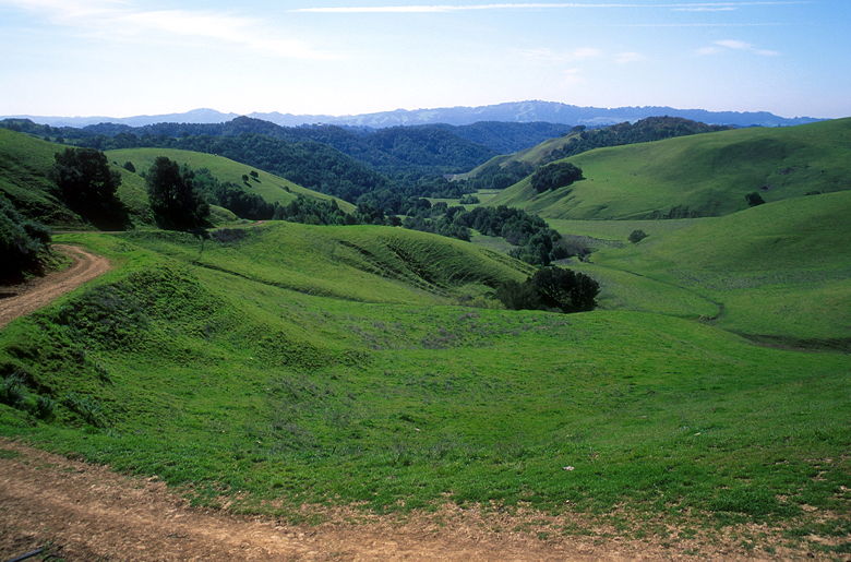
View over the fence looking west
We had a weird rainy season this year -- lots of rain in November and
December, and not much in January and February. Usually it's the other
way around, and I wonder if this caused the wildflower season to get out
of whack. I expected to see lots of wildflowers, but there weren't very
many. I can't tell if we were early or late; it looked like some of
the flowers were past their prime. Most of the flowers we did see were
small lavender flowers; we saw occasional poppies and a few scattered others.
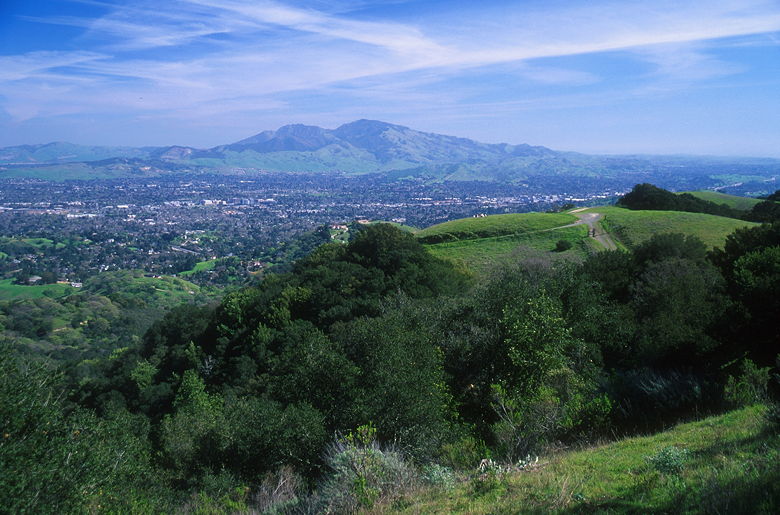
Mount Diablo from Briones Peak
About 2.5 miles and 1200 feet of climbing into the hike, we reached
Briones Peak, which at 1483 feet is the highest point in the park.
There's a short single-track spur trail which leads to the top, which
you can see from the main trail. There's a fence here, and a bench on the
other side of the fence. To get to the bench, you have to climb through
some bars in a gate, which doesn't open. The bench was occupied when we
arrived, so we opted for the shade of a tree just down the slope from the
bench.
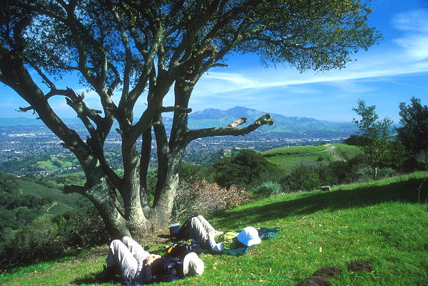
Nap time on the summit
The views from the top are impressive. There are a fair number of trees
on the summit, so there aren't 360 degree views. However, there are nice
views of the rolling green hills to the west; you can still see the
Benicia-Martinez bridge, Concord, Walnut Creek, and everything in-between.
The big attraction, though, is the most impressive view of Mount Diablo I've
seen. I'd never viewed Mt. Diablo from this vantage point before, and
really shows how the Diablo massif dominates the surrounding area.
View looking northwest from the summit
After lunch, we packed up and were getting ready to leave. While we were
still on top, a couple of raptors soared in front of us. Later, another
spread its wings right above us. Unfortunately I didn't capture any of
this on film, but I'd get my chance later...
After lunch we continued on the spur trail and rejoined the main trail.
I noticed a gopher sticking its head out of its hole, then retreating. It
did this a couple more times, a la Caddy Shack, before disappearing for
good. After being amused by his antics, we climbed past another gate,
then bore right onto the Table Top Trail. This trail climbs up and down,
in and out of the shade of trees. Along the way we passed a large
communications complex -- one of the largest I've seen on a hike. Rows of
antennas and a small bunker adorn the hill to the left. And on the right,
there's a massive radio telescope pointed towards the heavens. It must
be about 30 feet across. It's fenced off, of course.
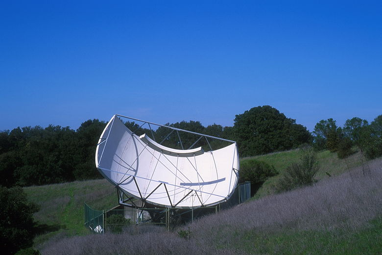
Radio telescope
While on the Table Top Trail, we caught glimpses of a couple raptors, perhaps
the same ones we'd seen earlier. We came to another gate, but turned
left and continued onto the Spengler Trail. We now started a descent in
the shade of a pleasant forest. As we descended, we could see massive houses
down the right, on the edge of the park near Reliez Valley Road. Huge houses
with no backyards built right next to each other.
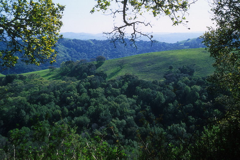
View of a ridge through the trees
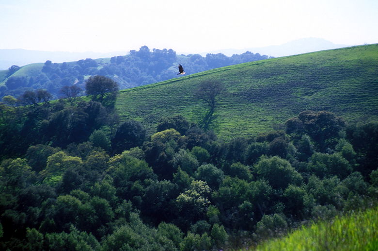
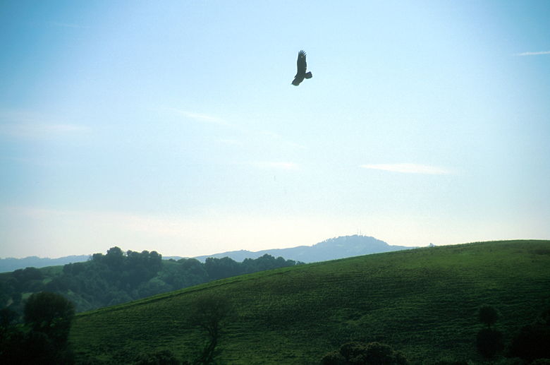
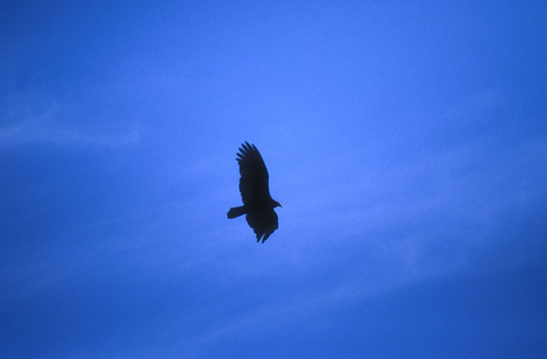
Vulture soaring over the valley
We emerged from the trees and saw the raptors at it again. They soared through
the air. But this time, there were more than just two. More and more kept
appearing -- up to about 7 of them. I frantically brought out my camera with
the fast film and long lens and started snapping away. These are amazing
creatures and, at least for me, the hike is worth it just to be able to see
them. I think most of the raptors were turkey vultures, though I think I
might have also spotted a red-tailed hawk. Hopefully my pictures will turn
out and I'll be able to tell later. By the way, turkey vultures have wing
spans of up to 6 feet.
Vulture over the ridge
Turkey vulture
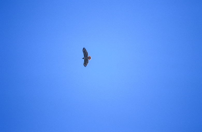
Hawk
After admiring the raptors, we continued down the sometimes very steep trail.
There are a number of intersections, some signed and some not -- it's
important to take a map with you, and even then you may have to end up
backtracking. Somehow, with the help of a map and book we managed to stay
on course. We expected this section of the hike to be mostly downhill, but
there is still a fair amount of climbing here. It is shaded for the
most part, however, and nice and quiet late in the day. We also encountered
quite a few wildflowers in this part of the hike, including a lot of poppies.
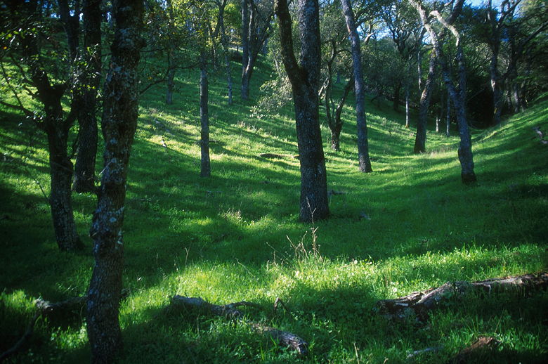
Open forest
Eventually we reached the Diablo View Trail and turned right for our final
descent. This drops down to an unsigned gravel road. Take the fork to
the right, as we did, and you'll soon see the parking lot below. With all
the gravel, this section is slippery-steep, so we were glad to have our
trekking poles with us.
This was a nice hike with great views and a chance to see raptors. And we've
only scratched the surface of the park. At 5,756 acres, the park is one of the largest
in the East Bay, and is criss-crossed by a myriad of trails which can be
combined to form a nice loop, short or long. Perhaps I'll return sometime
to explore the trails from the Bear Creek staging area of the park.
| 

