|
If you keep your eyes open, you can see a lot on this hike. Angie,
Cammy, Jason, Jean, Jenny, Tom, and I arrived at the trailhead shortly
after 11am on a fine spring day, perfect for hiking. The skies were
clear but the proximity to the ocean provided lots of cooling breezes.
There were about 10 other cars at the parking lot, but we didn't meet many
people on the trail. There are pit toilets at the trailhead, but
no water, so bring your own.
The trail starts off heading west through grassland. There were
wildflowers here and there, but no spectacular displays at this
time of year. There were some very nice dark blue irises on display
near the beginning of the hike.
Shortly, we came upon a forest of Monterey pine, which apparently is
the remains of an old Christmas tree farm. The pines now soar 30-40
feet into the air, so I doubt you can fit this in your living room.
This looks like a pleasant place to relax, and indeed there's a bench
situated right in the middle of the forest. The trail skirts this
first stand of trees, then descends through more grassland before
descending through another stand.
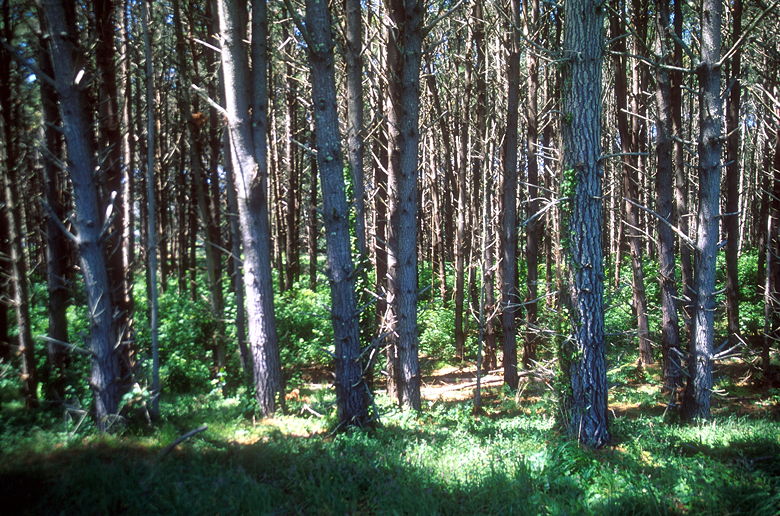
Monterey pine forest
Earlier this week, we'd read that a black bear had been sighted at
Point Reyes, searching through garbage at the hostel. It was the
first bear sighting in Marin county in about 100 years. There was
speculation that it had found its way down from Sonoma County,
where they still roam. Unfortunately, we didn't see any signs of
the bear on this hike.
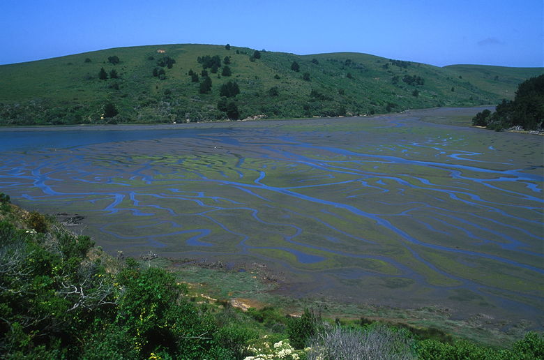
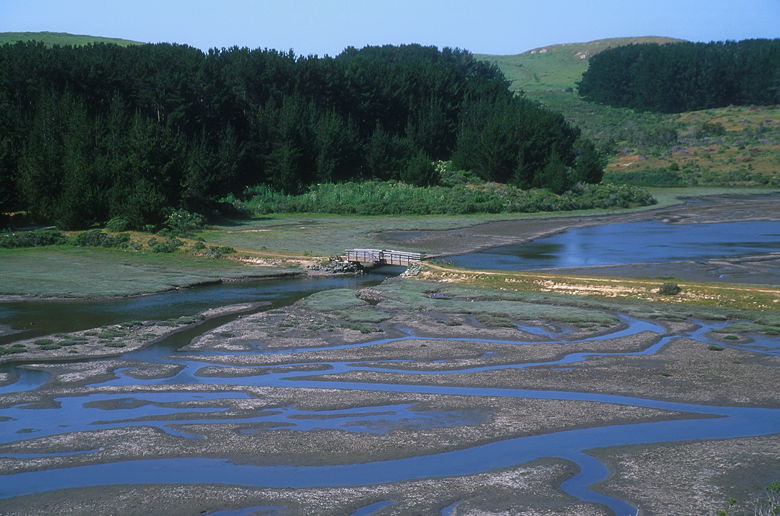
After making our descent, we found ourselves coming out into the
open and crossing a footbridge on the southeast end of Home Bay.
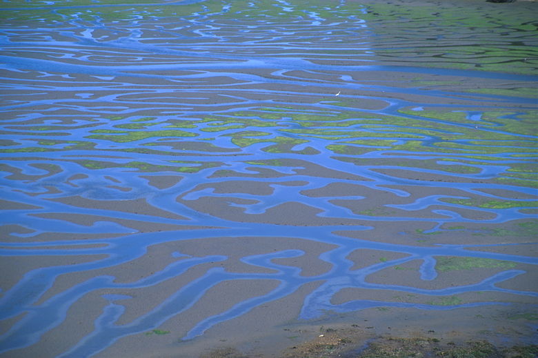
It was low tide when we crossed, and we could see mud flats extending
far out into the distance. In fact, we could later see egrets standing
hundreds of yards west of the bridge.
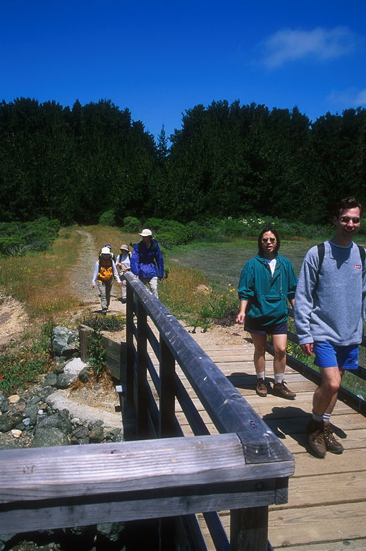
Crossing the footbridge
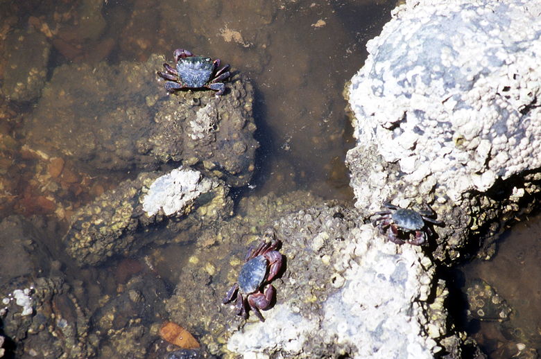
Crabs under the bridge
While we were standing on the bridge, we saw our first animals on the
hike. They probably would have gone unnoticed, but Jean looked down
and saw that there were crabs along the shore under the bridge. I
stopped to take several pictures. They're very skittish creatures, and
crawled away rapidly as I got closer, so I tried not to disturb them
as much as I could avoid it.
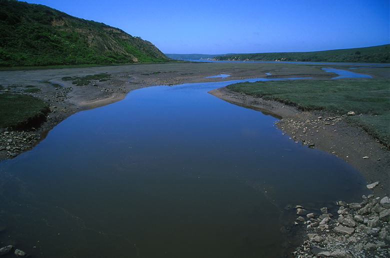
View from the bridge
After crossing the bridge, the trail heads up the hill to the right,
climbing to provide great views of Home Bay. We climbed steadily past
blackberry bushes for about 200 feet of elevation gain. We could now see
the egrets and other birds out on the water. We could also see large
metallic structures lying on the surface of the water. These are
probably the oyster beds of Johnson's Oyster Farm.
View from above
Home Bay
At some point on the trail, there were muddy patches we had to navigate
through or around. If do this hike earlier in the year, keep that in
mind. It's not much of a problem in May, but I imagine it might be in
January or February.
Hawks and turkey vultures soared above us occasionally. The trail veers
to the left and begins a steep descent. Near the top of the descent
there's a little overlook. I walked out to the edge of the cliff and
looked down at the waters of Drake's Estero. I thought maybe we would
see sea lions lying on the beach, but we didn't. Jason noticed what at
first looked like the tips of sea lion fins poking through the surface
of the water. We later realized these were actually the tips of rays
as they flapped their big fins. Several rays were clearly visible
swimming near the shore, their unmistakeable shapes gliding at the bottom
of the water. Unfortunately we were well above them with no easy way to
get down, so I don't have any pictures to share with you. You'll just
have to witness them for yourself on the trail.
As we crossed a levee next to a small pond at the bottom, we saw these
black birds with shoulders colored bright orange/red. They flitted
about as we walked past more blackberries. The trail disappears into
the short grass at one point, but it's pretty clear where it's headed, so
you won't have a problem.
After 2.4 miles, we reached the one and only trail intersection on this
hike. The Estero Trail continues to the left. Instead, we continued
straight onto the Sunset Beach Trail, which continues for another 1.5
miles to the beach. The trail descends gradually, with views of Drake's
Estero on the right and, eventually, views of the ocean in front.
At the end of the descent, we picked our way over some muddy sections and
veered to the left, eventually picking up a faint trail. At one point
while we were still on the grassy section of the trail, we passed a dead
sea lion. We walked past as quickly as we could to avoid the horrible
stench.
The trail follows a 15 foot wide beach along Drake's Estero beneath
50 foot high vertical sandstone walls. We walked and walked, but hunger
eventually took over and we stopped at a section with some deadwood to
sit down to lunch. I didn't think the actual beach was much further, so
I continued along with Jason while the others settled down. It turned out
we were less than 5 minutes away from the actual beach, but it was quite
windy there so we decided to eat lunch at the original resting place, where
it was not nearly as windy.
As we ate, we were entertained by the wildlife. There's a large kelp
forest extending for a couple hundred feet here. Two or three sea lions
occasionally popped their heads out of the water, as if they were
checking us out and then hiding. There were also ducks and sea gulls.
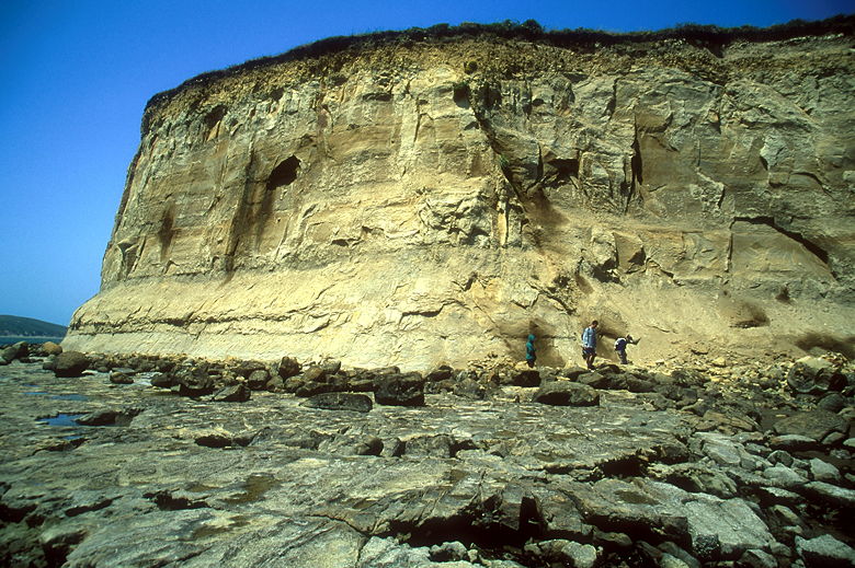
High sandstone walls at Sunset Beach
Sandstone walls above the shore
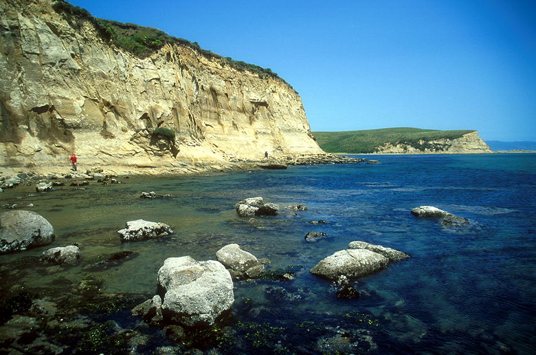
After lunch, we made the short hike to Sunset Beach. Just as we arrived,
the group that had been eating lunch there was starting their trek back to
the trailhead. We settled down to explore the area to ourselves for a
few minutes. The wind constantly blasted sand at us as we took in views of
Drake's Bay. A tall bare sandstone wall backed us as we looked out onto
the water to see two or three sea lions playing hide and seek with us.
In the distance, dozens of the animals lay on Limantour Spit. We didn't
hear their distinctive barking, as they all seemed to be taking an afternoon
nap.
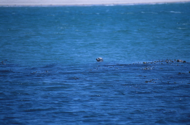
Head of a sea lion
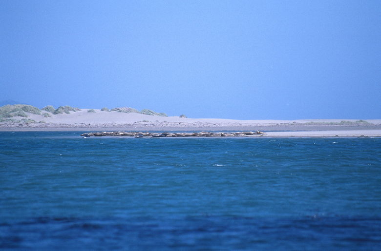
Sea lions sunning themselves
After enjoying the views and the sea lions, we turned around and started
back. The wind seemed to have picked up as we walked back the way we
came. I didn't notice too much different as we walked back. One thing
I did notice is that, to my eyes,
the scenery looks better in morning light than in afternoon light.
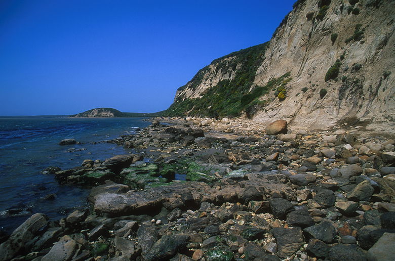
Rocky shore heading back on the trail
At the top of a hill we passed is a large, solitary tortured tree. It
reminds me of the famous "Lone Cypress," for it sits perched atop a
cliff, braving the wind, its limbs twisted in unnatural positions. Now
I regret not taking a picture of it. The book I have says it is a
eucalyptus tree, but that probably wouldn't be your first guess if you
just glanced at it.
On the way back, I stopped at the place where we'd seen the rays.
At first I thought it was the wrong place, but I shortly realized that
it was the same place, but the tide was now in. I could no longer
see the beach, and I didn't see any rays.
As we descended the hill toward the first bridge, I could see that
egrets that earlier were standing hundreds of feet further out into
the bay, were now forced to move inland with the incoming tide.
When we crossed the bridge, I didn't see any crabs.
Back at the bridge
We crossed the bridge, climbed back up through the pine trees, and back
to the parking lot. This is a nice spring hike with lots going for it.
Perhaps I'll return sometime and make a left turn at the trail
intersection to explore the Drake's Head Trail. It's a bit longer, but
I'm sure it would be worth it.
| 

