|
The trail to Hiram Peak starts out from camp site 31 in the upper
section of the Highland Lakes campground. There are small posts here
with a small sign that says simply "trail", and the trail immediately
veers off to the right. Unfortunately, I didn't know any of this when
I started on the hike. Instead, I started off to the left of the trail
under the early afternoon sun.
Not finding the trail (I didn't know there was an established trail
anyway), I decided I'd just go cross-country through the forest.
After a few minutes I took
out my compass and realized I was headed in the wrong direction. I
was going east when I should have been going southeast. This meant
heading up some very steep terrain, so I zig-zagged my way up, working my way
more southerly to make up for my early mistake.
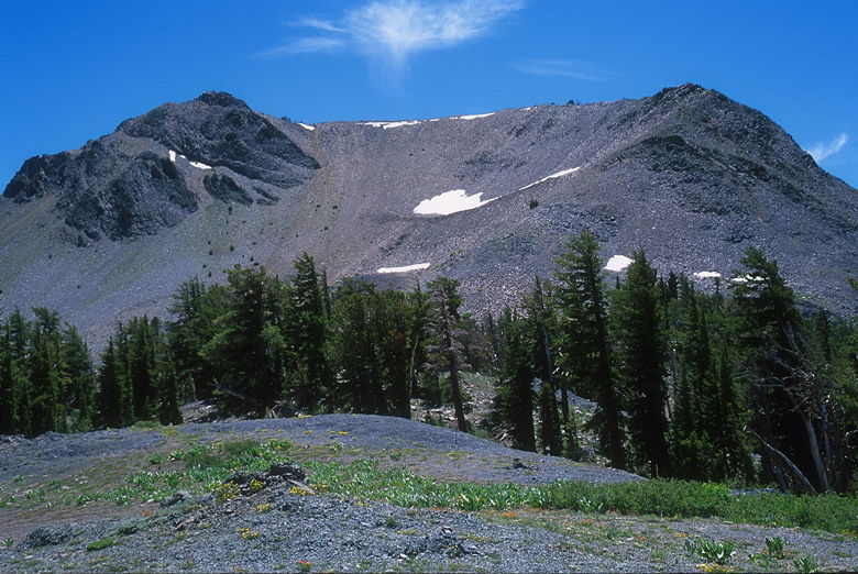
Hiram Peak
I zigged and zagged before emerging from the forest and then shortly
joined the main trail just before it reaches a crest. The trail
continues on over the crest toward Arnot Creek, but I turned right
and crossed a large snow patch. The trail is mostly level as it goes in
and out of forest on the way to the base of a large talus slope. As I
walked this section of trail, I could see people up on the summit.
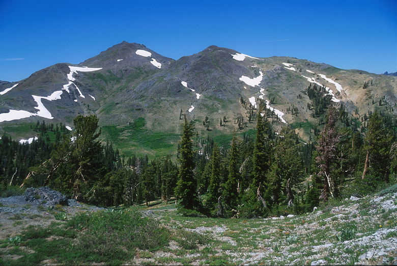
Folger Peak
The talus slope looks intimidating at first, but it's perfectly safe.
In fact, you'll eventually discover that there's a trail that you can
follow. Halfway up the slope, I met a group of three hikers coming down.
One of them mentioned that they'd come up on the opposite side, from the
lake side (they're nuts). They also thought this was Folger, not Hiram
(I corrected them). One good thing I got out of them -- they said the
trail ahead wasn't that bad, even though I was scared of heights.
After reaching the top of the talus slope I tackled what, for me, was the
scariest part of the trail. The trail wraps around the talus summit,
with steep drop-offs on the right. I put my trekking poles into my outside
hand so that I could grip the rocks on my left. Once safely through
that section, I waited as another hiker approached from the summit. I
waited because he was going along the ridge which the Schaffer book says
may scare off acrophobics. After a couple minutes, he came to where I was
waiting. He said he'd been coming to the park for 40 years (since he was a
kid -- he didn't look more than mid-forties), but this was his first time
up Hiram Peak. He said he actually got cell phone reception at the summit
and called his brother to say "Guess where I am!"
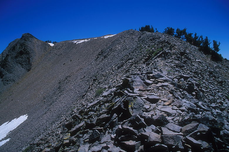
The narrow section
He continued his descent and I faced the knife-edge ridge. Actually, it
wasn't so bad. It was narrow, but I felt pretty safe. I just kept my head
down and focused on the trail, not on the drop-offs. The trail gets wider
pretty quickly. The trail is nowhere near as scary as Angels Landing, where
I was hunkered down on the ground like a baby.
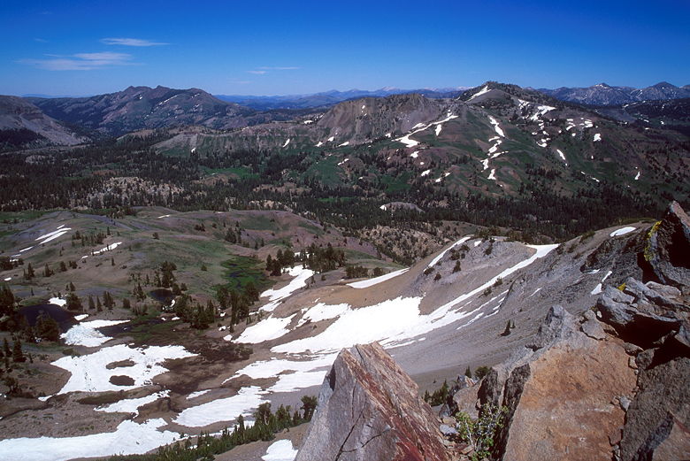
Snow slopes below Hiram Peak
The narrow section conquered, I now passed some tortured pine trees on the
right. The ridge becomes very wide now, with commanding views of nearby
Airola Peak. When I reached the summit block, I knew from the Schaffer
book to go to the left. I did so, and found the easy chute to the top.
There's not much space to enjoy the 9795 foot summit, which consists of slabs of
sharp rocks below you and on all sides. I don't know if there's a summit
register; if there is, I couldn't find it.
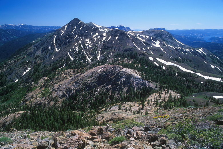
Airola Peak
I enjoyed the views, but
decided that the best view was of Airola Peak and I could enjoy that from
down below. So after a short stay at the top, I descended from the summit
block and found a nice piece of flat ground to sit down and set up my
tripod. I enjoyed another bagel with peanut butter. As I did so, a couple
of hikers came up. I told them about the hidden chute on the left. They
disappeared into the summit and I ate my bagel before setting up my tripod
for some pictures of Airola Peak.
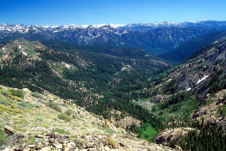
Snowy peaks to the south
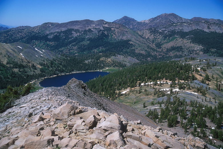
Looking down at Upper Highland Lake
By the time I was done with my pictures, the couple was done with their
lunch. We both started our descent around the same time, and leap-frogged
a few times. As I started the descent of the talus slope, I encountered
two more hikers coming up. Only they were headed back down for some
reason. They seemed to be having trouble descending, so they sat and
rested. They asked if my trekking poles helped, and I assured them that
they certainly did, especially on ground like this. I was able to keep
a steady pace going down; the talus wasn't nearly as bad as the gravel
on Folger Peak.
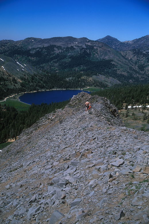
Hikers on the ridge
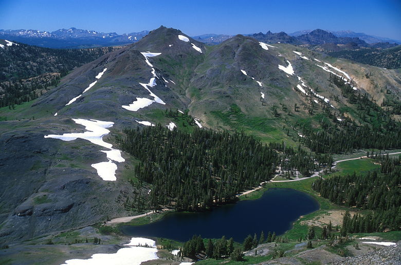
Folger Peak above Upper Highland Lake
Once I crossed the snow patch, I turned left and joined the trail. Now
I could see what I'd missed coming up. There were lots of Indian paintbrush
on the left. The couple who'd been on the summit with me took a shortcut and
cut in front of me at this point. The other pair of hikers who'd had
trouble descending also tried to take a shortcut. They slid down a snow
patch. Or rather, one slid (amazingly) standing up. I kept waiting for him
to fall down. The other one did end up on his rear end. Once they reached
the bottom of the patch, they looked like they were trying to find a way
back up. I'm not sure if they were trapped by the bushes, or simply wanted
to do it again because it was so much fun.
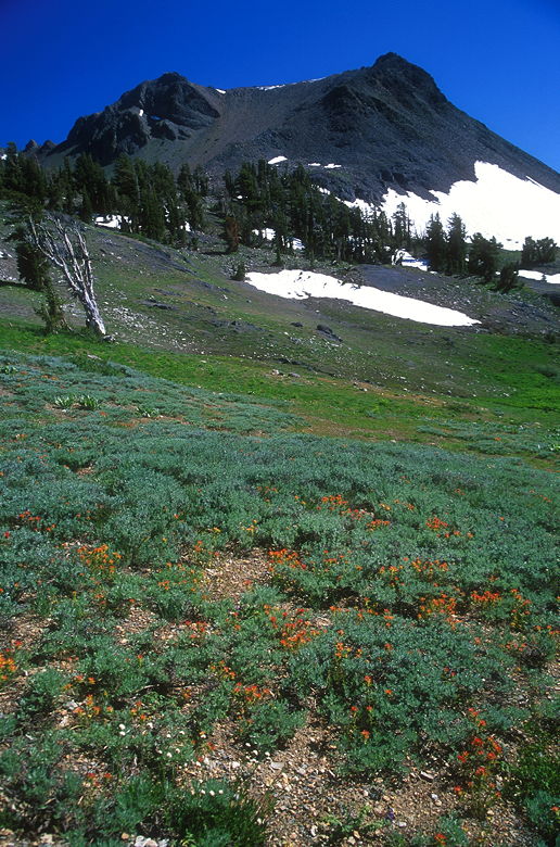
Flowers below Hiram Peak
After watching their antics, I continued my descent down the trail, which is
very gentle and would have been much easier than the route I'd taken up.
Eventually I emerged at camp site 31 and realized my original mistake.
Return to Highland Lakes trip report.
| 

