|
As we entered the park just after 2:30pm, we noticed the sign said that
the gate closed at 5pm. This probably varies by season, since sunset on
this particular day was about 5:15pm. In any case, we made haste in
prepping and getting out onto the trail. This was Nathan's second hike,
and Jean still carried him in the Baby Bjorn. I have about 3-4 months
until I have to carry him on my back.
There's actually a paved service road that goes straight to the top, and
some people choose to just walk on that (only service vehicles are allowed
to drive on it). I don't see much point in walking on it, though. It's
not a very pretty road to walk on. We chose to do the Summit Trail Loop
instead.
At the very beginning, you have a choice of whether to go left or right
to start the loop. We chose the left side, which is shorter. The trail
goes through low brush before entering a small eucalyptus forest. After
emerging from the forest, the trail continues zig-zagging up through low
brush (including poison oak, so be careful). The grade is gentle, and
you quickly get views of downtown San Francisco. Unfortunately the afternoon
haze prevented us from enjoying the view we could have had.
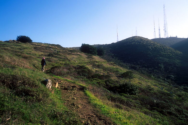
Climbing towards the antenna-filled peak
The trail eventually winds east, providing views of San Francisco Bay.
As you climb, the radio towers at the top of San Bruno Mountain are clearly
visible above you. We reached a trail intersection with the Ridge Trail.
Here, we were supposed to turn left onto the Ridge Trail but instead went
straight on the Summit Trail. This wasn't much of a problem, though...it
would just cause us to backtrack a little bit later.
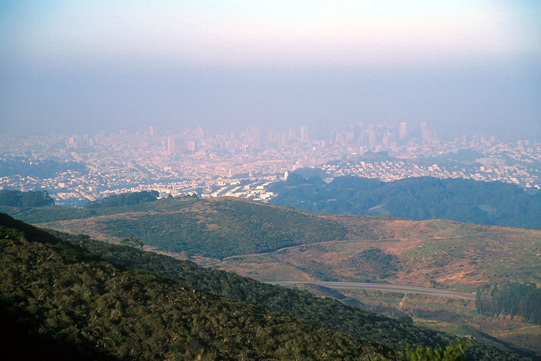
San Francisco through the haze
Shortly after the trail intersection, the trail meets the service road.
It's completely anti-climatic. The road is lined with numerous radio towers
and associated buildings, one next to the other. We turned left and headed
up the road toward the peak. This section has to be one of the worst sections
of a hike I've ever done, and the reason this hike deserves no more than a 5
rating. There are some nice views, to be sure, but the road and towers
are disappointing.
At the end of the road, we reached the intersection other end of the Ridge
Trail, where we stopped for a few minutes to enjoy the views, such as they
were. The peak is just 550 feet above the trailhead.
Were the day not so hazy, I'm sure we could have seen the Pacific Ocean
to the west, and San Francisco Bay to the east. Mostly we could just see
a range of hills heading south and cities below to the east and west.
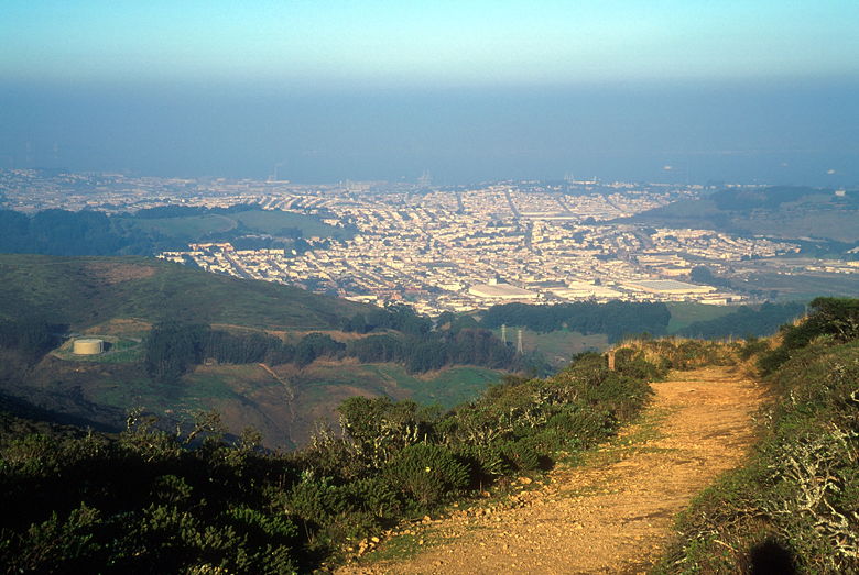
View of San Francisco Bay
Continuing on the Ridge Trail now, we followed the trail in shadow.
This is a nice section of trail with views to the east. Back at the
intersection where we'd taken the wrong turn earlier, we made a left
turn and got back on the Summit Trail, leading us back to the service
road again. This time, instead of turning left up the road, we went
straight across to the other side, re-joining the Summit Trail.
The western portion of the Summit Trail has great views to the west,
but the haze and setting sun prevented us from seeing anything.
Again, mostly what we could see below was row upon row of houses.
The trail crosses another road, then continues descending. Having now
done both sides of the Summit Loop Trail, I would have to say that I
much rather enjoyed the eastern side. The western one zigs and zags
and takes its sweet time getting back to the trailhead, without much
reward. In fact, the trail goes down so far that you have to climb 200
feet back up to the parking lot.
All this time I kept checking my watch to make sure we made it back on
time. We ended up getting back with about 5-10 minutes to spare. Just
as we finished, the ranger pulled into the parking lot to wait for the
stragglers. I was surprised that there were still half a dozen cars in the
lot, and two remained after we left.
Note: despite the fact that this hike is listed at 3.1 miles, and the
Brooks Falls hike is listed at 3.0 miles, I think this hike is at least
a half mile longer. I suspect that Brooks Falls is closer to 2.75 and
San Bruno Mountain is closer to 3.25.
| 

