|
About a half mile from the parking lot, on the drive in, you'll pass
through Stump Meadow, which has dozens of old sequoia stumps -- remnants
of sequoias cut down by loggers in the early 1900's. It's a ghostly
image. When you reach the Boole Tree, you'll wonder how anyone could have
done this.
The Boole Tree can be done as a 2-mile out-and-back, but we opted for the
2.5 mile loop. We started off on the right fork, since the book I had
said it would be a more gradual climb. In fact, it is completely the
opposite. If you want a gradual climb, start on the left fork.
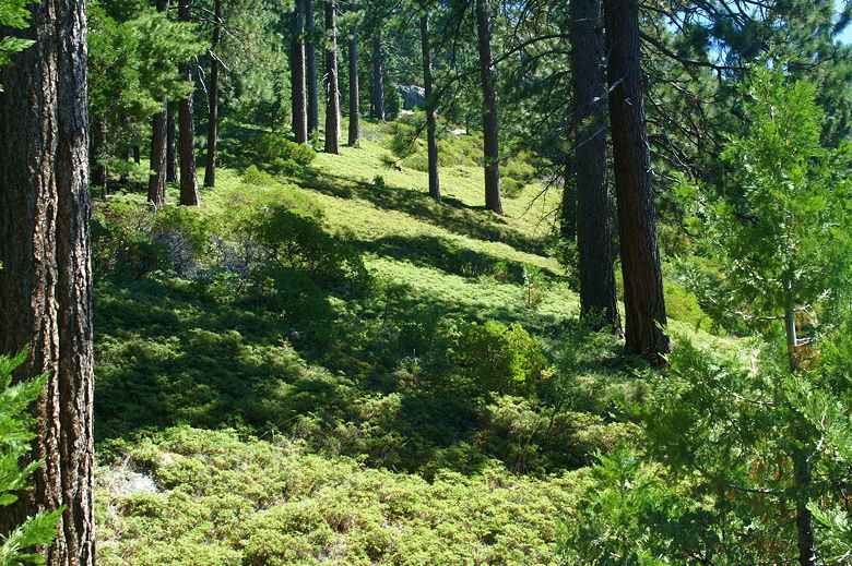
View looking up from the trail
In any case, we took the right fork and climbed steadily, gaining about
500 feet in one mile. Along the way, we saw every single hiker who'd come
in the 5 other cars in the parking lot. Apparently they were all one big
group, about 20 or so strong, all coming down as we were coming up. After
that, though, we had the whole place to ourselves the rest of the hike.
The trail is mostly shaded, and gets steeper near the top. Here, there
are wooden steps built into the trail to help. The trail actually crests
and then descends briefly before there's a spur trail to the right to
the Boole Tree. The spur trail descends some more. When you first glimpse
the Boole Tree through all the other trees, you'll see a display sign which
explains how the loggers cut everything else down except this tree.
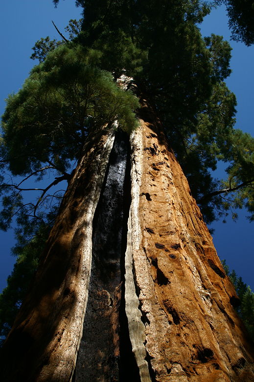
Looking up a the Boole Tree
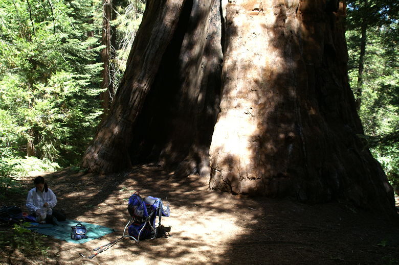
Lunch at the Boole Tree
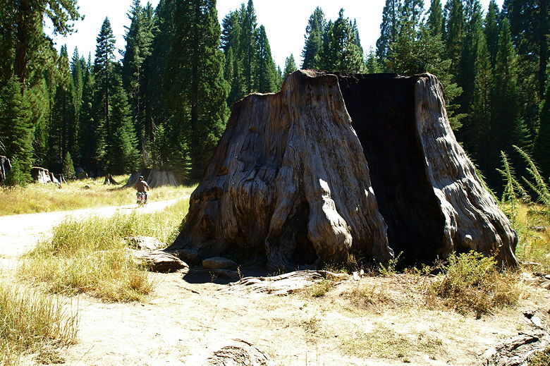
Shortly, you'll be standing right next to the Boole Tree itself, which is
massive. It's about 269 feet tall and 35 feet wide at the base, and
probably over 2000 years old. There's a small perimeter of bare ground
around it, which is then surrounded by brush and much younger and smaller
conifers. It has a very closed-in feel, in contrast to places like the
Congress Trail or General Grant Trail.
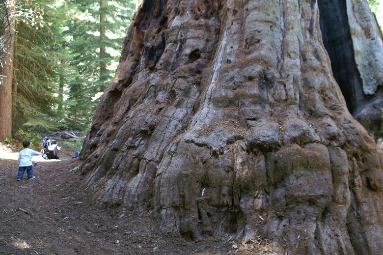
Base of the Boole Tree
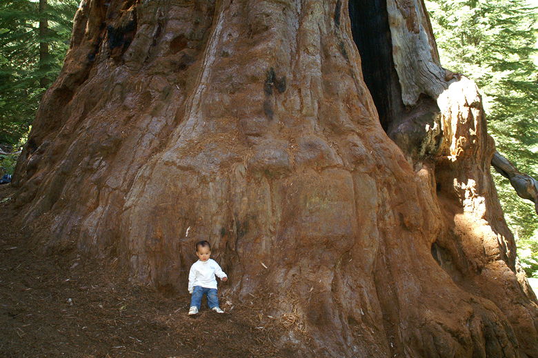
Base of the Boole Tree
We settled down on the ground next to the tree for lunch. After a nice
quiet lunch (just us and the birds) and admiring the tree, we retraced
our steps back up to the main trail, then turned right to complete the loop.
The trail climbs again, and almost immediately presents some partially
obscured views of Kings Canyon. From this vantage point, you can also see
the Boole Tree poking out above the rest of the forest. Its top (which you
can't see from the base) is almost a perfect upside-down cone.
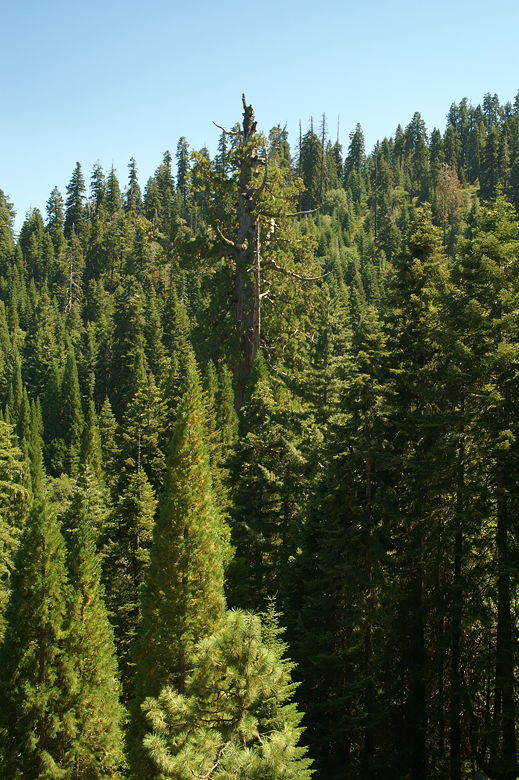
Boole Tree poking out above the other trees
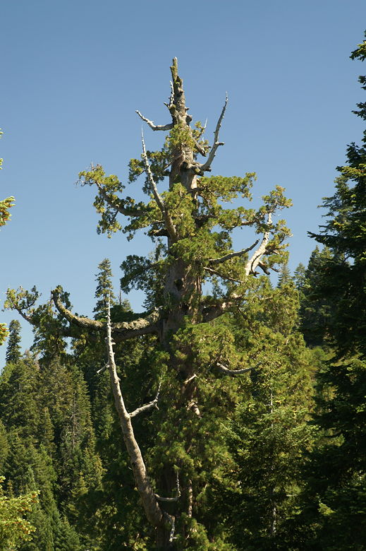
Top of the Boole Tree
While the trail up to the Boole Tree was mostly shaded, this part of the
trail is mostly open. The trail levels out for stretch. Just after
passing through a gate, you'll have great unobstructed views of Kings Canyon.
The cool breeze is a treat, too. The view persists while you go down a
series of gentle switchbacks.
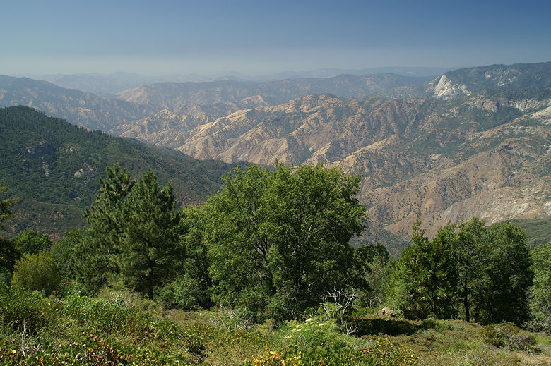
The mountains of Kings Canyon
As I reached to open a second gate, I suddenly yelped out in pain. I got
stung by a wasp or something. As my finger throbbed in pain, Jean applied
the Sting-Eze that I carry in my first aid kit. The wasps or whatever they
were still circled as we went through the gate. But they didn't bother us
after that. Down we went, and less than 5 minutes later, we were back at
the now-empty parking lot.
On the drive back, I stopped and took a few pictures of Stump Meadow.
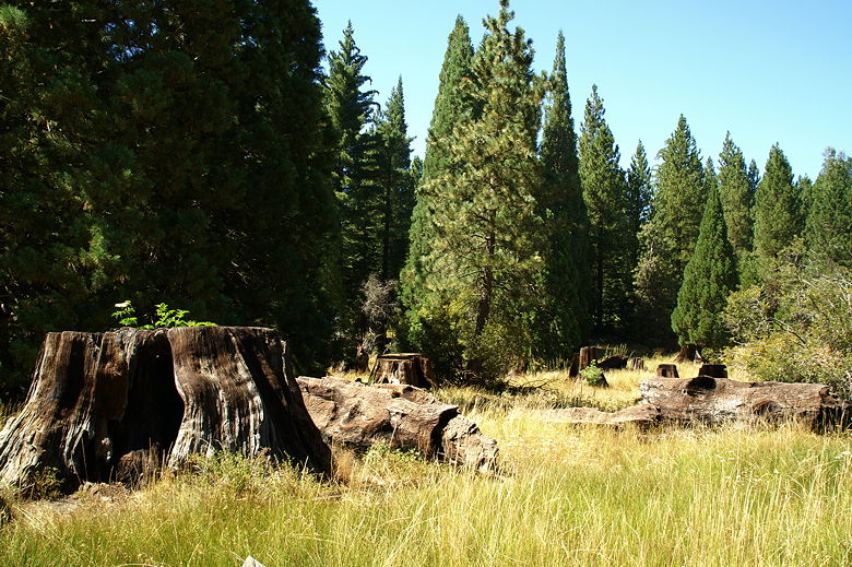
Stump Meadow
Motorcyclist leaving Stump Meadow
| 

