|
The book I had didn't tell me that the last 1.3 miles of road to Eureka Lake
were not paved. The sign at the start of the unpaved section warns of rough
road. It's not kidding. It's only 1.3 miles, but this has to be the worst
section of road I've driven on. We bounced along the rocky dirt road, which
starts out relatively wide but quickly narrows. When driving on such a road,
the first thing that enters your mind is that you hope you don't encounter any
cars coming the opposite direction. Well, despite it being 11am, we encountered
not one, not two, but three cars coming in the opposite direction. We gingerly
passed each other. The passenger of the last car got out to direct the driver
to pass, as there was very little space (and a mistake would result in the car
slipping off the side of the road and into the trees). But we made it in one
piece.
Relieved to be done with the harrowing drive, we pulled into the empty dirt
parking lot. Our reward was beautiful Eureka Lake, with Eureka Peak looming
above it. There's a surprisingly clean bathroom here, but no drinking water, so be
sure to bring your own.
There are trail signs along the trail, but they don't say anything other than
"trail". You'll have to take it for granted that you're on the right one.
From the parking area, the trail starts at the gate, heading west on top of
an earthen dam just above the lake. We enjoyed the views of the lake before the
trail slipped into the forest.
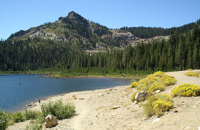
Eureka Peak over Eureka Lake
The trail starts climbing gradually through the dense forest, with limited views
of the surrounding area. Shortly after we started I spotted another car pulling
into the lot. Minutes later, a hiker and her dog caught up to us on the trail.
She looked like a regular, so I asked if she'd been on the trail and could confirm
it was a loop trail. Yes, she had been on the trail before, but it was just an
out and back trail. I'm not sure why she told us that, though, because there was
a loop section later on. Perhaps she didn't quite understand my question.
In any case, we continued on up the trail. Eventually the trail breaks out of the
forest and onto a rocky section that gets a little steeper. From here, the peak
is clearly visible, with nice views to the lake below. A pair of descending hikers
met us here. Since there weren't any other cars in the dirt lot, they must have
parked in the paved lot just before the dirt road. This adds another 2.6 miles of
hiking, but is probably worth considering if you're not up for the bumpy drive.
The hikers were kind enough to offer us their map of the area, since they didn't
need it anymore. I appreciated it, since the edge of the map I had went right
through the middle of the hike. They also mentioned that there was a pile of
rocks at a trail intersection. They'd missed it and taken the right fork, which
loops around to the peak. They said the left fork was steeper but obviously
shorter.
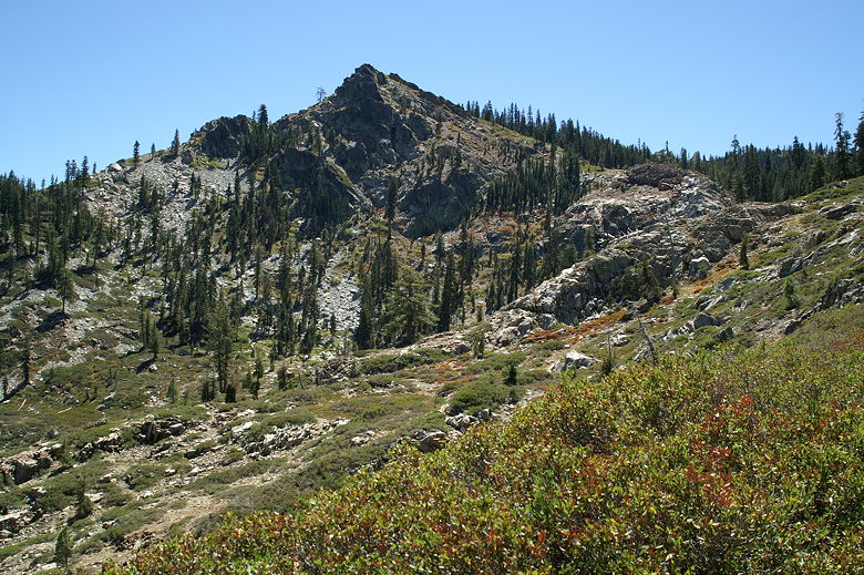
Eureka Peak
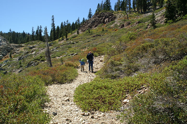
Heading up the rocky trail
Eureka Lake
We continued on up the rocky trail and soon topped out on a plateau. The rock
cairn was clearly visible at the trail intersection. We decided to continue
on the right fork, taking the more gradual route. The trail starts climbing
through the forest again, and we shortly stopped for a lunch break. After lunch
we continued on up the trail. The climb is relentless during this section,
climbing out of the forest and providing some views of the forested mountains
to the right.
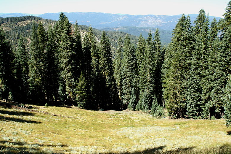
Looking down on a grassy bowl
After what seemed like a very long time, we reached a big plateau and then
reached a wide dirt road. We turned left to head to the peak. Again, there are
no words on the trail sign, so you'll just have to trust that you're going the
right way. The trail/road is mostly level for a short time before starting to
climb again. We shortly came upon a family, their dog, and their pickup truck.
I hadn't known you could drive this close to the peak, but I don't think it's a
straightforward drive. The national forest in this entire area is dotted with
unmarked dirt roads. If you have the nerve and the right maps, you could explore
a lot of places here using your car.
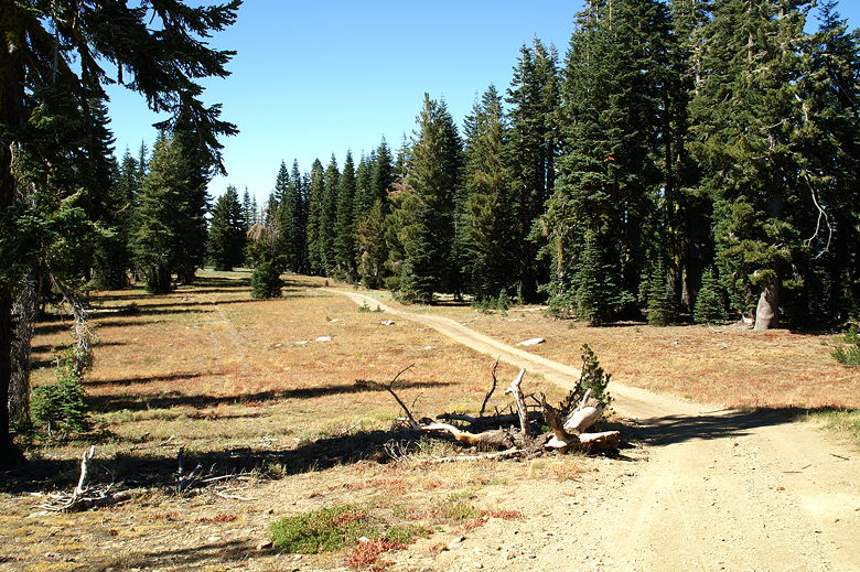
Looking back at the trail/road
Through the gusting winds, we continued on up the trail, which soon provided some
views of the mountains to the
southwest. We then reached the high point of our hike, South Eureka Peak, at 7447
feet, about 1200 feet above the trailhead. We didn't stop here, though. The trail
goes right through the peak. You can scramble up the rocks to the top if you like,
but the views here aren't as good as at the north peak.
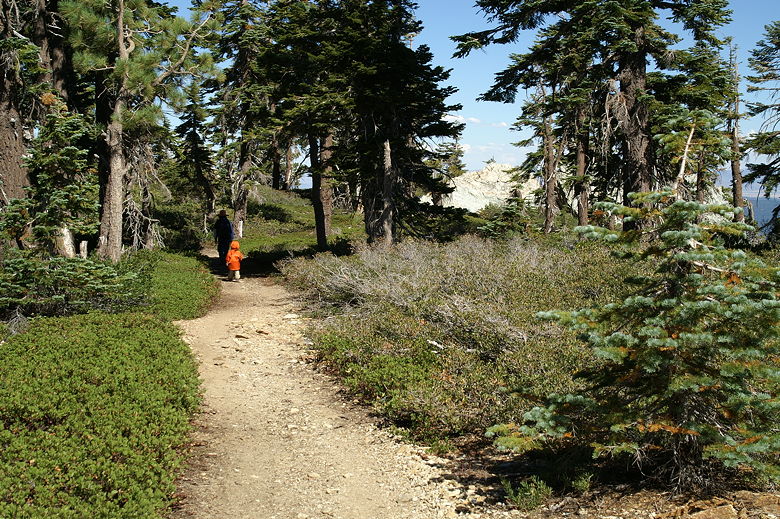
Hiking from the South Peak to the North Peak
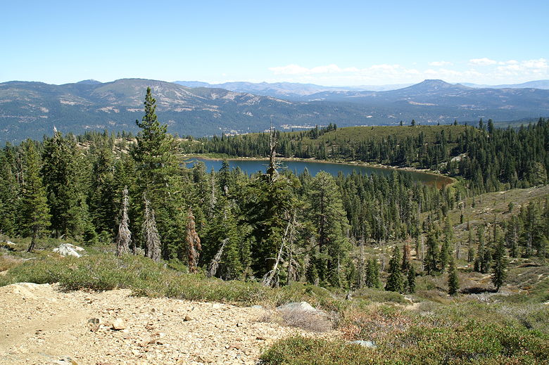
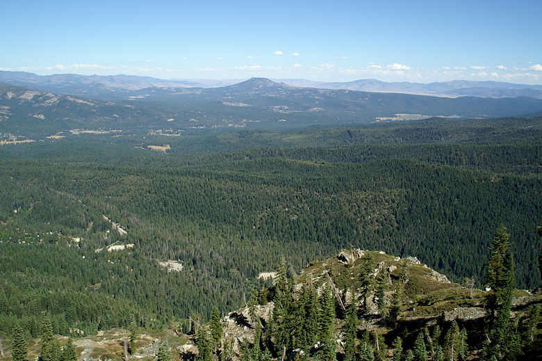
The trail now descends for about 210 feet down to the north peak. From here,
there are great views of all the mountains and forests to the east. You can see
Eureka Lake below. There is a distinctive mountain with a flat top in the
distance. I haven't quite figured out where it is on the map yet, so if anyone
knows what it is, feel free to let me know. [Note: I've since been told that it
is Beckwourth Peak.]
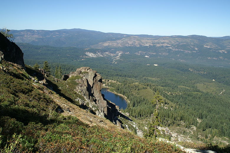
Eureka Lake
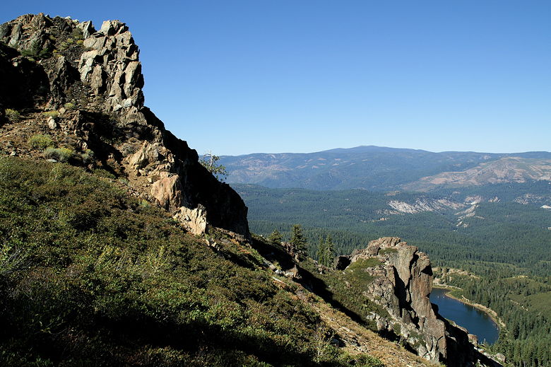
Eureka Peak and Eureka Lake
The summit itself is rocky with a bit too much exposure than I'm comfortable with
(especially with 2 small children), so I stayed about 20-30 feet below to take
my pictures. I would guess that being on the actual summit provides a full
view of Eureka Lake below.
Beckwourth Peak from Eureka Peak
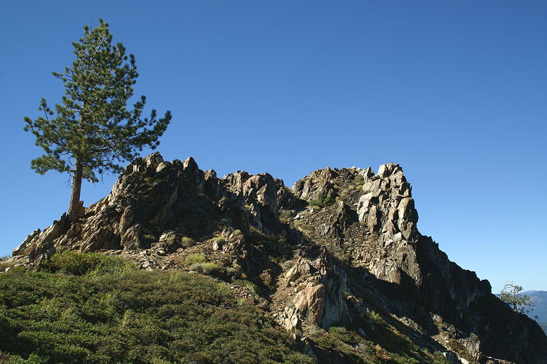
Tree at Eureka Peak
After a break, we continued on down the trail, which descends steeply through the
forest without any views. You will cross a small stream or two, and a huge
granite rock, but not much else of interest. Soon enough we reached the rock
cairn at the trail intersection and turned right to head downhill to the finish.
Along the way, we passed a group of four hikers who were headed uphill. In all,
we only saw about 10 people on the trail, despite it being Labor Day weekend.
If you go on a weekday you may have the whole place to yourself.
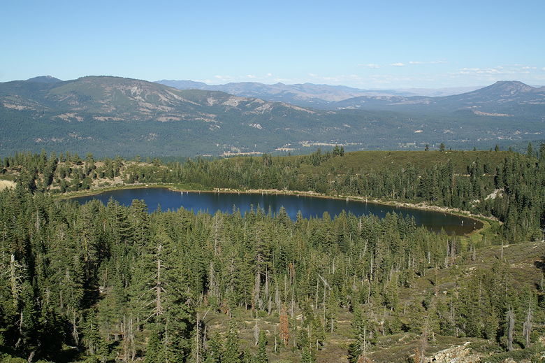
Eureka Lake
The funny thing about rocks on the trail is that you don't mind or notice them
that much going uphill, but they're a real pain going downhill. Thankfully,
it's a relatively short section of trail on the rocks. Eventually we re-entered
the forest and soon arrived back at the parking lot. We were surprised to find
that the lot was almost full -- which means there were 5 other cars in the lot.
A group of people were there, enjoying the lake.
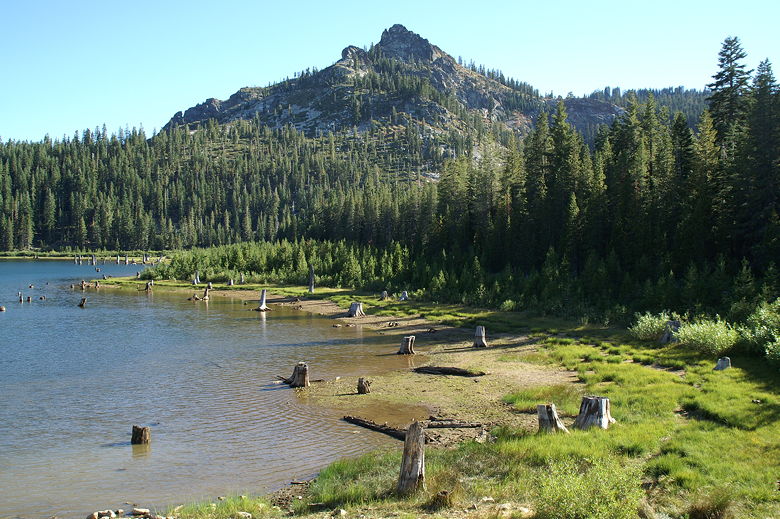
Eureka Peak and stumps at Eureka Lake
We drove back along the dirt road, thankfully not encountering any other cars
until we reached the end. Another car was just about to enter the dirt road,
but backed up when he saw us coming. We told the other driver that there were
cars behind
us (the group had just packed up to leave), so he might want to wait to avoid
having to pass cars in the opposite direction.
| 

