|
Snow blanketed the valley on this cloudy but rain/snow-free winter's day. I decided to
leave the snow shoes back at the cabin because I figured the trail would be well-packed,
and it was. We saw lots of other people on the trail, and most of them just wore boots
or even tennis shoes, although there were a few with cross-country skies and some with
snowshoes. While the main trail was stamped down, using snowshoes would allow for
exploration further afield.
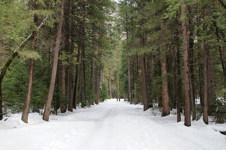
Start of the trail to Mirror Lake
The trail leaves the shuttle bus stop and heads directly into the conifer forest.
It's pretty much pancake flat up to and a little beyond the Tenaya Creek bridge.
From the bridge, of course, we could see Tenaya Creek below. The trail then basically
follows the creek upstream, with the creek on the right side of the trail.
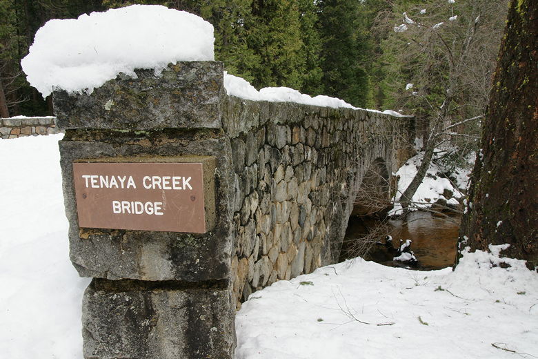
Tenaya Creek Bridge
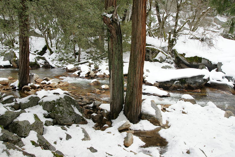
Tenaya Creek
After the bridge, there's a sign saying 0.6 miles to go to the lake. Shortly after
that there's a sign saying that rented bikes are prohibited from going further, and to
park your bike there (there's a rack). From then on, the trail starts to climb a bit,
though the total elevation for the hike is only 180 feet, so it's never very steep.
The nice thing about hiking in the snow with kids is that it provides endless
opportunities for them to play in the snow along the way to keep them occupied. They
can write in the snow, have snowball fights, or make snow angels. The downside is that
they'll probably expend more energy doing all this and may get tired hiking quicker.
Eventually we reached the lake, where there's a restroom and a sign saying that no
bikes at all (or dogs) are permitted any further. The trail then basically continues
along the shore of what's left of Mirror Lake. In summer, the lake pretty much dries up,
although it didn't use to be that way years ago. The lake is now really a seasonal pool
and recedes to display a meadow in summer. Interestingly, my family visited Mirror Lake
two years before I was born, in the summer, and it was definitely a lake back then.

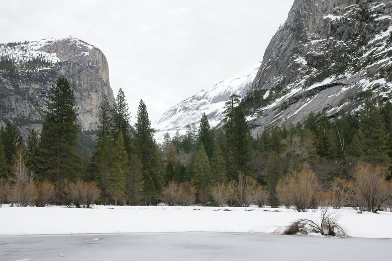
Half Dome over Mirror Lake

Peering out at Mirror Lake
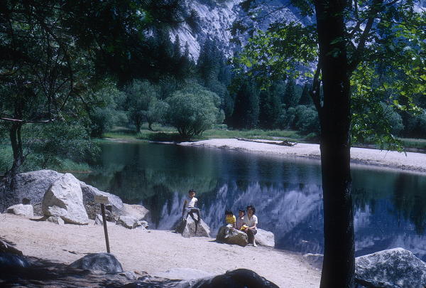
My siblings and mom at Mirror Lake in the summer of 1968
On this winter's day, Mirror Lake looked nothing like it did back then. For one, what we
could see of the lake was frozen over. And of course there was snow on all sides. Because
of that we could not see the iconic reflection of Half Dome in the surface of the lake.
But we could still see Half Dome rising abruptly in front of us.
We settled down amongst the trees next to the lake and had a picnic lunch. While we did
so, a family around the corner was making an igloo of sorts -- it sort of looked like a snow
closet, about 6 feet high and big enough to fit 3 or 4 people packed in tightly. They probably
spent about an hour on it before taking pictures and then leaving it there.
Mt. Watkins
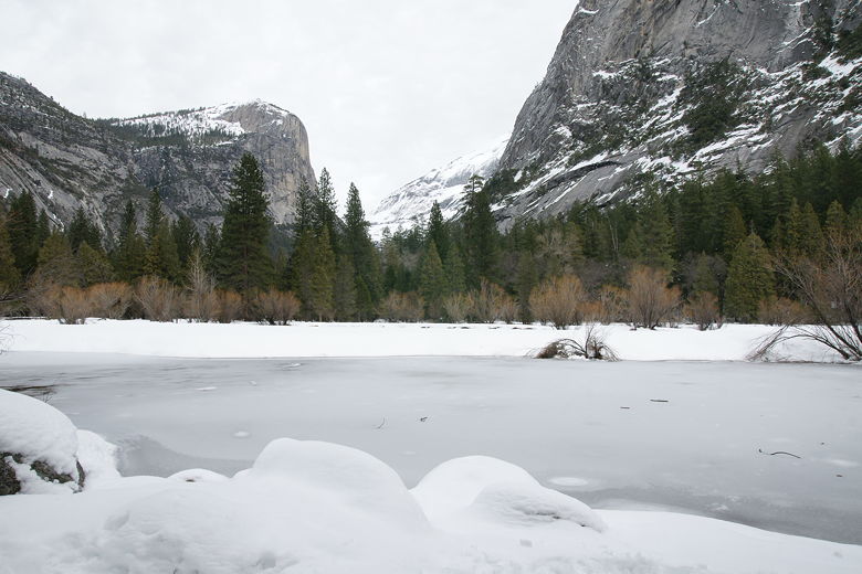
Mt. Watkins behind frozen Mirror Lake
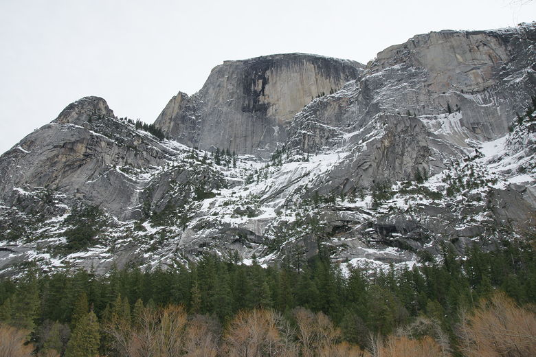
Half Dome
While taking pictures of the area I heard what sounded like the distant crackle of
thunder. I looked up and saw a puff of white high up on the steep granite slopes.
Apparently some combination of snow and ice had broken free and fallen in a mini-avalanche.
This was quite common, as I heard this happen several times. I waited and tried to get
a picture, but it was too hard to associate the sound with the actual place of the
snow/ice fall. It was kind of soothing sitting there listening to it, though.
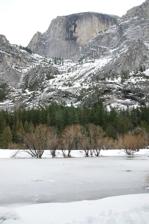
Half Dome over Mirror Lake
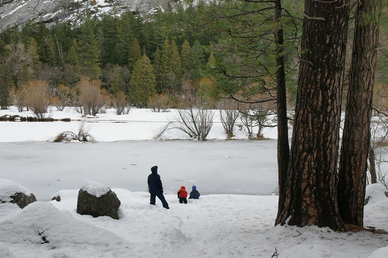
Playing at the snow-covered shore of Mirror Lake
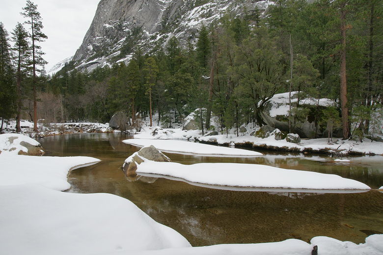
Tenaya Creek
You could continue to take the trail around the lake, but we turned around and headed
back the way we came. Supposedly the lake is 1.0 mile from the trailhead, but
according to the GPS, it's only about 0.8 miles.
| 

