|
Both the normal parking lot and the oversized vehicle parking lot were already full when we
arrived around 11:30am. There's a fair amount of turnover, however, so it was only a minute
or two before someone left and we found a space. Cars continually circle the lot like vultures,
waiting for a space. There's also a prominent sign saying that cars must be parked in marked
spaces (i.e., not on the side of the road).
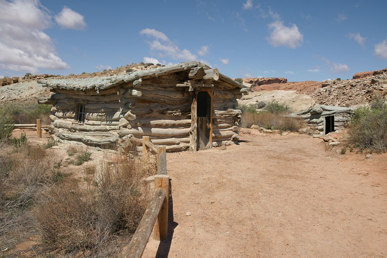
Wolfe Ranch Cabin
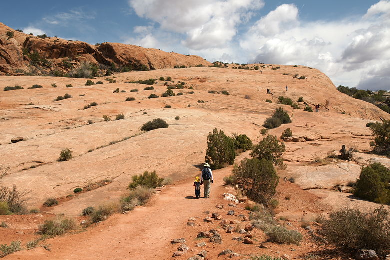
We started off on the hike at noon under sunny skies. It's completely flat as it passes an
old house from the Wolfe Ranch. Yes, there used to be a ranch here, although it didn't last
long. It's fenced off so you can't go inside. Not much to see here.
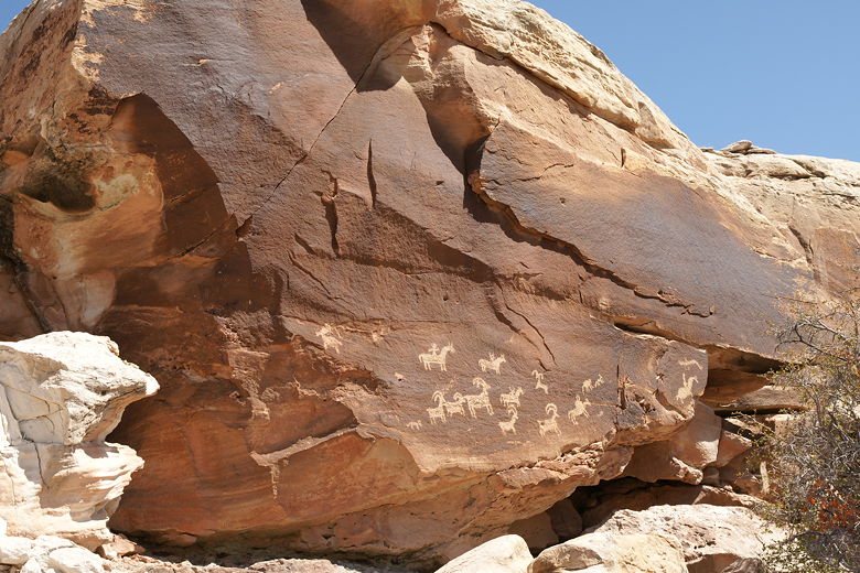
Petroglyphs
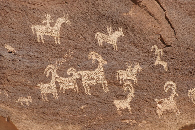
Petroglyphs
We crossed a footbridge and took the left fork toward the petroglyphs, off the main trail.
It's a small detour and well worth it to see. There's a display sign in front of the rock
wall here, explaining these drawings that were made between 1650 and 1850. There's a metal
chain here to keep people from getting too close, but you can get close enough to see it
pretty well.
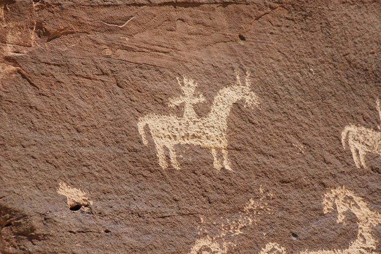
Petroglyphs
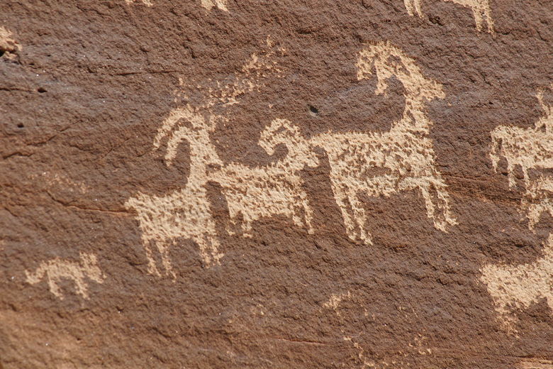
Petroglyphs
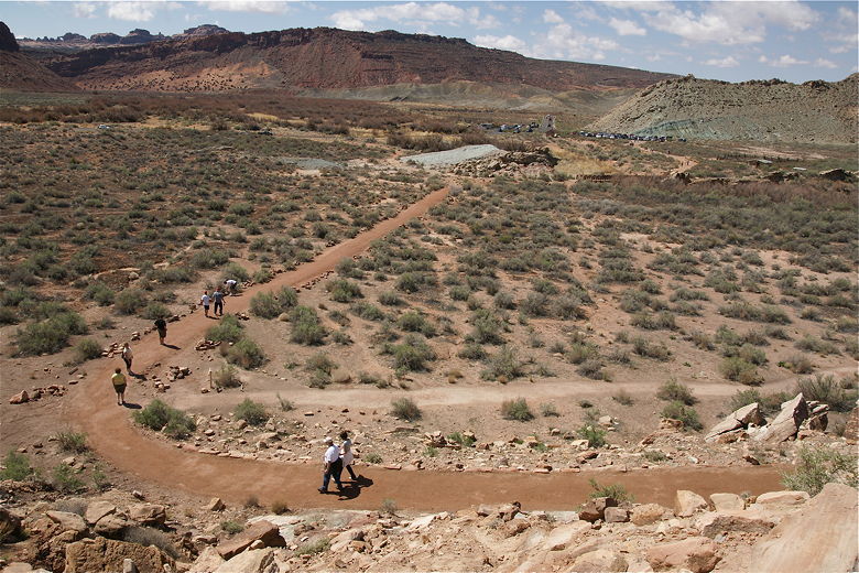
Instead of doubling back, we simply took the trail to the right to rejoin the main trail,
then turned left onto the main trail, which now starts a series of a few switchbacks.
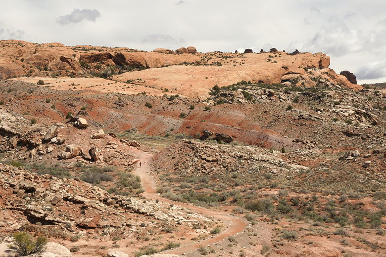
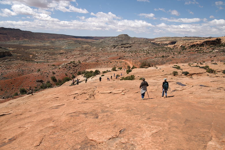
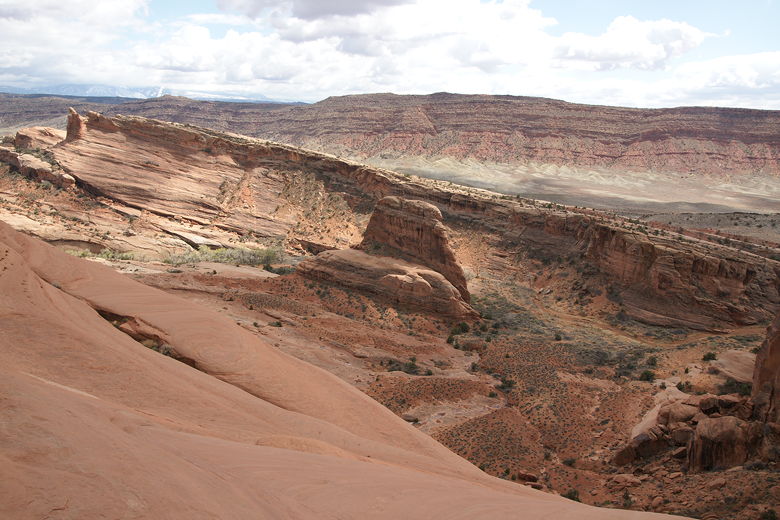
At the top of the switchbacks, the trail levels out and then even descends slightly.
There's no shade to speak of anywhere -- just low brush, reddish sand and rock, and
views of the same kind of terrain for miles around.
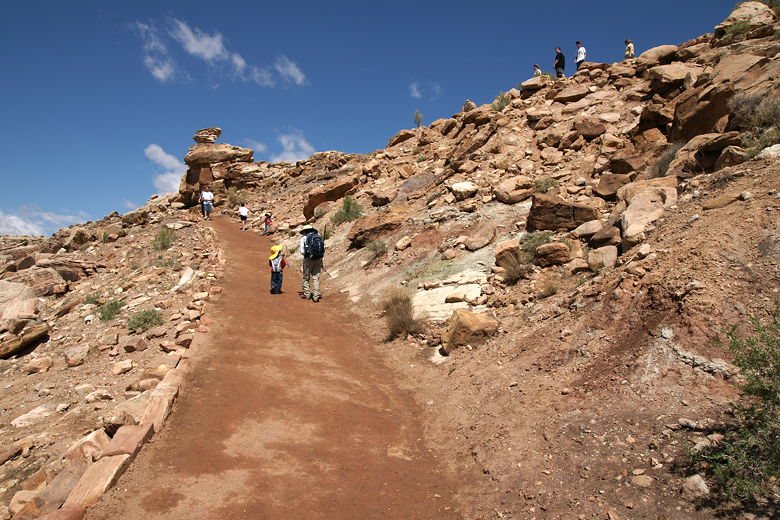
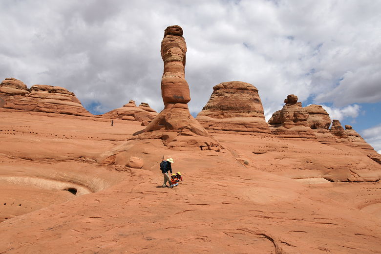
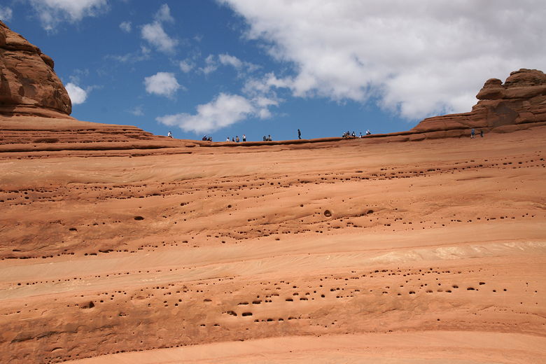
Heading up the switchbacks
From here, you can see people on the main climb on the slickrock ahead, looking like ants
from this distance. Soon enough you join them, however. All marching up the hill.
Needless to say, it is a very busy trail, with people going in both directions since it's
an out-and-back trail.
Looking back from the top of the switchbacks
Looking up at the slickrock section
After the slickrock section, the trail flattens out a bit, then continues a more gradual
climb up toward the top. Near the end there's a narrow section where the trail is blasted
into the rock face, where you'll want to hold onto your kids. It's a relatively short section,
however. And if our three year old can do it, well, don't worry too much. Just be prepared
for it.
Start of the slickrock section
Looking back down from the slickrock
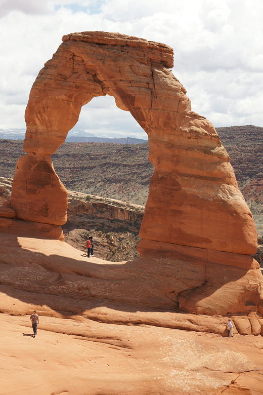
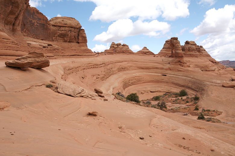
We rounded the corner and then there it was -- Delicate Arch staring at us. Two or
three dozen people milled about, eating lunch, taking pictures, posing for pictures.
Some people went out to the arch while others stayed back and enjoyed the view. The arch
sits at the top edge of a rock bowl, at the opposite end from where you first see it.
In the distance are the snow-capped La Sal Mountains. The other thing you'll almost certainly
encounter is a stiff wind coming from the west. Hang onto your hat!
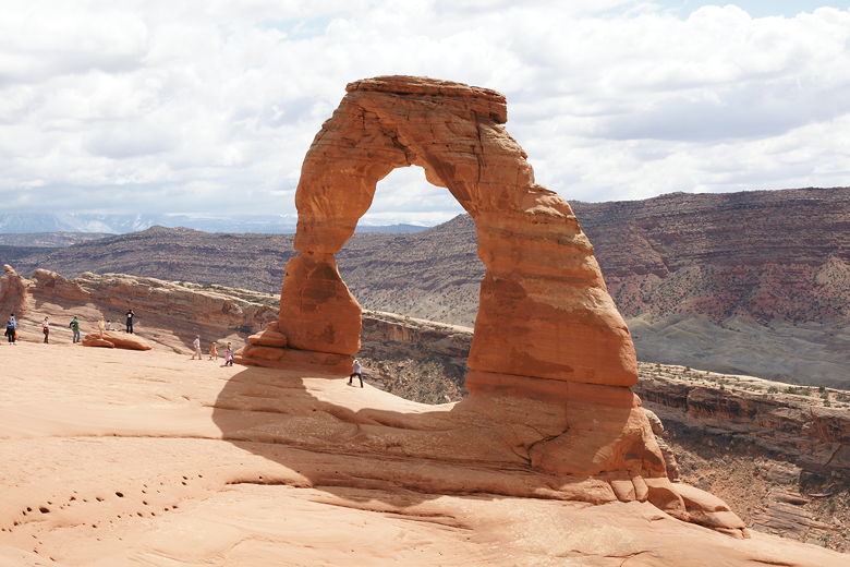
Delicate Arch
Delicate Arch
Delicate Arch
As we ate lunch we noticed several groups of people taking an alternate way back. Instead of
returning exactly the way we came, they were heading down to the arch, then continuing down the
edge of the rock bowl, on the slickrock, and back to the main trail that way. That looked better than
torturing the kids with the narrow section of trail, so we decided we'd follow that route.
It's not exactly trivial to follow, however. There are a couple places where you'll need to
help kids down from the arch to avoid falling into the rock bowl.
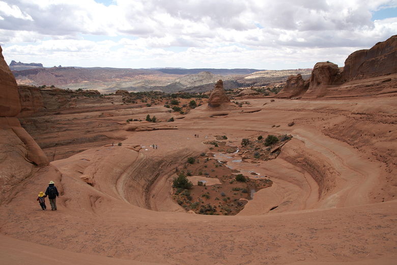
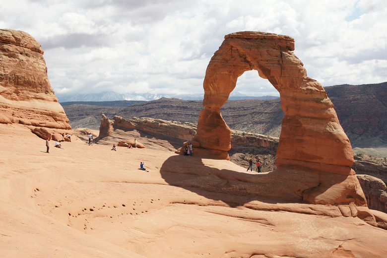
Looking down at the bowl from Delicate Arch
The view on the other side of Delicate Arch
Eventually, we made it down, then found our way back to the main trail. Try to stick to the
slickrock as much as you can. There are places in the soil where you'll find cryptobiotic
soil, which takes years to form, and stepping on it kills it. You can usually notice it by
seeing small black dots on the soil, but some of it is less visible. And if you're at all
unsure of your route-finding skills, stick to the original route back instead.
Side view of Delicate Arch
Hikers on the rim looking out at Delicate Arch
Delicate Arch (on right) above the bowl
From here, we went back the same way we came, even revisiting the petroglyphs. The parking
lot was still full, and would probably remain that way until close to sunset. There were even
cars parked on the side of the road (even though they weren't supposed to). For those of you
who want a slightly easier way to view the arch, there's another trail about a mile or so
down the road, called Delicate Arch Viewpoint. It's about a mile roundtrip hike. You don't
get as close to the arch, but it provides an alternate viewpoint.
| 

