|
When we arrived at Logan Pass around 10:30am, there was plenty of parking. Unfortunately we had
to wait until 11am for the next shuttle bus down to Avalanche Creek. It was a long ride made
longer by construction along the road. Twice we had to stop completely because of it. The
scenery was beautiful, and I even took a couple of decent pictures while the bus was moving.
When we got to Avalanche Creek, I did see one parking spot available. I suspect that we
would not have had too much trouble with parking if we had driven; we would have arrived
sooner so there probably would have been more parking available. Keep in mind that the
road between Avalanche Creek and Logan Pass is mostly a winding road with no place to pass,
so you're probably going to be stuck behind a bus anyway. However, we would have saved the
half hour we had to wait for the shuttle bus to arrive.
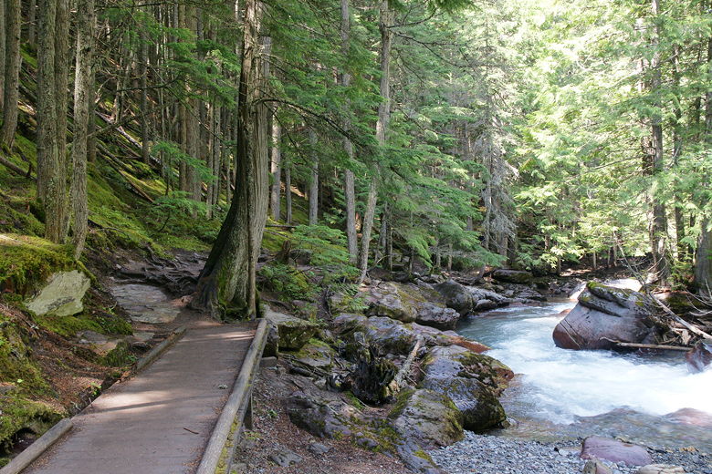
There are bathrooms near the bus stop, but no other facilities. We crossed the road and
started off on the Trail of the Cedars. This is a paved loop through a nice forest
next to the campground here. Since it's a loop we could have gone in either direction; we
chose the path on the right. The trail passes uneventfully through the forest for about 0.3
miles before it reaches the trail to Avalanche Lake. We turned right onto the
Avalanche Lake trail, which immediately begins climbing.
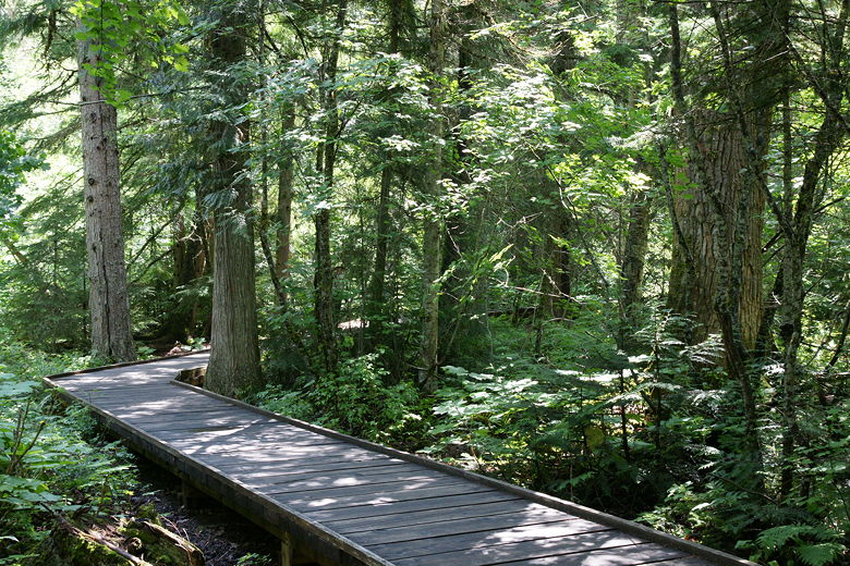
Boardwalk on the Trail of the Cedars

Trees on the Trail of the Cedars
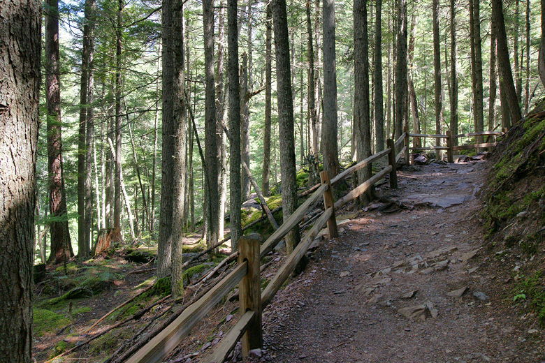
Heading up the Avalanche Lake trail
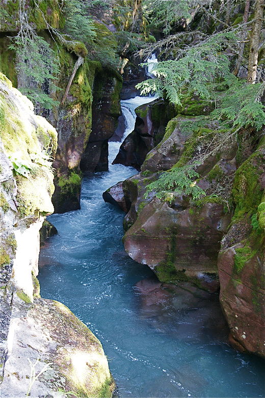
At the top of this short climb is a nice view to the left of the water rushing in
Avalanche Gorge. The view is off the trail to the left. If you want to see this
view you have to be extremely careful, as there are no guard rails here and it's a steep
fall into a fast-flowing river. If you have young children or are at all unsure of yourself,
you're better off getting a view from below (which I'll describe later in the hike).
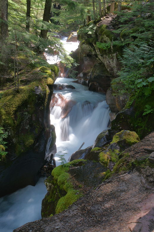
Avalanche Gorge
Trail above Avalanche Gorge
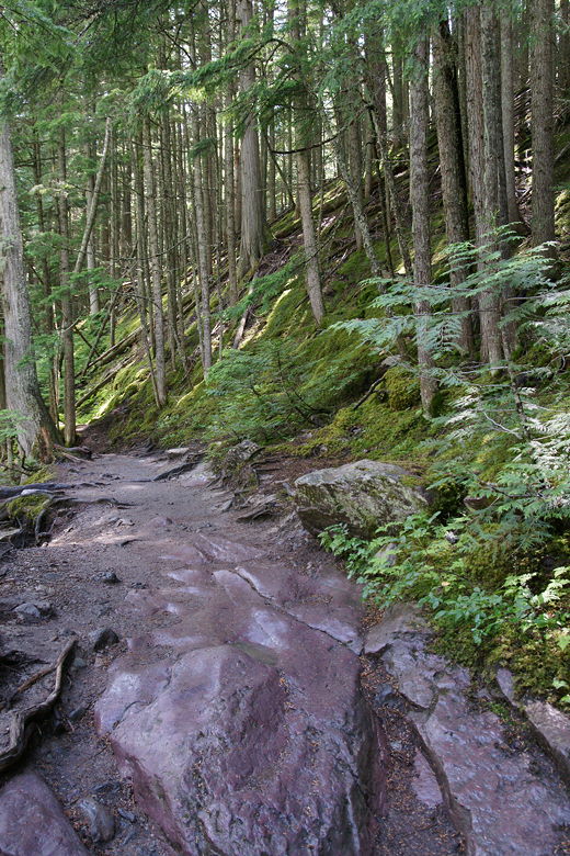
From here, the trail climbs up and down, mostly up, through the humid forest. Parts of
it felt very much like the Hoh Rain Forest in Washington. After the gorge the trail has
some access to the creek, but then after that it goes deeper into the forest away from
the creek.
Trail next to Avalanche Creek
This was another very crowded hike. Not quite as crowded as the Hidden Lake Overlook hike, but
still crowded. Once again we got lots of comments about the kids. A man who had somehow
managed to take a picture of Nathan on yesterday's hike coincidentally was doing the
Avalanche Lake hike today and stopped when he saw us, showing Nathan the picture. We are
hard to miss with the kids with us. Hard to miss when Jared is probably the youngest person
hiking the trail under his own power on almost every hike we do. I guess I'll start to feel
older when that's no longer the case.
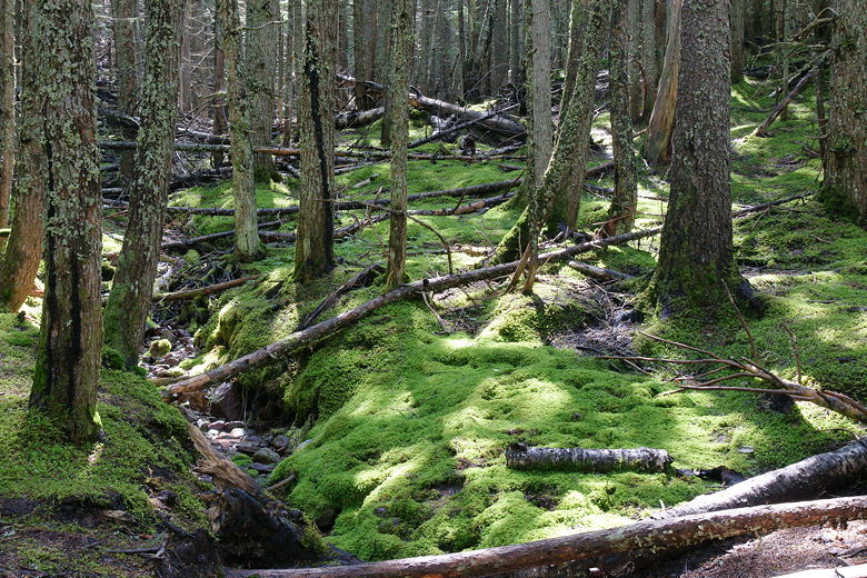
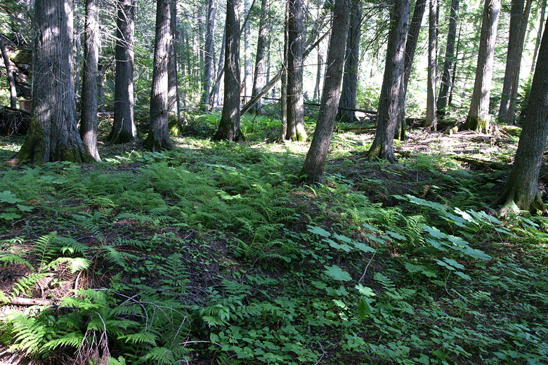
Moss-covered ground next to trail
After about a mile, we stopped for a snack break. Shortly after our break we encountered
a man coming from the lake who said we were only 25 minutes away from the lake. I didn't think
this was possible, since the lake was supposed to be about 2.3 miles from the trailhead. Well,
about 25 minutes later we reached the lake. At this point the GPS read 1.5 miles from the
trailhead. I suspect that perhaps the distance listed on the trail signs is exaggerated in an attempt to make
the tourists more prepared. But we still saw people walking with almost nothing, not even
water.
There's a side path to the right to some toilets before you reach the lake. When we reached
the lake we saw a group of Amish people there. For some reason I always thought they mostly
live in Pennsylvania, but there is an Amish community in Montana. A group of young Amish men
were fishing at the lake.
The western end of Avalanche Lake is filled with downed trees. There's a large flat gravel
area here, but there were lots of people here and it looked like there were better places
to stop for lunch further along the shore. So we went up the southern shore (there's no trail
up the northern shore) about halfway up the lake before settling down for lunch. Unfortunately
the shore here is pretty narrow. There was just enough space between the dense forest behind us
and the water's edge in front of us to squeeze in next to the trail. As it was, several
groups of hikers walked along the trail right in front of us.
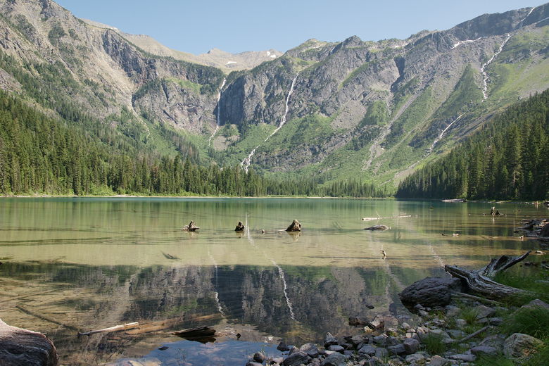
Avalanche Lake
There are a couple thin waterfalls snaking down the side of the mountain on the eastern side
of the lake. The lake itself is pretty shallow and, I have to say, a bit of a disappointment.
It's not the prettiest lake you'll ever see. Perhaps my expectations were high because I had
heard this was a great hike. At least it was a nice place for me to dunk my head in the water
after 10 nights of camping.
We spent a fair amount of time here, throwing rocks in the water (there are lots to choose
from). Because of our late start, though, we had to start heading back because the last bus
for Logan Pass leaves Avalanche Creek at 6pm. I wanted to avoid cutting it that close, aiming
for the 5:30pm bus instead. So around 4pm we picked ourselves up and started the walk back.
We made good time heading back. We arrived at the intersection with the Trail of the Cedars,
this time turning right to complete the loop. Immediately, we crossed a bridge over the creek
and had a great view of Avalanche Gorge. As I mentioned, you can see the gorge from above,
on the Avalanche Lake trail, but the view from here is almost as nice and a lot less dangerous.
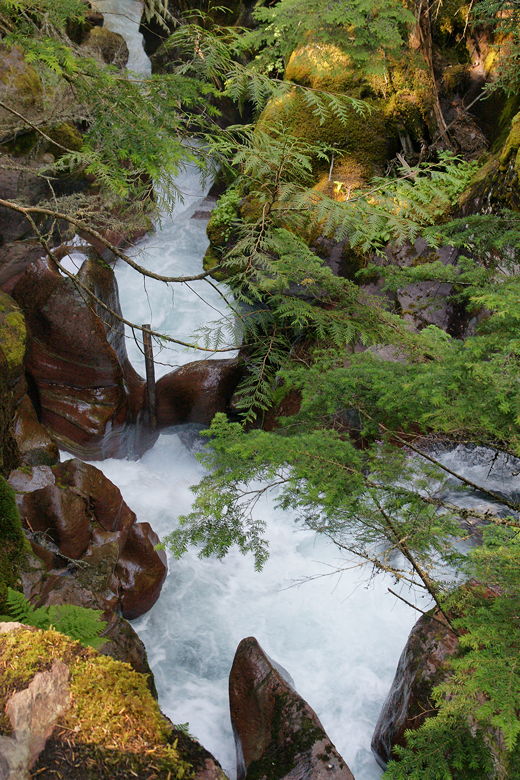
Looking down at Avalanche Gorge
Avalanche Gorge from below
We continued along the paved trail through the forest. It's about the same distance back to the
trailhead as the other side of the loop, but I would have to say that this northern side of
the loop is much nicer.
Fern-covered ground on Trail of the Cedars
We arrived back at the bus stop at 5:25pm, in plenty of time for the bus back to Logan Pass.
| 

