|
The parking lot was completely full by the time we arrived around noon, with many cars already
parked on the side of the road below the lot. We didn't even attempt to park in the lot, finding
a spot next to the road not too far down. As soon as we parked, the driver of the car in front
of us came out and asked, "Did you see the grizzly bears back there?" Apparently a bear and her two cubs
had been attracted to some of the orange caution flags, nibbling on them while gawking tourists
inched their way past in their cars. Jean saw them since they were on the passenger side, but
I didn't get a chance to see them.
I was a bit apprehensive about doing this hike because I knew it was pushing it as far as
the kids go. Jared (still only 3 1/2 years old) had never done more than 3.5 miles and 690
feet of climbing. This hike would involve much more climbing, and would be longer as well.
How much longer I wasn't sure. One hiking guide I had listed it as 6.1 kilometers (3.8 miles),
but another listed it as 8 kilometers (5 miles). Clearly I was hoping the first guide was
more accurate, but I'll explain the discrepancies as I continue.
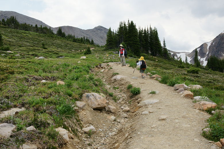
The first 500 meters of the trail is paved, although it does climb, and relatively steeply
in some places. Still, the pavement makes it pretty easy, even for kids. There are also
several memorial benches next to the trail so you can stop and enjoy the view of Angel
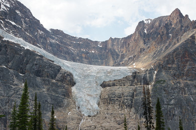
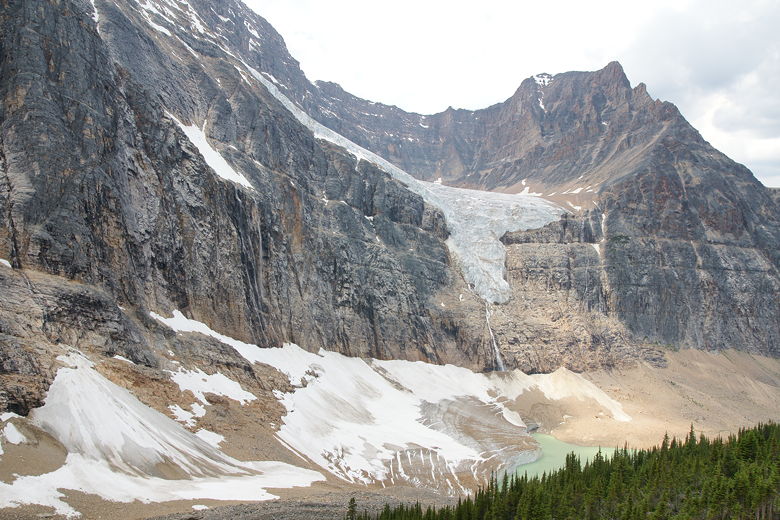
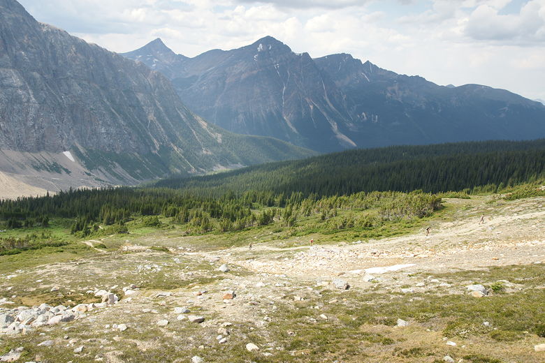
Glacier hanging onto the face of Mt. Edith Cavell above to the right. The views of the glacier
get better and better as you travel up the trail. The glaciers here used to occupy the space
in the valley to the right, and you can see that it's still recovering. Much of it is still
bare, although there are trees beginning to take hold where the glacier used to be.
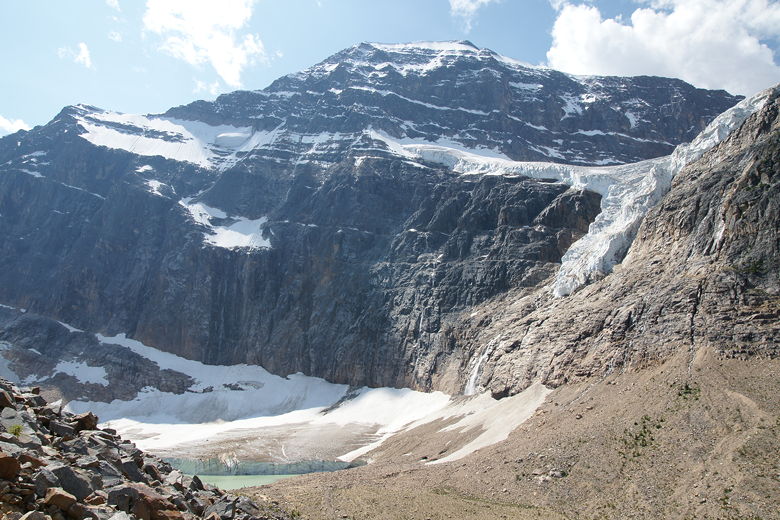
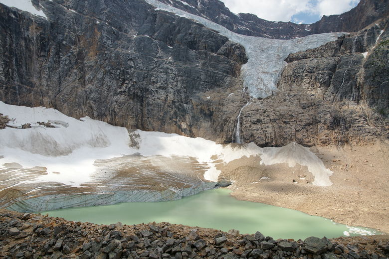
Angel Glacier (top right) and Cavell Glacier (bottom left)
As you get further up the trail, you'll see what looks like snow at the foot of the mountain.
As you get closer, you'll discover that it's a second glacier.
This is Cavell Glacier, and in front of it sits a glacial melt pond (Cavell Pond) colored light murky
green. At the end of the paved section, you have a choice. You can continue another 0.3
kilometers to the edge of Cavell Pond and then take the trail through the valley
another 0.8 kilometers, creating a 1.6 kilometer loop back to the parking lot. Or you can
turn left and head up toward the meadows, which is what we did.
Note, even if all you're up for is the 1.6 kilometer loop, that would be a very nice hike.
But more awaits above. It was at this point that I figured out where the first hiking
guide's 6.1 kilometers came from. It's actually a 6.1 kilometer loop from this point on,
which would make it at least a 7.1 kilometer trip in total. Well, I figured we'd already
started and one kilometer was paved, so the kids would probably be able to handle it.
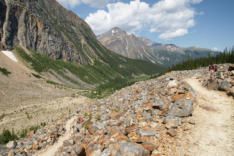
So we continued up the trail through and around a large lateral moraine.
The trail heads back in the direction of the parking lot before doing a u-turn and flattening
out a bit. Now there's a forest on the left with the lateral moraine on the right partially
blocking views.
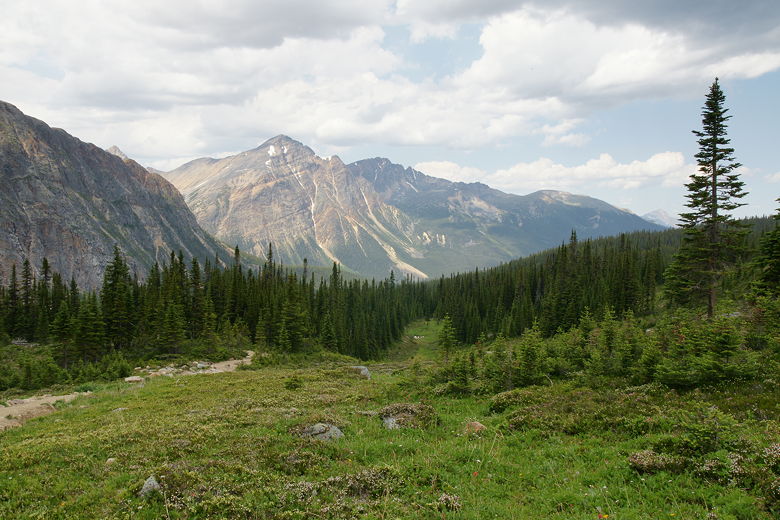
Looking back at the valley
As we walked along this part of the trail, we saw a marmot perched up on a rock, sunning
himself. Later, while the others stopped for a snack break by a small pond, I made a
short side trip up the moraine to get some better views of Cavell Glacier and Cavell Pond.
The views were nice, but I'd get mostly the same views just a few minutes further up the
main trail.

Marmot on rock in front of Angel Glacier
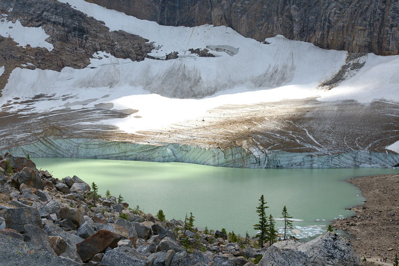
Cavell Glacier and Cavell Pond
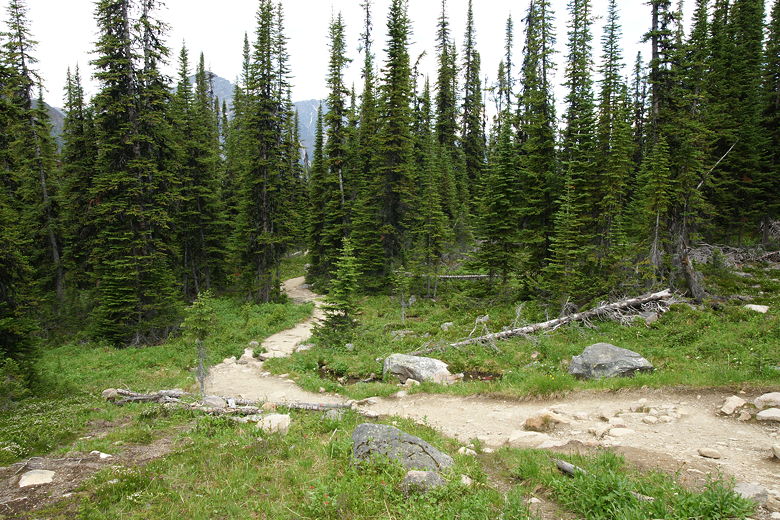
Trail between lateral moraine and forest
Next up is a trail sign with some climber's route on the right. Stay on the main trail to the
left (the sign is pretty clear). The trail now heads into the forest, leaving the views
temporarily behind. It climbs pretty steadily until the next trail intersection. Here you have a
choice -- it's a loop from here, so you can go left or right. I'd read that the right trail
is a more gradual climb, so we decided to take that.
Angel Glacier, Cavell Glacier, and Cavell Pond
It is in fact a pretty gradual climb, at least to start with. The forest begins to open up and you can start to see
the meadow. Soon we came to the first viewpoint, a little window in the forest to the right of
the trail. There's a bench here with views of Angel Glacier, but trees block the view of
Cavell Glacier and Cavell Pond. We were starting to get hungry and briefly
considered stopping here for lunch, but there were already people on the bench, and I figured
we could
hold out until the second viewpoint.
Looking back at the trail heading up through the trees
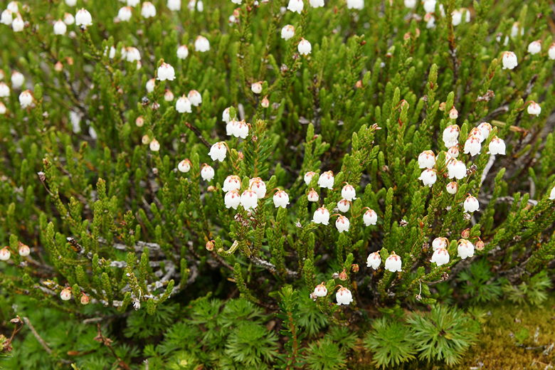
Heather flowers
Angel Glacier from first viewpoint
After the first viewpoint, the trail continues to climb, a bit more steeply now,
and completely out of the forest.
Instead, the meadows stretch out all across the hillsides. There are tiny heather flowers,
anenome flowers, paintbrush flowers, whites, purples, yellows, reds. It's a beautiful sight.
Across the meadows I could hear the occasional sound of ice crashing down from Angel Glacier
as pieces of it melted. This was probably the favorite part of the hike for me.
Closer look at Angel Glacier
Heading up the steep trail through the meadow
Looking back at the view
Hiker heading down through meadow; Angel Glacier behind and above
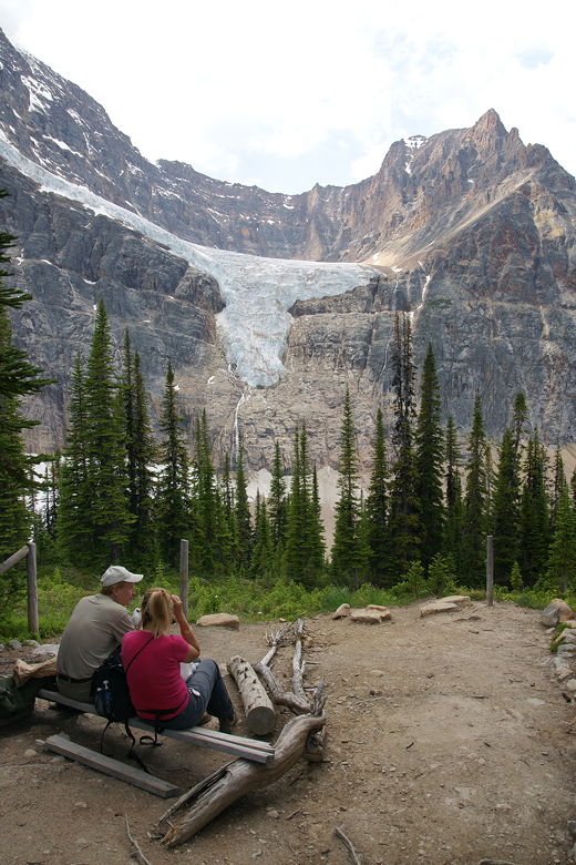
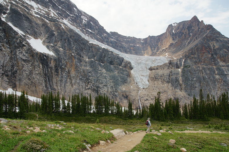
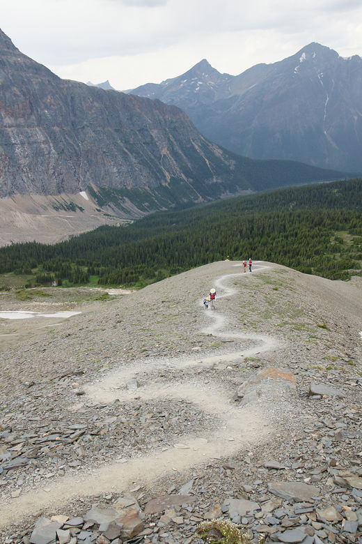
Soon enough we reached the second viewpoint. A spur trail to the right heads down into
a snow patch (even in late July), then up to a large plateau. From here there's a great
view of the two glaciers, and most of Cavell Pond. We stopped here for lunch.
While it was almost empty when we arrived, several groups of hikers stopped here as we
ate our lunch. I took a family picture of one group, and they returned the favor a few
minutes later. I did have my tripod with me, but it was easier to have someone else take
it, and there were occasional gusts of wind.
Angel Glacier above Cavell Glacier and Cavell Pond
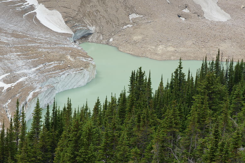
Cavell Glacier and Cavell Pond
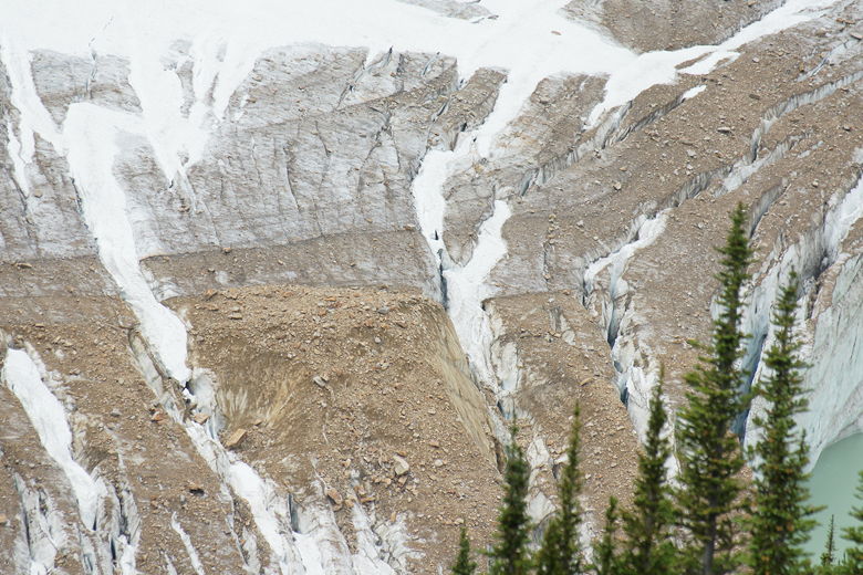
Crevasses in Cavell Glacier
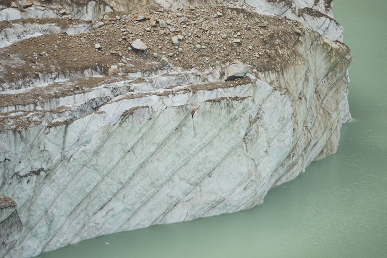
Closer look at Cavell Glacier
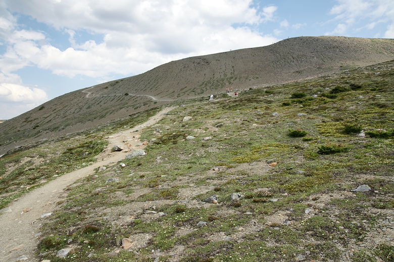
After lunch, we left the viewpoint at around 3pm. Clouds were beginning to gather above,
but didn't look too threatening yet. The climb up to the third viewpoint is the toughest
part of the hike. It's relentlessly steep and completely exposed. It's only about 170 meters
higher than the second viewpoint, but it seems higher.
We next came to a trail intersection where we could give up. A shortcut trail leads down to
the left, headed toward the parking lot. But we were seemingly so close, we took the right
fork to continue on up the trail. After some more uphill slogging, we reached the final
trail intersection on the way up. To the left was the steep downhill trail toward the parking
lot - the trail we'd eventually take whether we went up or not. To the right was more pain.
By this time we'd seen 2 hikers turn around, partly due to weather concerns. But, really, the
weather didn't look too bad. And several people continued up the trail ahead and behind us.
Hikers heading up the steeper side of the loop trail
Looking up at the climb still left for us
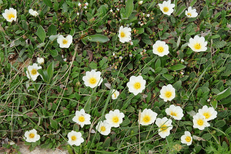
Wildflowers
We continued on up the trail, which was now almost completely devoid of vegetation. Only the
steep dusty trail lay below us. To make matters worse, when we reached the ridge and
turned right to head up to the top, the wind started to howl at us. So now it was steep,
windy, and cold. At least it wasn't raining -- yet. Some people coming down stopped
here and told us that there were caribou at the top, and that was enough to keep me going.
The start of the steep final stretch to the third viewpoint
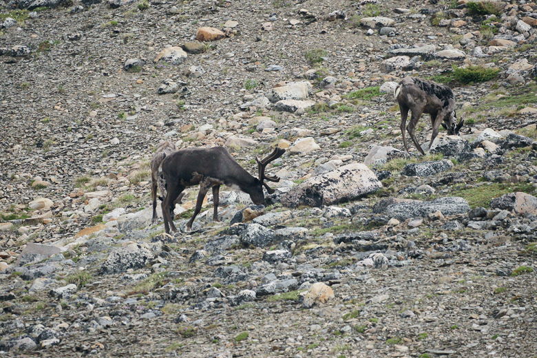
Eventually, despite some complaining, we all made it up to the top. And there were the caribou,
about 6-8 of them, foraging near the snow patches maybe 200 feet away from us. The "top" wasn't even the top,
really. There's a marker here to denote the end of the official trail, and there are
unobstructed views to the west (but those views aren't much different than those on the
trail between the second and third viewpoints). The mountain continues above to the east,
with a use trail visible leading up it. It looks like a long way up, still, though, if you
insist on reaching the highest point.
I used my 500mm lens to take pictures of the caribou. Another photographer was kind enough
to offer me the use of his monopod, which I gladly accepted to take a few more pictures.
Again, I had my tripod, but it didn't seem worth it to set it up to take wildlife pictures,
especially considering I don't have a ball head for the tripod (now I know why that would
be good). I never really considered getting one, but now that I think about it, a monopod
probably fits better with my usage patterns than a tripod. A tripod takes longer to set up
and put away, while a monopod is quick, easy, and lighter. Sure, it's not nearly the same
in terms of stability, but it definitely helps. I'll have to consider it for the future.
Knowing me I'll probably even consider carrying both a tripod and monopod, much to the chagrin of ultralight
hikers.
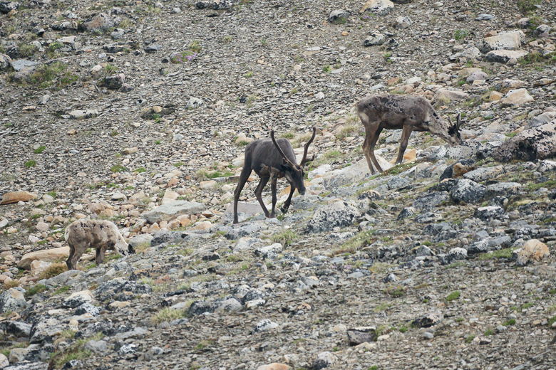
Caribou
Caribou
Rain drops. At the first drop, I immediately started putting my camera gear away and we
started descending the mountain quickly. It started to sprinkle, then rain a bit, but it
never got very bad. No thunder and lightning. In fact the rain stopped fairly quickly.
The sun even started to come out as we reached the bottom of the steep descent, the trail
we could have taken earlier.
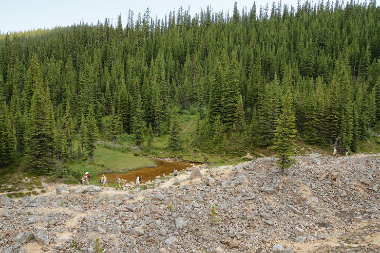
As we continued down the trail, past the original loop intersection and into the forested
section we'd come up through, I thought about Cavell Pond. I thought about how great
it would be to take the left fork at the bottom and head to the edge of the pond, stand
there and look across to Cavell Glacier, and listen to pieces of Angel Glacier above crash
onto the mountainside. I'm sure it would
be a beautiful part of the hike, but it would add an extra 0.6 kilometers to the hike.
That doesn't sound like much, but by the time we reached that intersection it was almost 6pm,
the kids were tired, and Jared was having a total meltdown (not actually caused by the
difficulty of the hike). So, sadly, we turned right and took the short way back to the parking
lot. Certainly, if you can, I highly recommend you take the left fork and go to the edge of
the pond. I'll just have to go back there again in the future.
By the time we got back to the parking lot, it was mostly empty. We noticed a marmot taking a
nap underneath one of the cars here. I wonder if they like radiator hoses like they do at
Mineral King. We never saw any warnings here, or chicken wire, so I guess it's not a major
problem.
| 

