|
After getting in late last night, we got up around 8:30am and had a leisurely breakfast.
We left a bit after 10am, and it was already 87 degrees in Angels Camp. I started off
south through town to head up Highway 4, where I found a sign saying "Closed to thru
traffic." I began to worry that there was a forest fire and the road was closed, although
the ranger hadn't mentioned it yesterday. I stopped at the fire station at the corner
and looked at the notice on the door. The road here was closed, but there was an alternate
route back where we came from.
So, I went back through town to where Highway 4 comes into town from the west, then turned
right -- onto Highway 4 east. Apparently they'd re-routed Highway 4 and no one bothered to tell me.
I would later find out that Highway 4 was re-routed to basically bypass downtown Angels Camp,
at a cost of $61.5 million, and this section had just opened a month ago. It's now a straight shot
right through town with just one stoplight on the highway here. It will save travelers going
straight through a few minutes, and save the residents some traffic noise, but I wonder how
the businesses will suffer. I imagine they will probably start building out stores along this
new section of highway, instead.
After about 20 minutes, we reached the Calaveras Ranger Station, where I stopped to get a
permit. Permits are required for overnight travel in the Carson-Iceberg Wilderness, but
they are free. The ranger asked for my itinerary, which I gave. Another ranger said I
was the third one today, I'm assuming meaning I was the third one staying at Heiser Lake
tonight.
45 minutes to an hour later, we were at the Heiser Lake trailhead at Mosquito Lake.
There were already 4 cars parked in the tiny roadside parking lot, and we took one of the last
2 remaining spots. Then we started finalizing our packs.
While we were prepping, another car pulled up. Robert and his 9-year old daughter Evelyn were
also planning to stay at Heiser Lake tonight. We chatted a bit, then waved goodbye as they
left before us, knowing we'd see them at the lake later.
I put everything into my pack, then got onto the scale (yes I bring a scale for the start of
every backpacking trip). Ugh - over 60 pounds. This would not do. This was even more than
what I carried on the 6-day Rae Lakes trip. That's the price you pay for backpacking with kids.
I had been trying to decide whether to bring my 100mm macro or 500mm lens, but now I decided
that I'd have to go without either. Besides, the 100mm I usually only use for things like flowers,
and the 500mm for wildlife -- basically, in this case, only if we saw a bear from a distance.
So chances were that I wouldn't need either, anyway. I'd have to just live with my 17-50mm lens.
So I ditched the extra lens, took the small Gorillapod instead of my 3+ pound tripod, and got
Nathan to try carrying my 2-pound sandals. Usually, I carry some lightweight fuzzy slippers
for walking around camp, but I figured that we'd be at lakes both days and I might want to wade
into the water.
All this got me down to 57.5 pounds, a pound lighter than what I'd carried on the Rae Lakes
trip. That would have to do. The final starting tally was 57.5 pounds for me, 35 for Jean,
9.5 for Nathan, and 6.5 for Jared.
See what's in our packs.
We started off on the trail, which heads south away from Highway 4. Immediately there's an
intersection, with a trail heading to the right, headed toward Stanislaus Meadow. We stayed
to the left, as the trail goes around the edge of Mosquito Lake. The trail then climbs up
above the lake to the right; be sure not to follow the trail that simply follows the shoreline.
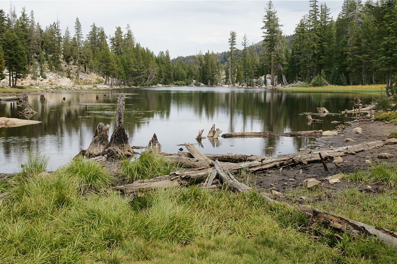
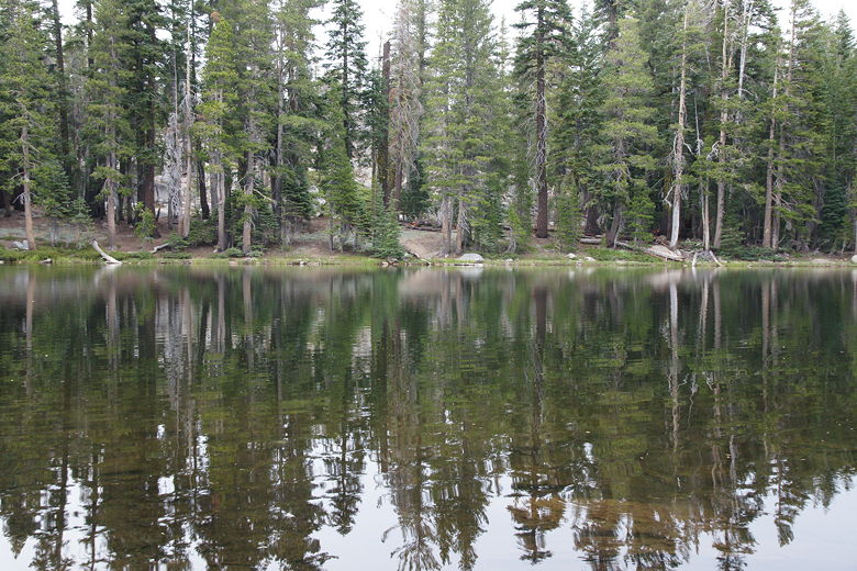
Mosquito Lake
While our destination was an alpine lake only 2 miles from the trailhead, and I'd read that
the trail is relatively busy, we didn't see many people. We probably only saw about 15 other
people on the entire trail, and that included one group of about 8 people.
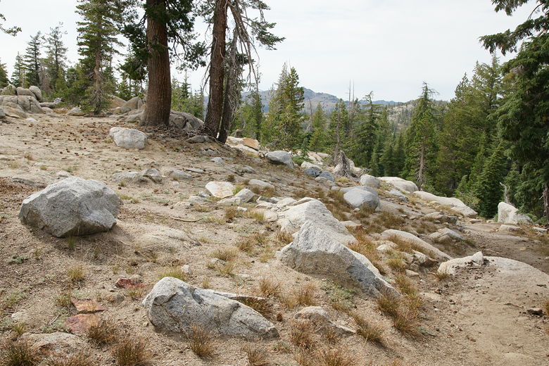
The beginning section of the trail climbs about 230 feet in about 0.4 miles,
steeply and without much in the way of
views. From there, it's mostly a gradual downhill for a bit, passing by a sign telling you
that you're entering the Carson-Iceberg Wilderness. Then it's another small climb up, and
another downhill.
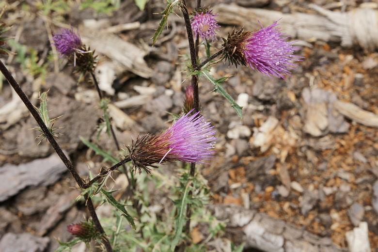
Flower next to the trail
There are rock stacks and I-blazes (sections of tree bark cut out at eye level) that help
you keep track of the trail. Near the bottom of this hill there's an I-blaze with an arrow
pointing right, as the trail makes a 90-degree turn. Then it's a steep climb up to a
trail intersection at 1.4 miles. A short 2-foot high signpost here points the way. To the
right is the way to Bull Run Lake. We'd go there tomorrow, but today we turned left to
head to Heiser Lake. The trail continues to climb, up a few switchbacks to the highpoint of
the hike.
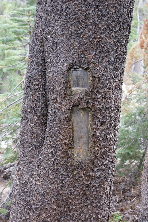
One of many I-blazes marking the trail
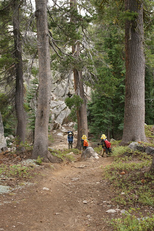
Heading down the trail just before a sharp right turn
Looking back from the crest just before the descent down to the lake
Once at the top, you still can't quite see the lake through the trees. After a short descent
and a quick walk through a small meadow, we were standing on the northern shore of Heiser
Lake at 1.8 miles. On some boulders on the south side were Robert and Evelyn. They told us the best camp
sites appeared to be on the south shore. From where we stood, that looked right, so we
continued along the trail to the right as it curves around the lake for about 0.2 miles.
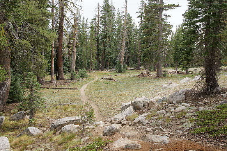
Heading down to meadow in front of Heiser Lake
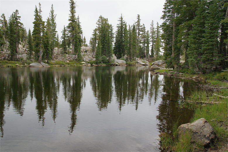
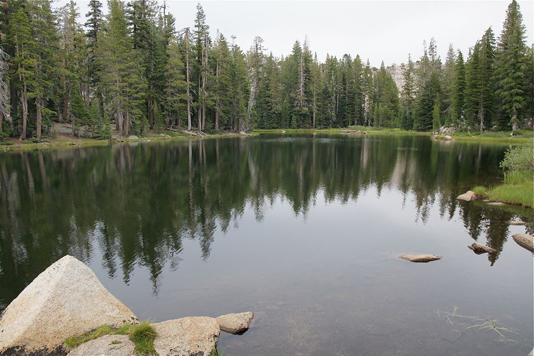
Heiser Lake from northern shore
Heiser Lake from northern shore
Once on the other side, we started to scope out a spot to put our tent. There are a few
spots further up the shore toward the east end of the lake. We saw just one other tent
there, at the far end. We turned around and decided that the best choice was a wide flat
open area next to an established campfire ring, not too far from where Robert and Evelyn
were staying.

Our camp site
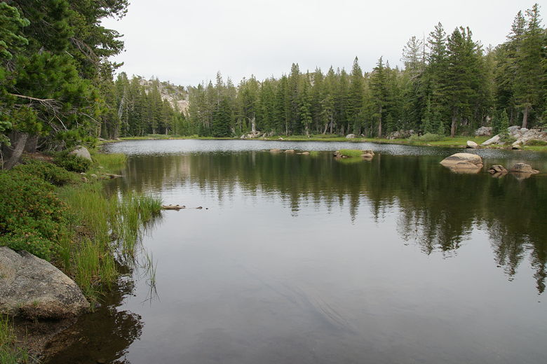
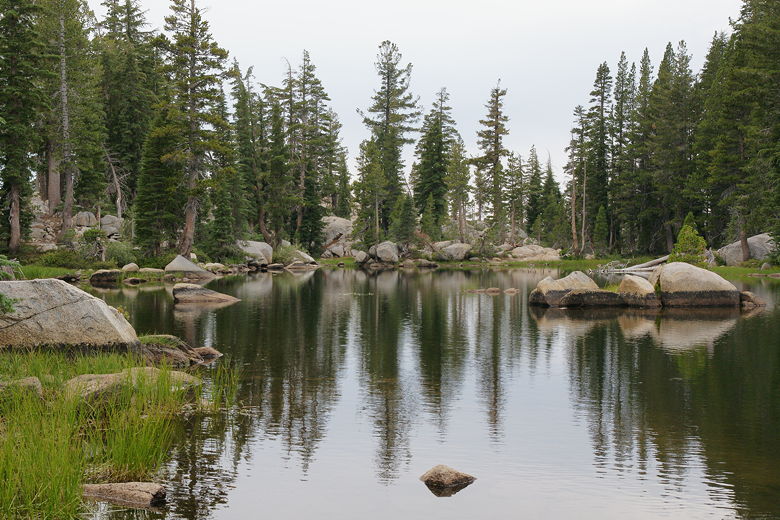
Heiser Lake
We set up our camp under the overcast skies which had been present most of the afternoon.
The kids played by the water as I filtered water. Heiser Lake is shallow and not all that big,
but it did provide habitat for 4 ducks at this time. Much of the shoreline is covered with
grass or mud, although there are a few places with rocks from which I could easily get water
from the lake.
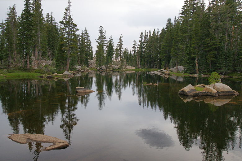
Heiser Lake
Heiser Lake
After dinner, we all gathered bits of downed wood and twigs for a camp fire. We learned that
this was Evelyn's first backpacking trip, and we enjoyed listening to Robert talk about his
adventures all over the world, including a recent trip to Mongolia. He was hoping that
Evelyn would take to backpacking and they could plan more adventures.
Heiser Lake
Robert mentioned something about the sunset and I suddenly noticed the sky was turning some
very nice colors. I quickly grabbed my camera and Gorillapod and perched myself on a rock at
the edge of the lake to take some sunset pictures.
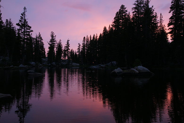
Sunset at Heiser Lake
We discovered that we couldn't quite fit our garbage into our bear canister, which was still
stuffed with food. Robert was nice enough to add our garbage to the bag that he hung from
a tree.
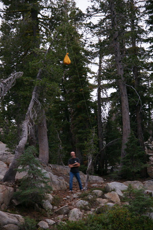
Robert after hanging up his food bag
When it was time to put out the campfire, I went down to the lake to get some water. It
was rather spooky, even with my headlamp, as it was a completely moonless and starless
night and it was pitch black looking out across the water from the edge of the lake.
I apparently startled one of the ducks who might have been sleeping. He, in turn, scared
the crap out of me with his squawking.
We started to feel a few sprinkles as we prepared to get in the tent. Because of that, we
put all our gear into the vestibule, leaving out only our bear canister (which I turned upside
down to make sure the contents didn't get wet). We got into the tent around 9pm and it
started to sprinkle constantly. In about 2 hours those sprinkles would turn into a steady light rain,
tapping on the tent all night.
| 

