Directions:
From Mammoth Lakes, take Highway 395 south for about 8.5 miles. Turn right onto McGee Creek Road
and follow it all the way to the end (about 4.5 miles). The last 0.9 miles is not paved, but it's
an easily traveled gravel road. Strangely, the large parking lot at the end of the road is paved.
View Driving Map
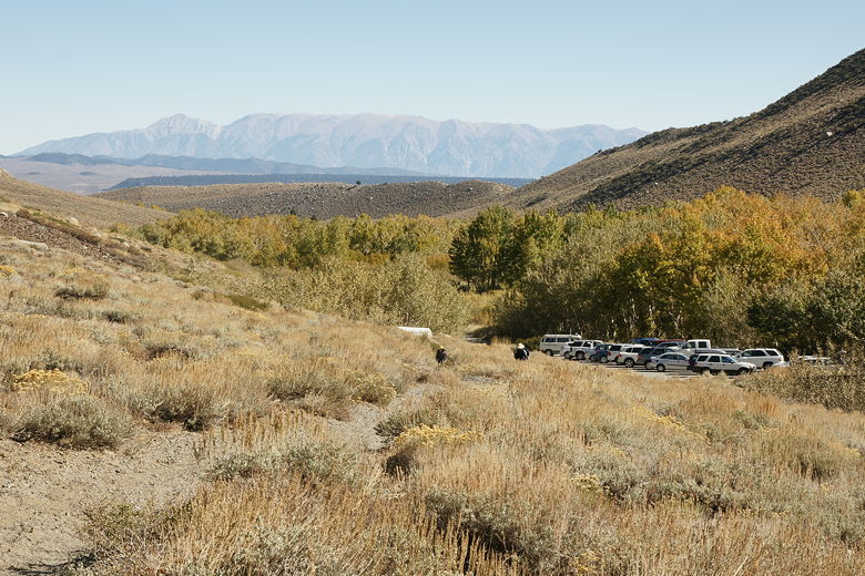
After driving the last 0.9 miles on a gravel road to the trailhead parking lot, I was surprised to find
that (1) the lot was paved, and (2) it was full of cars, about 15 of them. It's a pretty drive,
providing views of Lake Crowley on the eastern side of Highway 395. We saw a few patches of aspens
on the way in, but nothing spectacular. I hadn't read any descriptions of the trail beforehand;
the only reason we were here was that I'd read that McGee Canyon had nice color at this time.
So, really, we didn't know what to expect. The colors from the parking lot were a bit on the
disappointing side. At least I could see Mount Aggie rising up in the distance to the west.
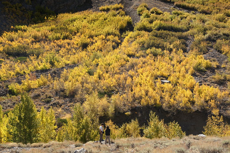
My expectations were fairly low as we prepped in the parking lot. We did, however, see lots of people
heading out onto the trail, including lots of photographers with tripods. It's also a popular
place to bring dogs.
As soon as we started onto the trail, we had a choice to make. The trail immediately forks, with
one branch staying to the left, close to the creek and the aspens, while the other goes right,
uphill a bit and with better views of the surrounding area. We chose the right fork, figuring we
could return on the lower trail.
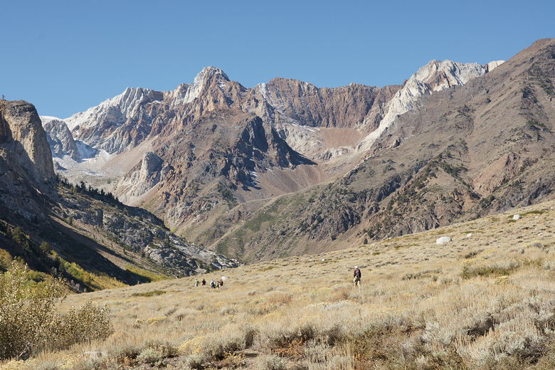
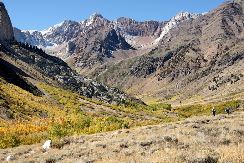
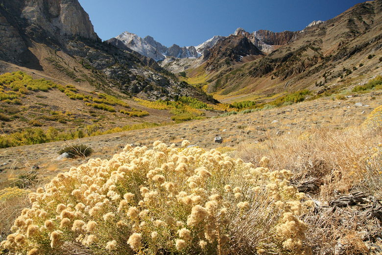
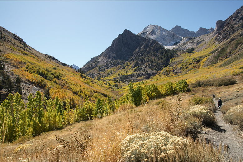
Mount Baldwin (left) and Mount Aggie up McGee Canyon
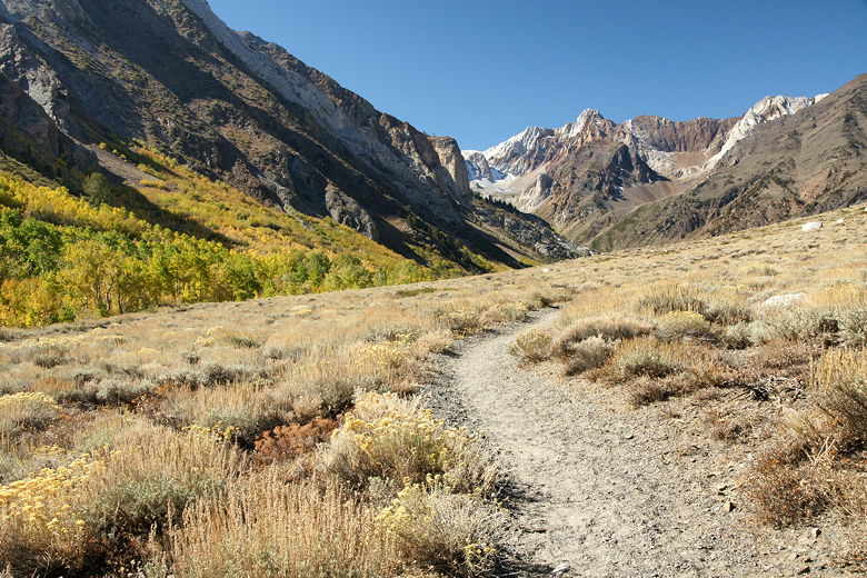
McGee Canyon trail
Left side of McGee Canyon
Looking back at the trailhead parking lot
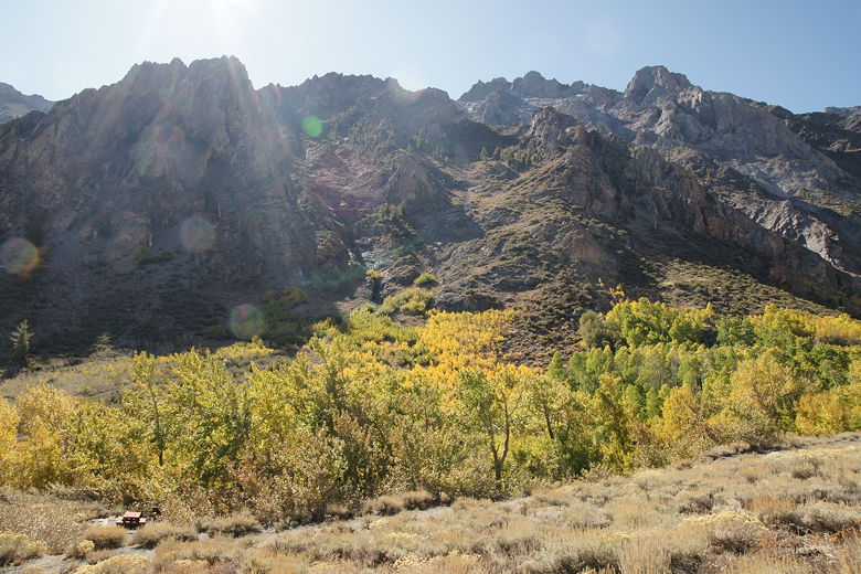
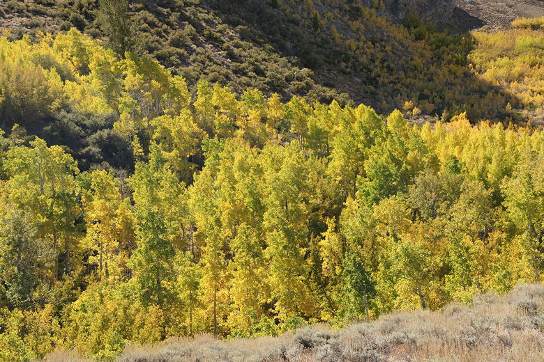
Almost immediately we could see mostly yellow and green aspens and other deciduous trees growing on the left below us, on
either side of the creek. In contrast, the trail we were on was surrounded by dry brown grasses
and low bushes, with the occasional dried up flowers, and no shade to speak of. The trail climbed very gradually, providing
better and better views. I expected the aspens to stop at some point, but they just kept going up
the canyon. Something else unexpected was crickets -- hundreds of them. We could hear them
clicking away and see them jumping on and next to the trail.
Aspens along McGee Creek
Photographer in front of aspens
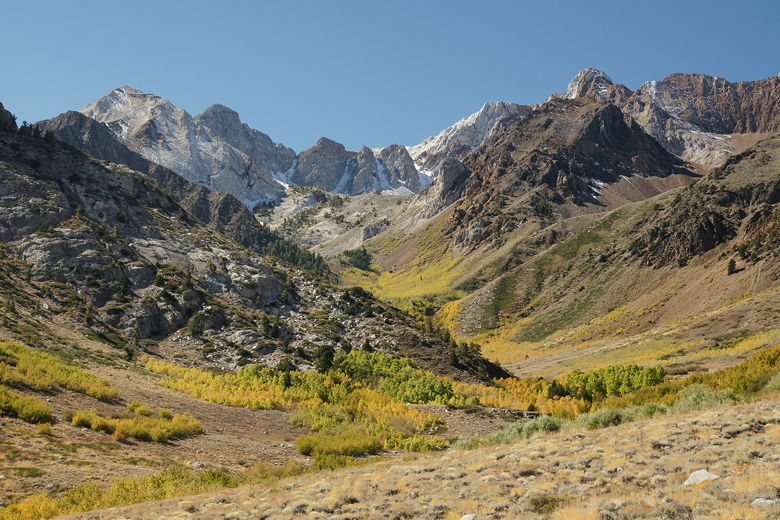
Mount Baldwin above McGee Canyon
After about 0.8 miles, we reached a sign telling us we were entering the John Muir Wilderness.
There's also a trail intersection here, with the left fork heading downhill to join the trail
we hadn't taken at the trailhead. We continued straight and finally started passing through
some small stands of trees. The trail also starts bending to the left and providing views
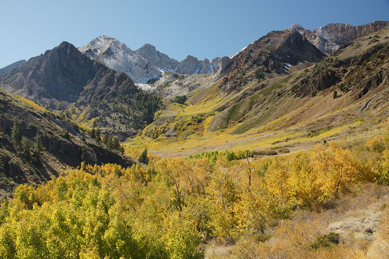
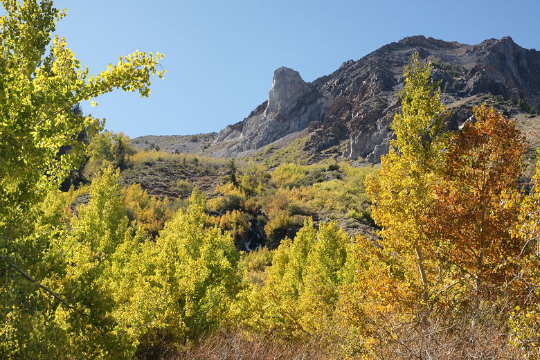
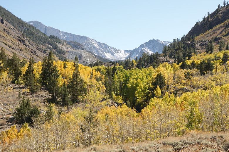
around the corner of more mountains, as well as yet more aspens continuing on up the canyon. I
don't think I've ever seen a greater expanse of aspens anywhere.
Mount Baldwin above McGee Canyon
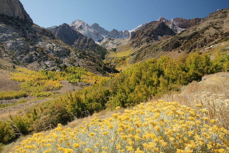
Flowers in McGee Canyon
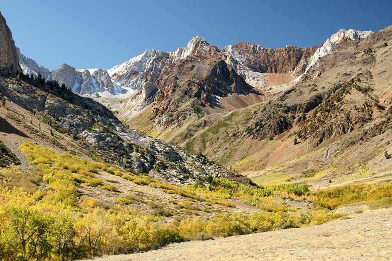
Mountains above McGee Canyon
Flowers in McGee Canyon
It was early afternoon at this point, and the sun was providing dramatic backlighting of the
aspens. We continued heading southwest now along the trail, finally seeing the creek through
a crack in the aspens on the left. It was lunchtime, and I wondered where the trail might
intersect the creek or come close to it. I asked a couple hikers coming in the opposite
direction, and they pointed to a place that seemed too far for us to reach for lunch.
Mountains above McGee Canyon
Trail heading up McGee Canyon
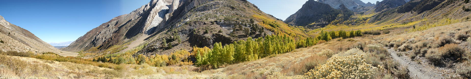
Panorama of the canyon (Click image to view full size)
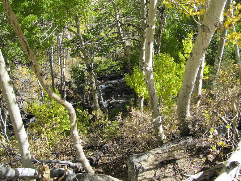
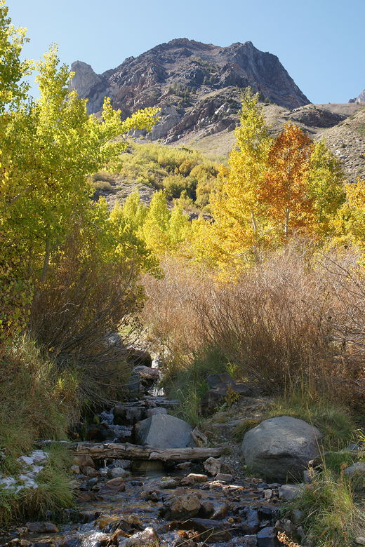
We did, however, shortly cross a couple streams that were headed for the creek. They were only
about 15 feet wide and very shallow, relatively easy to rock-hop across. We decided to stop at
the second one for lunch. It' entirely possible that we stopped at the base of the stream
coming down from Horsetail Falls, although it wasn't very impressive at this time of year.
At least we had a nice set of rocks to sit on and have a picnic surrounded by aspens and other
deciduous trees.
Looking down at McGee Creek
Looking up from our lunch spot
Stream at our lunch spot
After lunch I briefly headed up the trail to see what lay ahead. It looked like it started to
climb a bit steeper now, but otherwise not much different than what we'd seen. So we decided
to turn around. As we walked with our backs to the sun, I kept turning around and taking
pictures. Unfortunately, since the sun was getting lower it was hard to take pictures
without getting lens flare, and the lack of contrast on the now-shaded mountains was bad.
I would guess that late morning to early afternoon would be the best time to shoot the aspens
here.
Looking further up McGee Canyon
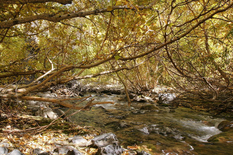
When we got back to the John Muir Wilderness sign, we turned right and headed downhill, then took
another right fork to get close to the creek. There are several short side trails from
here that lead down to the water's edge. We took one of them and enjoyed the creek for a
short break underneath a thick canopy. Then we returned to the main trail and took it back to the
trailhead parking lot.
McGee Creek
Just before reaching the parking lot, I noticed a picnic table leading down to the creek. It
looked like a promising spot to try to take pictures, so I started to head there, but then I
noticed someone had already beaten me to it. I didn't want to crowd him while he took his pictures
in the small space, so I just finished the hike. But if you're here, you might want to check
that area out.