|
Earlier in the morning, I had mentioned to the owner of the rental house we were staying at that
we were thinking of visiting Palomar Mountain today. He said that we might get some snow up there.
I was a bit surprised at that statement, since it was now April (and we were near San Diego!),
but I figured I should call the
park and ask anyway. I had also learned from the website that due to budget cuts, the park had
been mostly closed until April 1st. So I called the park and the ranger assured me that while
there had been 3/4 of an inch of snow a couple days ago (the park is about 5500 feet elevation),
it had melted that same day. He did, however, say that one of the trails I wanted to use as part
of a loop, the Scott's Cabin Trail, was closed due to logging. He did say that if there wasn't
a trail closed sign, or if there was no one around, that I could "wing it" and just take the
trail, anyway. I figured I could do that, or at the worst just follow the park road as a
replacement instead. So off we went.
As we drove along Valley Center Road toward Highway 76, we saw two things of note: (1) flowers placed
by the side of the road in at least two places, I'm guessing as memorials to accident victims,
and (2) lots of CHP officers. It was only when we reached the bottom of the hill that we saw
the somewhat out of place Harrah's Rincon Casino. That could explain the other things we saw
on the road.
In any case, as we were winding our way up the road on Palomar Mountain, we saw cyclists and
motorcyclists. We also saw what was apparently a professional photo shoot going on, with a
photographer lying by the side of the road as two motorcycles came down. The other interesting
thing we saw was a sign saying that it is illegal to throw snowballs at vehicle occupants.
I am not making this up. Was it that much of a problem that people needed to see a sign telling
them that? Apparently so.
When we reached the park entrance, much to my surprise, there was no one there. The office was
closed, and we had to self-pay the $8 vehicle fee. The people in the cars behind us were
going to camp at the campground, which was just recently opened for the year. The air was crisp and cool, about
50 degrees. It felt like we had the park mostly to ourselves. Only one car passed by during the
several minutes we were there, filling out the vehicle permit.
Continuing along the main park road, we saw a few people at the Silver Crest Picnic Area. We continued
to the Boucher Hill lookout. The small parking area was completely devoid of cars. And yet, there
were about 12 other people there, 4 by the picnic tables near a trailhead, and the other 8 on a
wooden deck overlooking the view to the west of the hills and farms below. Next to the parking lot to the south
are a few buildings -- an old lookout tower, a bathroom, and a couple other buildings, all painted
light green. Amidst these old buildings were modern satellite dishes and transmission towers.
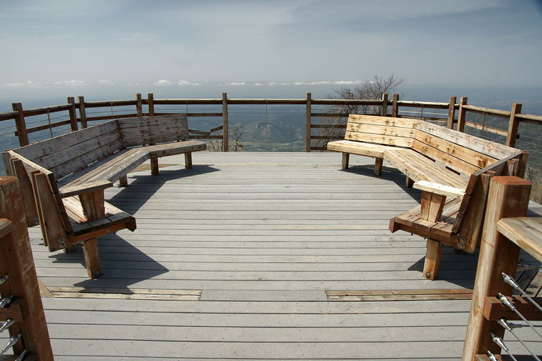
Inviting benches at Boucher Hill lookout
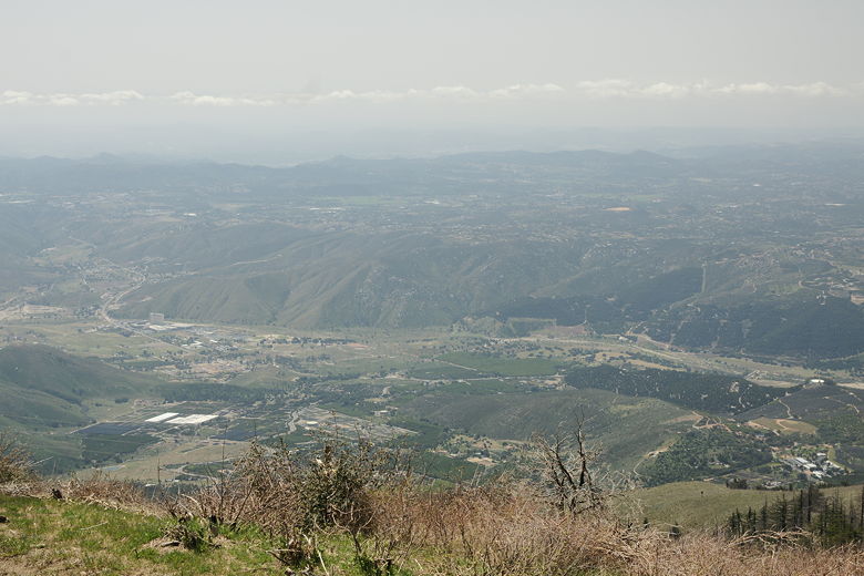
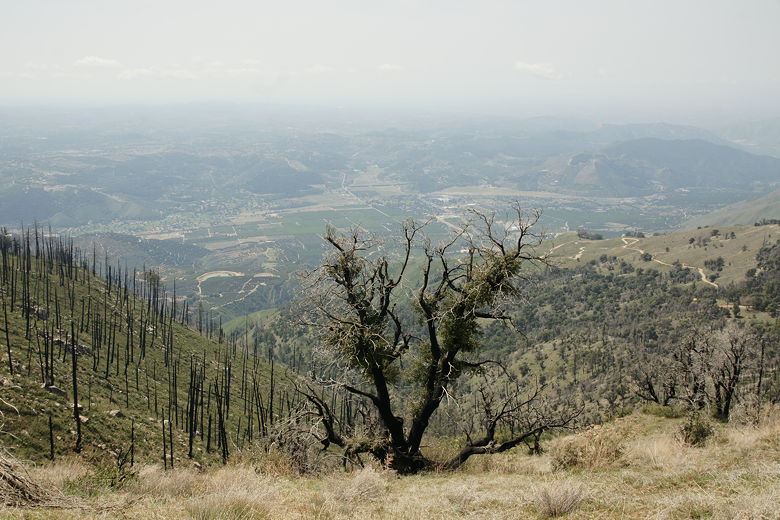
View looking southwest from Boucher Hill
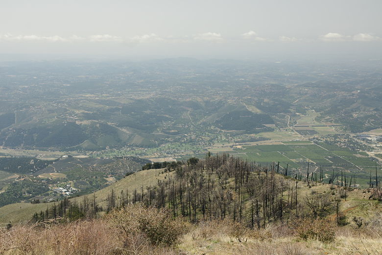
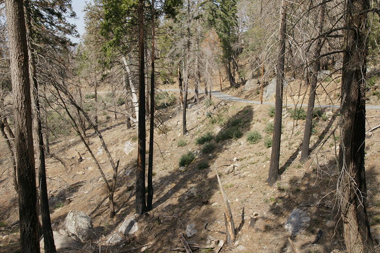
View looking west over the burned forest

Buildings and satellite dishes at the lookout
We had lunch at the picnic area, where there were 2-3 picnic tables. The other people left
by the time we wrapped up lunch and started off on the Boucher Trail, heading downhill west of the
road. If you read some old guidebooks, you'll read that Palomar Mountain State Park is known for its
big conifers, a stark contrast from the desert flora in other parts near San Diego. But on our descent
of the Boucher Trail, the main thing we noticed was burnt trees. What we were seeing was probably
the effects of an October 2007 fire that burned 30% of the park. Still, some trees survived, and you
could definitely see signs of recovery.
Picnic area
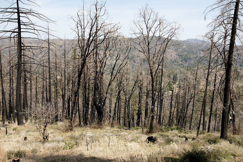
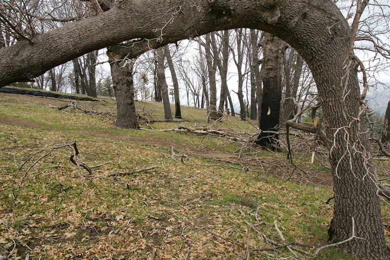
Burned forest
An apparently local hiker we ran into lamented the fact that we'd come when the one of the hills
was brown instead of covered by green ferns like it is at some point during the year. But we still
got to enjoy the view, some of the trees, and some other interesting plantlife. We also got to witness
a couple of hang gliders, soaring just above us.
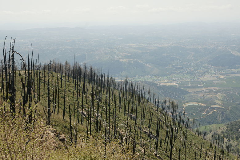
View looking over the burned forest
View looking over the burned forest
As we continued along the Boucher Trail, a huge group of hikers passed us (in the same direction).
There must have been at least 40 hikers. I'm not sure where they came from. Up until that point, I
had felt like the park was mostly deserted. Not anymore. But they passed and we didn't see anyone
else for a while.
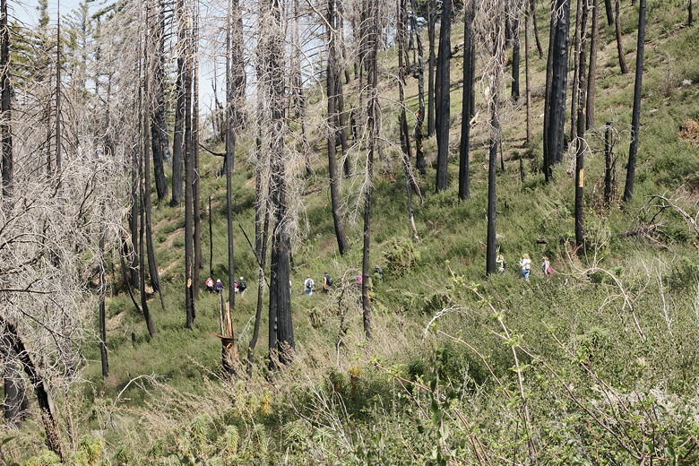
Big group of hikers on the trail
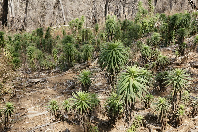
Plants next to the trail
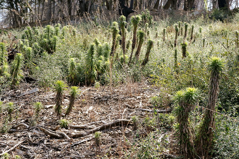
Doesn't this look like something from a Dr. Seuss book?
If you're going to do this hike, I suggest wearing pants. At one point on the trail, the vegetation
is in danger of overtaking the trail. You have to brush past it for several minutes. It's not
quite as bad as some of the bushwhacking we had to do at Ventana Wilderness years ago, but almost as
bad. Thankfully, after the trail crosses Nate Harrison Road, it becomes a wide dirt road.
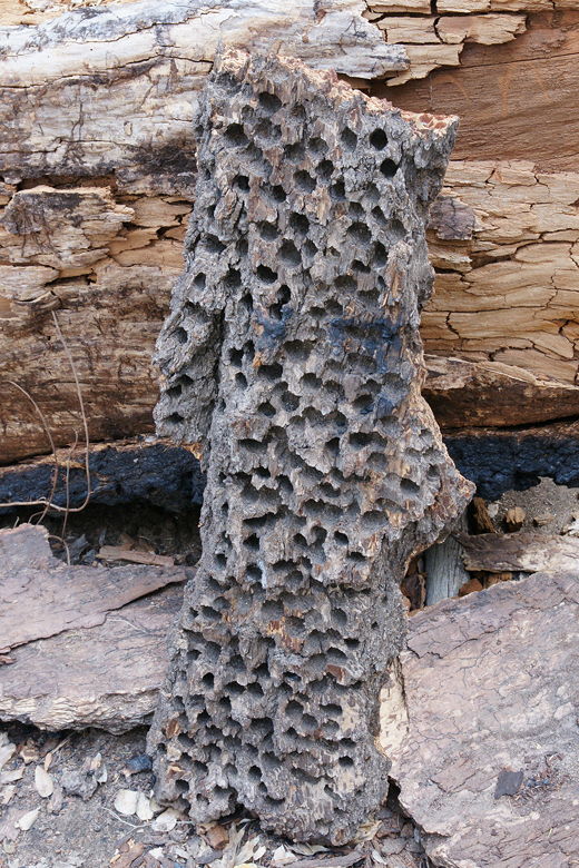
Bark from a downed tree; I'm guessing those holes are from woodpeckers
We continued along the trail, crossing a small stream, which marked the end of our descent from
the lookout. We now climbed briefly, passing a trail leading to a Christian conference center which
is next to the park. We
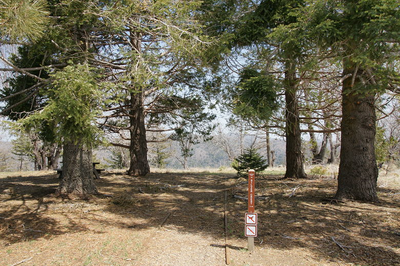
continued on up the trail to the Cedar Grove campground. It looked like there were only a few people
staying at the campground, which is well-shaded by cedars and other conifers. There was no fire
damage to speak of here.
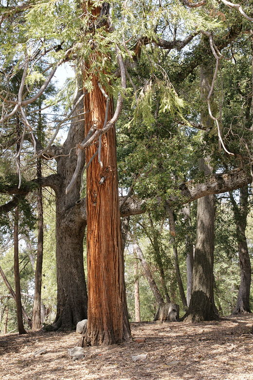
Trees at Cedar Grove campground
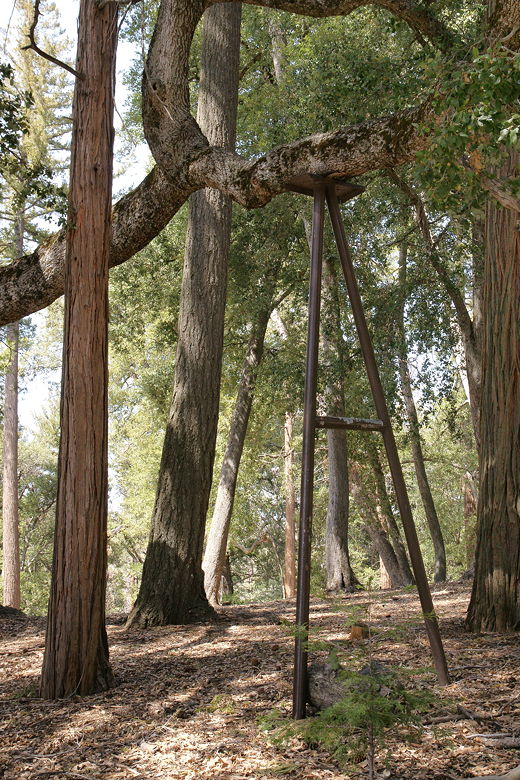
Metal support for a tree branch
We now crossed the park road and reached the Scott's Cabin Trail. As somewhat expected, there
was a trail closed sign, upon which was another sign detailing the logging company contact information.
There clearly wasn't any logging happening today, a Saturday. We went a little ways up the trail
to see if we could "wing it", as the ranger had suggested. Unfortunately we were immediately
blocked by a large felled tree. We also talked to another hiker who said it was a complete mess
in there, with felled trees and poison oak. So we decided to just walk along the park
road instead.
So we turned right and mostly followed the park road back toward the intersection of
Nate Harrison Road and the Boucher Hill road. Of course it wasn't much fun walking near the road;
I'd much rather be on a trail. We stopped on a large tree stump for a snack, watching a few
other people walking along the road, as well. After our snack we continued along the road, quickly
putting on our jackets as the temperature started to drop, even though it was still only around 3pm.
View from the road
We reached Boucher Hill Road and turned right up the Boucher Trail; this segment would return
us to the parking lot in about 0.7 miles. The trail climbs steadily, and we immediately got
the treat of seeing the fog rolling in. The fog swept in, rapidly at times, from left to right
as we climbed. I found it actually quite soothing. We were on somewhat of a ridge with the
road on either side of us, out of sight. Mostly barren trees dotted the fog-covered landscape.
It reminded me of some stretches of the Ohlone Wilderness Trail.

Trees and fog
Twisted tree and fog
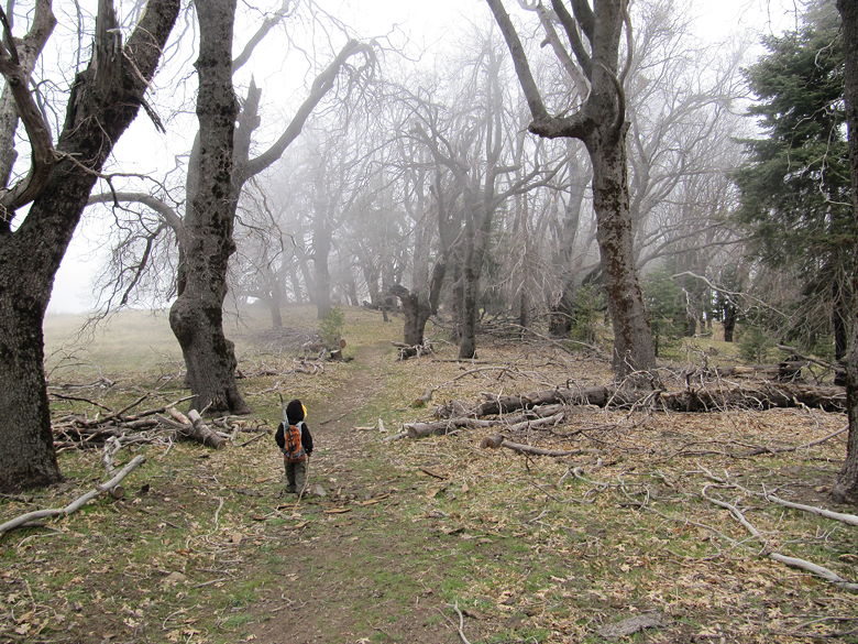
Jared headed into the foggy forest
By the time we reached our car, the view from the lookout was completely obscured. So, if you
want to come up for the views, I'm going to guess that you don't want to wait for the late afternoon.
Come earlier, enjoy the views, and enjoy the fog.
| 

