|
When we arrived at the trailhead, there were already about a half dozen cars there, filling the tiny
lot. There's plenty of space along the side of the road, however, so we found a spot under the
trees to park. An alternative is to continue along the road to the boat ramp area and park
near there, starting the loop from there. It's not much further, although parking may be even
more cramped there (and you can't park along the road there because it's too narrow.
Since this is a loop hike, you can do it in either direction. We first considered doing it
clockwise, but couldn't find a trail sign. As it turns out, the way to do the loop clockwise
from here is to actually walk along the road and pick up the trail near the boat ramp. We
didn't know that, though, so we took the safe route and did the route counter-clockwise,
starting on the well-signed trail next to the road.
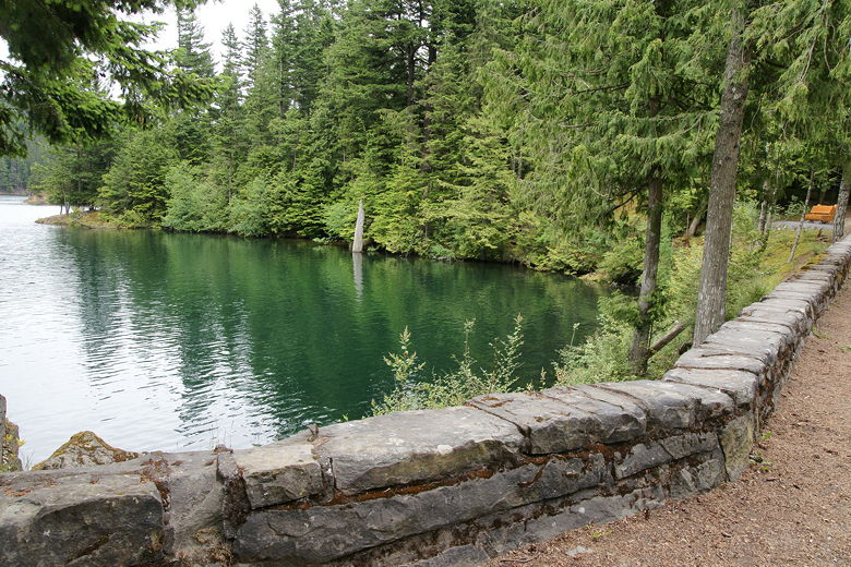
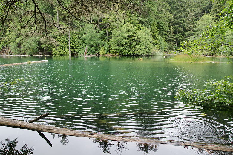
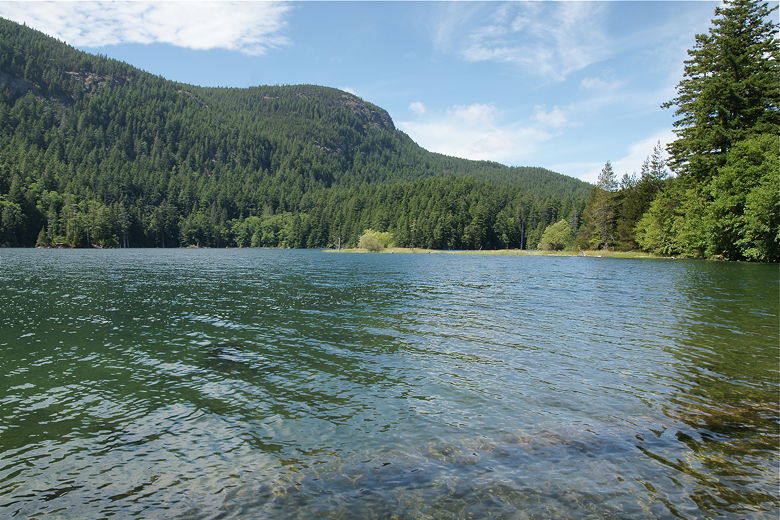
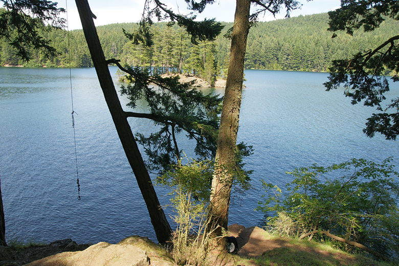
Mountain Lake at the trailhead
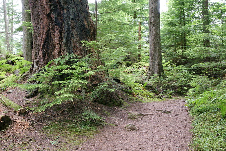
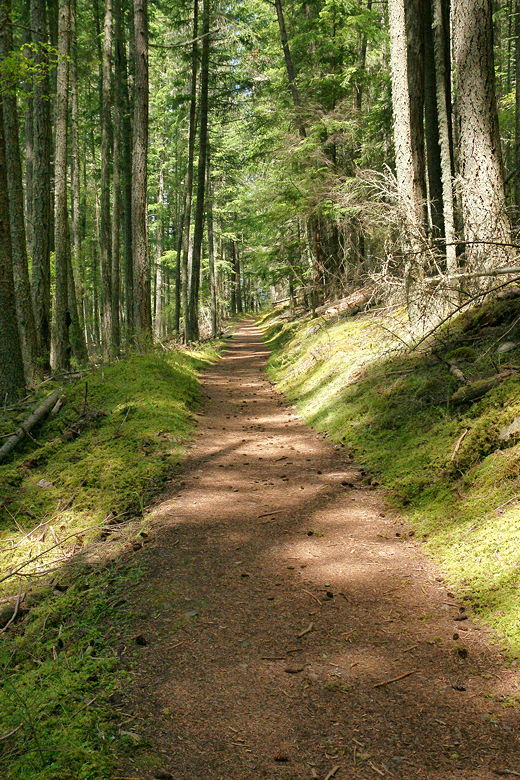
The trail around the lake is mostly level, but it does undulate a bit, including a brief little
climb near the start. Almost the entire hike is done in a dense, lush forest. To the left,
through the trees, is the
lake, which stretches out parallel to the road. We could see a small island to our left,
looking exactly like the giant lion turtle in Avatar: The Last Airbender (the animated TV show) -
small, humped, and completely covered in trees.
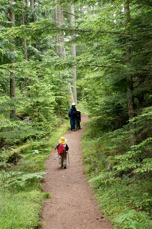
Hiking along the forested trail
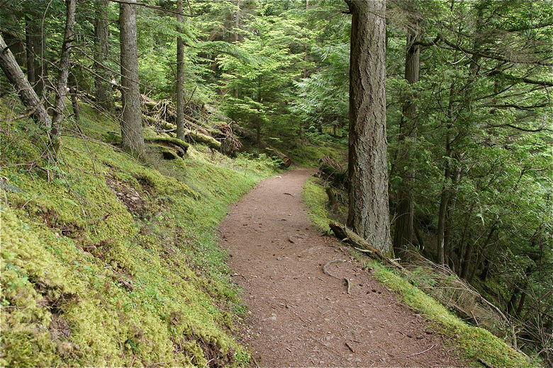
A curve in the trail
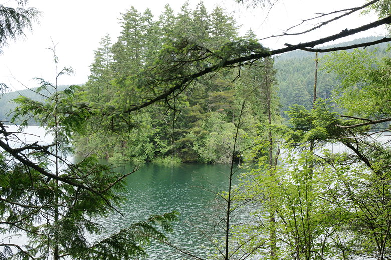
Island or giant lion turtle?
Soon we found ourselves near the southern end of the lake. Occasional foxglove flowers dotted the
hills here, and the forest opened up. The lake is actually dammed here, with water spilling
over the top of it. Downstream, a fork to the right leads to Cascade Falls. I wasn't sure
how far it was, and didn't want to have the kids backtrack uphill, so we didn't take it. Instead,
we turned left to continue on the loop trail.
Near the southern end of Mountain Lake
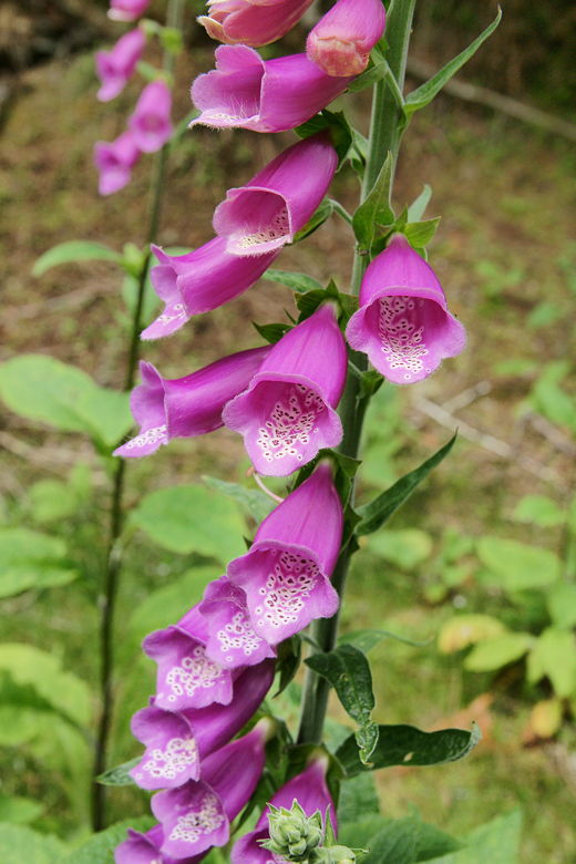
Foxglove
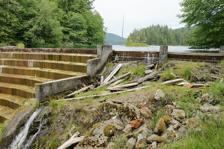
Dam at the southern end of the lake
During our hike we encountered several trail runners, in either direction. I guess it's the
perfect distance for runners, a bit under 4 miles, and the trail is in good shape, without many
rocks or tree limbs or other obstacles. Now on the other side of the lake, the trail now undulates
a bit but heads steadily, gently uphill. Along the way we could hear the thin trees creaking above
us in the wind.
Trail near the southern end of the lake
A long straight section of trail on the eastern side
After cresting a bit inland from the shore, the trail starts to descend and return to shore. We
started to scan the shore for a good lunch spot. There aren't many here, but we eventually found
the perfect spot, a small open space right next to the shore, and just a few feet from the trail.
Mountain Lake as seen from our lunch spot
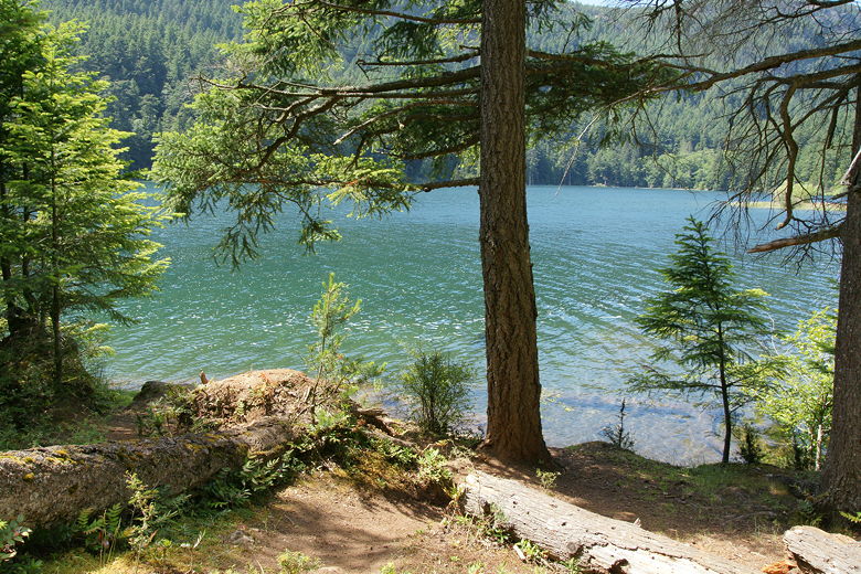
Our lunch spot by the lake
I noticed a fair bit of sudsy water lapping on the shore here, and also a stream of it in the lake.
I'm not sure where it came from. It eventually dissipated while we were there. After lunch and
some rock skipping (which was a bit hard, since there were hardly any rocks here), we continued
on the trail. At the northern end of the lake, we came to another trail intersection. To the right
was a trail leading to Twin Lakes, 0.8 miles away. We instead veered left, staying on the main
trail.
To our left, in the lake, we could see another tiny island. As we went around to the other side,
we found that there were two people on the island, but no boat. Apparently they had simply dropped
their packs and taken a swim in the lake to reach the island. That's one way to get some
solitude.
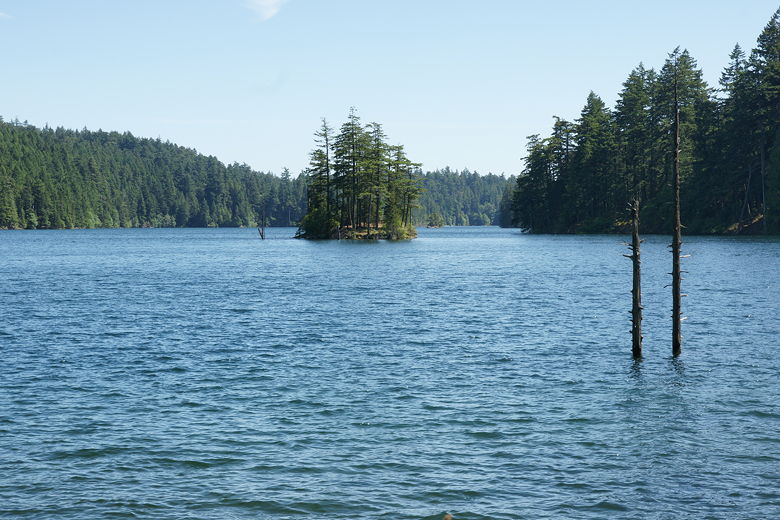
Another small island in the northern end of the lake
The two hikers swam from here to the island
The section of trail here is dedicated to Bonnie Sliger, a Youth Conservation Corps supervisor
who died of a fall in 1977. There's a large boulder with a plaque with her name on it here.
We continued hiking along the trail, the lake still visible through the trees on our left.
Soon we came to the boat ramp, which was quiet and pretty much deserted. We never actually saw
any boats on the lake. Passing the Mountain Lake Campground (on the left), we now made the short
walk along the road back to our car. The trailhead parking area had many more cars now, most
of them parked along the road. So, if you want solitude on this hike, I'd recommend arriving in
the morning or a weekday.
| 

