|
The hiking guide book I had referred to Pyramid Lake as a "puddle", and
gave it a lowly 1 out of 5 stars. I wasn't completely sold on the book's ratings, however, and
decided we would go anyway, with somewhat lowered expectations.
There's a roadside sign noting the Pyramid Lake trailhead. Note that the parking area is on the
other side of the road, however. It's a busy highway with a blind turn on one end of the lot,
so take care when crossing the road.
Pyramid Creek is visible from the trailhead, cascading toward a big pipe underneath the roadway.
To the left of the creek, the trail begins, switchbacking up steeply on a narrow trail.
Not only is the trail narrow, but it's also rocky.
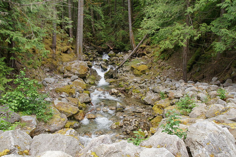
Pyramid Creek at the trailhead
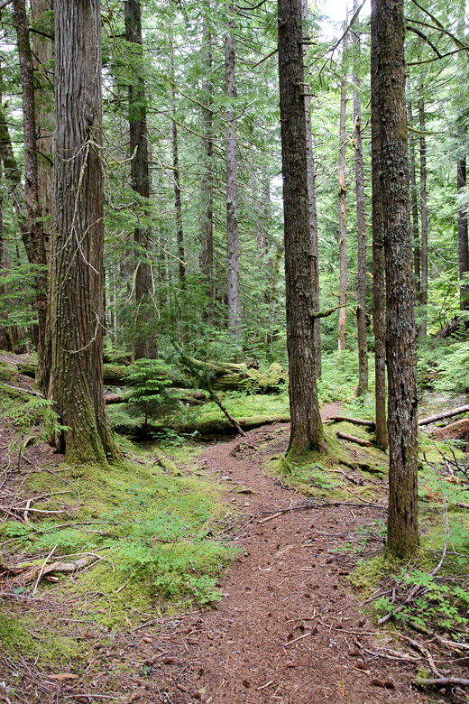
Once past this steep initial section, the trail continues to climb, although the trail is not
quite as rocky. The creek is left behind and the only scenery is a relatively open forest of
thin trees. It gets quite monotonous, and if the trail was like this the whole way, I would
have to agree with the 1 star rating. Fortunately, it changes dramatically further up.
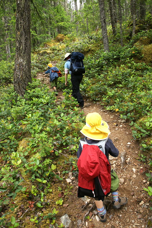
We leapfrogged several other hikers (young and old) and a dog, as we would each rest and then overtake the
other. It's a pretty popular trail. After climbing about 400 feet, we encountered a couple
trees tumbled over the trail. I had to take off my pack to squeeze between them.
Looking back near the top of the first forest section
Heading up the steep trail
We had a snack break at a boulder next to the trail, after which the trail levels off a bit.
About halfway up, we reached a stream. The trail continues on the other side. There was no
obvious crossing point, so we just walked up and down the shore before we found a suitable place. It's
relatively shallow and not that wide, so you should be able to find someplace to hop across
without getting wet.
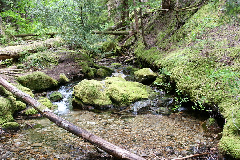
Stream just before our crossing
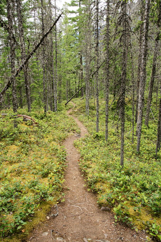
Trail through the forest above the stream crossing
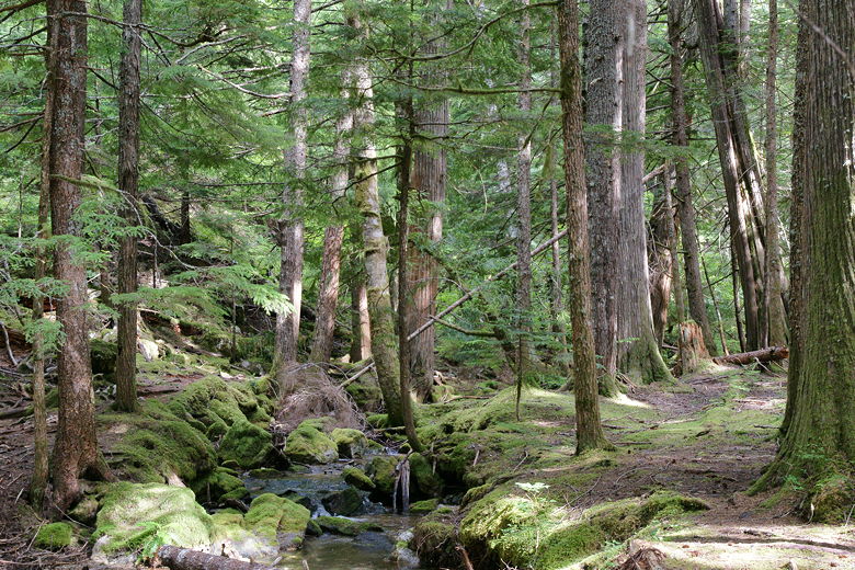
Once on the other side, we picked up the trail again, which continued its ascent. The trail parallels
the stream for a bit. There's a short use trail to a viewpoint of a pretty little waterfall, which I
took a photograph of. I then rejoined the trail. As we continued the ascent, I noticed two things.
First, there were mushrooms everywhere, mostly growing on dead trees. Second, there were tree roots
everywhere we stepped on the trail. At one point, every single step either landed on a tree root or was next to
one.
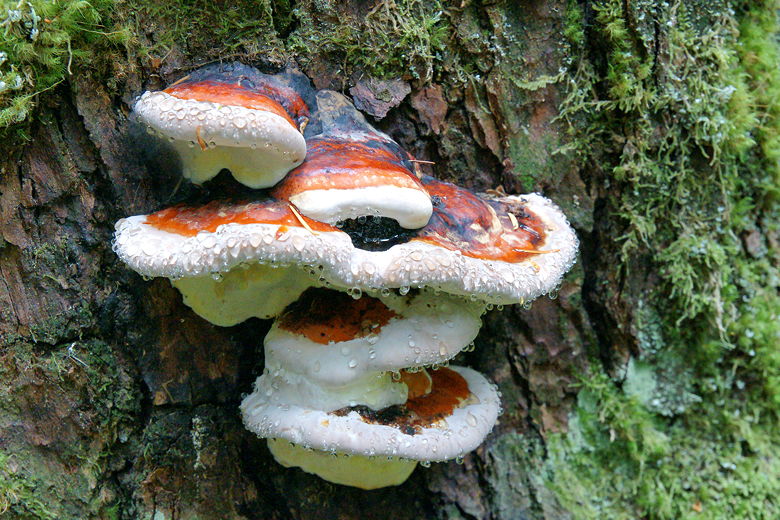
Water droplets on mushrooms
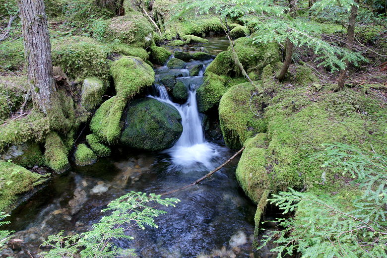
Little waterfall seen via the short side trail
That being said, it's a pretty section of forest, much different (more lush) than the one near the trailhead.
We stepped over (in one big step) another little stream.
Eventually the forest becomes more open and the tree roots less frequent. It's still steep,
however.
Finally, we reached the top of the climb and saw the lake directly in front of us. We descended
to the shore, where 10 other people were already gathered along the steep dirt shore. I looked around,
trying to find a good spot along the shore for lunch. I eventually spotted what looked like
a good perch just above the lake to the right. We clambered over in that direction, and then I climbed
up over some rocks to find the perfect picnic spot.
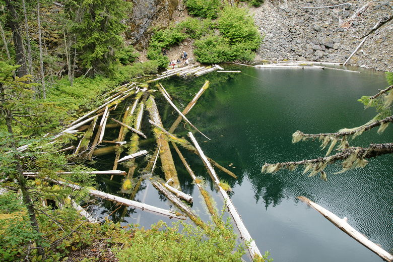
Pyramid Lake from above; the trail reaches the shore where those people are.
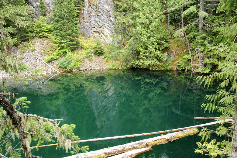
Pyramid Lake
Our lunch spot was a relatively large flat area about 20-30 feet above the lake. It actually had two
levels, each flat, with the lower level about 2 feet below and in front of the other. There was an
extinguished campfire on the lower level, so we definitely weren't the first ones to find this place.
From here we could look down at the lake, which has logs in the water near the trail. Looking to
the right of that we could see a steep talus slope leading down to the water. To the right of that,
steep rock walls rose up from the water. The lake is small, more like a pond, and there aren't many
good picnic spots, but if you manage to find the perch above that we did and it isn't already occupied,
I think you'll like it.
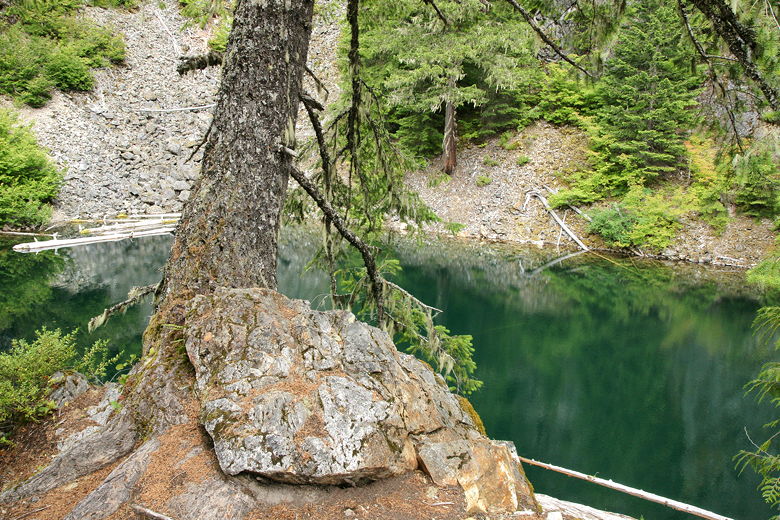
Tree above Pyramid Lake
Now that we were out of the forest, we could actually see the sky. It was still mostly overcast,
but we did spot a bit of blue sky here and there. It also was much warmer than it had been at the start
of the hike. By the time we were done with lunch and started heading back down, there were only
2 other people by the lake. We left them behind and started our descent back the way we came.
We ran into about a dozen people after we left the lake, about half headed uphill and half downhill.
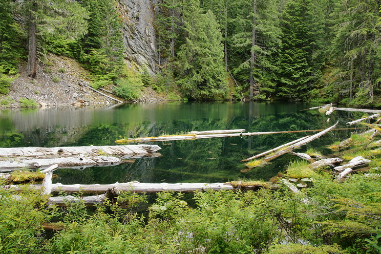
Pyramid Lake from the shore
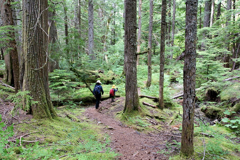
On the way back we again observed the three distinct areas of the hike. Near the top is the
relatively open forest. In the the middle is the lush dense forest leading down to the stream.
We stopped here for a little break, the continued down to the lower section, the least interesting
of the three, the forest of skinny trees.
Heading back down the trail
Near the stream crossing
As we neared the bottom, we could start to hear the car traffic on Highway 20. Then we could see
the road, and were back at the parking lot. The lot was still full when we returned. Since not
that many people were still on the trail to Pyramid Lake, I'm guessing that there are other trails
which you can do from this point.
| 

