|
After breakfast, we checked out of our bed and breakfast and drove to Eagle Falls.
We arrived at 9:50am, just minutes late for the 9:46am trolley. However, I knew we'd
have to spend several minutes prepping our packs so I didn't mind the wait. By the time
we'd put on our boots, sunscreen, and finalized our packs, we just walked up to the
trolley stop as the southbound trolley left. If I had gotten there a few seconds earlier,
I would have asked the driver where the northbound shuttle stop was. But I was too late.
I looked up and down Highway 89, but couldn't see any other shuttle stop signs. I figured
that the northbound trolley would just pull into the pullout next to the Eagle Falls parking lot, or
pull into the parking lot itself. So we waited.
A few minutes later, the 10:46am northbound shuttle approached, its left turn signal blinking.
But it didn't stop. The driver waved us off, as if telling us we were in the wrong place, but not
telling us where to go. Exasperated, I decided the stop must be further up the road. We
crossed the highway and walked on a little trail next to the road, up to the parking lot for
Emerald Bay State Park. It's only a 5 minute walk. Finally, just above the park, we saw
the trolley stop sign. Unfortunately we'd have to wait almost another hour now.
I tried to make the most of it, walking over to the viewpoint and taking in the view of Emerald
Bay. We ate some snacks and watched the tourists file in and out of the full parking lot.
Finally, the northbound trolley came, right on time. There were only 3 or 4 other people on it.
The fare for us was only 5 dollars - 4 dollars for the two adults, and 1 dollar for one of the
kids. I told the driver we were heading to Meeks Bay.
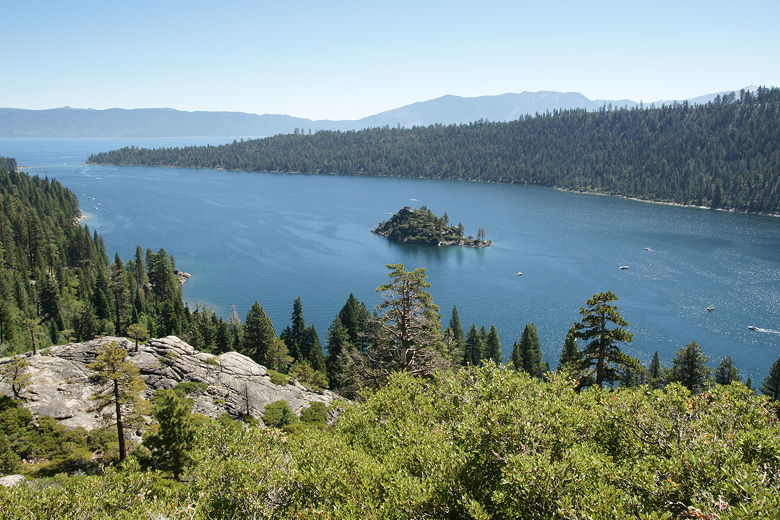
Emerald Bay
I marveled at the fact that we were taking a 13 minute bus ride between the end and start of our
trail, and it would take us 4 days to actually hike the trail. The driver dropped us off at the
Meeks Bay campground entrance. We crossed the road and then walked north along the road
for a couple minutes before we reached the trailhead on the left.
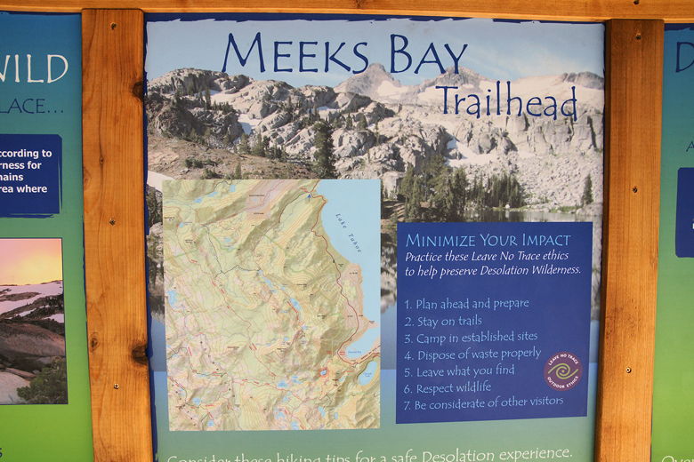
Trailhead sign
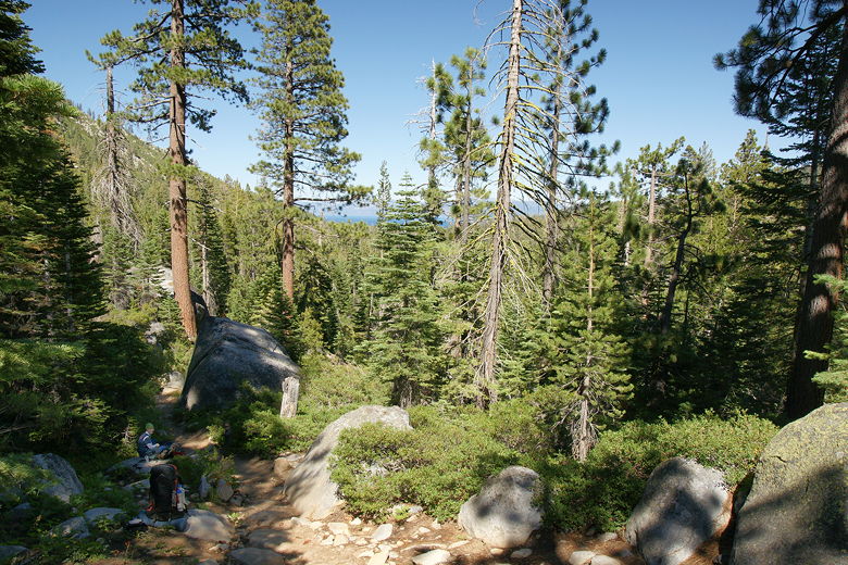
We soon started off on the flat, hot, dusty trail. It's actually a wide dirt road that heads
pretty much straight out (roughly west) into the wilderness. There are sections of forest and also some open
sections with views over wildflowers to mountains to the south. It's easy to make good time on this
part of the trail, but there's also not much to see. We encountered a couple of backpackers coming
in the opposite direction; they'd started at Echo Lakes. We'd encounter several groups that started
at that trailhead (to the south, near Highway 50).
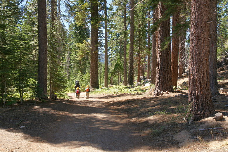
Heading out on the trail
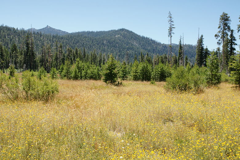
View looking south from the trail
After about 1.3 miles, the trail changes drastically. There's a fork off to the right, a trail
that's both much narrower than the road and also starts to climb through denser forest.
We took this trail as it climbed
in fits and starts, briefly almost touching Meeks Creek before climbing above it.
After a little more climbing we stopped to rest on some rocks. As we did so, we turned around and
saw that we now had a view of Lake Tahoe to the east, through the treetops.
Looking back at a glimpse of Lake Tahoe
Back on the trail, we crossed over Meeks Creek about 3.5 miles from the trailhead. There was a
partially broken log bridge here which we crossed, although we probably could have rock-hopped across
since the water level was pretty low here.
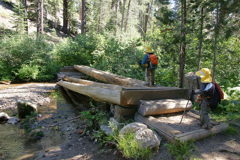
Crossing Meeks Creek
After the bridge crossing, the trail climbs some more. We encountered lots of hikers and dogs on the
trail. Most of the hikers were backpackers, and after crossing the bridge we ran into a large group of
backpackers - probably a boy scout troop.
Looking back along the trail (roughly north)
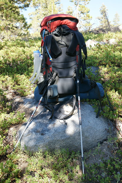
I spent most rest breaks the first day trying to balance my pack on my trekking poles to avoid having to wrench my back putting my pack back on.
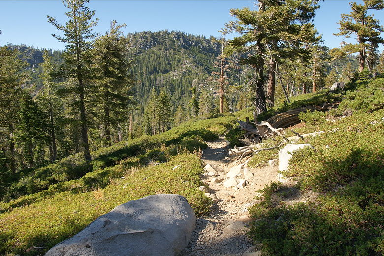
We continued to climb. As we did so, the forest thinned out and we got better and better
views of the surrounding mountains. The trail then followed Meeks Creek closely before reaching
Lake Genevieve, the first of several lakes we'd see on this trip. Lake Genevieve was pleasant but
small. We didn't see anyone here - no day hikers or campers, and the afternoon light lent a
peaceful glow to the lake.
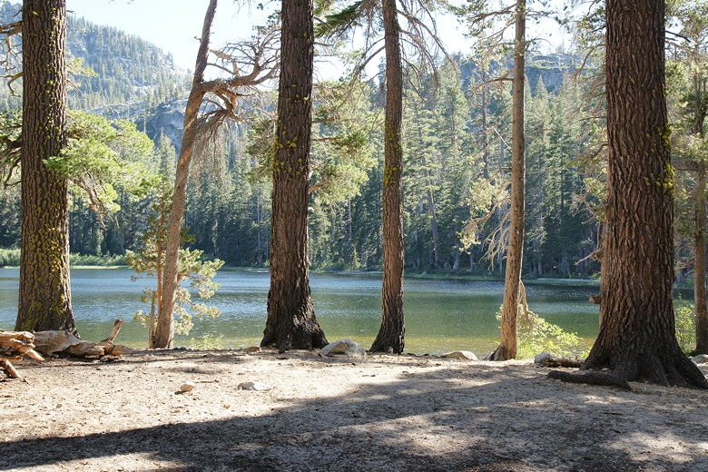
Lake Genevieve
Lake Genevieve
Lake Genevieve
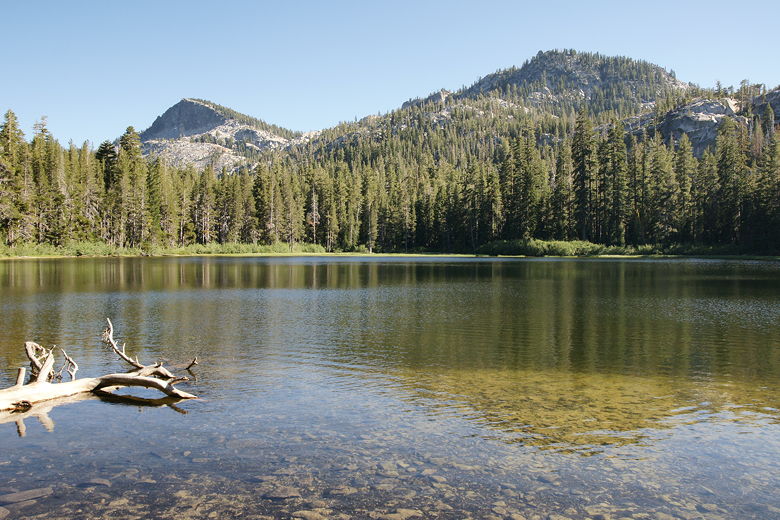
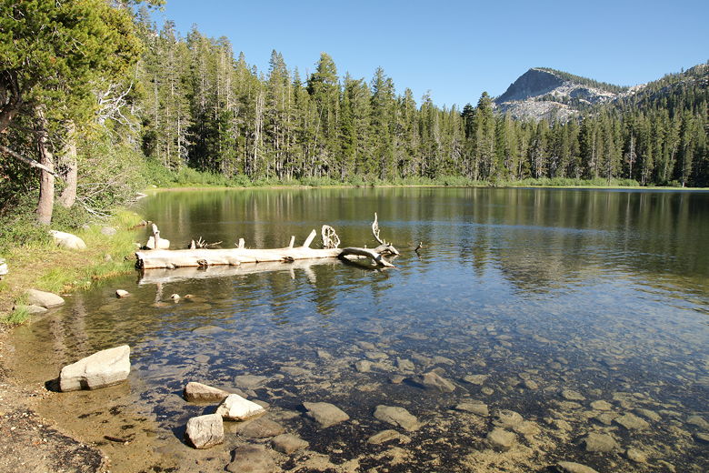
After enjoying the lake, we continued along the trail and shortly, after only about a third of
a mile, we reached Crag Lake, our destination for the day. Crag Lake is about twice as big as
Lake Genevieve. The trail follows the northeastern shore of the lake. We put down our packs
and walked around, looking for a good campsite. Eventually we decided on a spot and set up
camp. We didn't see anyone else around, but we would later see people fishing on the other side of
the lake. It looked like they were camped near the southern or southwestern shore.
Crag Lake
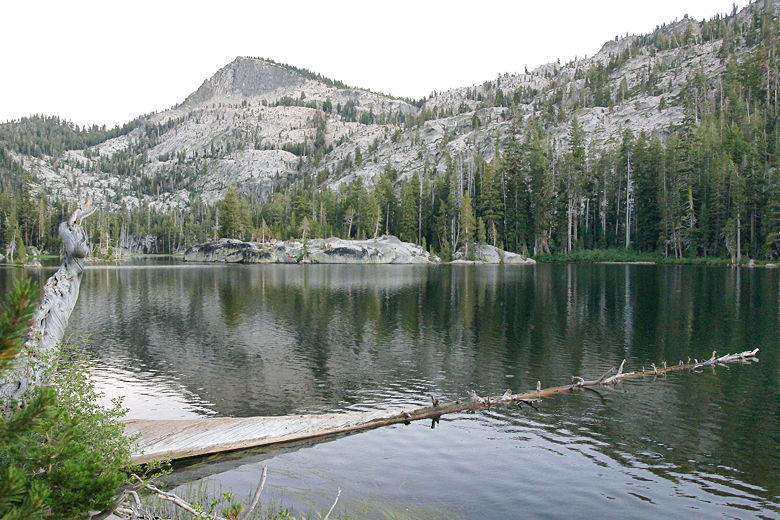
For dinner tonight I had the MH Pro-Pak meal of beef stroganoff. It was excellent. I give high
marks to the Pro-Pak meals in general. I'd say they were much better than the other meals we
had this trip. After dinner, mosquitoes bothered us, so everyone else went inside the tent. I
braved the mosquitoes for a little while, filtering water and taking a few moonlit pictures
of the lake.
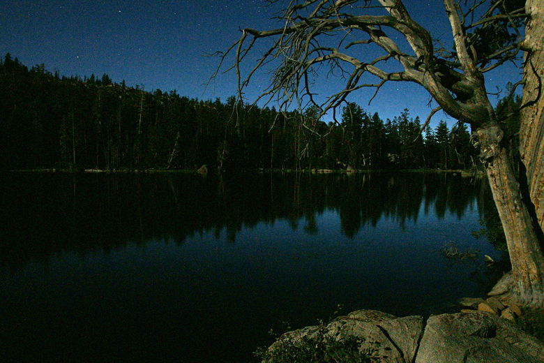
Moonlit Crag Lake
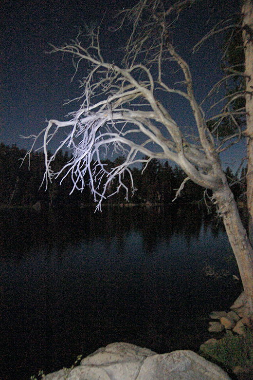
I don't think this composition works all that well, but here's an experiment I
did lighting this snag with my headlamp.
| 

