|
Just past midnight, I was woken by the wind starting to pick up. One of the hikers we
had met a couple days ago had mentioned camping at Middle Velma Lake and suffering through
high winds. He said he could hear the wind coming over Phipps Pass like a freight train,
and then hitting his tent a few seconds later. He thought it was going to blow away his
tent with him in it. It wasn't nearly that bad for us, but I could hear the wind winding
up on the mountains above. Our tent flapped a little, but nothing like the nights before.
Still, it woke me up.
I went outside and we made sure the tent was staked and guyed. I noticed that the moon
was almost full and it was nice just walking around on the granite slabs above the lake.
I decided I'd take advantage of my restlessness and take some moonlit pictures of the
lake. I grabbed my little Gorillapod and headed down toward the water. I took a few
pictures and went back to sleep.
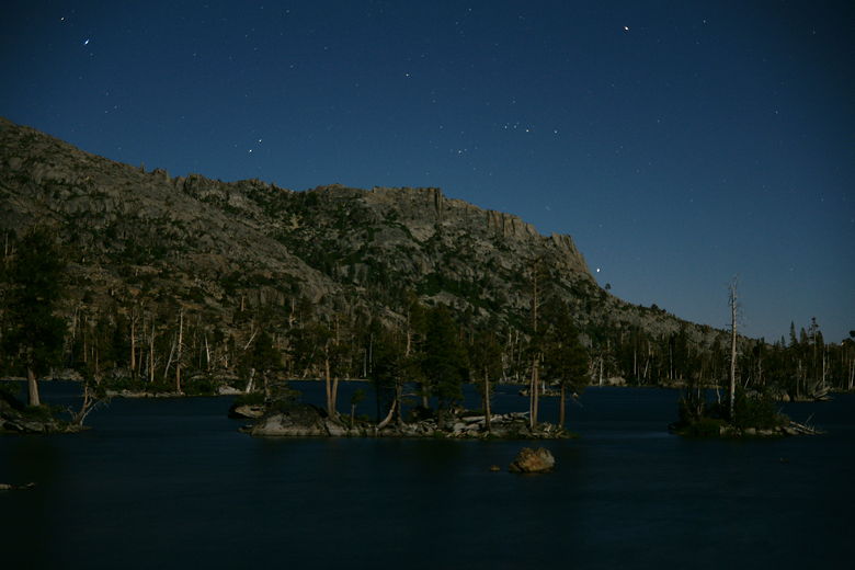
Moonlit Middle Velma Lake

Moonlit Middle Velma Lake
In the morning, I woke up refreshed, noticing that the wind had never really picked up
much and we were all able to get a good night's sleep. We woke up at 7am to the distant
sound of dogs barking at another campsite by the lake. The skies were clear and it looked
like great weather for the last day of our trip.
After packing and breakfast, we headed out at 10:20am. We retraced our steps back to the
main trail and then continued south along it. Almost immediately we reached the first of
several well-signed trail intersections. Here, the Velma Lakes Trail leads to the right
toward Camper Flat. We instead continued straight (signed for Bayview).
We soon noticed another use trail down to
the lake on the left. It probably leads to the campsite of the two other backpackers we saw east of us
last night. After that, though, the trail veers away from the lake. Still, at any point
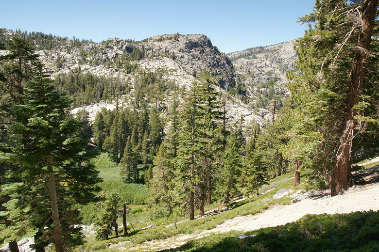
for quite some time, you could leave the trail and head downhill to the lake. The trail
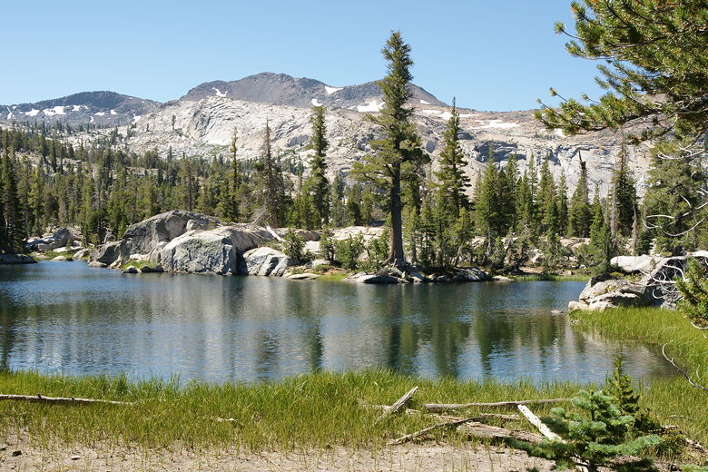
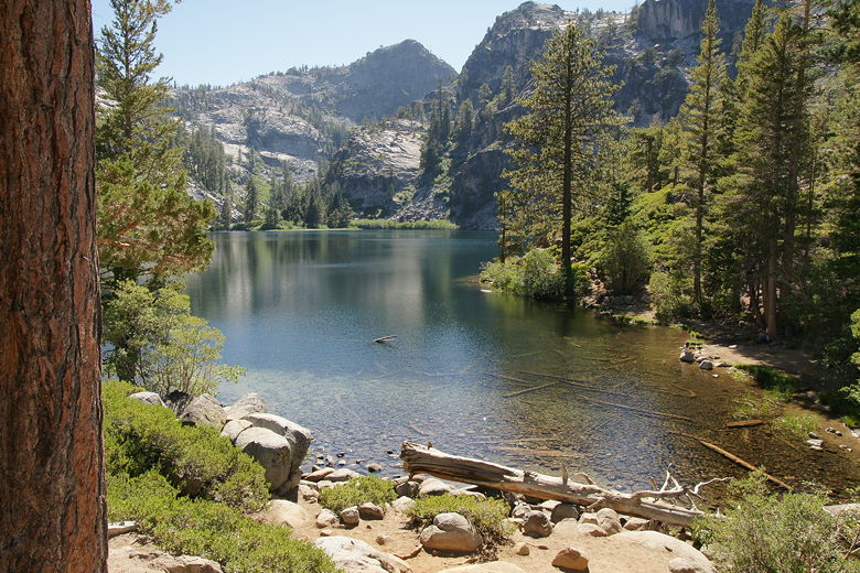
mostly follows the southern shore of the lake, albeit from a distance.
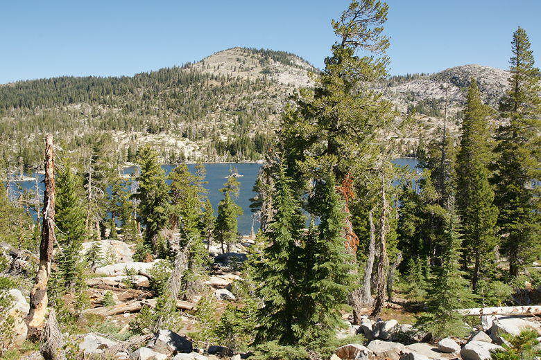
Middle Velma Lake from the trail south of the lake
After about 0.3 miles, we came to the next intersection.
To the right, a trail leads toward Fontanillis Lake, Dicks Lake, and ultimately Echo Lakes.
We continued left, continuing to follow the sign toward Bayview. We weren't ultimately going to the
Bayview Campground, but it shares the same trail with the Eagle Falls destination for a while.
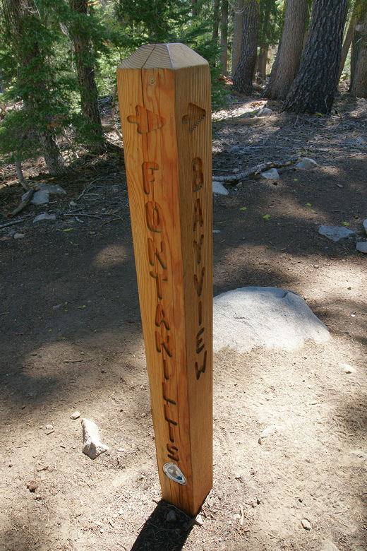
One of the many trail markers
Only a tenth of a mile later, we reached yet another intersection. To the right, a side trail leads
to Upper Velma Lake. We instead stayed on the main trail. At this point we stopped for a brief rest,
and a couple of backpackers and their dog walked by. Once we got back on the trail, we saw them
again, refreshing themselves in an outlet stream of Upper Velma Lake. We easily crossed the
creek, which was wide but shallow and full of large rocks to hop across.
Upper Velma Lake outlet stream
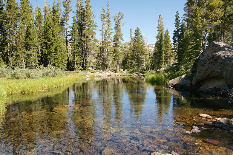
The trail now curves around a body of water which I'm not sure has a name. It's just north
of Upper Velma Lake and almost as big, connected to the lake itself by a short stretch of creek.
However, I don't know that it's technically part of Upper Velma Lake itself. In any case, it was
pretty. We could glimpse its grass-lined shores through the trees to our right.
Pond north of Upper Velma Lake

Pond north of Upper Velma Lake
Eventually the trail veers away from the lake. Up to this point, the trail had been mostly level.
Now, however, the trail starts an earnest climb up to a saddle. It's another one of those climbs
where it looks like the top keeps getting further away. But eventually, after 1.2 miles from
the previous junction, we made it to the top. Somehow, the stats tell me it was only about a 300
foot climb, but it seemed like more, maybe because I was expecting most of the day to be downhill.
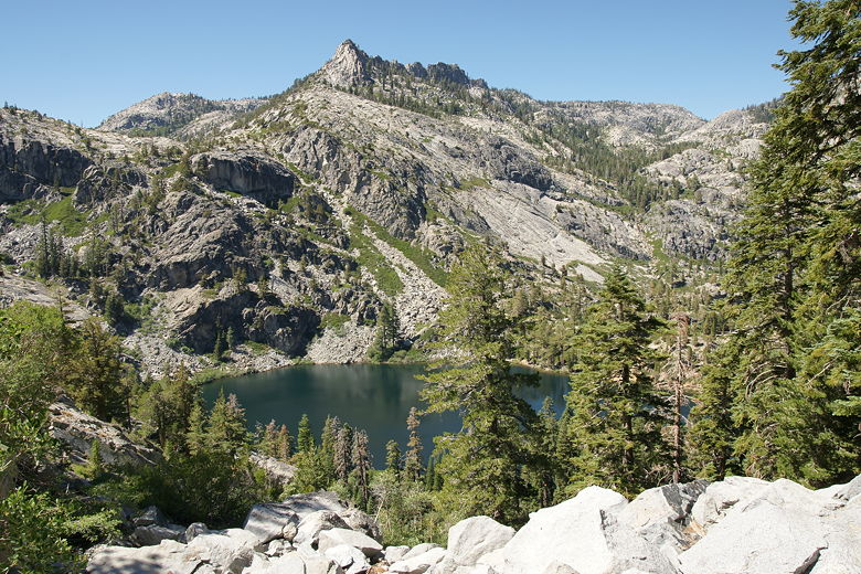
At the top is another trail intersection. To the right is another trail south to Dicks Lake. We
instead took the left fork toward Bayview, but not before having lunch. Afterwards, we took the
mostly level trail for about a mile as it heads east. Below us to the right, a bit in the
distance, we could see Azure Lake, mostly obscured by trees. About halfway into this stretch of
trail we got our first glimpse of Lake Tahoe in days. Soon it was obscured by the terrain,
though.
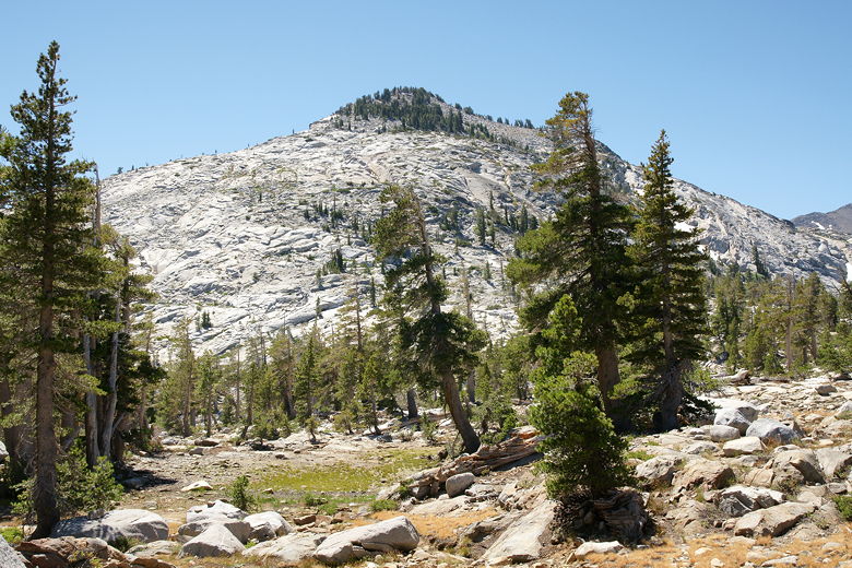
Mountain northeast of Dicks Lake, seen from the trail junction
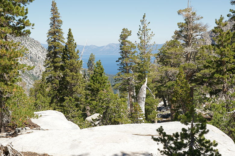
First glimpse of Lake Tahoe in a while

View from the relatively flat trail
After this pretty easy section, we came to our last main intersection. To the right was the
trail to Bayview Campground. That trail goes past Granite Lake, which we had visited two years
earlier. Instead, we took the left fork toward Eagle Lake. After a short break at the
intersection, we extended our trekking poles and headed down. It was pretty much all downhill
from here, and much of it steep, about 2.6 miles between us and our car.
The first part of downhill was pretty easy dirt. We started to encounter more and more day hikers
and their dogs as we got closer to the trailhead. Many were probably doing a day hike to Middle Velma Lake or
Dicks Lake. As we got further down the trail, switchbacks became
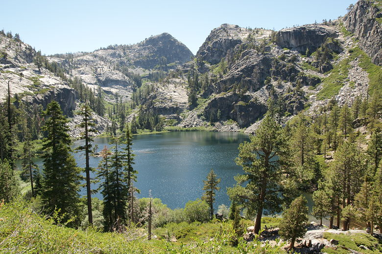
more common, as did rocky sections. We then traversed a steep cliffside above Eagle Lake,
clearly visible to our left. At this point there weren't a lot of trees so we had great views of
the surrounding area.
There was one brief little climb before the trail plunged downhill again, this time on some tall
rock steps. This is the one terrain that gives our youngest son the most trouble. I'm amazed that
he doesn't seem to have much trouble going up tall steps (even those that go up to his waist),
but not surprised that he has trouble
going down those same steps. He has to take it pretty slow to avoid falling - something to keep
in mind if you're going with young children.
Traversing the steep incline above Eagle Lake
Steep incline above Eagle Lake
Eagle Lake from the trail southeast of the lake
Eventually we made it down to the Eagle Lake intersection. To the left was a short side trail to the
lake itself, and to the right was the trail leading to our car. We all wanted a nice relaxing break,
so we took the short detour to the lake. It was a hot day and the lake is only a mile from the
trailhead, so as you can imagine it was a bit crowded. It felt like the Sand Pond hike, although not
quite as bad. There were not a dozen inflatables in the water like there was there.
Eagle Lake from the Eagle Lake trail
There were, however, lots of people swimming or playing in the lake, dogs swimming, lots of people
trying to cool off on a hot summer day. We crossed the lake's outlet stream (hopping across
rocks) and found a little spot next to the water. I dunked my feet, hands, and hair into the lake -
ah, refreshing.
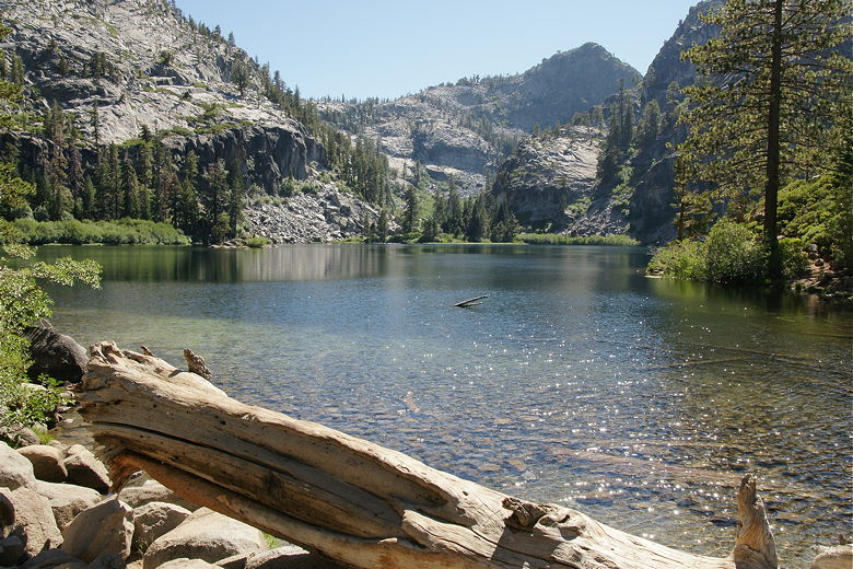
Eagle Lake
As we left the lake, a woman stopped me and made a strange request.
She saw the big pack I was wearing, and asked me, "Excuse me,
but do you happen to have an inflatable?" I don't know if she was asking me for something her
kids could play with or if someone was in dire need of a flotation device, but in any case of course
I didn't have one.
Eagle Lake from above the northeastern shore
Now it was an easy downhill mile to the car. This was the only stretch of the trail I had been
on before this trip, having visited Eagle Lake back in 1999. Halfway down we finally saw
Emerald Bay. Soon we were crossing the bridge over Eagle Falls, which I knew meant we were
nearly there. The falls themselves were not much to look at this late in the year, and at
this point we didn't care to stop, anyway.

View of Emerald Bay and Lake Tahoe
We made the right turn (avoiding the scenic loop trail), and soon were back at the parking lot
where we'd started this adventure back on Friday. As we unwound, taking off our packs and
changing into clean clothes, several emergency vehicles arrived. Fire engines and SAR vehicles
met at the Eagle Falls trailhead. I never did find out what the emergency was. Probably someone
fell, I would guess, but I never found anything on the web about it.
We drove into South Lake Tahoe for dinner before making the quick drive back home - without any
traffic it took barely over 3 hours. Back home, I started to think about future
backpacking possibilities. While the Desolation Wilderness is relatively crowded for a
wilderness area, the rewards are some very nice lakes and scenery. Despite having hiked in the
Tahoe area on many occasions, there are vast areas of the Desolation Wilderness I've never
visited. I look forward to a trip involving Lake Aloha and beyond.
As for the route we just completed, it should appeal to many people and the numerous lakes
makes for a lot of flexibility. At 18 miles, it can be
done as a long day hike if you're fit and ambitious. Or you can do it as a 2-day trip, probably
staying at Stony Ridge Lake or Rubicon Lake for one night. Or you can do it as a 3-day trip,
probably staying at Stony Ridge Lake and Middle Velma Lake. Or if you're limited in your daily
mileage like we were, do it in 4 days like we did. Of course, for those willing to hike a longer
distance (about 31 miles), the trip from Echo Lakes to Meeks Bay (or vice versa) looks great.
| 

