Desolation Wilderness Loop |
Day 2 of 5
Today would be the longest hiking day of the trip.
We woke up around 7:45am, and it was bright and sunny as it would be every day of this trip.
The other 3 groups within sight of us left while we were having breakfast. Despite the large
number of backpackers in the area, because the area is so spread out, it didn't feel
at all crowded camping at Lake Aloha. Something unexpected did happen overnight, though - a
squirrel or chipmunk had clawed at my handkerchief (which I had left out to dry), leaving a few
small holes in it. I made sure to tuck it away on future nights.
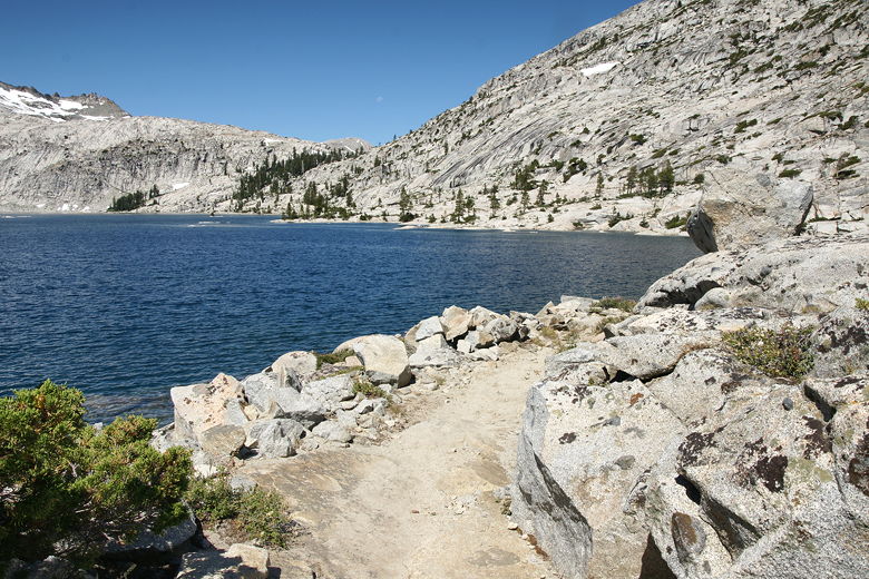
After enjoying the lake and packing up, we left the area at 10:40am. The trail continues to
basically parallel the northwestern shore of Lake Aloha. This part of the trail comes closest
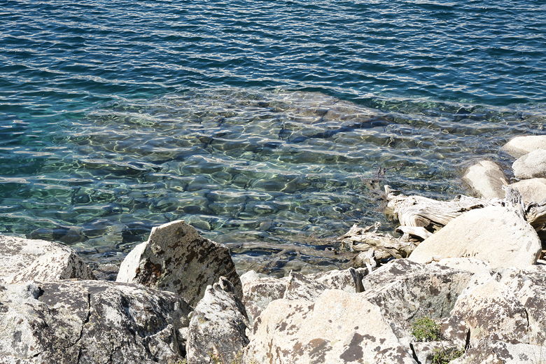
to the lake shore. The water looks so clean and pure. The rocky bottom was clearly visible
under the blue-green waters.
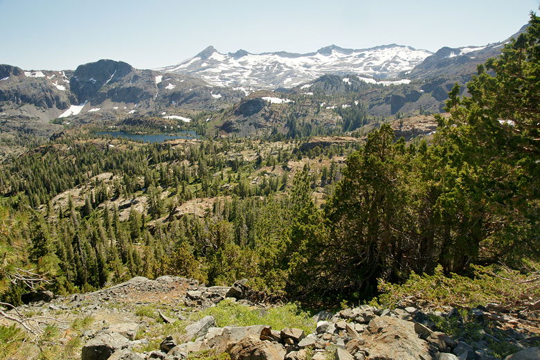
Pyramid Peak, Mt. Agassiz, and Mt. Price above Lake Aloha Trail along the northern shore of Lake Aloha Clear waters of Lake Aloha
I wasn't quite sure exactly how far we had gone the previous day, so I
didn't know exactly how far the next trail intersection was. I did know, however, that it was near
the base of Jacks Peak, which was clearly visible in front of us, with Dicks Peak to its right.
After about 0.7 miles, we reached our first trail intersection of
the day. This was the start of the loop section of our hike. We'd be taking the right fork,
leading to Dicks Lake. The left fork goes up and over Mosquito Pass to Clyde Lake; we'd be
returning on that trail on the 5th day.
Jacks Peak (left) and Dicks Peak
At this point, we also encountered the first other people of the day, three backpackers going in
the same direction. This was quite a contrast to the previous day, which was filled with
hikers and backpackers. After a snack break here, we took the right fork and soon crossed some small
snow patches. Shortly after that we got our first glimpse of Heather Lake down below. After a
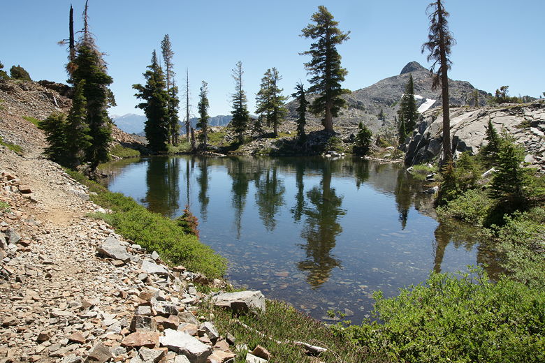
brief descent, we reached a pond just in front of Heather Lake. A pretty little stream tumbled
down from the left here, across the trail and forming a tiny waterfall. There was also a backpacker
camped here, right next to the trail and right next to the pond, clearly in violation of the regulation
to camp at least 100 feet from water and trail. It doesn't seem like the regulations are enforced,
as there are many obvious campsites which violate these distances, and it seems like any ranger walking
along the trail could post a sign saying camping was not allowed there. In any case, I tried my best
to abide by the rules.
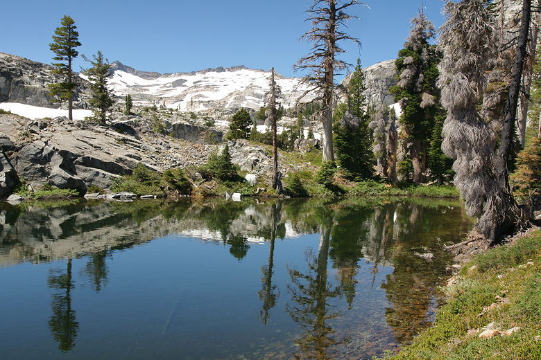
Pond in front of Heather Lake Pond just before Heather Lake Mountain reflections in pond
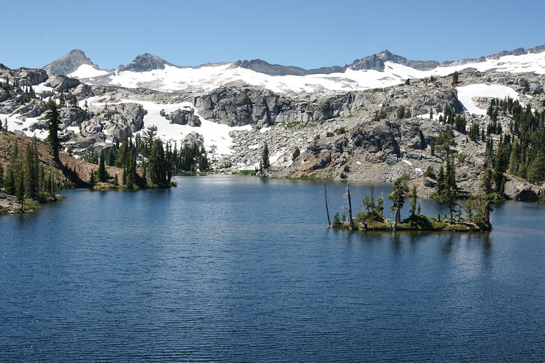
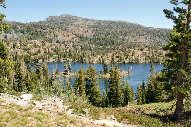
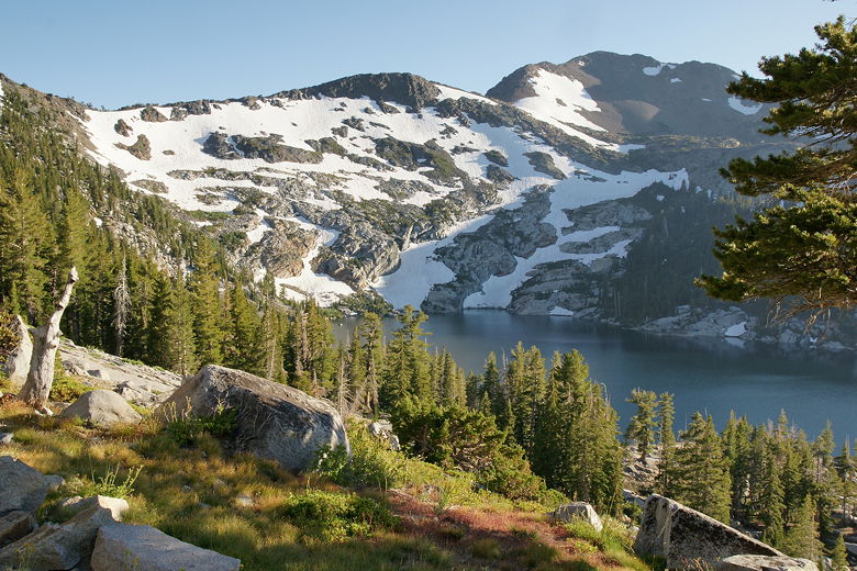
After we passed the pond, we reached Heather Lake itself. It's a beautiful sight, especially from
a little further along the trail. About halfway along the northern shore, the mountains above Lake
Aloha are clearly visible to the southwest - Mt. Price, Mt. Agassiz, and Pyramid Peak. Because those
mountains rise so much higher than the rocky hills above Heather Lake, an optical illusion forms and
it looks like those mountains are rising right from the shores of Heather Lake itself, rather than
being separated by Lake Aloha.
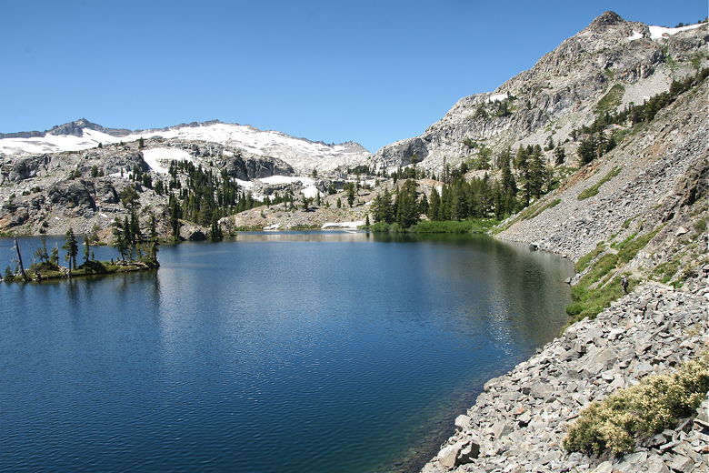
Talus slopes next to Heather Lake Mountains behind Heather Lake
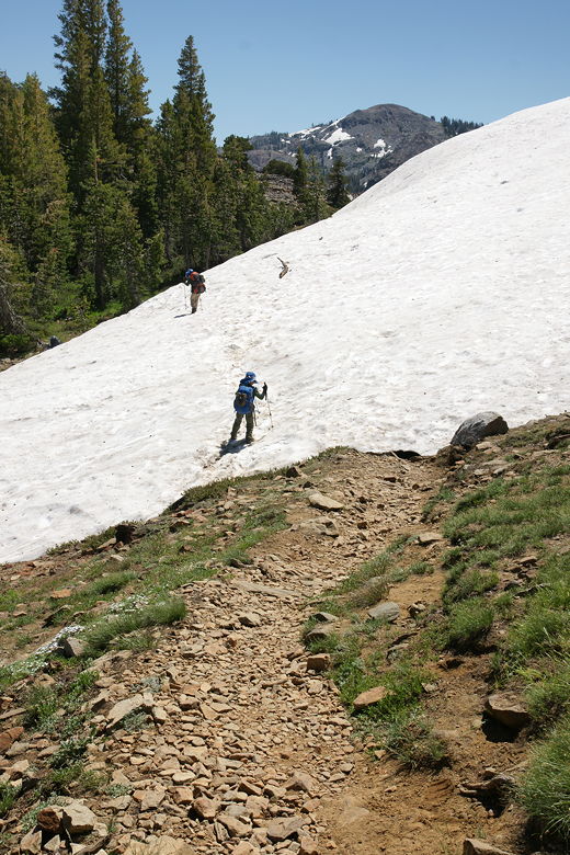
After hiking along the steep talus shore of Heather Lake, we left it behind. After crossing a snow
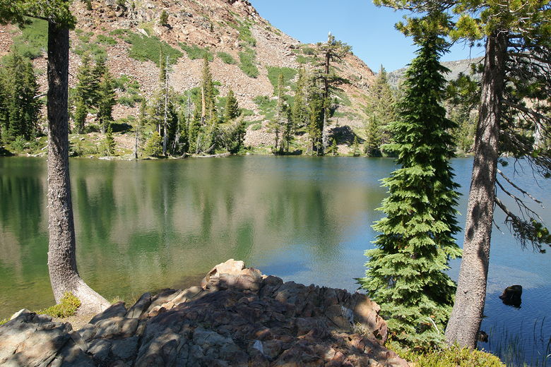
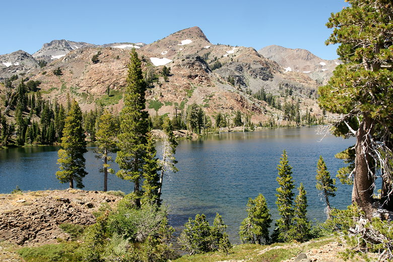
field, we descended down to the shore of Susie Lake. We stopped here for a snack break, watching
tiny little fish swimming in the lake. The setting at Susie Lake is not as dramatic as at Heather
Lake. While Heather Lake is surrounded by mostly granite and backed by majestic mountains, Susie
Lake is surrounded by brown hills populated by a sparse forest. There do appear to be slightly
more campsites available here, though.
Susie Lake Crossing snow before Susie Lake Susie Lake Susie Lake
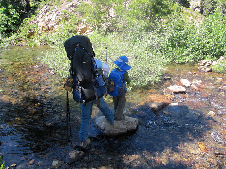
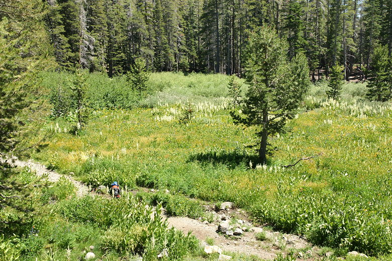
After our break, we continued along the trail, following the southern shore. After crossing the
outlet stream, we followed the eastern shore before the trail veers away from the lake. The trail
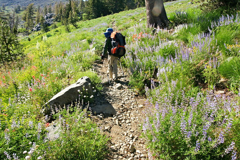
passes through some wildflower-filled meadows, then starts climbing. After climbing for about a
half mile, we stopped at a trail intersection. A trail to the left leads to a dead end at
Half Moon Lake, the trail to the right leads to the Glen Alpine trailhead near Fallen Leaf Lake.
We would be taking the trail straight ahead (roughly north), leading toward Gilmore Lake.
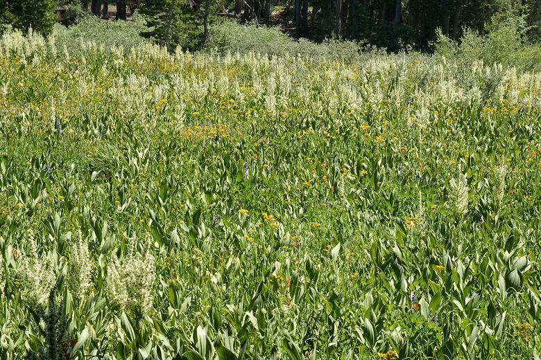
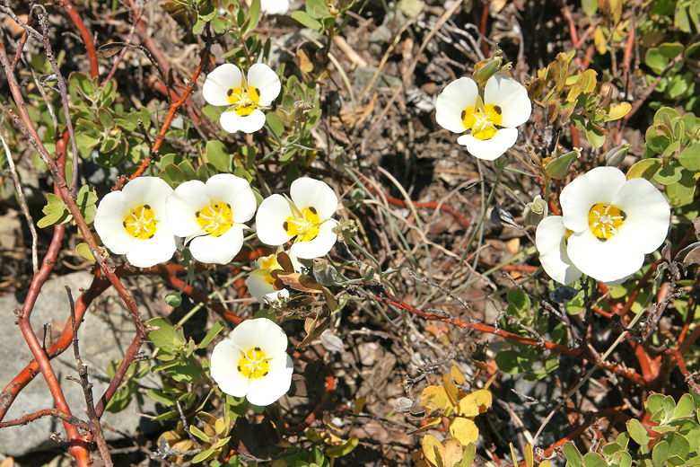
Crossing the Susie Lake outlet stream Passing through a flower-filled meadow after Susie Lake Flowers
While sitting there resting, it occurred to me that we'd been on this section of trail before.
Twelve years ago, we had descended from Mt. Tallac in a lengthy thunderstorm, and our route took
us down this 0.6 mile section of trail that we were about to ascend in the opposite direction.
In contrast, today was sunny and hot. Before we ascended, a man stopped and decided he had to take
our kids' pictures. He was an artist and planned to make a drawing based on them.
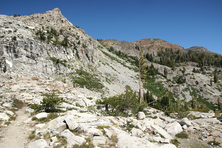
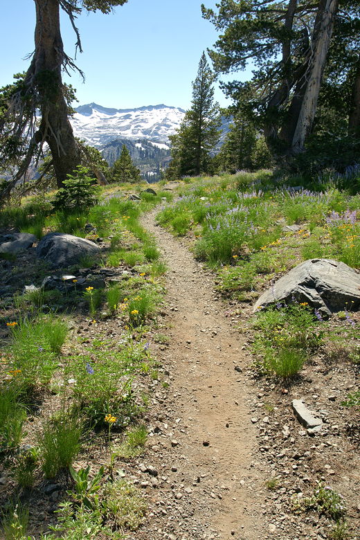
After our break, we started up the climb, which is wooden frames around gravelly platforms leading
up the hill. It then switchbacks up for 0.6 miles to the next intersection. Here, we stopped just 0.1
miles from Gilmore Lake (still out of sight over the hill) and turned left toward Dicks Pass, just as a large group of backpackers headed
in toward Gilmore Lake. Those would be the last people we'd see on the trail today. We still had
4.8 miles to go (2.9 miles up, then 1.9 miles down to the lake), and it was about 3pm. I was beginning
to worry that we wouldn't reach the pass until
6pm and the lake until almost 8pm.
Climbing up toward Gilmore Lake
The trail to Dicks Pass starts out relatively flat. After about a mile, though, it starts to climb.
It's not too steep, but it is relentless. The thinning air does you no favors, either (the pass sits at
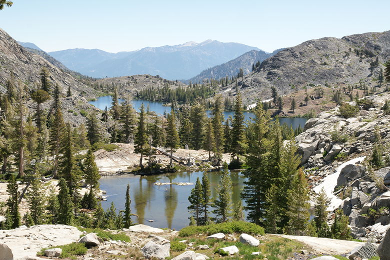
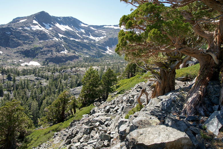
over 9300 feet, the high point of our trip). On the bright side, the trail provides some astounding views. To the south,
Susie Lake, Pyramid Peak, Mt. Agassiz, and Mt. Price are clearly visible. If you look at just
the right place, you might see just a sliver of Lake Aloha. Beautiful pine trees dot the hillside.
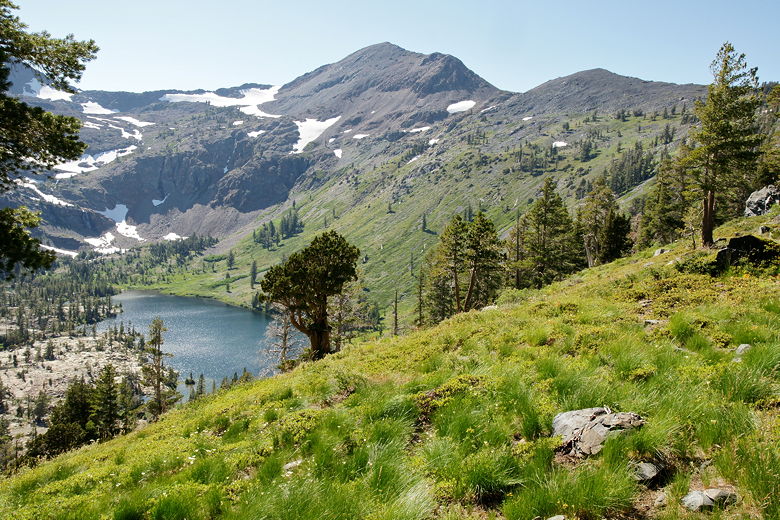
As you climb further still, Half Moon Lake becomes visible down below Dicks Peak. We could not see
anyone camped down there; if you want solitude, that might be the place for you.
Heading toward a magnificent view along the trail to Dicks Pass Susie Lake and mountains above Lake Aloha Heading toward the overlook of Half Moon Lake
Friday, August 19th
Lake Aloha to Dicks Lake
8.6 miles
1840 vertical feet (ascent)
1510 vertical feet (descent)
8:04


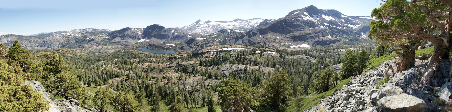
Panoramic of the view from the trail to Dicks Pass
We stopped for a short break with views of Half Moon Lake below. After the break, we left those
views behind and continued up the trail. Soon we started crossing snow fields. The snow was
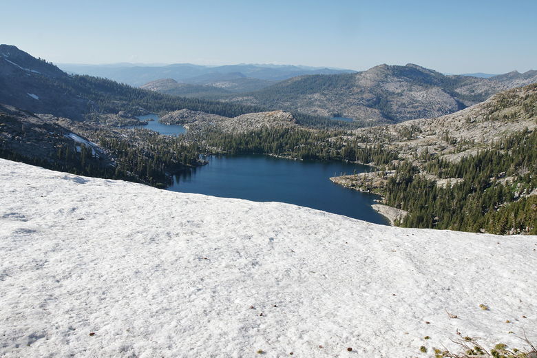
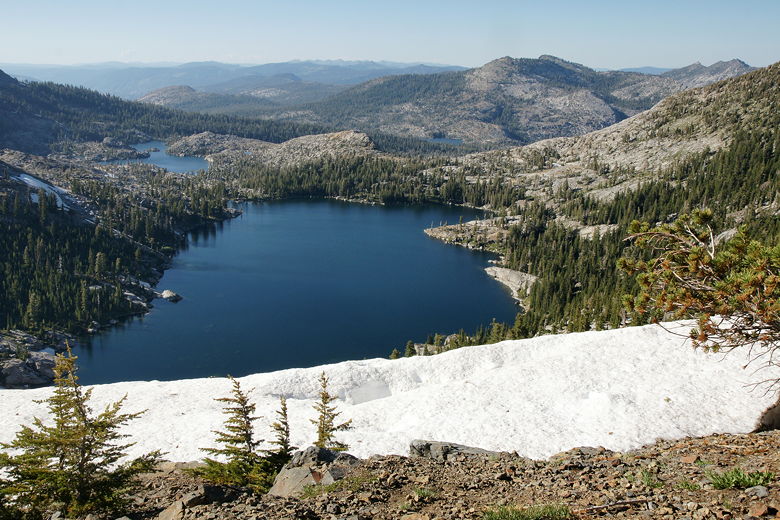
firm, not steep at all, and easy to cross. Before we knew it, we were peering over an edge looking
down at Dicks Lake to the north. It was only 5:10pm now. Unfortunately, that's not the top.
You can't head down from here because the snowy terrain drops precipitously from here down to the
lake. Instead, the trail continues to the right, up some more switchbacks. Having seen the lake
already, this was my least favorite part of the hike. I felt cheated somehow.
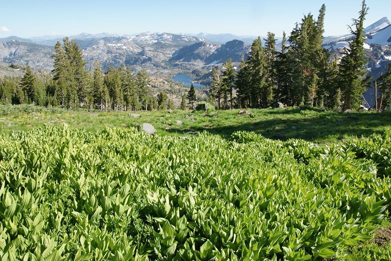
Flowers next to the trail Flowers next to the trail Dicks Peak above Half Moon Lake Hiking past wildflowers Looking past corn lilies to Susie Lake Peering down at Dicks Lake from the false pass Another view of Dicks Lake from above
Finally, after about 20 minutes, we reached the flat plateau of Dicks Pass. It was mostly covered
in show. We went up and over the pass, then started the long descent down to the lake. Just a few
minutes later we crossed some sloped snow fields. An ice ax wasn't necessary, but I was glad we
had our trekking poles to assist here. After this crossing, the rest was much easier, but there were
still lots of other snow patches to cross. It usually wasn't too hard to pick up the trail after
passing over the snow, but we did have to spend a few seconds each time re-orienting ourself back
onto the trail. This slowed us down a bit, but it was all downhill, switchback after switchback
through the forest. Dicks Lake was to our left, but it didn't seem to be getting any closer.
Dicks Pass
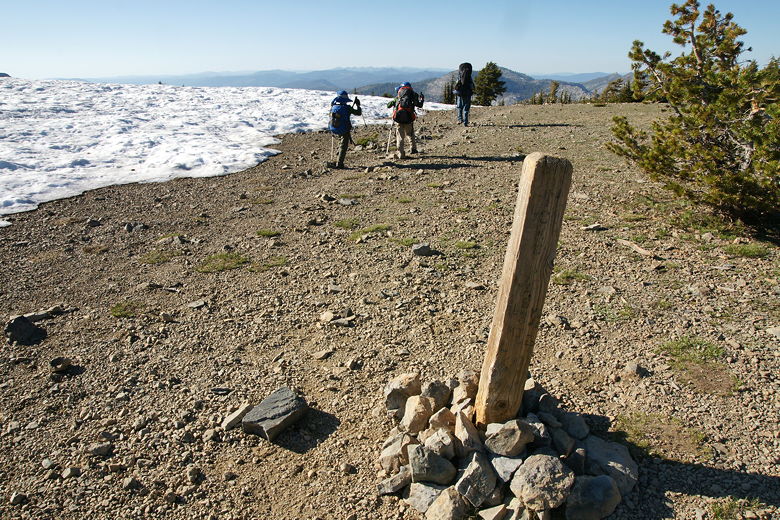
Eventually, about halfway down, the snow patches stopped. We finally reached another trail
intersection, taking the left fork to head to the lake. 0.2 miles later, at 6:40pm,
we reached the lake
itself. There to greet us were scores of mosquitoes. We put our packs down and looked for a
campsite, eventually choosing one on top of a small hill with ample rocks around us for wind
protection. We could also step up onto the rocks and have great views of the lake.
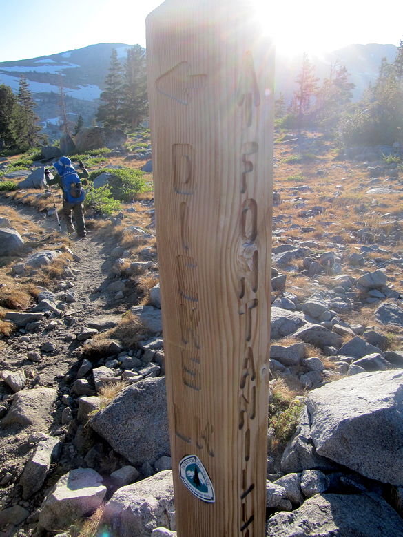
Dicks Lake lit by the afternoon sun Trail sign leading us to Dicks Lake
It seemed like we had the whole lake to ourselves, but when I went down to get some water to
filter, I saw that someone had set up camp down near the water. They had what looked like a
sleeping bag in a hammock. I didn't actually see the camper, but the site was gone in the
morning. That night we also saw the light of another campsite on the northeastern shore. So
I suspect we were one of only 3 groups at the lake that night.
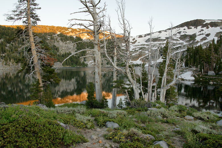
Sunset at Dicks Lake
We enjoyed dinner and a nice sunset, then turned in for the night.
(Click image to view full size)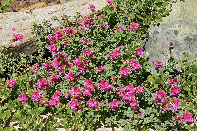
Related Pages:


|

|