Directions:
From Kahului, take the Haleakala Highway. Turn left onto State Highway 377.
Next, turn left onto State Highway 378 at the sign for Haleakala National Park and
drive up the winding road to the park entrance. Pass the first visitor's center
on the right, then continue on up the road to the second visitor's center near the
summit, on the left. The trail starts near the entrance to the parking lot.
View Driving Map
We'd driven from an elevation of about 3000 feet to nearly the top of Haleakala,
elevation over 10,000 feet. As you can imagine the lack of oxygen affected us a
little. Thankfully, the start of the trail is mostly flat or downhill.
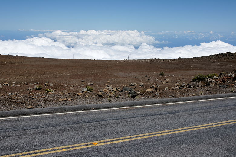
One interesting aspect of the hike was that it started above the clouds. After
driving under cloud cover most of the way up the mountain, we drove above the
clouds and were now looking down on them.
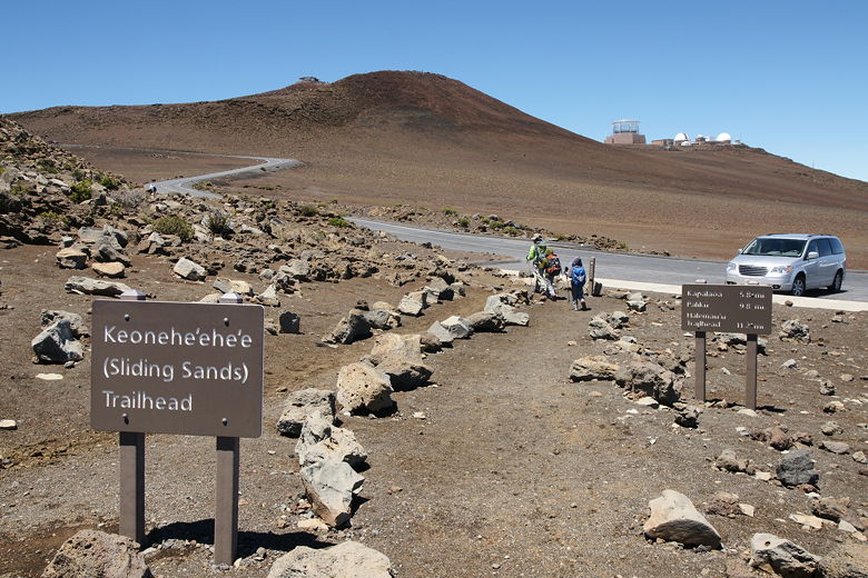
The visitor's center parking lot where the trail starts was nearly full when we
arrived around 11am. After prepping, we started off on the trail, which starts
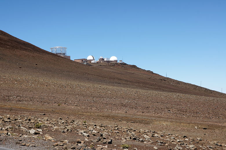
near the entrance to the parking lot. We immediately had views of the observatories
on the summit. The trail parallels the road very briefly, then turns left away
from the road.
Start of the trail
Observatories near the summit
Looking across the road and down to the clouds
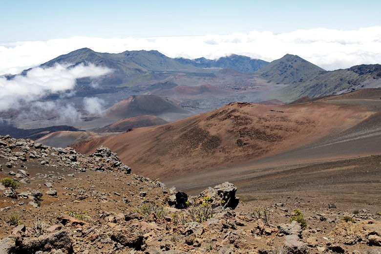
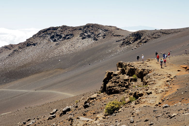
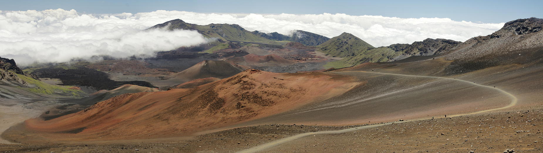
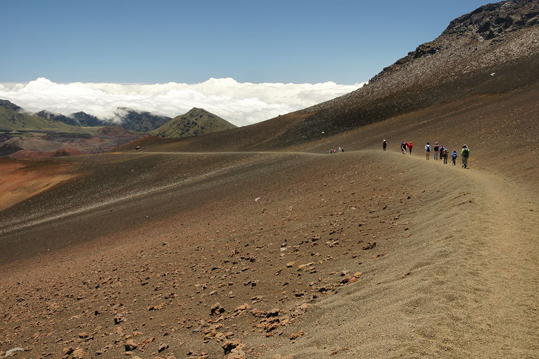
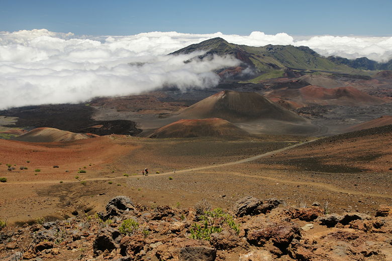
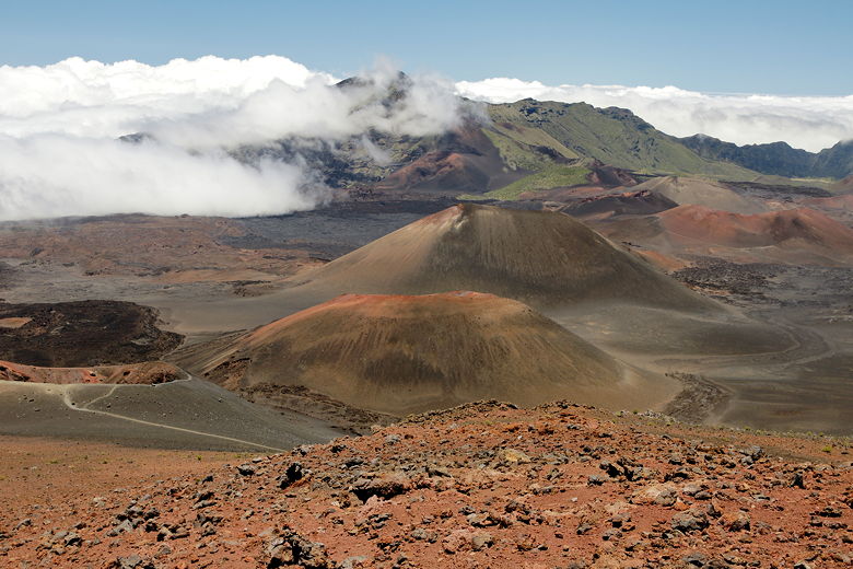
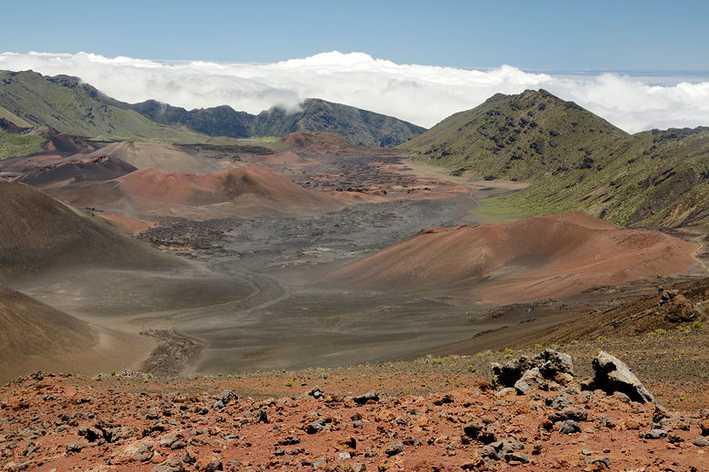
Almost everywhere you look, the land is mostly barren. There are bushes here and
there, but there's mostly rock and sand. After a very short climb, the trail flattens
out. Soon, we reached our first views. A sign told us that what we were looking down at
was not a crater, but the result of erosion.
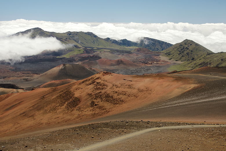
One of the first views of the valley
Descending to a nice viewpoint
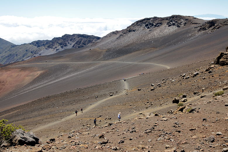
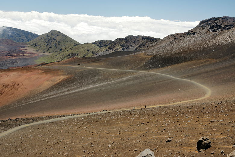
Curving trail
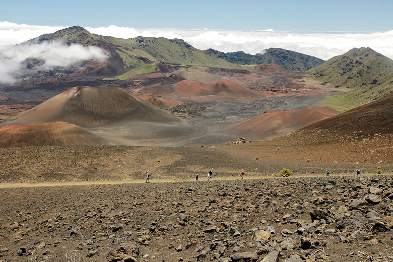
The trail traverses the curves of the mountainsides, without the need for much in the
way of switchbacks. There are no trees for the trail to maneuver around, no hard edges.
Only a very gradual descent with views in all directions.
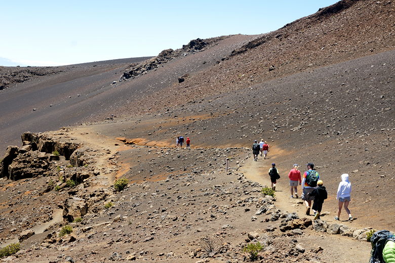
Hikers at the viewpoint
You'll probably see horse manure on the trail, although we didn't actually see any horses,
which must have gone on the trail before us. You'll also see a lot of people. It's the
type of trail that you can walk on for as long or short as you want. Someone could walk
10-15 minutes and still get decent views. I didn't have any particular goal in mind. I
figured we'd just walk for 1-2 miles, have lunch, and return.
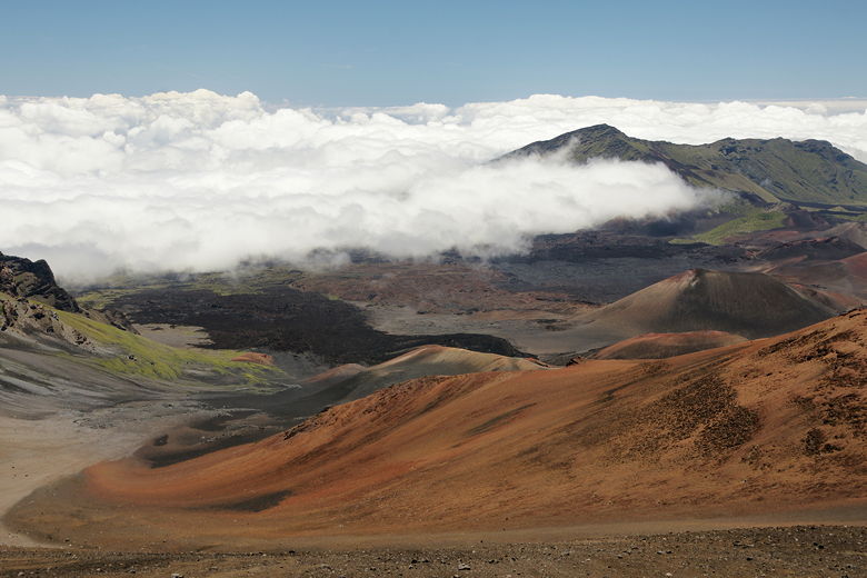
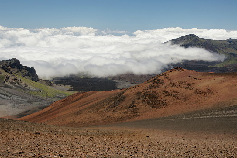
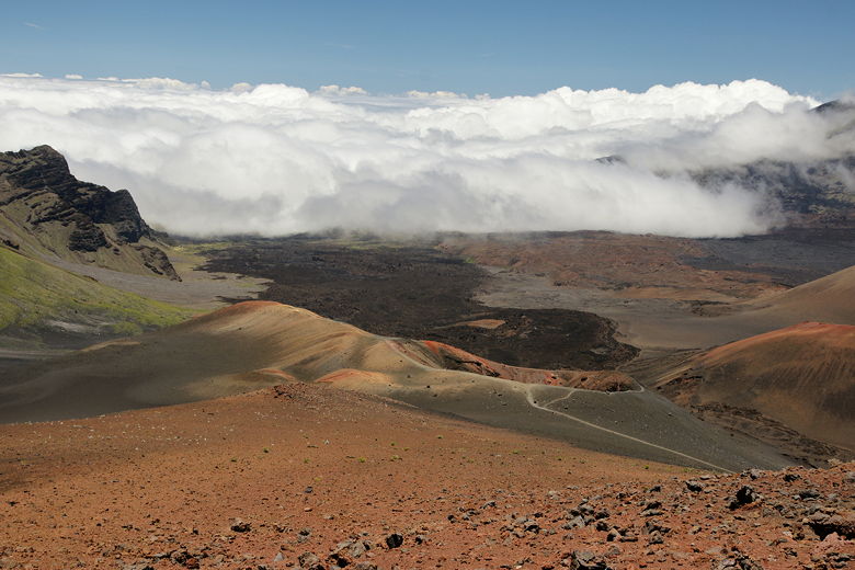
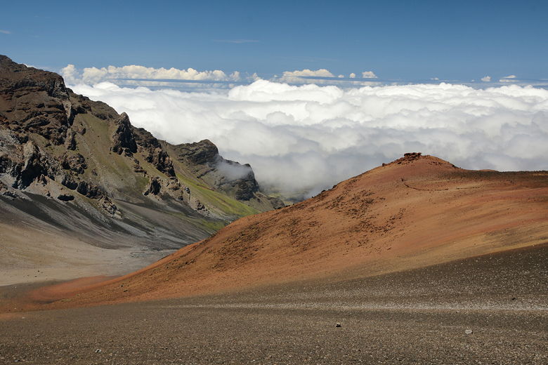
Clouds on the edge of the valley
(Click image to view full size)
As we continued our descent, we could see clouds at the edges of the valley, far below.
Although much of the land was barren, it wasn't uniform. The land had several different
colors, including browns, reds, and oranges, and even some greens further away, at
lower elevations.
Hikers on the sandy trail
After hiking for about 1.5 miles, we found a nice spot to sit down for lunch, just off
the trail. A couple other groups were stopped nearby for lunch, as well. After lunch
we headed back up the trail. Going uphill was taxing given the high altitude, but we
made good progress. We climbed nearly 1000 feet, back to the flat area, then descended
back toward the road and returned to the parking lot.