|
As you may know, I make it a point to almost never do the same hike twice. There
are just too many good places to explore. However, the view from the top of
Mt. Tallac is so amazing that I've made an exception - twice. The first time I
hiked it was in 1997, and I liked it so much I returned in 1999 (albeit using a
slightly different route). I had planned to do it every few years, but kids have a
way of changing things.
In the last couple years, I would gauge my kids and decide if they were Tallac-ready.
The answer was obviously no until this year. They'd done an 8.5 mile hike with a
fair bit of climbing last year, so I thought they were finally ready for Tallac's
nearly 10 mile hike and over 3000 feet of climbing. After their performance on our
recent backpacking trip, I was sure they were ready.
And so on this bright sunny morning, we arrived at the Mt. Tallac trailhead parking
area. It was 8:15am, and there were already quite a few cars parked here (maybe a
dozen), though we
had no trouble finding a space. Joining us about 20 minutes later was Reza, who
would be the only person who's been on all 3 hikes up Tallac with me.
It was about 8:50am by the time we got started, and I did some rough calculations. I
estimated about 5 hours for the hike up, arriving around 2pm, staying at the top for
an hour, and taking about 3 1/2 hours for the descent. So I figured we'd get back
around 6:30pm. That was the plan, anyway, and as it turned out it went pretty much to
plan.
Well, my plan didn't get off to a good start. After picking up a permit (self-register)
at the trailhead, we started up the flat dusty trail. Less than 2 minutes later, Jean
noticed that Jared wasn't wearing his hiking shoes. I'd told him to change into them
as soon as we'd arrived, but hadn't checked to see if he had. He was still wearing his
sneakers. And so we all went back to the car, he changed his shoes, and off we went.
Although I had hiked this trail before, it was 15 years ago, so my memory of parts of it
were spotty. Somewhat forgettable is the first half mile or so of the hike, which
starts climbing in earnest after a short flat section. After a short twisting climb,
it straightens out but continues to climb a bit more gradually.
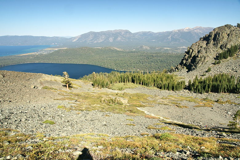
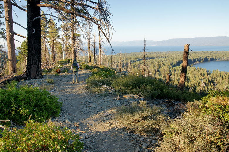
The trail heads mostly south and after about three quarters of a mile gains the ridge
to the west of Fallen Leaf Lake. Now the views start to come. There are nice views of
Fallen Leaf Lake to the east, Lake Tahoe to the north, and Mt. Tallac to the west.
The thing is, the views only get better the further you go. As Rez pointed out later,
if you stop and take a picture because the views are great, you'll walk further and
a few minutes later decide to trash the picture you just took because you just found a
better view.
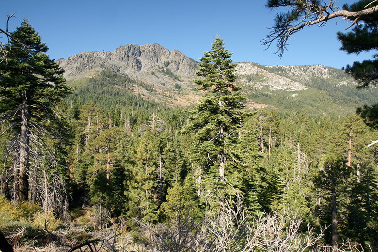
First view of Mt. Tallac from the trail
Looking back (north) along the ridge above Fallen Leaf Lake toward Lake Tahoe
The trail stays on the ridge, with all its views, for about a half mile before the trail
reaches a trail intersection. Here, a trail to the left leads down to Fallen Leaf Lake
and is the route we took from the Glen Alpine Trailhead in 1999. We followed the trail
straight ahead, which veers west away from the ridge. About 0.4 miles later (about
1.6 miles from the trailhead), we reached Floating Island Lake.
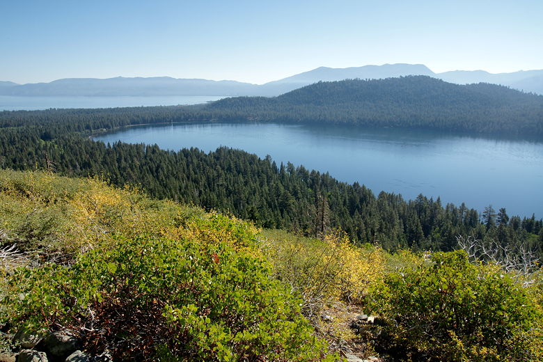
Fallen Leaf Lake and Lake Tahoe
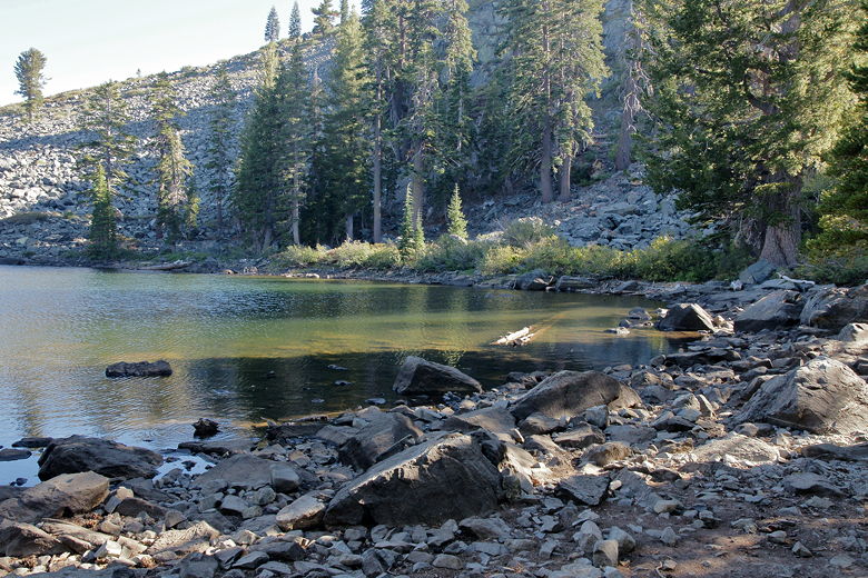
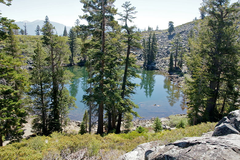
For some reason, I have no pictures of our visit to Floating Island Lake from 1997, nor
any real memory of it. But it's actually a fairly nice lake, and a nice place to stop
for a quick break, which we did. The north end is well-shaded, with plenty of downed
trees to sit down on. A little patch of dirt/grass about 10 feet long sits near the
northeastern shore, giving it the name "Floating Island" Lake.
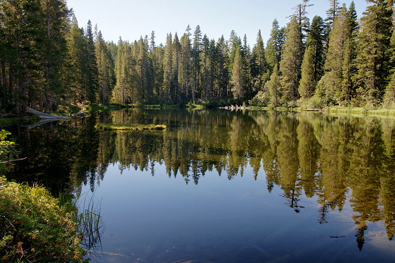
Floating Island Lake
After a snack break, we continued along the trail, which follows the eastern shore of the
lake. The climbing continues, up to Cathedral Lake about three quarters of a mile later.
Cathedral Lake is definitely not as photogenic as Floating Island Lake, but it's another
decent place to take a break and filter water if you need to. We didn't, as I had packed
plenty of water in preparation for a long hike on a warm day. I could have saved us
some weight by packing less water and carrying the filter, instead, but since we had
been backpacking recently, pack weight didn't seem like a factor.
Cathedral Lake
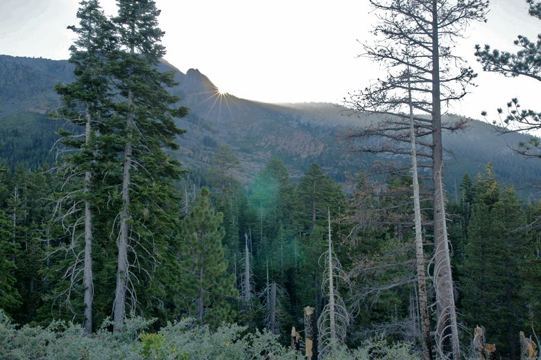
After a short snack break, we hit the trail again. The trail up to this point had climbed
mostly gradually. That would change as soon as we left Cathedral Lake. The trail
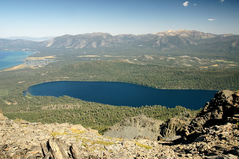
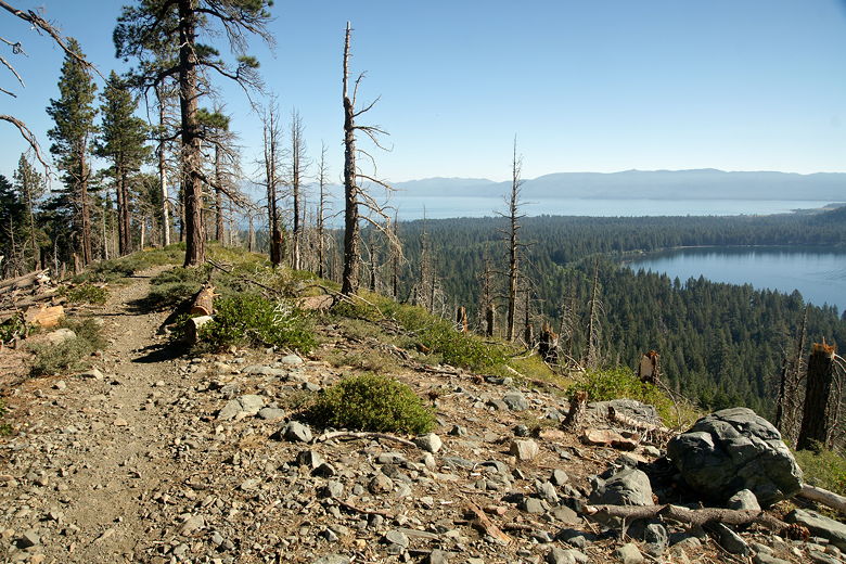
pitches upward steeply immediately, switchbacking up out of the trees. There are still
a few trees here and there, but for the most part you get unencumbered views of Lake
Tahoe and Fallen Leaf Lake, with Freel Peak clearly visible beyond Fallen Leaf Lake to
the east.
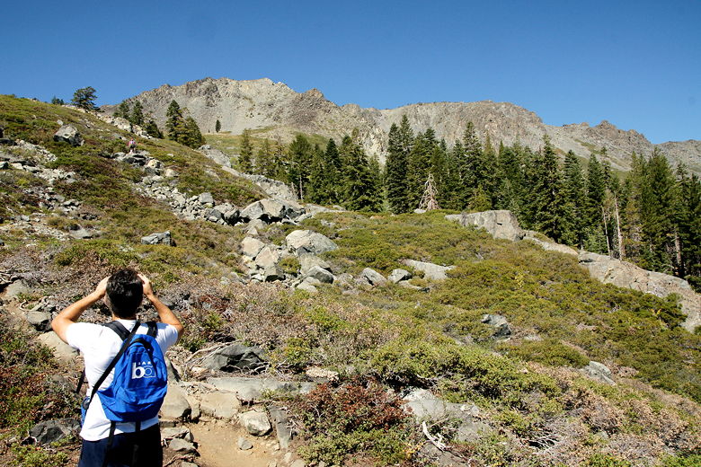
Looking up at the climb ahead
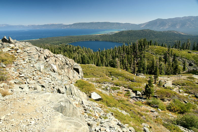
Looking back at Fallen Leaf Lake and Lake Tahoe
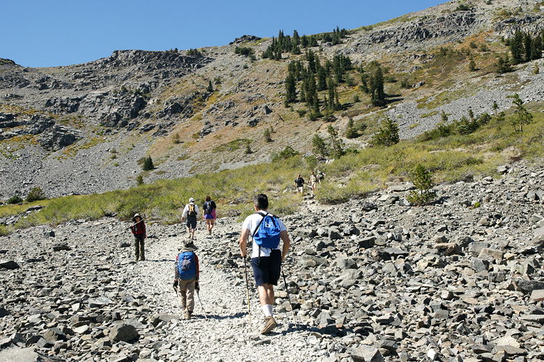
We could see hikers snaking their way up this section of trail. We saw a lot of people
on the trail today, probably somewhere in the range of 50-75 hikers, and at least
a dozen dogs. Mt. Tallac is a place to visit to enjoy the spectacular view, not a place
to find solitude.
Knowing what to expect, I told Nathan to stop at the last tree. We did so, taking one
last minute to enjoy some shade before starting the steep exposed (to the sun)
climb up the rocky bowl. Now I felt like we were starting the real climb. But to be
honest, this part of the trail wasn't as tough as I'd remembered it. It was fairly steep,
sure, but we just climbed steadily and soon enough we were at the top of the climb.
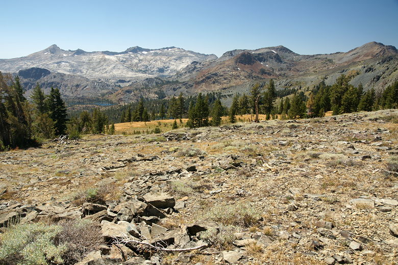
At the top we could see the big meadow in front of us. Interestingly, the large rock
pile we'd seen in the meadow in 1999 was no longer there; it hadn't been there in 1997,
either.
Heading up the big bowl of rocks
We were now about 3.3 miles in, with only about 1.4 miles to go. But they'd be climbing
miles.
The trail now flattens out before climbing steadily but not too steeply, cutting
westward across the southern face of Mt. Tallac. During this climb we couldn't actually
see the top, it being obscured by the topography. There are trees here and there, perhaps
a third shaded and two thirds unshaded.
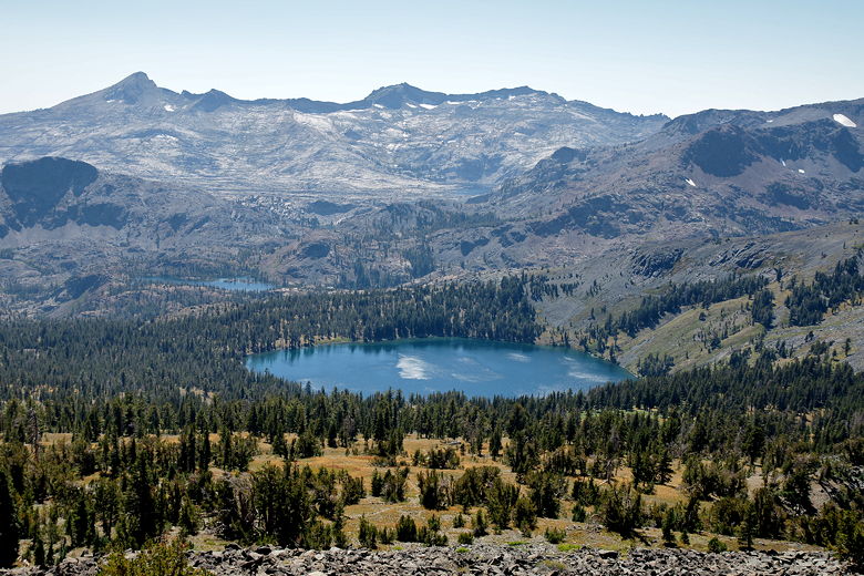
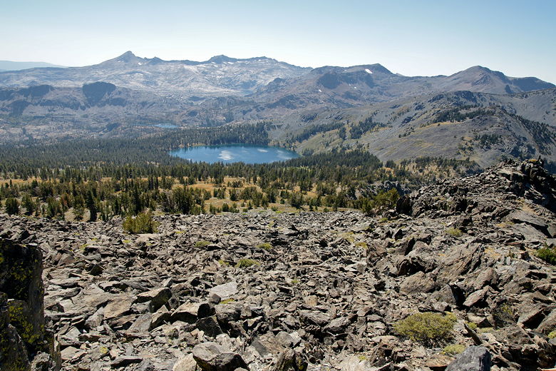
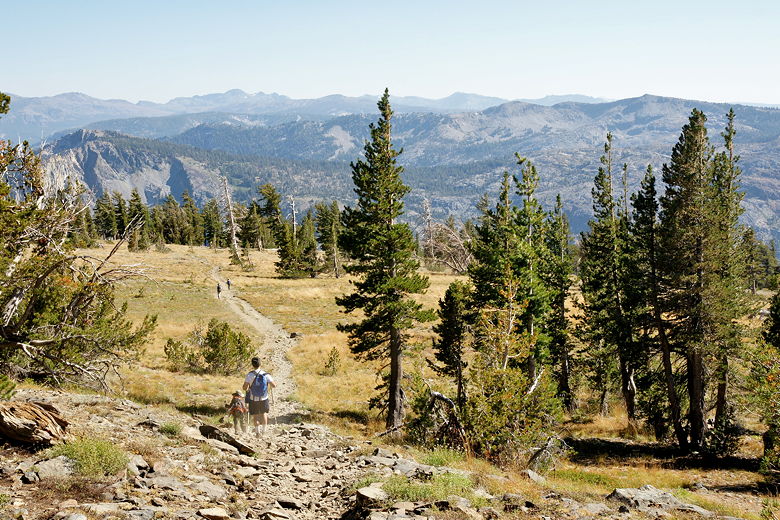
To the south, across the meadow, we could see
Mt. Price, Mt. Agassiz, and Pyramid Peak looming above Lake Aloha. The scenery took on
a different meaning since we'd backpacked in much of the Desolation Wilderness on two
different trips in the past two years. Jacks Peak and Dicks Peak were also clearly
visible to the east. As we climbed higher still, we could see Susie Lake to the southwest, a tiny corner of
Lake Aloha, and Gilmore Lake closer to us.
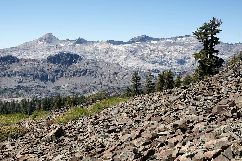
Mountains above Lake Aloha
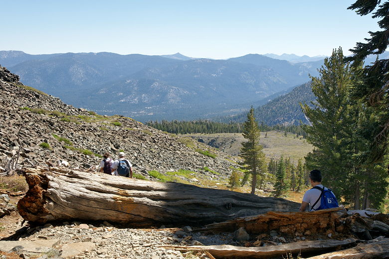
Looking back down from the trail
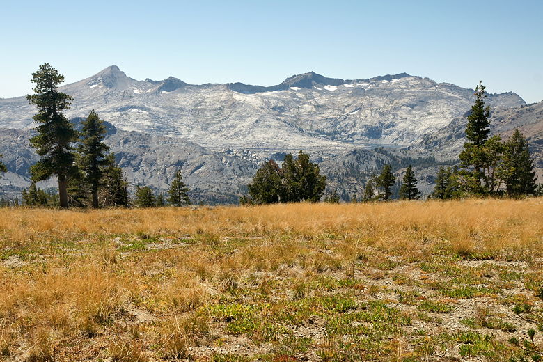
Mountains above Lake Aloha
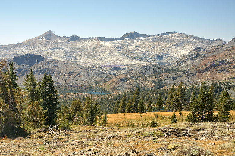
Susie Lake, with a tiny portion of Lake Aloha barely visible near top right
As we climbed and climbed, the summit nowhere in sight, Jared had a tough time going on.
Despite having come this far, he wanted to turn around. I had to keep prodding him along.
I knew he could do it, as long as he had a positive attitude (which he didn't at the time).
Around this time, a Russian man with an SLR in hand came up to him and said, "What is
your name? You are my hero!" He asked to take a picture of him, he was so excited to
find a 6-year old doing the trail. This seemed to help Jared go a bit further before he
started complaining again.
From left to right: Pyramid Peak, Mt. Agassiz, Mt. Price, Jacks Peak, and Dicks Peak (far right)
Finally, after a long slog uphill, we reached the second and last intersection on the
way up. To the left is a trail leading down to Gilmore Lake; we'd taken this trail down
fleeing from a thunderstorm in 1999. To the right is the trail to the summit of Mt. Tallac.
Just to the right of the trail post was a large pile of rocks. I'd remembered this
pile of rocks from a picture I'd taken in 1997. However, it's interesting to compare the
pictures because the pile of rocks has gotten at least 20 times larger since then.
Apparently, over the years people have added to the pile. Looking carefully at the
sign, maybe it's kind of a joke, since the sign says "Mt. Tallac" with an arrow pointing
directly at the pile of rocks. It does bear a striking resemblance. Who knows how big
the pile will be years from now.
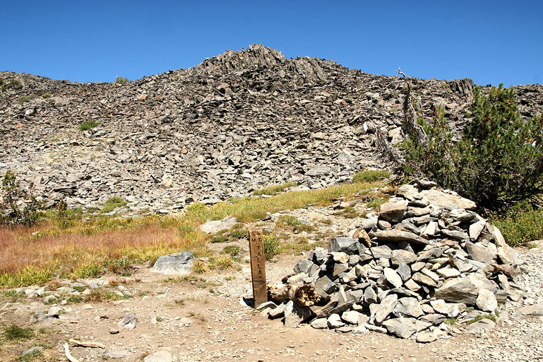
Pile of rocks next to the final trail intersection
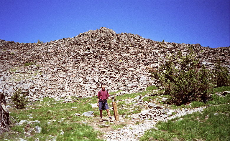
Same intersection, smaller pile of rocks in 1997
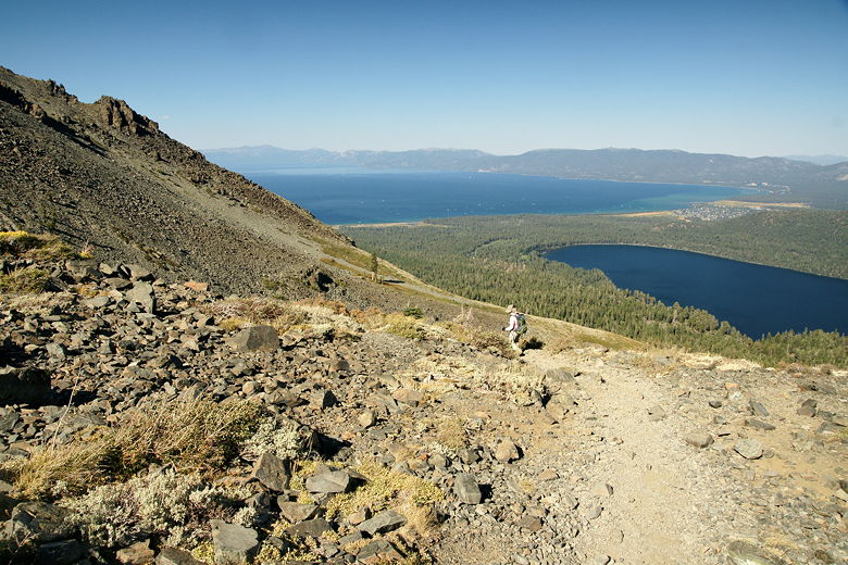
So we turned right and started the final push. It starts out as a trail, curving around the
base of the huge talus section at the top of Mt. Tallac. This brought us to the best view
so far, looking out at Fallen Leaf Lake and Lake Tahoe from the edge of a cliff.
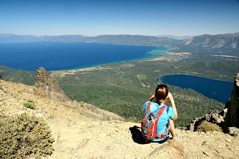
Hiker checking out the view from the edge of the cliff
After taking some pictures, we now started walking through the talus. Jean and Nathan
were already at the top. We could see that they weren't that far away, but reaching
them was slow-going because of the jumbled mess of rocks of varying shapes, sizes,
and angles (many of them thin and sharp). Eventually, though, we reached them, summiting
around 2:15pm, just a little behind schedule.
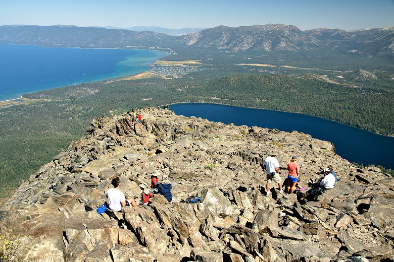
The view from the top, of course, was tremendous. We shared the summit with at least
15 other hikers and probably an equal number of chipmunks as we ate our lunch.
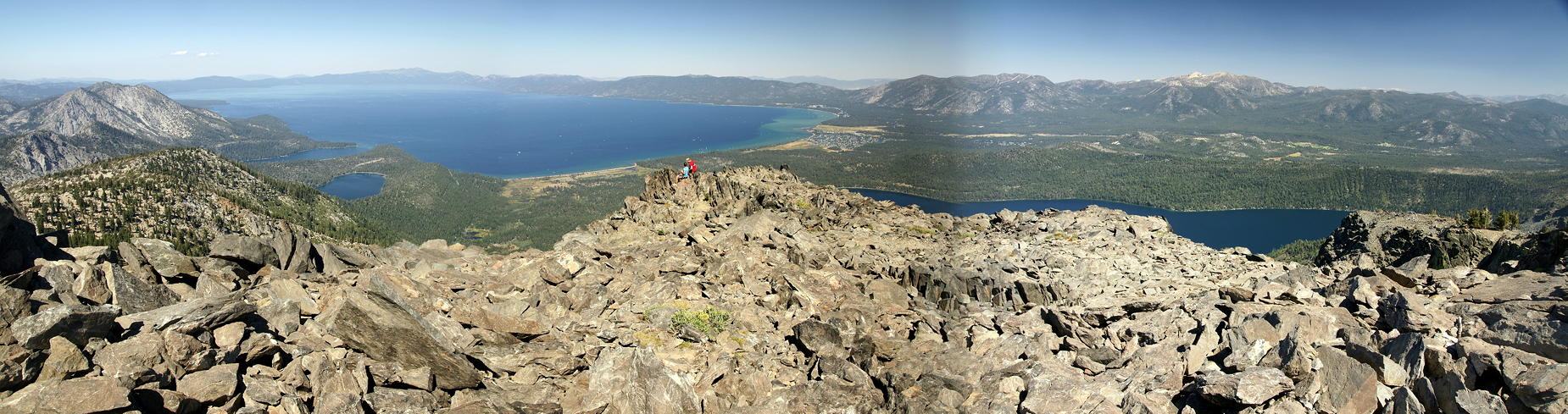
Afterwards we went to the very top itself, a
few feet away from our lunch spot. From there is a 360-degree view of the area.
Of course there's Lake Tahoe to the northeast and Fallen Leaf Lake to the east. There's
Emerald Bay and Cascade Lake next to each other at the southwest corner of Lake Tahoe.
There's Lake Aloha and the mountains above it. There's Gilmore Lake closest to us to
the southeast. There's Jacks Peak and Dicks Peak. There's Freel Peak beyond Fallen
Leaf Lake. Such an amazing view, and hardly a cloud in the sky.
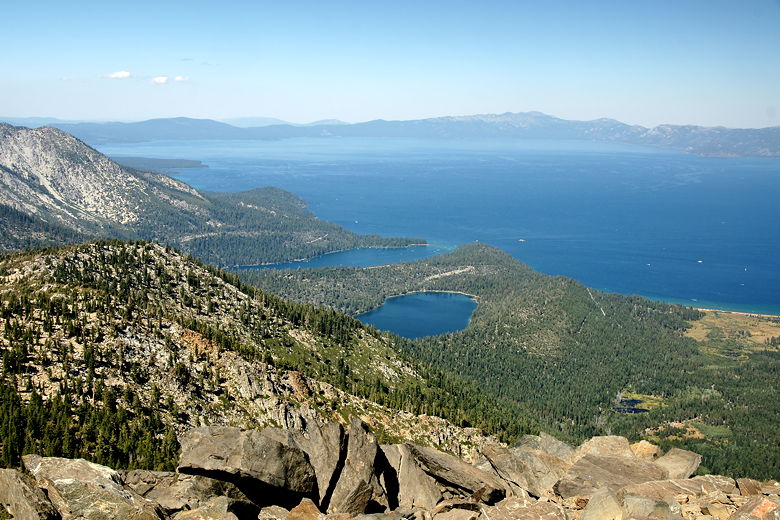
Emerald Bay, Cascade Lake, and Lake Tahoe
|