|
Monday morning, we woke up around 7am, had breakfast, cleaned up, and
did our final packing, leaving our rental house in Mammoth Lakes around
9:20am. We had an appointment to be picked up at 11am at South Lake, and I
didn't want to miss it. We had discussed several ways to complete the
near-loop in the months and weeks before the trip. Many people just
hitch-hike from one trailhead to the other. I could have dropped off my
family at North Lake, driven the car to South Lake, then hitched a ride
back to North Lake to start the hike. The though of me hitch-hiking didn't
please my wife, though.
We also had someone who was willing to let us borrow his car, but then we
would have to return it and it was a bit out of the way. Finally, a high
school friend of mine happened to be in the area at the same time and
offered to drive us, but he had a trailer which wouldn't do well on
North Lake Road. So, eventually, we discovered that there are actually
several taxi options. We settled on Mammoth Taxi, which provides trailhead
service for much of the Eastern Sierra. It's a bit expensive, but it's
very convenient and appears to be pretty reliable.
We drove south on 395 and then up to South Lake, parking in the overnight
lot which was almost full. We arrived at 10:20am, then started to finalize
our packs. I dumped out the trekking poles and 4 packs, and did a final
weigh-in. I made a last-minute adjustment, tossing out my medium pillow,
then convincing Jared to use the lightweight down pillow instead (I'd
use his small pillow). We were still sort of finalizing things when the
taxi arrived, early, a bit after 10:45am.
Click here to see a list of food and gear we brought, and unused food/gear (click tabs at bottom to switch views).
The taxi had plenty of space, and we dumped everything into the back and were off by 10:50am.
The drive to North Lake only took about 25 minutes. We talked to the driver,
who told us that they even do transport for people doing the John Muir Trail,
taking them from Whitney Portal to Tuolumne Meadows (or Yosemite Valley).
Maybe we'll use them for that in the future. The driver said they do about
2-3 trailhead trips per day.
The driver drove into the North Lake campground and all the way up to the
Piute trailhead sign. We unloaded our packs and said goodbye to the taxi.
We relaxed a bit and ate the lunch that we had brought -- the last "real"
food we'd eat until Sunday. We only had 4 miles to travel today. Even though
it was all uphill (about 1700 feet), I figured we could relax a bit and take
our time.
While we were at the trailhead, some guys finished their hike out. They
had spent the previous nights at Muriel Lake, using it as a base camp for day
hikes to the surrounding area. They did mention that their Camelbaks froze
overnight at Muriel Lake (11,336 feet elevation).
When we told them we were about to start the
North Lake to South Lake trip, they said they didn't feel so proud of themselves
anymore.
While we ate our lunch, I suddenly realized that we only had 7 trekking poles
instead of 8. I was sure we'd checked the taxi before it left, and it was
nowhere to be found at the trailhead, so I concluded that I'd simply left it
in the car. I hadn't actually had time to count them before we left the South
Lake parking lot. I'd just assumed they were all together, but one of them
must have fallen to the side in the trunk. We would easily have noticed this
if we'd started the hike from South Lake, and then we'd immediately return
to our car to get it. But because of the shuttle thing, that wasn't
possible.
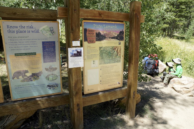
Piute Pass trailhead
Another guy came by the trailhead sign later, and we got to talking. It turned
out he'd be starting the same trip (North Lake to South Lake) that we were
doing, though he said they'd do it in 6 days instead of 7, starting
tomorrow. So we'd probably see him again later. He asked about the taxi,
and explained they had two cars and would leave one at South Lake.
He said they might try to make it all the way to Hutchinson Meadow tomorrow,
which is where we'd be camping.
Since I was already talking to him, I asked if he happened to have an extra
trekking pole, but he didn't. In hindsight, I guess I could have asked
him or someone else if they could drive me to South Lake and back so I could
retrieve the pole. But we just decided we'd make do with 7 poles instead of 8.
Jared doesn't really use his poles much, anyway. The only thing that
concerned me a bit was the river crossing. The Evolution Creek crossing looked
wide, and he'd probably need both poles for that. But I figured we could
still manage that.
So, around 12:30pm, we started off on the trail. We'd been at this
trailhead before - twice. Once for a hike to Grass Lake, and just last
October for a day hike to Lower Lamarck Lake. But this time, after hiking
for a couple minutes to the intersection, we continued straight toward
Piute Pass instead of turning left for the day hikes.
From the intersection, the trail basically starts climbing immediately and
fairly incessantly. It's a fairly steady climb, not too steep. But of
course since we had the full weight of our packs today, it wasn't easy.
The trail roughly parallels the North Fork of Bishop Creek heading upstream.
We rock-hopped it a couple times, passing a couple of women who were waiting
for their leader to head back down behind them. While we saw a couple day
hikers today, it was mostly backpackers that we saw, most of them heading
back to the trailhead.
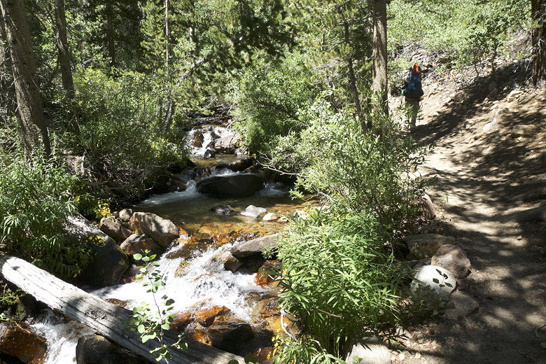
North Fork of Bishop Creek
After about 500 feet of climbing, the trail broke out into the open a bit
so that we could start getting some good views. Around this time we finally
ran into the group leader who was leading the other women downhill. Even
though she was heading out, we'd see her again later in our trip.
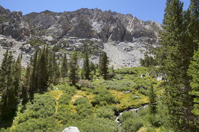
Mountains to the south
Above us to our right was Piute Crags, reddish-brown mountains to the
north. Behind us were better and better views of the valley. The trail climbs
granite rock steps, some of them quite high (especially for kids).
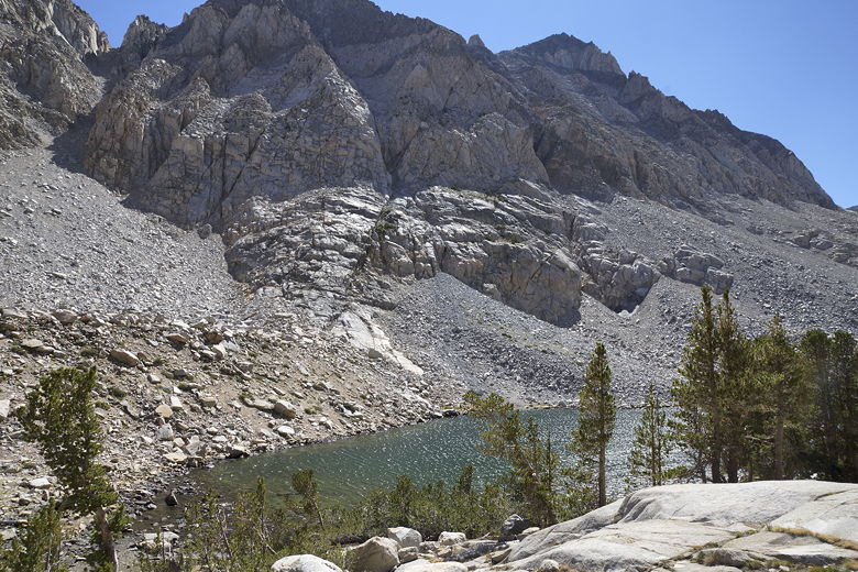
After about 2.8 miles, we reached Loch Leven, a pretty lake sitting at
10,743 feet elevation, about 1400 feet above the trailhead elevation.
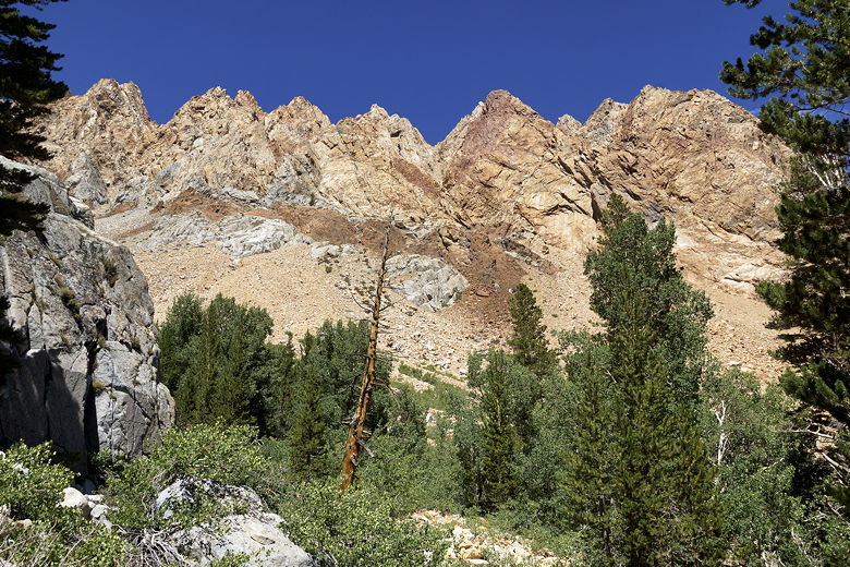
Piute Crags
View looking southeast
Lone tree, not sure what kind
Looking southwest up the trail
View to the east
Mountain above Loch Leven
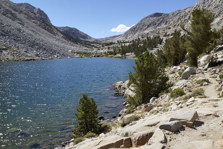
Trail next to Loch Leven
We enjoyed a nice snack break at Loch Leven, then continued up the trail.
From here, the trail is easier, since there's only about 200 feet left to
ascend. There are several smaller lakes or ponds between Loch Leven and
Piute Lake. Soon enough, we reahed Piute Lake, elevation 10,958.
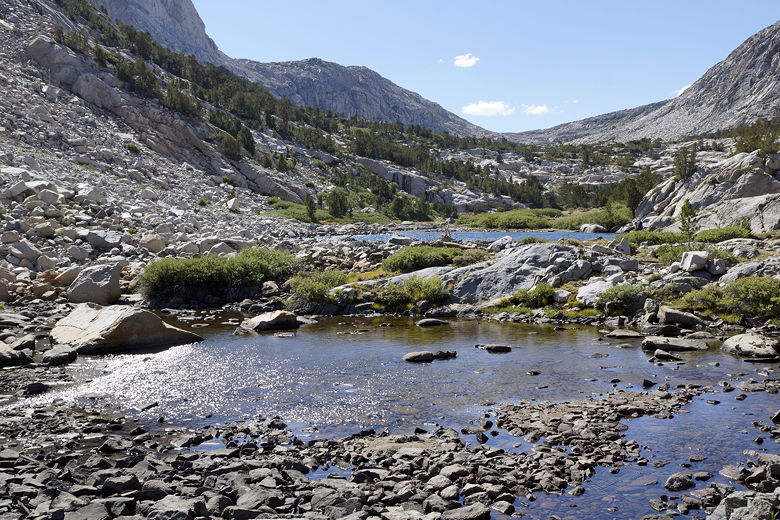
Ponds between Loch Leven and Piute Lake
There's a small stone and wood structure near the eastern end of Piute
Lake. I'm not sure what it is. It is fairly far from the main trail,
so I don't think it's an emergency shelter, though I'm not sure what it
is.
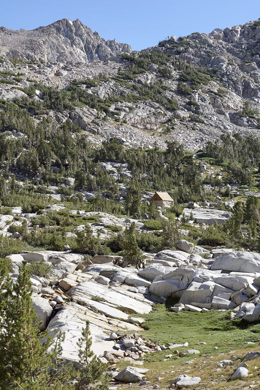
Small structure near Piute Lake
We put down our packs, then started looking for a camp site. One thing I
wish I had brought (sort of) was FRS radios; they would have been nice to have
while looking for campsites. But on the other hand, I didn't really want the
extra weight. In any case, we made do without.
There was
a large camp site near the northeastern shore of the lake. We looked in vain
for a nicer spot closer to the water that would fit our tent. We
eventually just stuck with the camp near the northeastern shore. It was
still only 5:30pm, so we had plenty of time to enjoy a relaxing dinner.
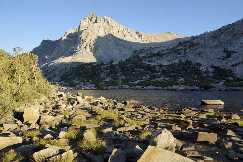
Piute Lake
Around 6:30pm, a large group of backpackers walked by. They eventually found
some sites about halfway up the shore, fairly far from us. After 7pm,
it got cold fast. At least it wasn't at all windy. We were so tired today,
though, that we were in the tent and asleep by around 8:30pm.
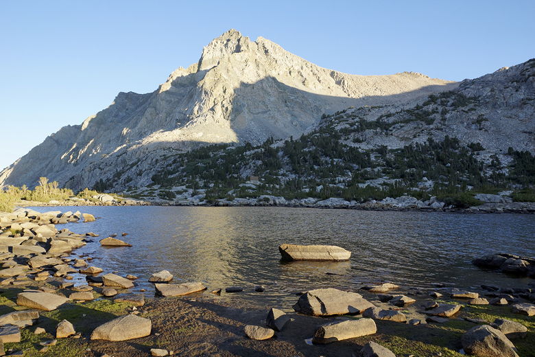
Piute Lake
At 10,958 feet elevation, the lake would be the highest campsite of this
trip, and in fact is the highest elevation we've ever camped at (the
previous high was Rae Lakes at about 10,600 feet). It showed itself
evident, too, as I developed a mild headache (despite having spent 3
nights sleeping at Mammoth Lakes).
| 

