|
We arrived in the nearly empty Eagle-Mosquito parking lot at 9:30am, just in time
to see some folks getting ready for a guided hike. We tarped our car near the
near end of the parking lot, since we'd be walking in the opposite direction from
the trailhead.
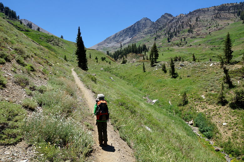
We got started at 10:10am, walking back down the road, crossing the bridge, then walking
along a path next to the bathrooms. Then we turned right and onto the wide dirt
road that is the start of the trail to Farewell Gap and Franklin Lakes.
The trail starts out relatively flat. Very shortly we passed the pack station on
our left. We didn't see any horses (or marmots) at this time, though we did soon
see a marmot perched on a rock next to the trail a little further ahead.
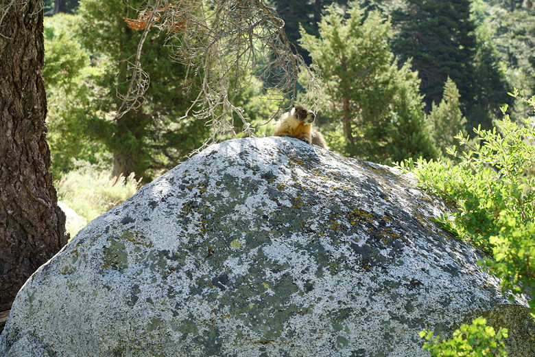
Marmot next to the trail
Marmot next to the trail
We'd been on this trail before on our way to Aspen Flat 6 years ago, and it hadn't
changed. After about a mile we crossed Crystal Creek; 6 years ago this had been an
ordeal, partly because we hadn't brought water shoes, partly because it was two weeks
earlier in the year, and partly because the winter had been much wetter. This time,
though, it was a breeze just quickly rock-hopping over what little flow of water there
was.
We shortly came to the Aspen Flat spur trail, but kept on the main trail. The trail
starts to climb a bit more, but still not too steeply. At this point a couple of
backpackers passed us headed in the same direction. We'd see them later. Next we
ran into Dan (our campground neighbor), hiking in the opposite direction with
his family. I'm guessing they'd gone to Franklin Creek and were now returning.
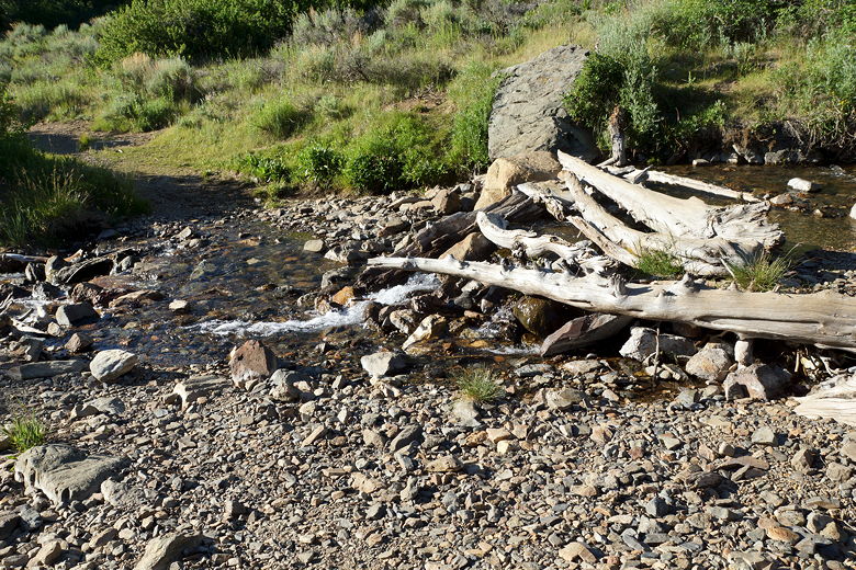
We shortly came to Franklin Creek, which was easily rock-hopped. The trail starts
climbing some switchbacks now, and we soon stopped for a break under some trees.
One of the backpackers (sans backpack) came racing down toward us. He'd apparently
taken a break here, as well, and had forgotten his walking stick. He grabbed the
stick and ran back up the trail to join his partner.
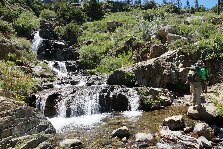
Crossing Franklin Creek
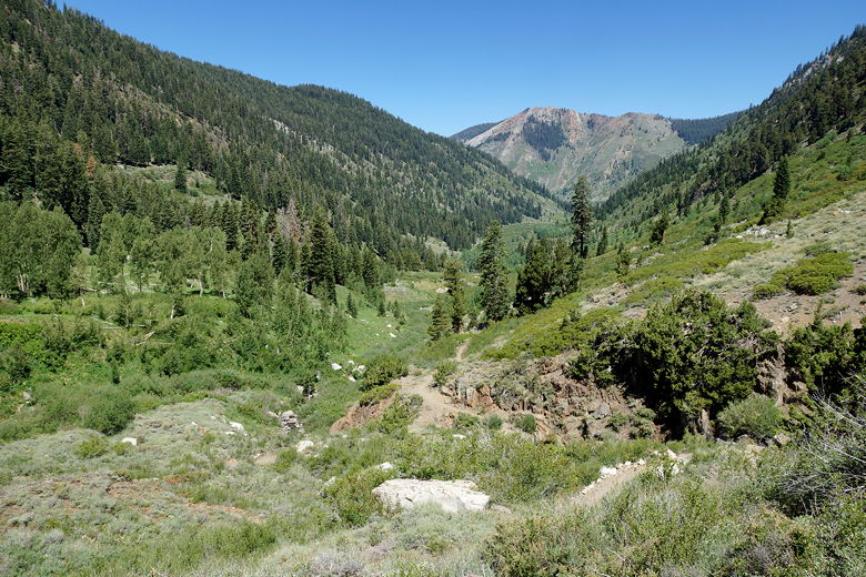
Looking back down the canyon
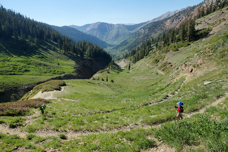
We continued up the switchbacks, before the trail straightened out a bit and
headed up the canyon. Up ahead, we saw the backpacking pair near the top of a
grassy hill, and a trail sign clearly visible on top of it - the next intersection.
Unfortunately we still had to navigate a long series of numerous switchbacks to
get there. The switchbacks almost seemed comical in their length and the lack
of steepness of the trail. I'm guessing the trail was built this way for the
benefit of horses, but I have to say that it just invites people to cut corners
(though we did our best not to).
Heading up toward the intersection
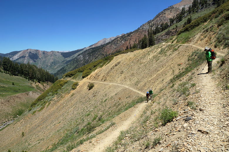
Switchbacks leading to the intersection
About four miles from the trailhead (with about 2 miles to go), we reached the
trail sign at the top of the hill.
The trail to the right leads to Farewell Gap. We took the left fork headed toward
Franklin Lakes. We spied a big tree up ahead which looked like the perfect resting
spot. Coincidentally, we saw that the pair of backpackers had had the same idea
and were just leaving the tree.
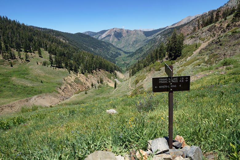
Trail intersection
A few minutes later we were sitting in the shade of the tree, enjoying the great
views looking over Farewell Canyon. We spied marmots here and there, both below
us and above us. After a snack break, we continued up the trail. It's not too
steep at this point, but there are steep drop-offs on the left.
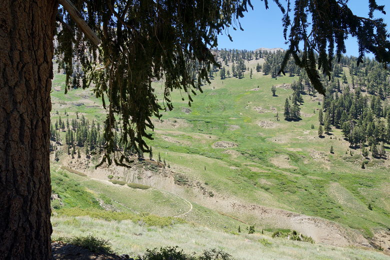
View from our rest stop
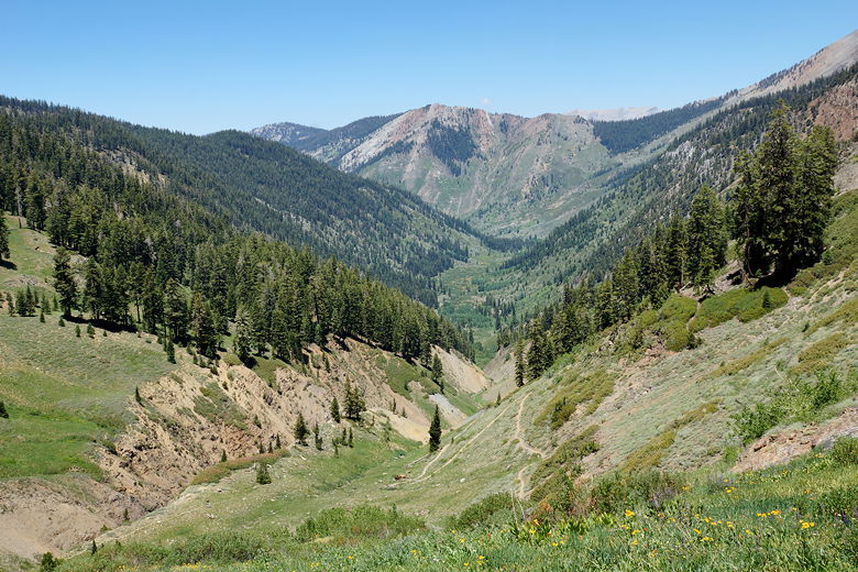
The map showed that the Lady Franklin Mine was to the right of the trail, but we
never saw any signs of the mine. Perhaps it's too far off the trail, or there's
not much left to see. We continued along the trail, which is a mostly unshaded
path through talus at this point. Nearing Franklin Creek again, we spied some
wild onions just before crossing the creek (again, easily rock-hopped).
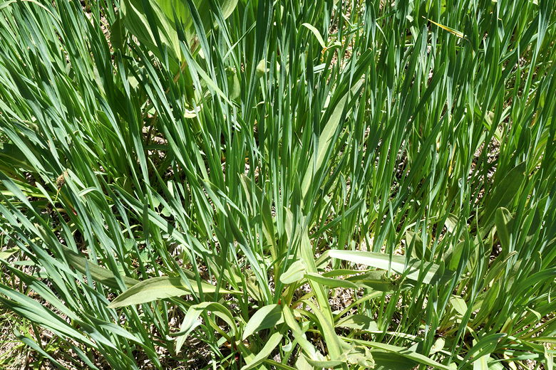
Wild onion
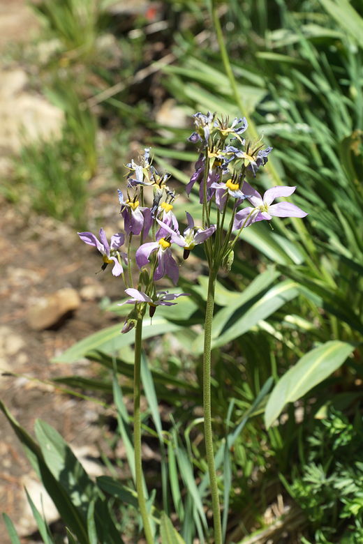
Wildflowers
We now had about a mile to go. We climbed up, spying what looked like was
possibly an old mine entrance on the left. It looked like there were some
use trails to get there, so we made a note to visit it on the way down.
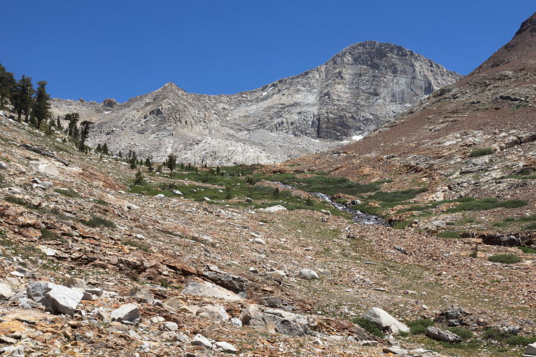
From here it looked like the lake was just up ahead, sitting on a plateau in front
of us. Unfortunately, as we climbed higher we realized that was not the case.
When we climbed higher we realized that the lake was a bit higher. Shortly,
though, we could see the dam at the far northwestern side of the lower lake.
It looked like the trail was headed straight for it. But every time I thought
we'd reached the last switchback, along came another one.
Final approach to the lake
We reached a sign warning backpackers to camp at least 100 feet from water, and a
bear box just in front of us. Surely there were no more switchbacks. Alas, there
were. The trail heads in the opposite direction and climbs some more before traversing
the slopes high above the northeastern shore of the lake. We now found ourselves a
hundred feet above and maybe 400 feet from the edge of the lake.
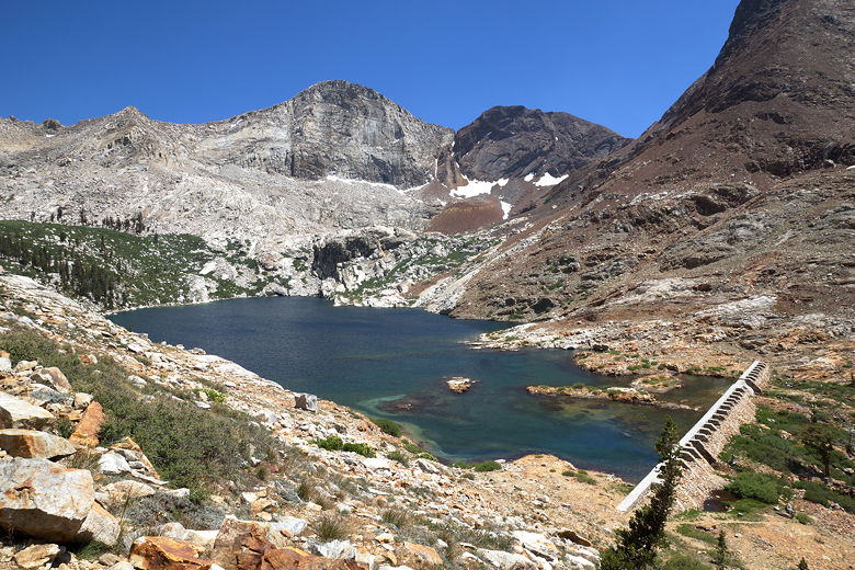
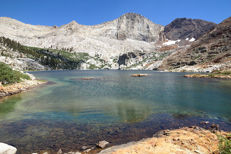
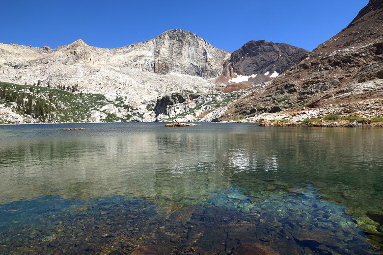
Franklin Lake from the trail
Scanning the lake below us, we couldn't see any good shaded areas by the shore. So
we opted to eat our lunch beneath the shade of a large tree between the trail and
the lake. We still enjoyed the view of the lake. A few clouds also drifted by,
momentarily blocking the sun, and it was noticeably cooler in general. That could
partly be explained by the fact that we were over 10,000 feet in elevation.
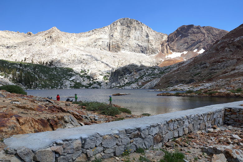
After lunch we walked down to the dam and the lake, carefully making our way
across the rocks until we found a use trail to the shore. I think I saw the backpackers
closer to the southeastern shore, but they left while we were still by the lake.
By now the wind had picked up a bit and it was actually getting a bit chilly. I
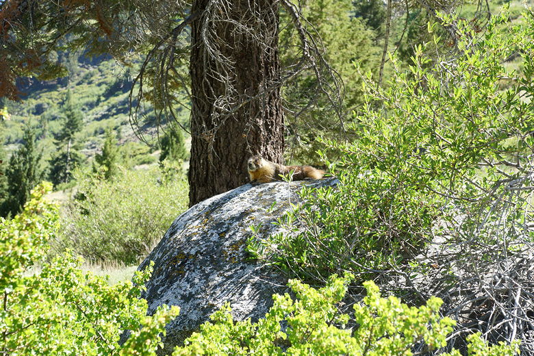
explored the shore a bit. We spotted two marmots chasing each other. Considering
the temperature I thought about not doing it, but I eventually kicked off my boots
and stepped into the water. Yikes, it was cold! Much colder than Eagle Lake or
Monarch Lake. We skipped rocks and enjoyed the lake, then started back.
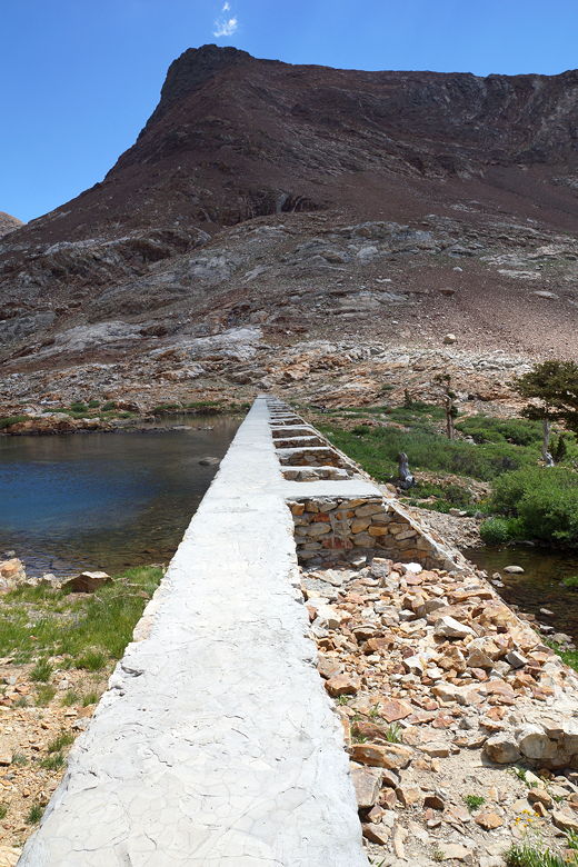
Franklin Lake dam
Franklin Lake dam
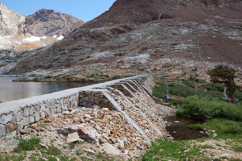
Franklin Lake dam
Franklin Lake
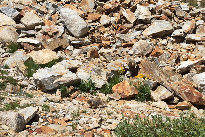
Two marmots
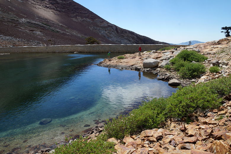
Playing near the Franklin Lake dam
Franklin Lake
Franklin Lake
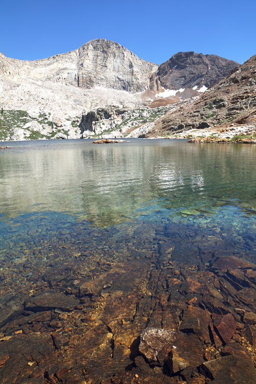
Franklin Lake
Rather than head back up to the trail, I spied a use trail that we used to get back
to the bear box, which was clearly visible from the dam. This was a much easier
route. If you're just planning to visit the lake shore (and not going past the lake),
then save yourself some trouble -- once you reach the sign and the bear box, just
walk to the bear box, then find a use trail up to the dam. You can thank me later.
We rejoined the main trail, descending back to what we thought might be a mine
entrance. It turned out to be just a small alcove. We returned to the main trail,
passing some backpackers who were headed up.
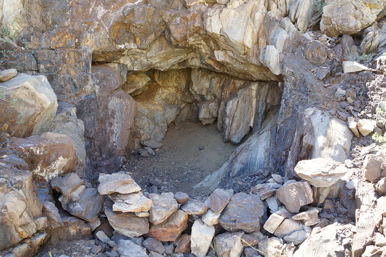
Alcove
We left the lake at 4pm, reaching the Farewell Gap intersection at 5pm, then reaching
the trailhead at 6:45pm. Along the way, we didn't see anyone else after those
backpackers near the alcove. Well, we did see some more marmots of course. You
can almost count on seeing several on any hike in the Mineral King area.
Descending switchbacks below the intersection
Crystal Creek crossing
| 

