|
We have a history of getting late starts each day on backpacking trips.
We knew that the JMT would be crowded (by backpacking standards), and
that many of the best campsites would be taken earlier in the day.
We wanted to avoid this problem as much as possible and start earlier. To
that end, I set my watch alarm for 6:15am for
this morning, though I didn't actually emerge from the tent until 6:45am.
We ended up leaving camp at 8:50am, which is quite good for us (in the
past, we'd get started between 10am-11am). For most of the trip, our
start times would be 8:30am-9:30am.
We got started just as the other group camping near us got started.
There were 8 of them, some of them who were just doing a short trip,
but some of them would be doing the entire JMT on almost the exact
same schedule as us. We would later learn they were the
Cullen family. They'd started from Mono Meadow. Today they'd be camping at Little Yosemite
Valley and doing a side trip to Half Dome. I had done Half Dome
as a day hike years before, and the rest of my family had no interest
in Half Dome, so we would skip it.
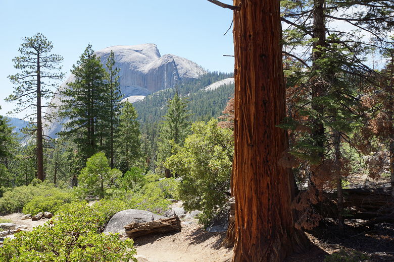
We hiked through the burned area we had seen yesterday, then climbed about
500 feet. The trail drops down briefly (about 150 feet), then climbs
another 200 feet to an intersection after which we took a break. We had
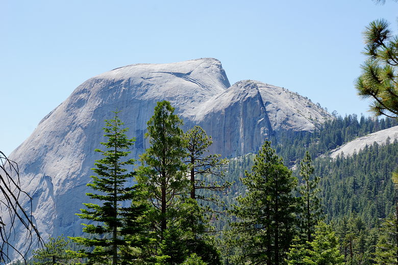
views of Mt. Broderick and Liberty Cap through the trees here.
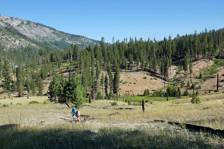
Hiking toward the burned area
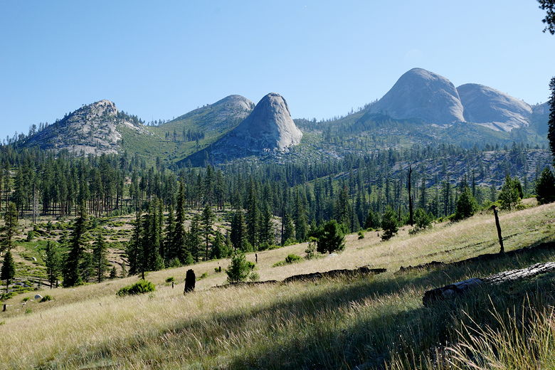
Mountains to the east
Burned area
We now descended to the John Muir Trail, which we joined just before
it reaches the top of Nevada Fall. As you might expect, there were lots of
people here. I took out my phone and got signal, checking the weather
(rain still forecast for Sunday) and notifying our resupply and pickup
friends that we were on schedule. I basically only used my phone for those
two purposes throughout the trip, otherwise keeping it turned off. Truth
be told, I'd rather never turn it on while backpacking, but since it was
such a long trip and we were depending on other people, I felt it
necessary to do so.
Heading down toward Nevada Fall
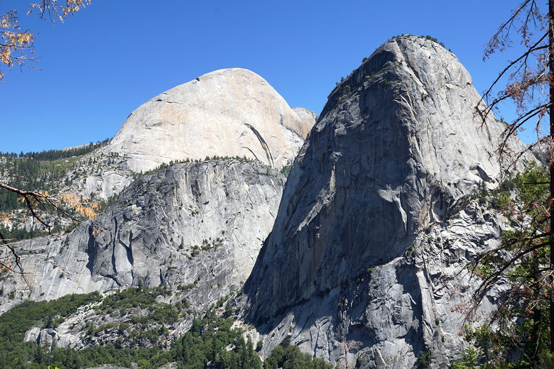
Half Dome, Mount Broderick, and Liberty Cap
Liberty Cap
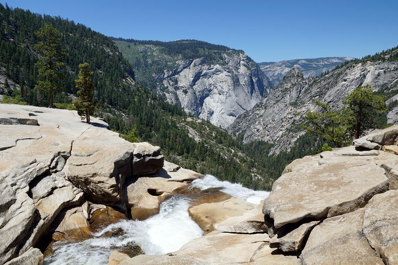
Top of Nevada Fall
We left Nevada Fall around noon. Instead of hiking back down the Mist
Trail like we had on Tuesday, we now hiked up past the bathroom toward
Little Yosemite Valley. We stayed on the John Muir Trail toward the camp
(there's a slightly shorter alternate path you can take, that most
Half Dome hikers take). There's another set of bathrooms at the camp.
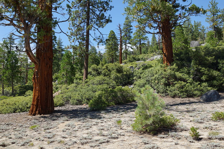
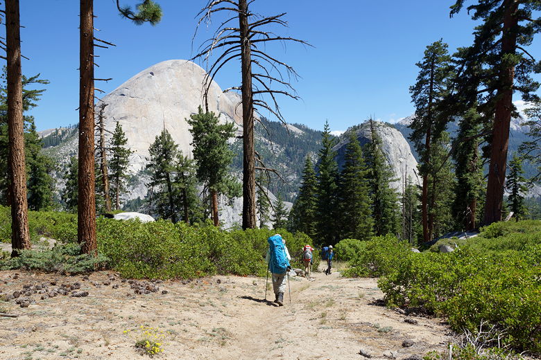
Pine trees
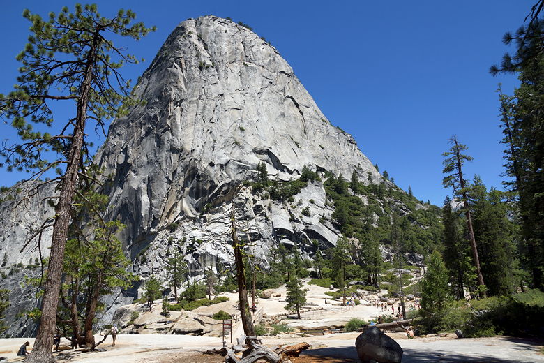
Pine tree and Half Dome
Top of Half Dome
From here, we climbed about 900 feet to the Half Dome intersection.
We ran into lots of Half Dome day hikers descending, as well as some
backpackers. This was a tough little stretch of trail, as it was
a hot day (my watch read 92 degrees at one point). We ran into
a couple doing the JMT as well, going in the same direction.
They were planning to camp near the Clouds Rest junction (as were
we), and we'd run into them a few times over the next few days.
They said they were planning to exit Whitney Portal on August 8th,
just two days after us.
We stayed on the JMT at the Half Dome junction, then went another half
mile before reaching the Clouds Rest junction. We crossed a small stream,
then took the trail as it made a sharp right turn. We noticed someone
already camping nearby. We decided we would keep going a little further,
as the book I had mentioned some good spots near the creek crossing
further up.
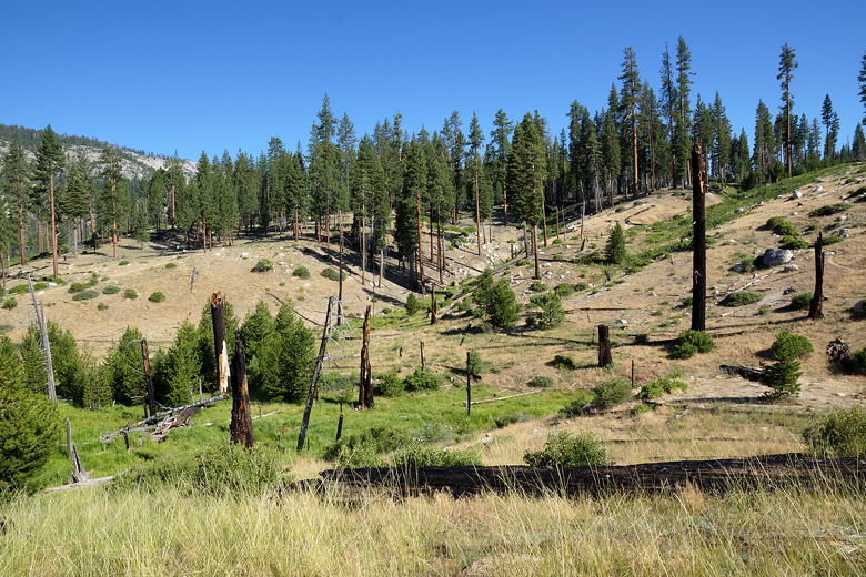
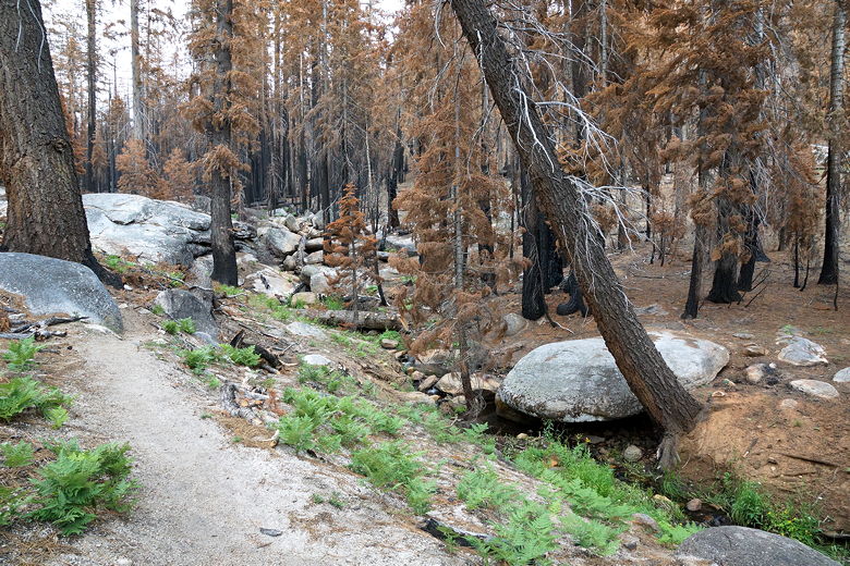
Unfortunately, that book was a little out of date since the "Meadow Fire"
had burned this area the previous year. We entered the eerie burned
area, but decided to keep going. While the area was burned, Sunrise Creek was
still flowing and clear (though small). Just before the next creek crossing
we started looking for a site and found a suitable one up on a small hill.
We did have to be a little careful about stepping on ash, and we had to be
sure to situate our tent in a spot where it wasn't in danger of falling trees.
But otherwise it was fine.
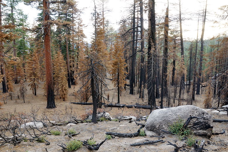
Burned area as seen from our campsite
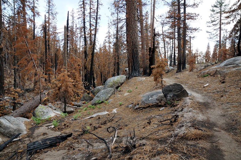
Burned area near Clouds Rest junction
Sunrise Creek flowing through burned area
It was warm enough tonight that we slept without the rain fly on (the only
night of the trip we did this). We also had the entire place to ourselves.
| 

