|
(Note, my GPS lost signal for some time during the hike, so the track above is edited and not complete.)
We arrived in Yosemite Valley on this Tuesday morning, finding one of the last parking
spots in the dirt hiker parking lot about a half mile from the trailhead. It was a
hot summer day as we prepped in the lot before starting at noon.
We walked about a half mile on mostly flat trail/sidewalk next to the road, past the
bus stop (where a bus dropped off a full load of passengers in front of us), and to
the Happy Isles trailhead.
We turned right and walked with the masses to the start of the trail. The trail starts
off flat, wide, and paved. Soon it starts climbing and begins to narrow a bit,
but remains paved for quite some time. It basically follows the Merced River along
the way, though it is sometimes out of view.
As we started to climb, we ran into a woman and her 2 daughters going in the
opposite direction. For some reason, she
had the sense we were doing the JMT, even though we wouldn't be starting it for
2 days, and started talking to us. Her two daughters were 8 and 13 years old, and
they were just finishing the JMT (starting about 35 miles south of Whitney and
going northbound (NOBO)),
partly because of the difficulty of getting a southbound permit starting at
Happy Isles. So, right away I knew Jared (9 years old) wouldn't be the youngest
one doing the JMT this year! My other son pointed out that their combined ages
(20) were still less than the girls (21).
We continued up the trail, climbing about 300 feet up to a bridge with a view
of Vernal Fall above. There's a water fountain on the other side of the bridge
where hikers were drinking and filling up their water bottles. We crossed
the bridge then came to an intersection where we turned right, off the Mist
Trail, and onto the John Muir Trail. This is a longer, more gradual climb
than the Mist Trail. It's also used by horses, and unfortunately this is
very evident as you walk on the trail.
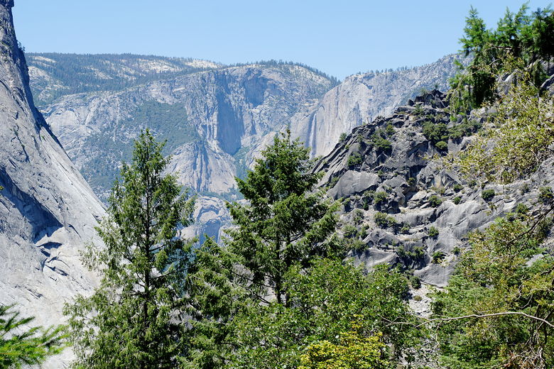
Looking back at Yosemite Falls
Most hikers appeared to be headed *down* the John Muir Trail, having probably gone
up the Mist Trail. We wanted to do the opposite so we would know what it was
like heading up the John Muir Trail as if we had gotten a permit to start at
Happy Isles (the traditional endpoint of the trail). There's not much to see
at the start, but eventually we got views of Mt. Broderick and Liberty Cap
beyond Nevada Fall. When we got to Clark Point, we had more expansive
views, including of Nevada Fall itself.
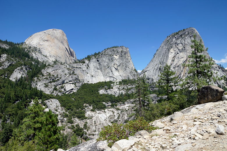
Half Dome, Mount Broderick, and Liberty Cap (left to right) from the John Muir Trail
From Clark Point, we could now take a short trail to rejoin the Mist Trail,
but we instead stayed on the John Muir Trail. There's a large arc section
of trail bordered by a stone wall with great views of the falls. After
passing through this area we saw a trail coming in from the right - the
trail we'd be taking two days from now from Illilouette Creek.
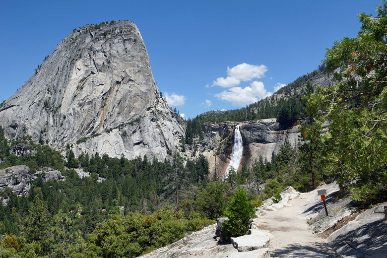
Liberty Cap and Nevada Fall from Clark Point
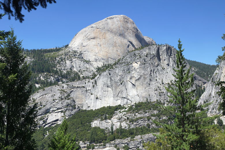
Half Dome and Mount Broderick
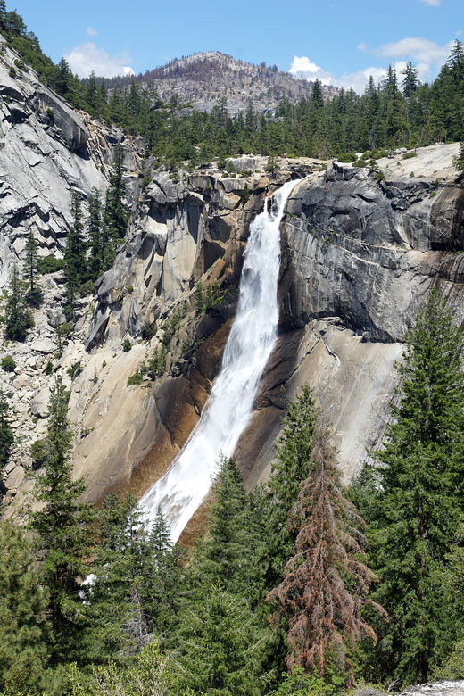
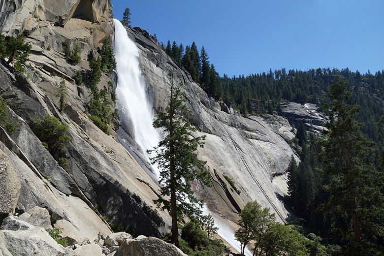
Nevada Fall
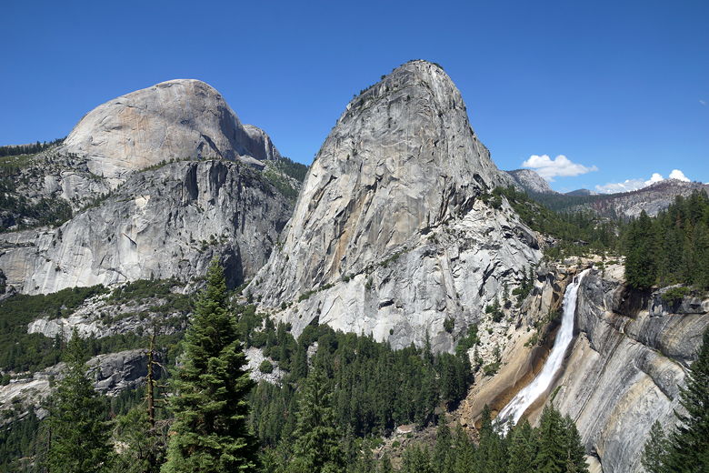
Half Dome, Mount Broderick, Liberty Cap, and Nevada Fall
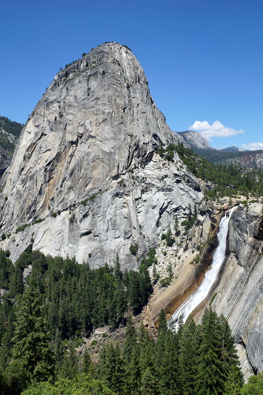
Liberty Cap and Nevada Fall
From here it's an easy flat walk to the top of Nevada Fall. There's ample
space here for a lunch break or a rest by the Merced River, which flows past
granite shores here. After taking a break we crossed the bridge over
the river and then walked up to the next intersection, where there's a bathroom.
From here, you can continue along the John Muir Trail up toward Little Yosemite
Valley and Half Dome. Instead, we turned left and started the return trip
downhill on the Mist Trail.
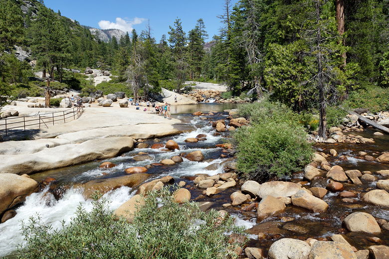
Merced River above Nevada Fall
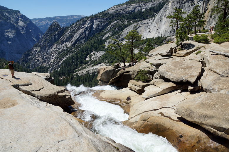
Top of Nevada Fall
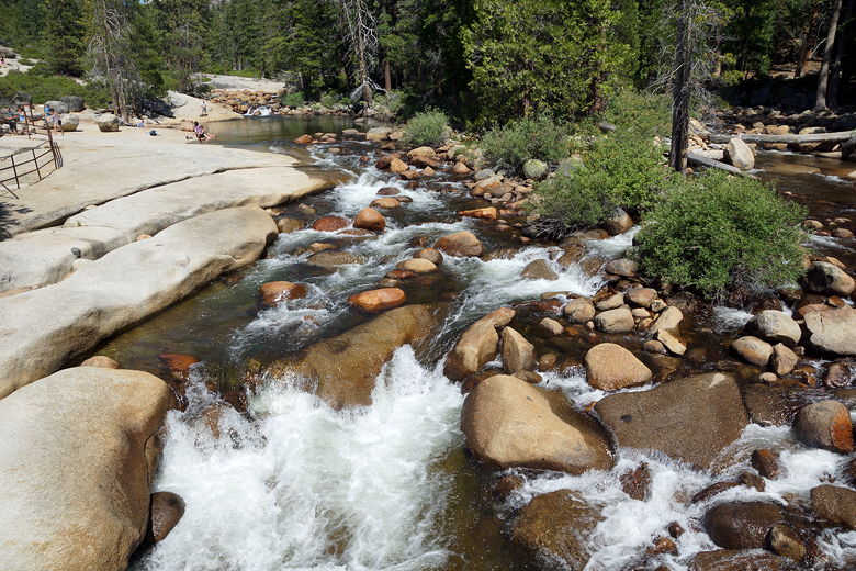
Merced River above Nevada Fall
The trail is steep and rocky as it heads down. Soon we had some nice views of Nevada
Fall, although I would say the best views of the falls are from the John Muir Trail.
You are closer to the falls on the Mist Trail, though. After viewing the falls,
we continued down and stopped near the Emerald Pool at the top of Vernal Fall.
This was a very crowded area, with people picnicking and a few people ignoring
signs not to enter the water. One guy used the rocks at the far end of the pool
as a water slide. There are lots of signs warning about people going over the falls
from here (many people have died going over the falls from here).
Nevada Fall from the Mist Trail
After our break, we walked toward the granite at the edge of the falls, then along
the railing toward the trail back down. There's a short section here which is
single-file, with a railing on one side and a rock wall on the other. One woman
coming up was in clear distress -- either winded from the climb up, or scared of
falling, or maybe both. After letting her pass with her friends, we descended this section and
then continued down the trail. The rock steps seemed shorter than when I'd done
the trail many years earlier. I seem to remember some of them being 2 feet
high or more, but they've probably done some work on the trail to improve this.
Heading down the Mist Trail below Vernal Fall
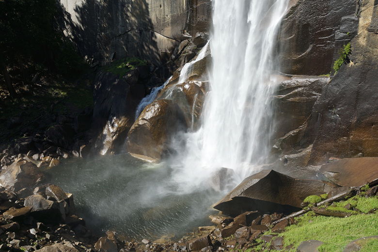
Bottom of Vernal Fall
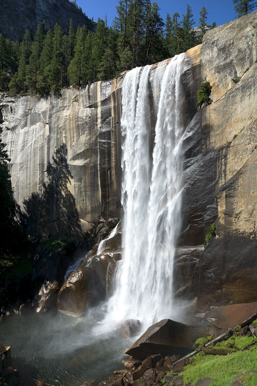
Vernal Fall
After the rock steps, the trail turns to gravel. After it reaches the JMT
intersection and the water faucets, it returns to pavement. From there it was
an easy shaded descent down to the sunny trailhead. Near the bus stop was a snack
stand where we got ice cold sodas and then returned to the parking lot.
| 

