|
We arrived at the Camp Sacramento parking area around 11:20am. The large lot was almost
full, but not overflowing like I thought it might be on this Labor Day weekend. It was
a sunny day, but not clear - it wasn't cloudy, but we could see signs of smoke.
After the trip, I found out that the smoke was from the Rough Fire, a large wildfire way
down in Sequoia/Kings Canyon. I hadn't thought the smoke would travel that far, but it did.
In any case, it wasn't so bad that we were going to cancel our hike. We prepped and left the parking area around 11:40am, walking up the dirt road to the trailhead. There were
a handful of cars parked by the sign. If you arrive early enough you can snag a spot, but if you arrive late it's probably not even worth trying. I'm not sure if it's worth trying in any case since it's really not that far to walk to the start of the trail.
There's a sign and a box of wilderness permits here. We filled one out and were on our way. The trail climbs through the forest, starting up gentle switchbacks. To be honest, there's really not much to see for maybe the first 800-1000 feet of climbing. It's just forest and more forest.
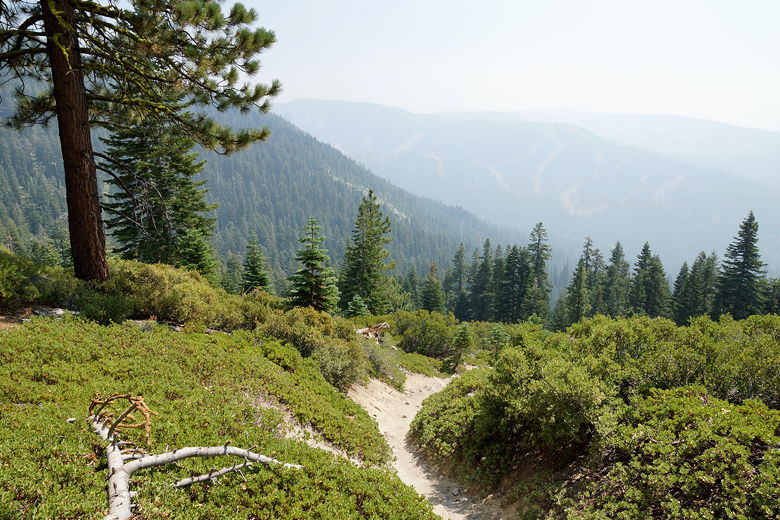
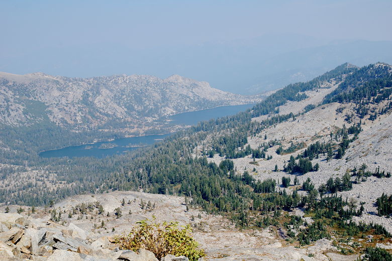
After climbing 800 feet or so, we started to see glimpses of the mountains to the south across Highway 50. However, the smoke dampened the views. Later, as we got higher still, we could start to see the mountains to the east, but again the smoke lessened the views.
At this point, the trail came out of the heavy forest cover and started to climb more
steeply. In many places the trail is straight up, no switchbacks, and very sandy. On
the bright side, the views did start to open up to the east and south, though still
marred by smoke at this time.
Looking back at the smoky skies
Looking back down
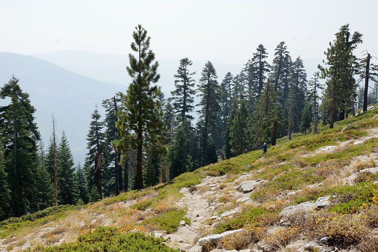
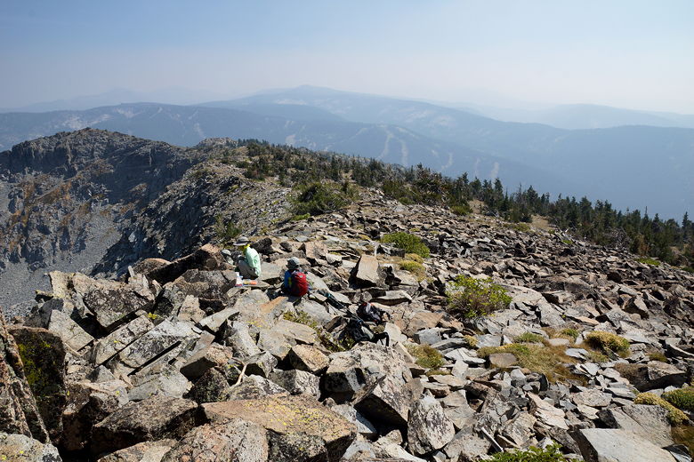
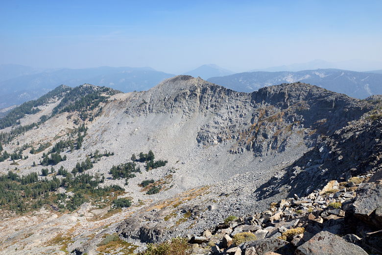
We did run into some hikers today, but not nearly as much as on the hike to Dardanelles Lake and Round Lake the day before. We saw some near some rocks, where there would be a view to the west, but again the smoke hadn't cleared yet. We got glimpses of Pyramid Peak and other mountains in the Desolation Wilderness to the west, but again the smoke limited the views.
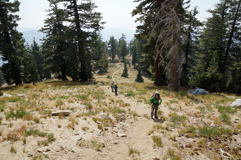
We stopped for a snack break after climbing for about 1000 feet. We still had about 1700-1800 feet of climbing to go. After a 20 minute break, we were back on the trail. At about 8400 feet elevation the grade eases a bit briefly. We next came to an unmarked intersection. The intersection wasn't on my trail map or my GPS. The main trail continues mostly flat (even slightly downhill) to the left. I knew that it would eventually curve to the right, and then we'd take a spur trail to the right to the peak. But the trail to the right in front of us clearly headed up and was a shortcut straight to the top. It looked well-used. After some discussion we decided to take it.
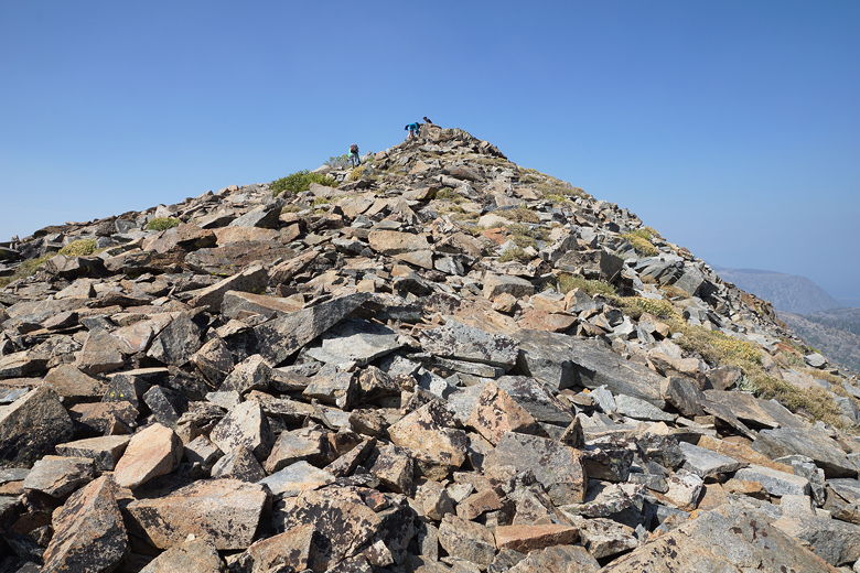
Up we went. It was steep, but not any steeper than anything we'd just climbed. Before
we knew it, we only had 500 vertical feet to go. Then 300. Near the top we came to a talus section where cairns show the trail curving around to the right before curving back to the left and reaching the peak.
Climbing up the use trail to the peak
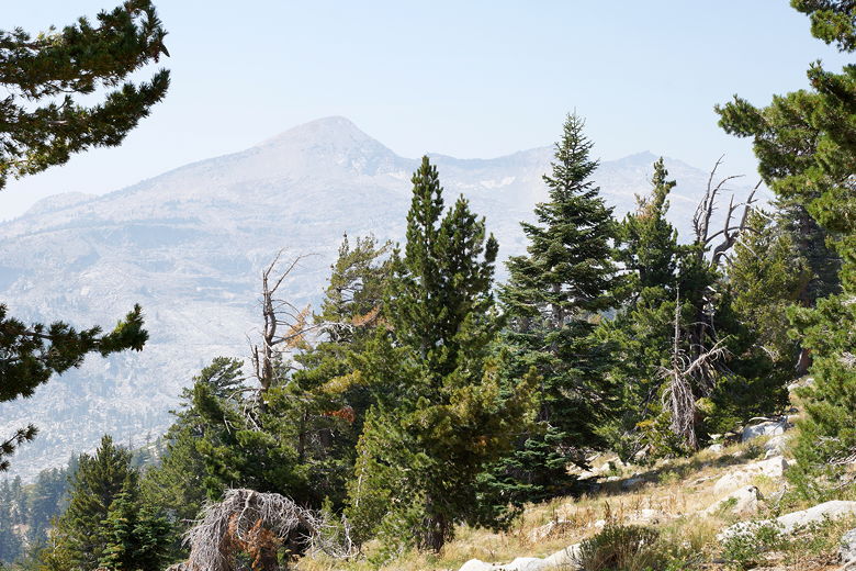
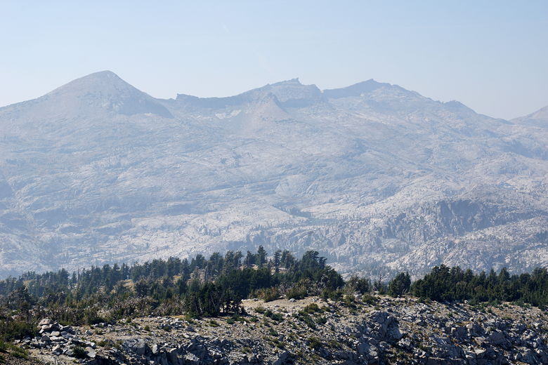
Hazy view of Pyramid Peak to the west
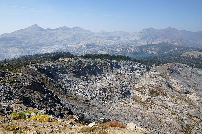
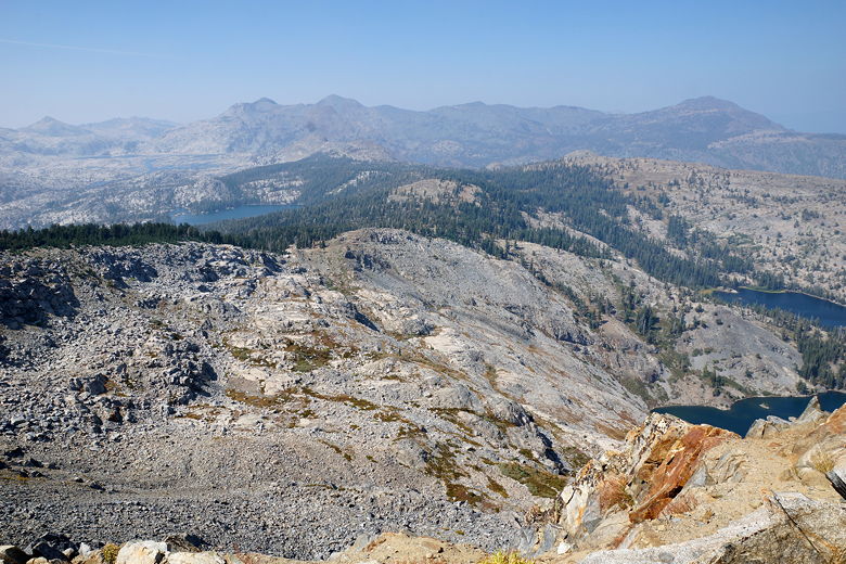
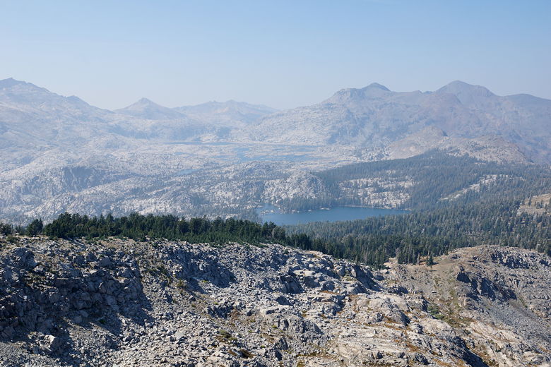
From the top, we had a nice view of Echo Lakes below us to the northeast. To the west, we could see Lake Aloha in the distance, backed by Pyramid Peak and others. To the northwest, we could barely make out Fallen Leaf Lake, probably Baldwin Beach, and a part of Lake Tahoe behind it, all of it obscured by smoke. Directly below us were Tamarack Lake and Ralston Lake.
Echo Lakes from Ralston Peak
Ralston Peak
View to the west
View to the west
View to the east
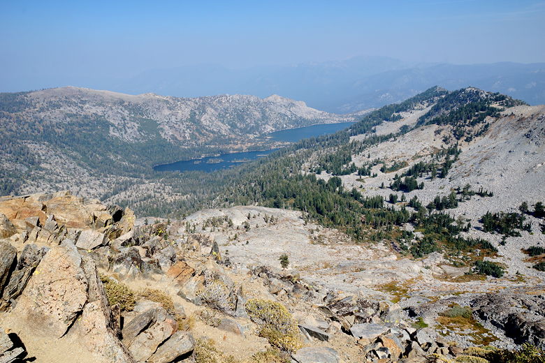
Lake of the Woods (foreground) and Lake Aloha
It was rather windy at the top, but we sat down and had a late lunch. A few
others (including 2 or 3 dogs) joined us at the top. On the way up a man
had warned us about marmots at the top, but we didn't see any. We
did see a chipmunk, but that was it.
Pyramid Peak (left)
Echo Lakes
View to the east
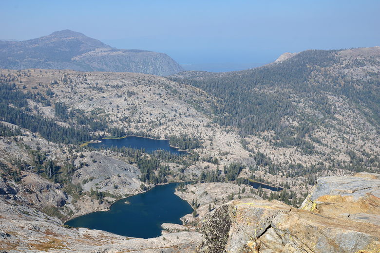
Tamarack Lake and Ralston Lake
After lunch, we started the descent. I had decided I didn't want to descend the same way, preferring to take the less steep standard way back to save my knees. So off we went down the talus toward the right. Unfortunately we didn't go right far enough. We soon found ourselves on a faint use trail that basically bisected the main trail and the trail we had taken up. We could follow the footprints for some time, but eventually we lost even the use trail. I knew if we kept descending we'd eventually hit the main trail, so that's what we did. Most of the time we were walking on easy sand, but there was one tricky section of talus. We tried to avoid stepping on any plants as much as we could.
Eventually we reached the main trail, almost perfectly bisecting the two trails all the way down. We turned left onto the main trail; this was the section of trail we hadn't taken on the way up. We followed it as it was mostly flat, though a little uphill. Soon enough we were back at the trail intersection we'd reached earlier on the way up, and turned right to begin the steep descent.
It was still hazy looking out to the west, toward the sun, but in the afternoon the view to the south and east started to clear up a bit. Still, the views here are nothing exciting. The only reason to really do this hike is the views at the top, and unfortunately the smoke marred those views today.
Starting to clear up a bit on the descent
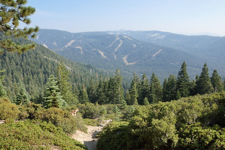
We quickly descended through the forest and back to the parking lot, which was still about half full.
| 

