|
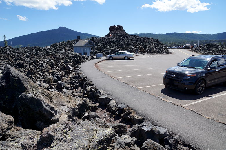
There were lots of cars parked at Dee Wright Observatory, but seemingly
all of the people were there just to check out the observatory, not to
hike to the lakes. The observatory itself is made out of volcanic rocks and
I'm sure provides some nice views, but we were going to be able to get
some of the same views on our hike, so we skipped the observatory.
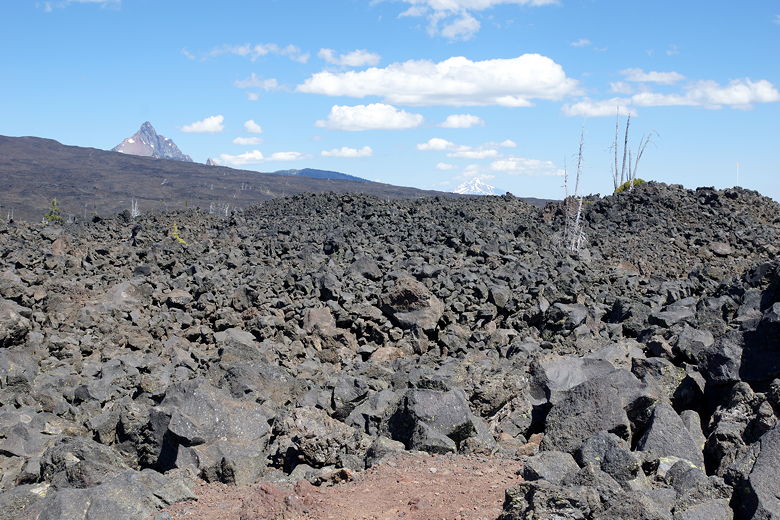
View from the parking lot
View from the parking lot
Dee Wright Observatory (center back)
Three Sisters from the parking lot
We parked at the far western end of the lot, as the trailhead is actually
west of the lot. While there is not a lot of traffic on Highway 242, and
cars go fairly slow here, there is also not a lot in the way of shoulder
here. So we were careful as we walked down the highway, then crossed the
road to the left to the PCT trailhead.
On the other side of the road, someone had pitched a tent for the night next
to a couple of cars they had crammed in. It's not really a parking area
so much as a pullout, so I wouldn't count on being able to park there.
The view from the parking area had been, um, interesting, as it felt like
we had driven up into some alien landscape. Volcanic rocks spread out in all
directions, with hardly any vegetation in sight. Now that we reached the
trail, that feeling just kind of intensified. Under our feet were volcanic rocks
of varying sizes. Sometimes we had to walk on top of big rocks, and
sometimes crushed rocks, and sometimes (thankfully) solid trail. But in
all directions were volcanic rocks. It was a unique experience.
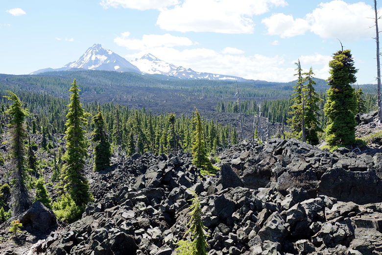
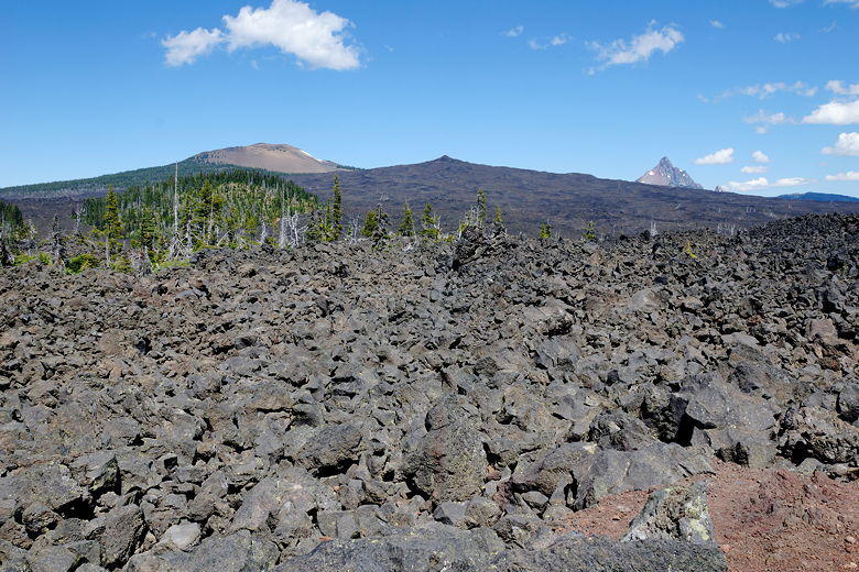
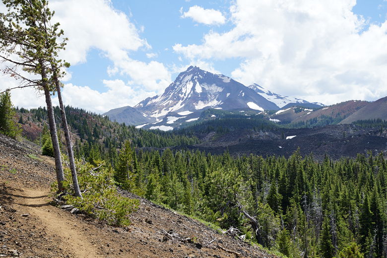
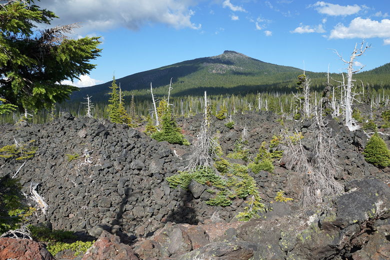
Three Sisters beyond lava field
We could see the forests in the distance, and some trees were trying to sprout
up amongst the rocks, but the rocks appeared to still be winning. Which is
a bit surprising since this lava field has been here for about 2000 years.
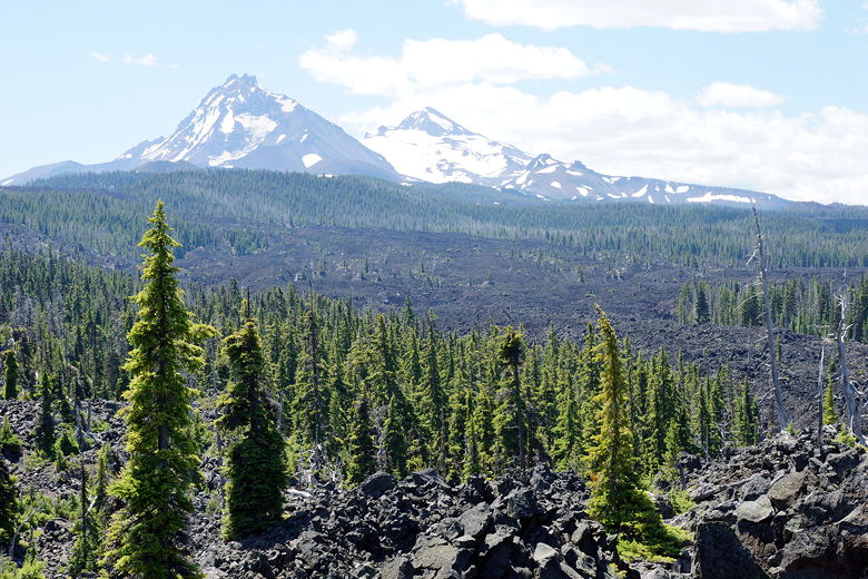
Three Sisters beyond lava field
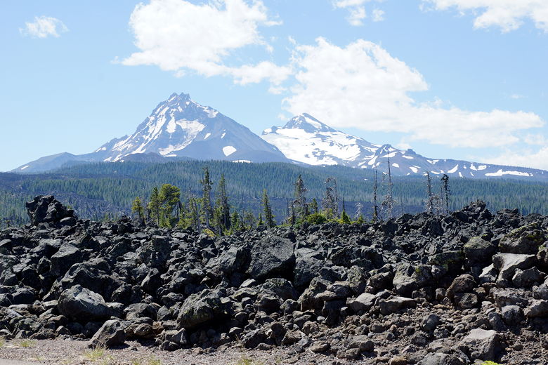
While we were walking in this alien landscape, we had views of the snow-covered
Three Sisters to the south. We had views of Mount Washington to the north,
distinctive with its steep summit.
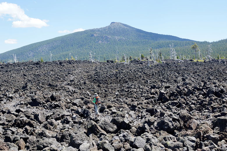
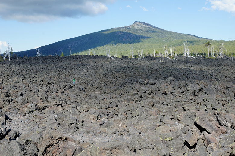
Hiking over the lava field
Mount Washington
It's tough going through the lava field. I did not look forward to hiking
it in the late afternoon heat on the way back. I suggested that we might
hardly see anyone on this hike. But I was wrong. Almost as soon as I
said that, we saw some backpackers heading north. I forgot we were on the
PCT, so there's quite a bit of traffic - probably people doing section hikes.
We will never do the entire PCT in one shot, and probably will never do the
entire trail, but doing a 2-3 week section of the PCT in Oregon sounds tempting.
We would also run into some day hikers, as well. But first, we had to hike
through this barren landscape. After a little over a mile, the trail exits the
lava field and enters the forest, reaching an intersection. To the left
is the trail to Lava Camp. An alternative would have been to start there,
which would have made for a shorter hike. But that would have avoided
hiking through the lava field, and as much as I complained about hiking in it,
it's a unique experience and sort of neat.
In any case, we turned right to head toward the lakes. About another half mile
or so later, we reached another intersection. The PCT continues to the left
toward South Matthieu Lake, while the trail to the right goes to North Matthieu
Lake. However, the trail to the right also eventually re-joins the PCT, so
it's a loop you can do in either direction.
We decided to take the left fork and stay on the PCT for now. Mosquitoes
were a little bit of an issue here at the intersection, but as soon as we
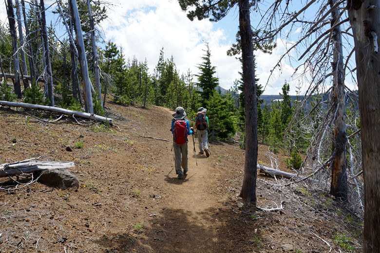
started moving we were fine. The trail starts climbing, about a thousand feet
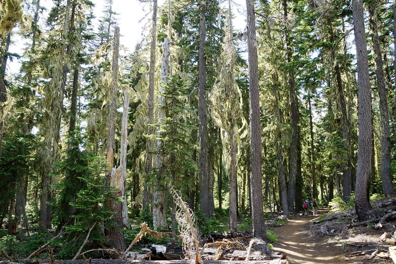
to South Matthieu Lake. The trail starts off in the forest, though it emerges
to provide some views further up. Eventually we could see North Matthieu
Lake below us to the right, with volcanic rocks between us and the lake. But we were
still headed south toward the other lake.
On the trail above North Lake Mattheiu
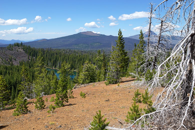
North Lake Mattheiu
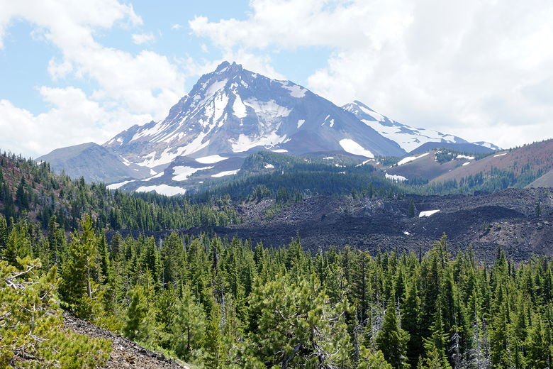
Three Sisters
Three Sisters
Despite the thousand feet of climbing, it's fairly gradual. Soon enough we reached
a sign telling us we were entering the South Matthieu Lake zone. There are only
3 specific spots at the lake that backpackers are supposed to use for camping.
We went past the sign and saw the lake below. At least 2 of those 3 camping sites
were already taken. We settled down by the shore for lunch.
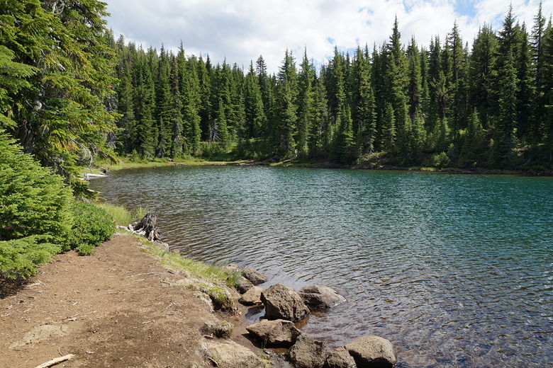
South Matthieu Lake
South Matthieu Lake
South Matthieu Lake
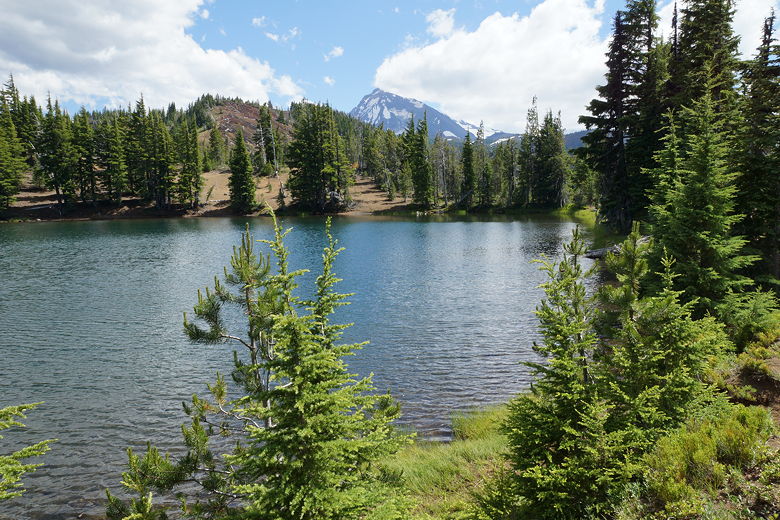
The lake is pretty small, and not much to look at. At least you can see the
North Sister behind it to the south. After lunch we returned to the sign,
then followed the trail downhill toward North Matthieu Lake. It's a fairly
steep descent, steeper than the ascent on the PCT. After descending for
about 3/4 of a mile, we reached North Matthieu Lake.
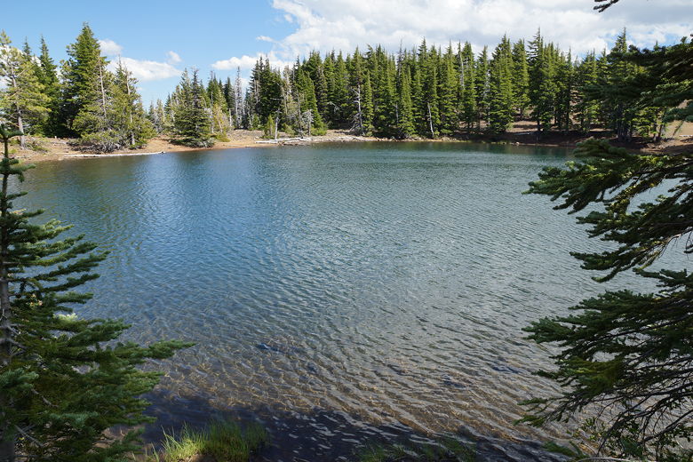
North Matthieu Lake
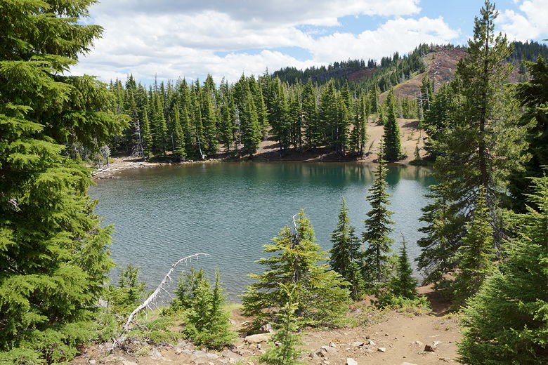
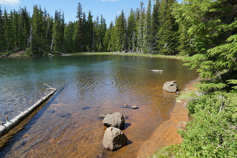
North Matthieu Lake is much larger and much prettier than South Matthieu Lake. Despite
this fact, there was no one else here. There are 7 numbered camp sites here, and as
far as I could tell, none of them were taken. Apparently PCTers are lazy and can't be
bothered to hike a bit off the PCT to get a better camp site (*). That just meant we had
the day use area next to the lake all to ourselves. If I had to do this hike again,
I'd have lunch at the north lake instead of the south lake.

North Matthieu Lake
North Matthieu Lake
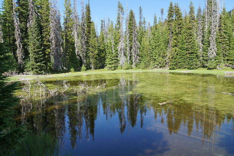
After enjoying the lake, we returned to the trail and continued the descent, which is
more gradual now. We passed a pond or two, then reached the intersection with
the PCT - the end of the loop section of the hike. We turned left to continue on the PCT
heading north. Thankfully, when we reached the lava field it had cooled off and it
was partly cloudy. We walked through the field, now noticing a view of Dee Observatory
to the north. Soon enough we were back at the trailhead. We walked back up the
highway to our car near the observatory.
Pond
Forest
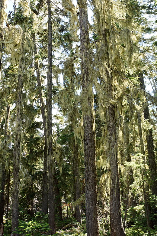
Forest
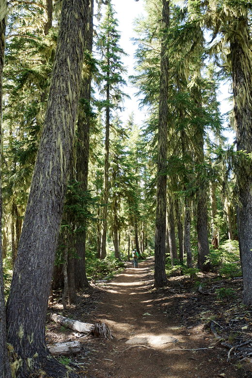
Forest
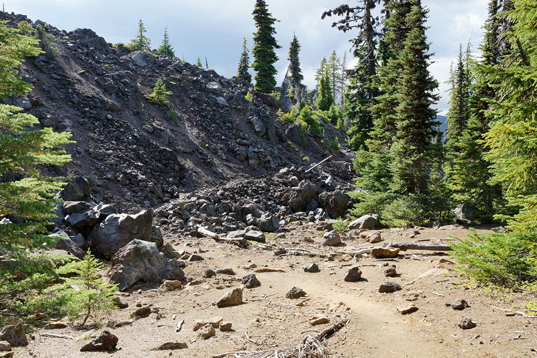
Heading back onto the lava field
Lava field
Hiking back through the lava field
(*) Truth be told, when we did the JMT, we never deviated from the JMT to get a
better campsite.
| 

