|
The Landmannalaugar hut kitchen is closed from midnight until 7am. However,
we had to get an earlier start since we had a long first day
ahead of us. I hadn't been able to reserve the Hrafntinnusker
hut, so we had to do a 2-day hike (about 15 miles) in one day.
I knew there wasn't a lot of climbing, but we still wanted
to allow us plenty of time.
So we got up around 5:30am, and were off on the trail at 6:30am,
probably the earliest we've hit the trail (other than when we
started a day hike of Mount Whitney). It was quite nice getting
out there, with plenty of light, while most everyone else was
still sleeping.
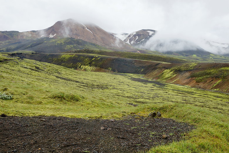
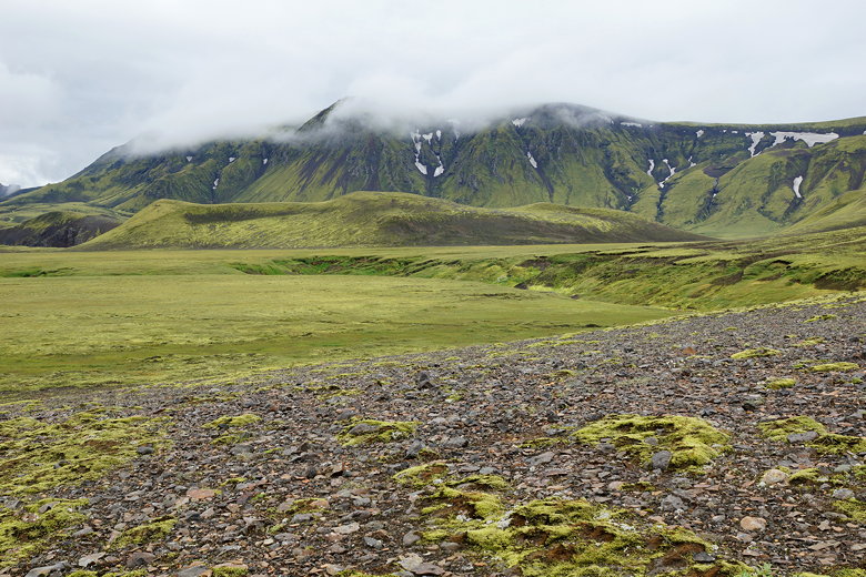
It was a little misty as we climbed up to the viewpoint I'd
visited the night before. It would be overcast or raining the whole day,
and we started the hike with our pack covers on.
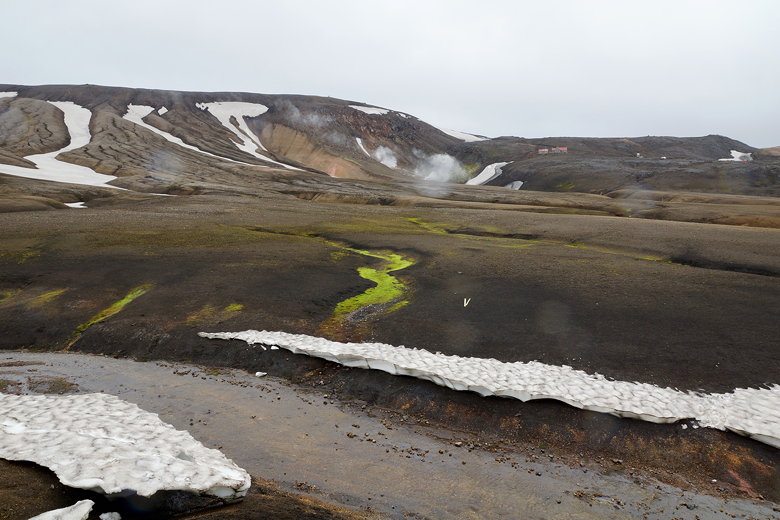
For now, though, we were mostly dry as we walked into a mostly
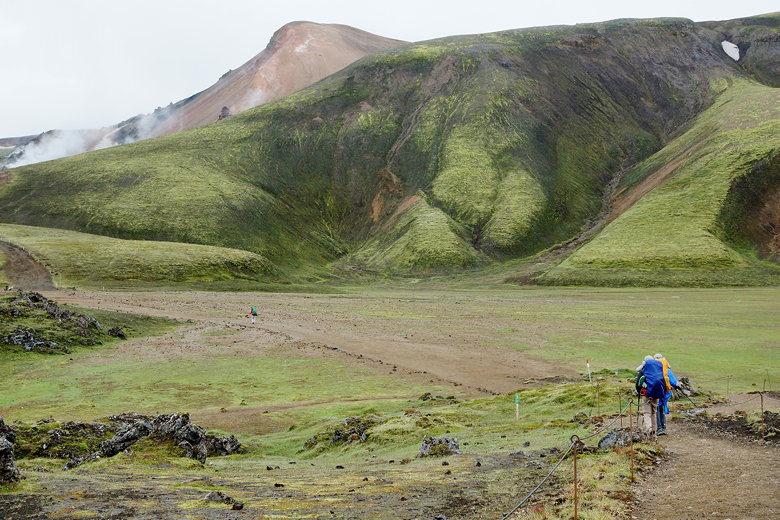
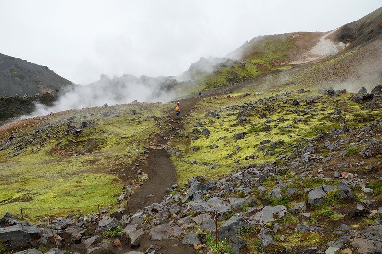
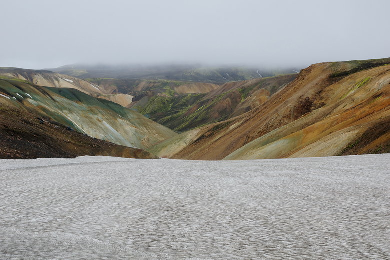
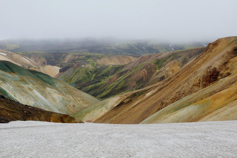
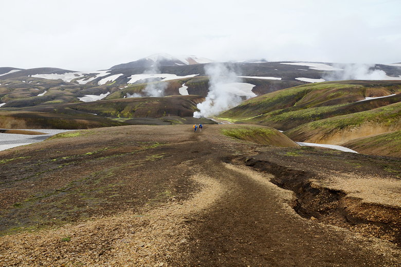
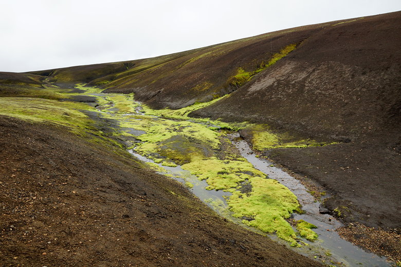
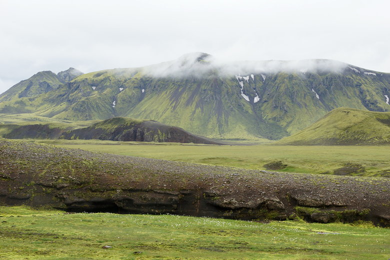
barren volcanic landscape. We could see steam rising from the
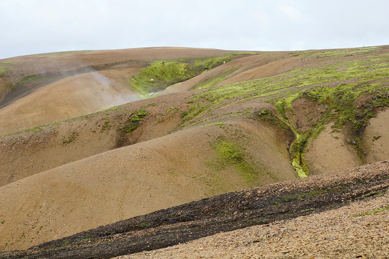
ground in several places. There are mountains, rock, and
green lichen painting the landscape. Occasionally we'd see small
pools of water. But in general it's a completely different
landsacpe than what we're used to. No trees or animals (other
than the occasional sheep or bird). The trail sometimes passed
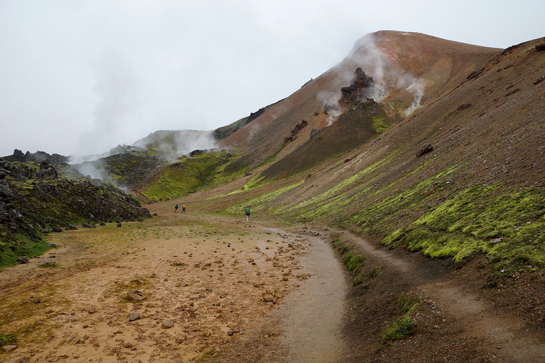
quite close to some of the steam, and we had to endure the sulfur
smell on a few occasions, including one stretch where we had a face
full of steam for several seconds.
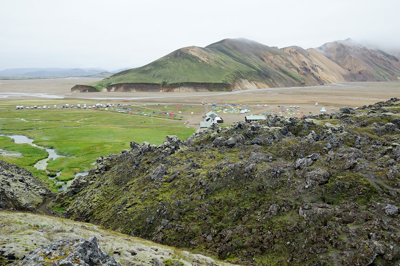
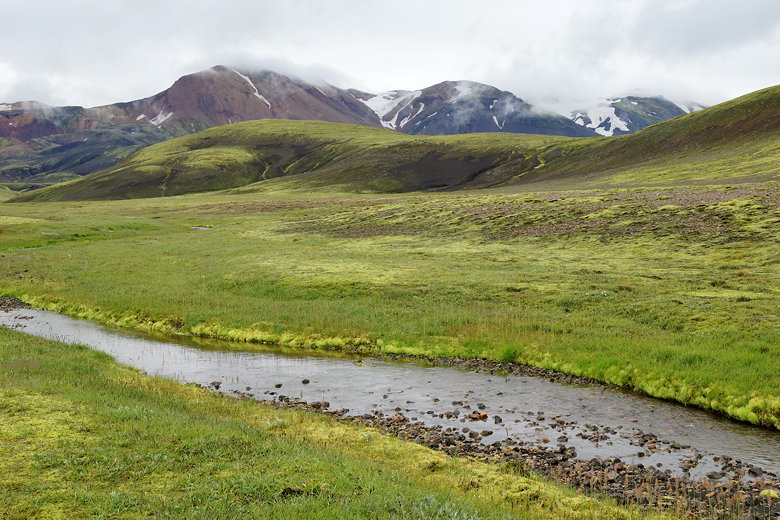
Landmannalaugar camp
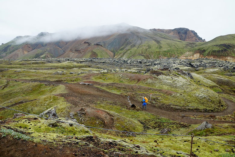
Hiking towards the steam vents
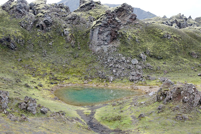
Pool
Hiking towards the steam vents
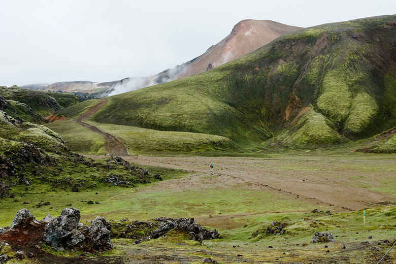
Hiking towards the steam vents
Hiking towards the steam vents
Hiking towards the steam vents
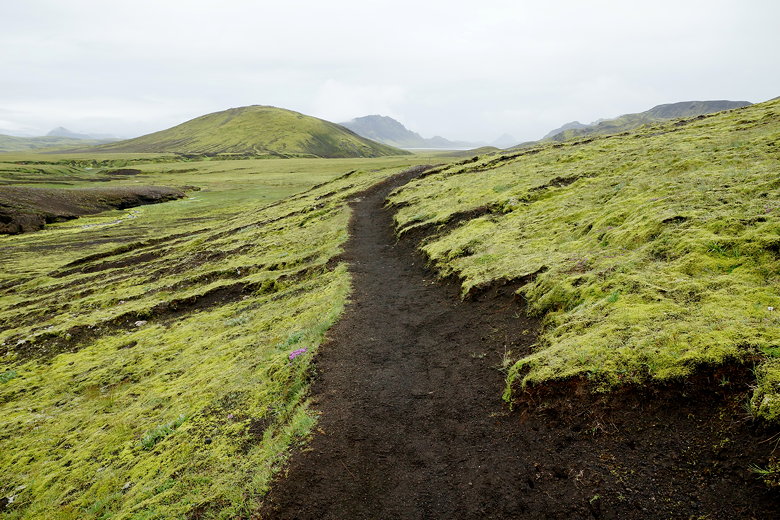
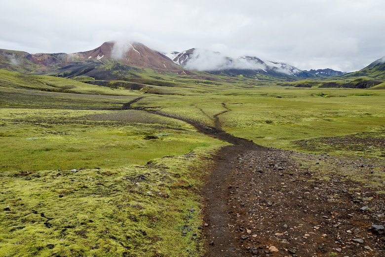
The trail is well-marked. I don't think anyone would ever be
in danger of getting lost (at least in reasonable weather
conditions). There are posts about every
hundred meters. Later I figured out that each post has a number,
counting down all the way to Skógar.
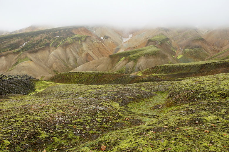
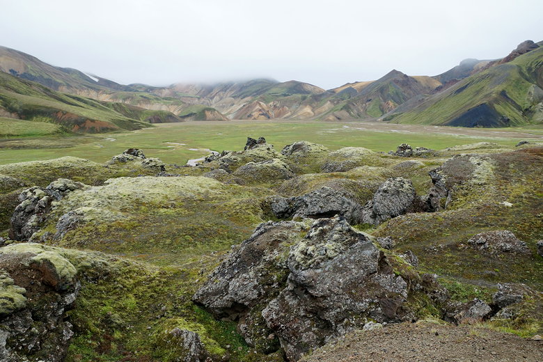
Painted landscape
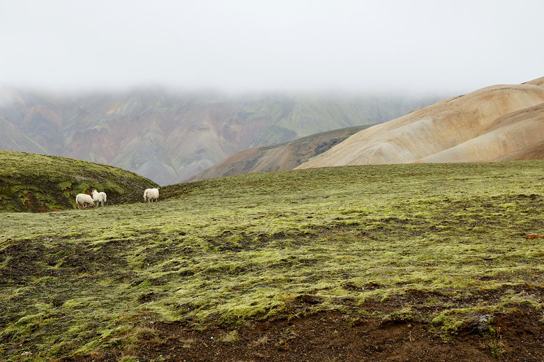
Roaming sheep
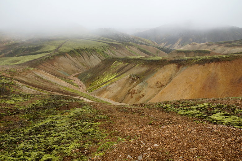
Painted landscape
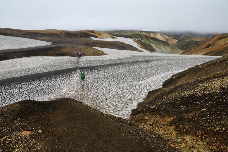
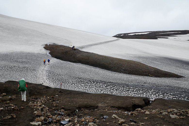
Crossing a snow patch
The trail itself is easy to walk on for the most part. Smooth
for the most part, without the rocks to navigate that we would
have to navigate in the Sierra. After a brief descent and then mostly
flat walking, we ascended again to some nice views.
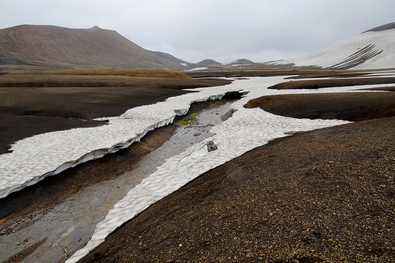
We crossed the occasional patch of hardened, blackened snow.
We saw very few people during this early morning time. There
were a few day hikers from Landmannalaugar, and we passed a
handful of backpackers, but that was it. In general, while it seems most
backpackers start from Landmannalaugar, there were a few in
the opposite direction as well.
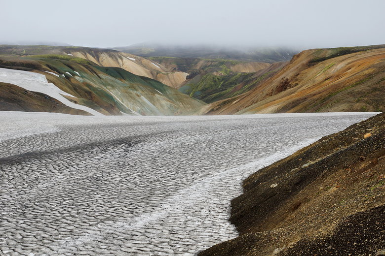
Hardened snow field
Hardened snow field
Hardened snow field
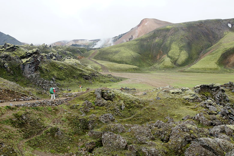
More steam vents
Sheep on the mountain
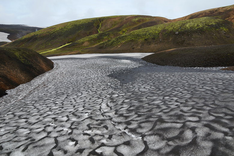
Hardened blackened snow river
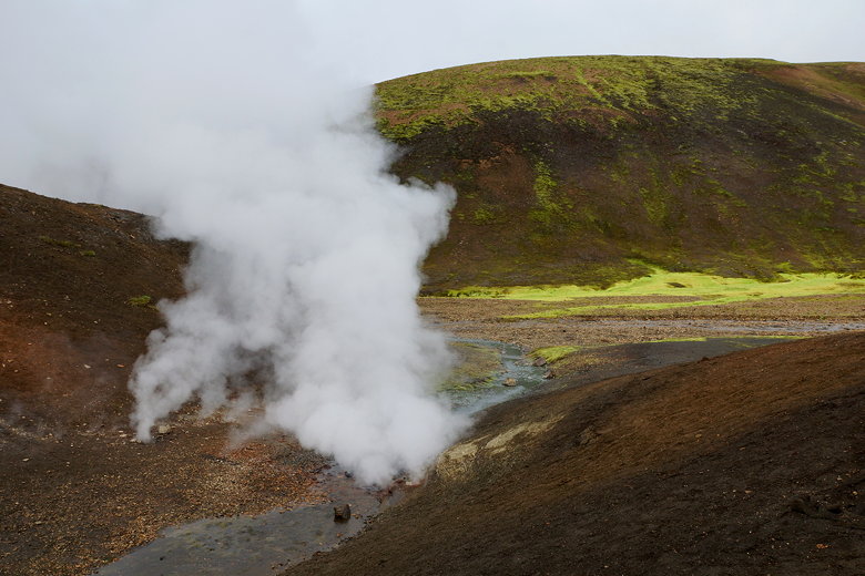
Big steam vent
Stream
More steam vents
More steam vents
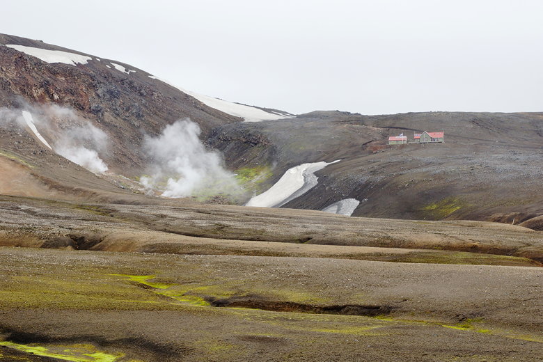
As we neared the Hrafntinnusker hut, we reached large cairn with
a plaque memorializing Ido Keinan, a young hiker who had died at
this spot in 2004 during a late June storm. "In loving memory of Ido Keinan who
passed away in a blizzard so close to the safe hut nearby yet so far at only 25 years old".
It was a sobering thought. You can read about his heart-breaking
ordeal online. Be safe out there!
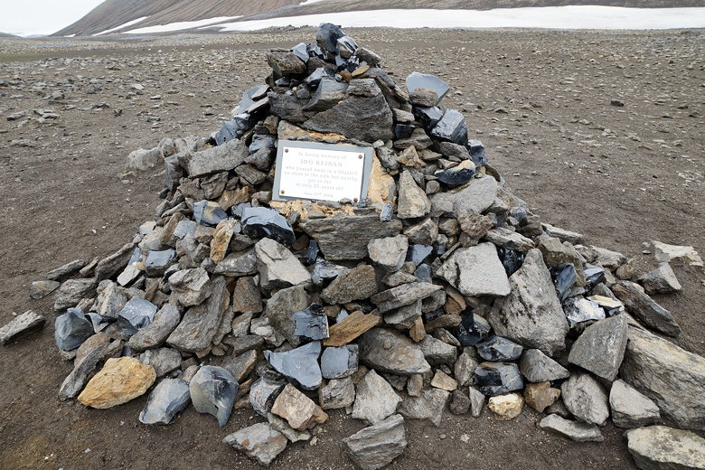
Memorial to Ido Keinan
Snow near the high point of the Laugavegur Trail
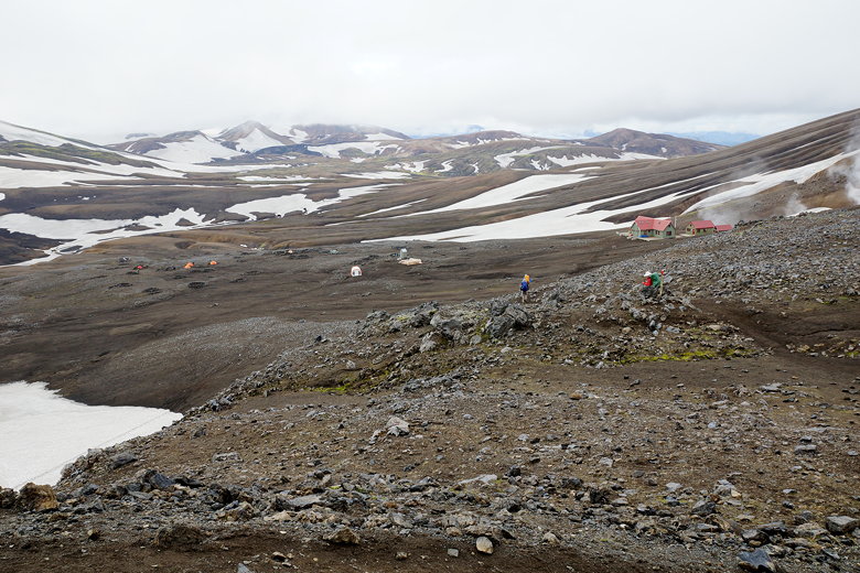
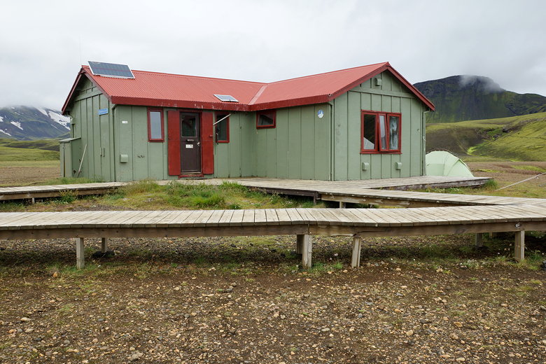
After almost 4 1/2 hours of hiking, we reached the Hrafntinnusker
hut at 10:50am. The hut itself was empty since each hut closes for cleaning
around 10am. There were still a few tents on the slopes below
the hut. It was windy as we sat on a picnic table next to the hut
and took a break. There are bathrooms here (though we had to use the
separate outhouse since the bathrooms were being cleaned at the moment).
Drinking water is also available. It was a little windy here, but
the sun came out for the first time. I took off my pack cover and jacket,
but this would turn out to be a mistake.
Hrafntinnusker hut
Tents below the Hrafntinnusker hut
Stream
Looking back up at the Hrafntinnusker hut as the rain starts
Looking back up at the Hrafntinnusker hut
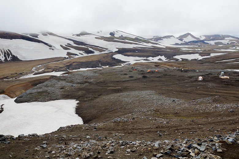
After a half hour break, we left the hut, knowing we were about half way
to our hut. We headed downhill from the hut, and almost immediately the
sun gave way to rain. I quickly stopped and stuffed my camera into
my pack, then put on my rain gear and pack cover. My camera would stay
stuffed into my pack, protected from the rain for the next 2 1/2 hours,
so I have no pictures from this part of the trail.
The rain was steady, harder than before, but you wouldn't call it a
downpour. More annoying than anything else. I didn't feel compelled
to bring out the camera, as the landscape was somewhat repetitive:
barren mountains, snow, mud, and a particularly bad stretch of
trail where the trail turned to a slippery clay substance, sticking
to our boots and threatening to send us sliding downhill.
After a lot of that, we could see Torfatindar, a majestic-looking mountain
below us, and I had to bring my camera out even though it was
still raining.
Torfatindar as seen from Jokultungur
Torfatindar as seen from Jokultungur
Next, we came to our first creek crossing of the trip.
Crossing a creek takes a bit of work in ideal situations, but doing
it while it's raining is even more annoying. We took off our boots
(trying to keep them as dry as possible, even in the rain), and
put on our water shoes. There was a large group of people here,
in various states of getting ready to cross or putting their boots
on after crossing. One brave soul decided he would make a running
start and make the leap over the water with his boots on. He made it
(barely). Everyone else crossed it in water shoes. The water wasn't
very deep - just under knee deep at the deepest part. But of course
it was cold!
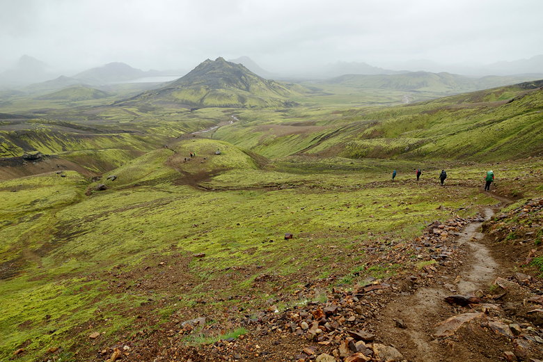
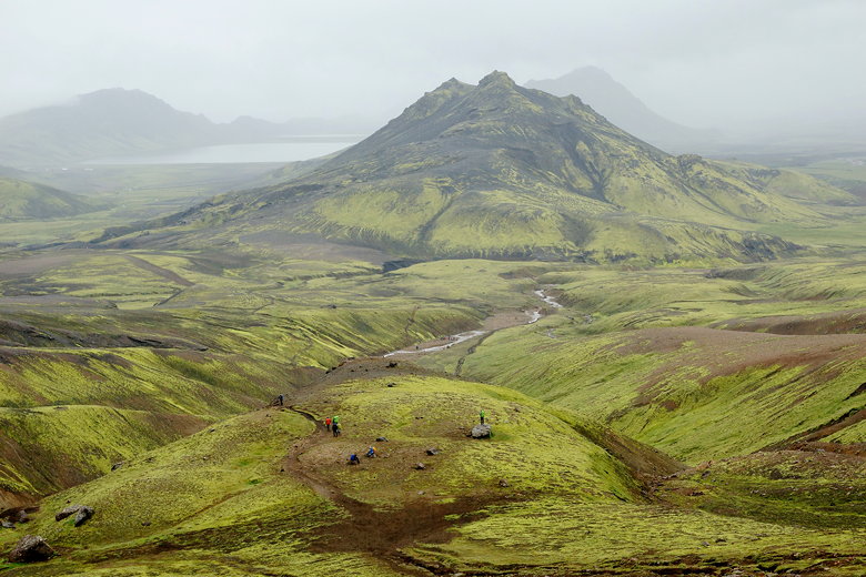
After crossing the creek, we climbed up, then the trail was mostly flat
or downhill the rest of the way. The rain finally subsided and I brought
out my camera for the last few kilometers. We could see the hut in the
distance on the edge of a lake, but we had to walk a long way on flat
terrain to get there.
Trail to Álftavatn
Looking back from the trail
View to the left
Looking back from the trail
View to the left
Final approach to Álftavatn
Final approach to Álftavatn
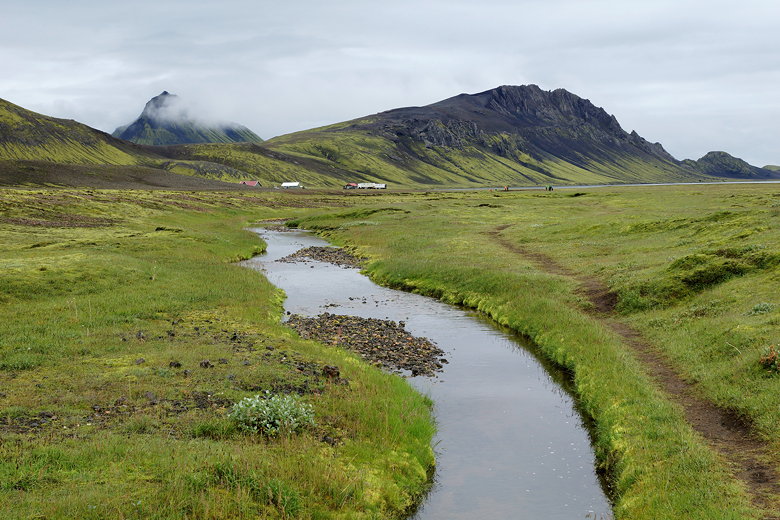
Stream leading to Álftavatn
Stream
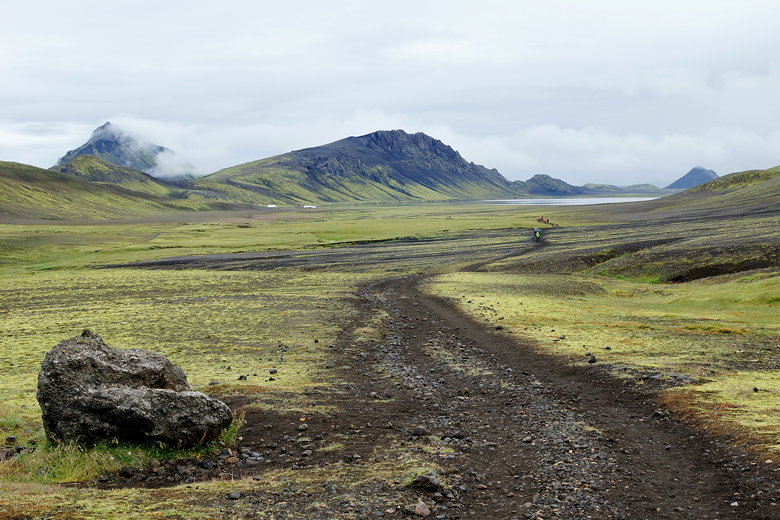
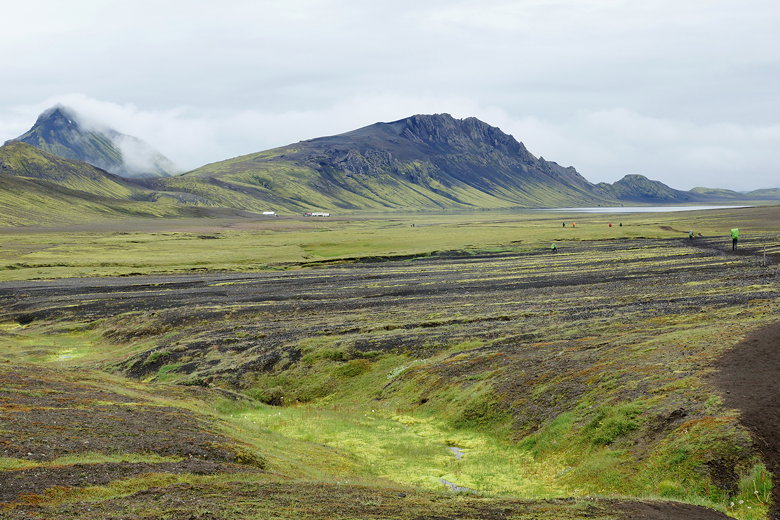
We were the first ones in our hut, arriving around 4:20pm. There are
two huts here, and we were in the smaller building. There are bathrooms
with showers (500 kronen for a hot shower) in a separate building,
and there's even a tiny
restaurant here.
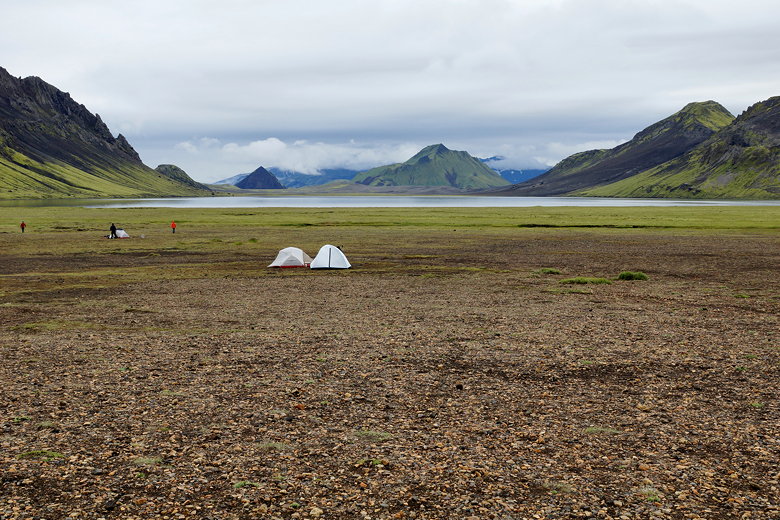
Álftavatn
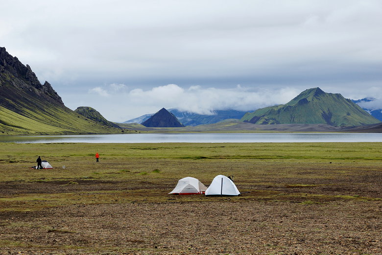
Tents at Álftavatn
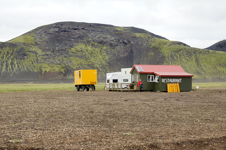
Álftavatn restaurant
Our hut at Álftavatn
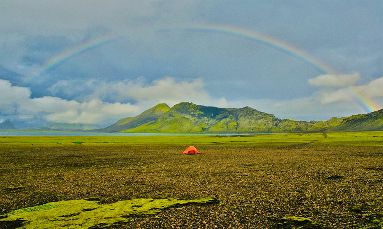
Rainbow at Álftavatn (photo credit: Nathan Gong)
While we dried off our gear in the hut, many people set up their tents near
the lake. While we usually like sleeping in a tent, the prospect of dealing
with a tent either in the rain or after hiking through rain doesn't
appeal to us. So we were glad we had reserved the hut (if you are planning
to use the huts, you'll need to reserve them well in advance). At first
we thought we might have the hut to ourselves. But after dinner,
another family came in about an hour later.
Then, around 8pm, a group of 17 people came in all at once! They didn't
have backpacking gear, so we knew they didn't hike in. We'd later find
out they'd come in two big vans (you can drive here if you have the right
kind of vehicle). Our kids weren't pleased, saying next time we should
stay in a place you can't drive to.
At least the large group left the hut to go have dinner and didn't come
back until about 11pm. We thought they might be going to the restaurant,
but we later learned that they were eating in the larger hut (we heard
this from some people who stayed in that hut and who we'd meet later).
The rain started coming down again around 10pm, and we were glad to be
safe and sound in the hut, even if we knew the large group would return
later.
| 

