|
This is a loop hike, so you can start in either direction. We walked to the trail sign
next to the tent camping area. At first we started down the dirt road, but after going
for a minute or two decided to turn around and go back over the single track.
We followed the green posts past the sauna through the forest (!). We saw mushrooms
next to the trail as it climbed slightly. There's a fork to the right which
leads to a cave. We briefly took it but stopped at the base of the cave
(it's a steep scramble over boulders to enter the cave, so we decided not to
go further), then retraced our steps and continued the climb.
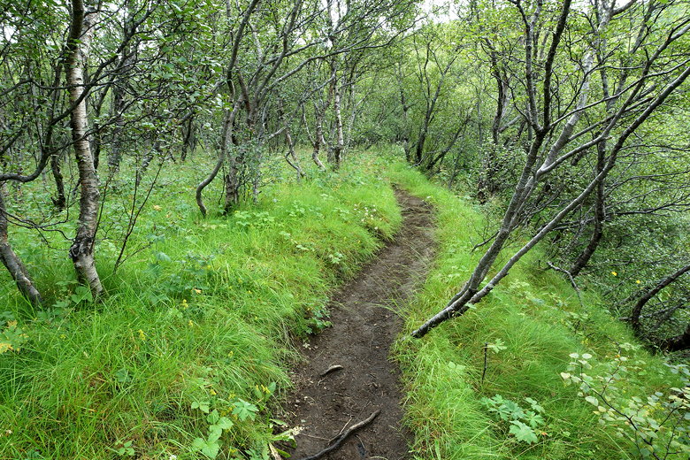
A rare Icelandic forest
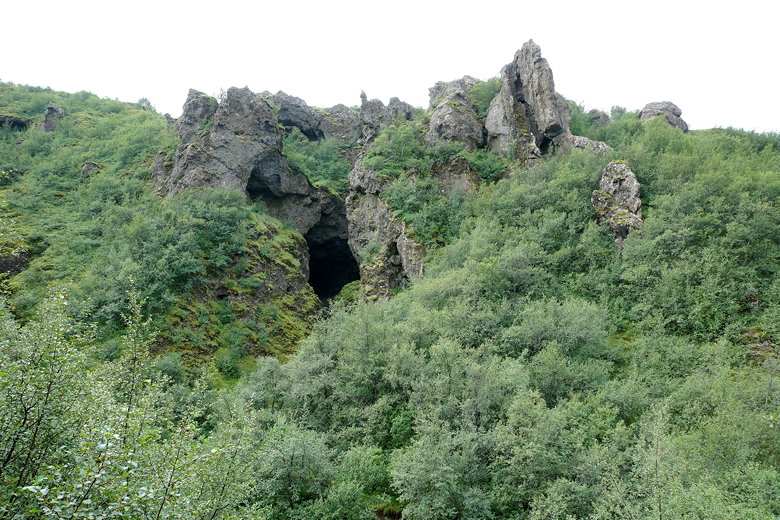
Cave
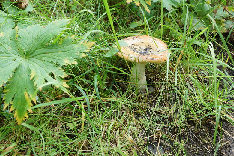
We saw several mushrooms along the forested part of the trail
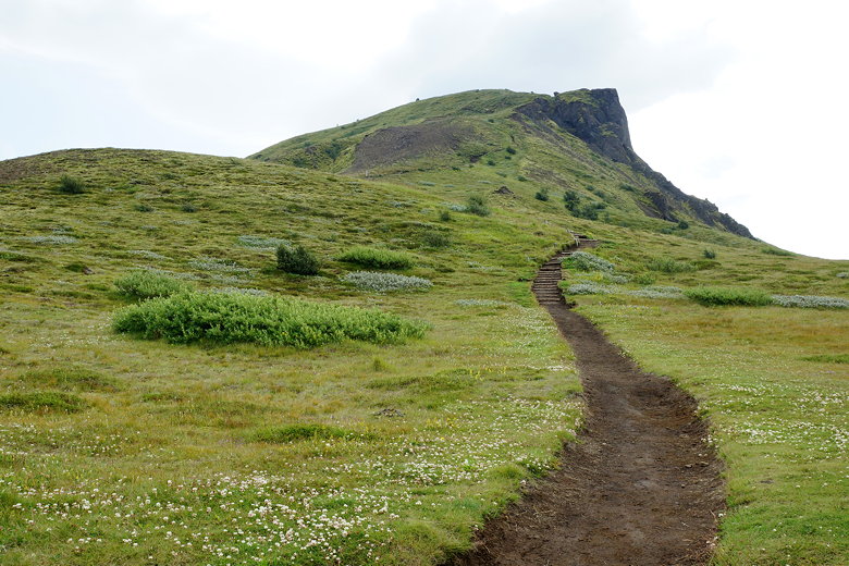
We started to hear pounding sounds as the trail started to climb steeply. We
emerged from the forest and saw the source of the pounding: a couple of
trail workers building a set of wooden stairs. The stairs were already functional
for the most part, and we passed them and admired the view from the
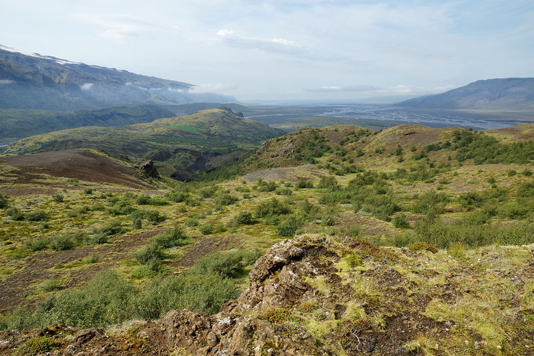
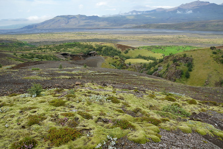
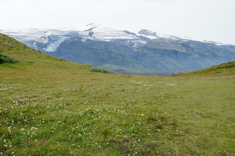
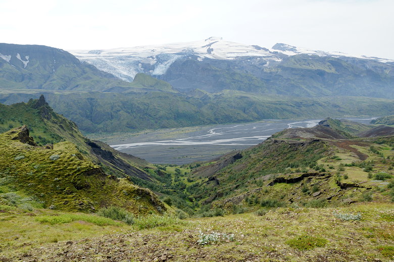
top of the stairs. Looking back over what we just climbed, we could see
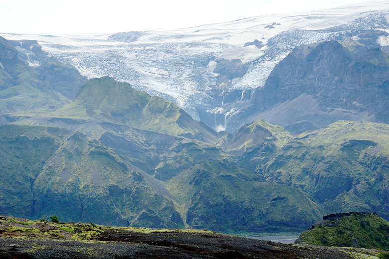
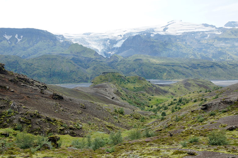
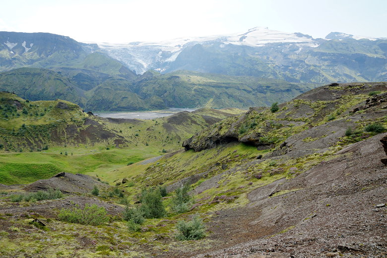
the valley below and the mountains behind them. We could still see the glacier to the right,
as well. Steam appears to come out of the base of the mountains on the other
side, I'm assuming signs of geothermal activity.
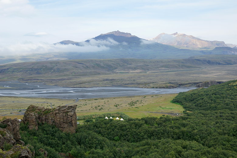
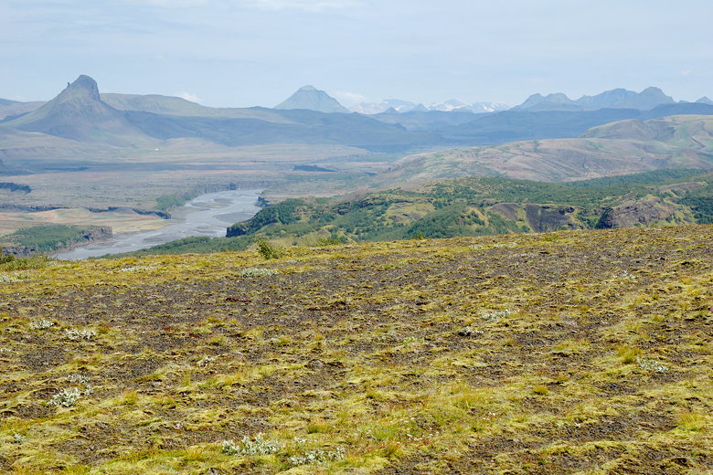
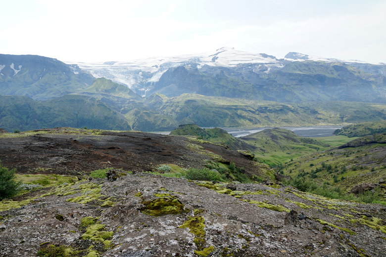
Markarfljot river valley, with Volcano huts visible near the bottom
Mýrdalsjökull glacier
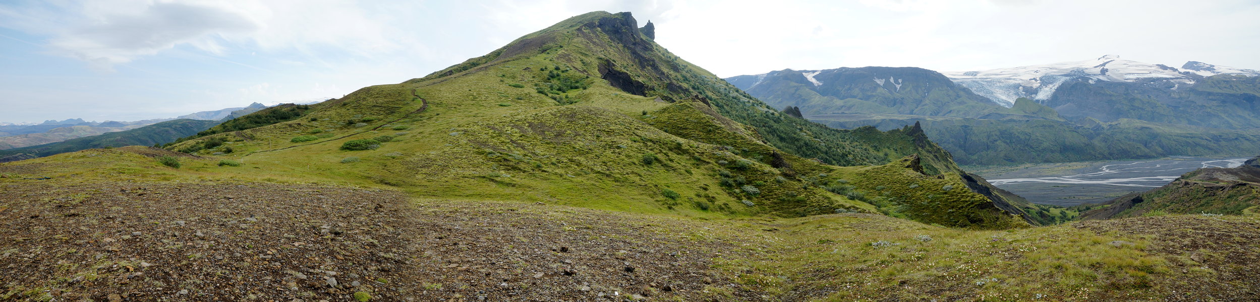
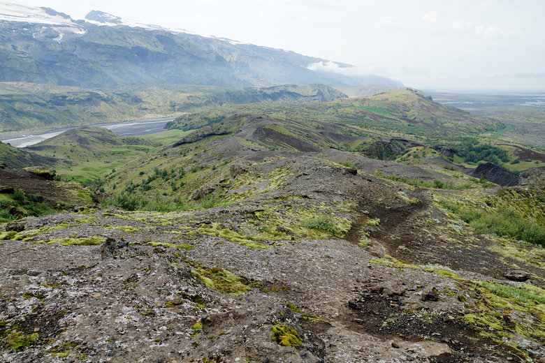
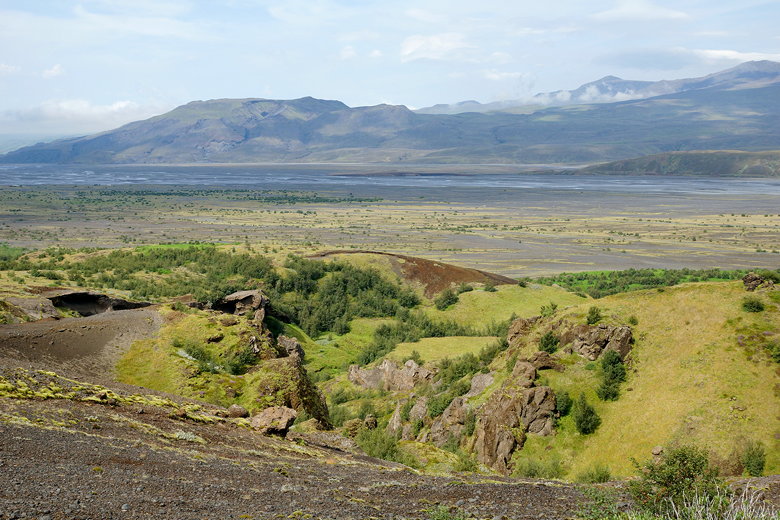
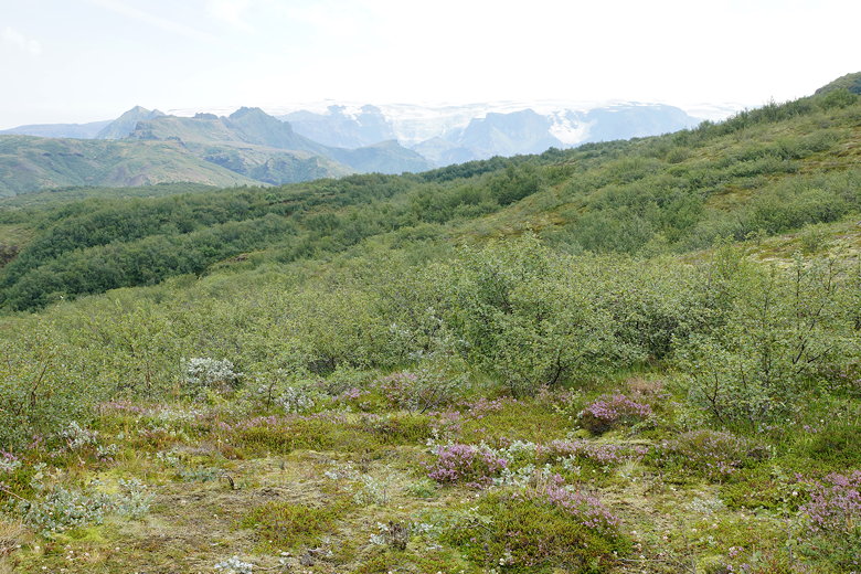
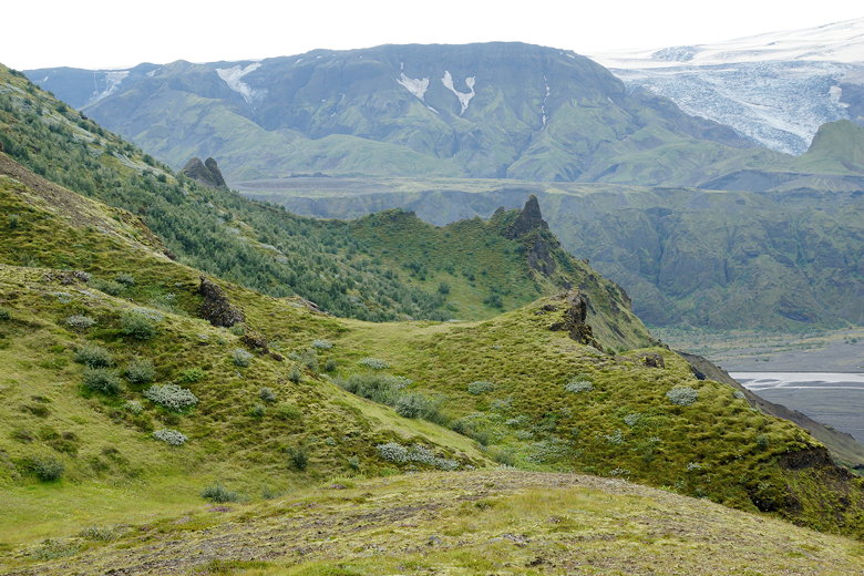
We continued climbing through brushland, soon seeing Valahnúkur rising above us.
We reached a plateau from which we could fairly easily have climbed up to the
top (and we saw several day hikers going to the top from another trail), but
decided to skip it.
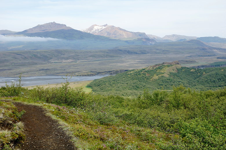
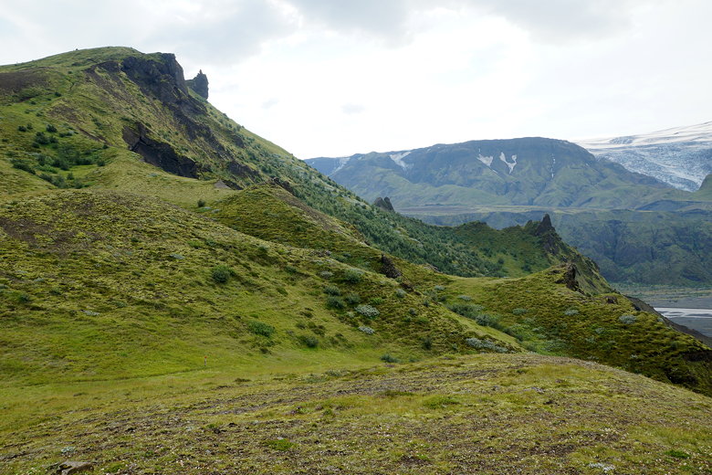
If I had to do it again, I probably would have gone to the top of Valahnúkur,
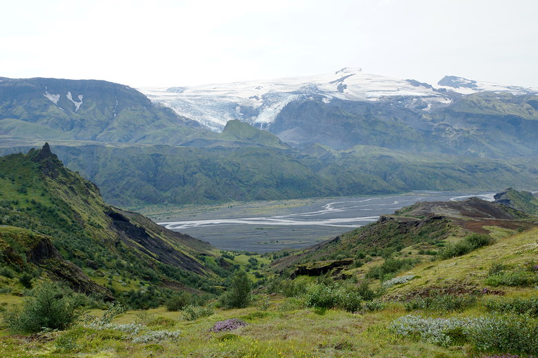
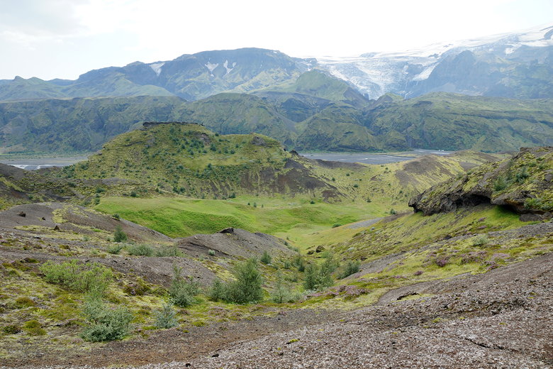
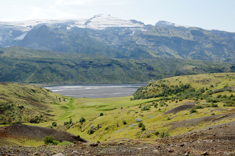
but instead we turned right onto a large plateau which provided tremendous
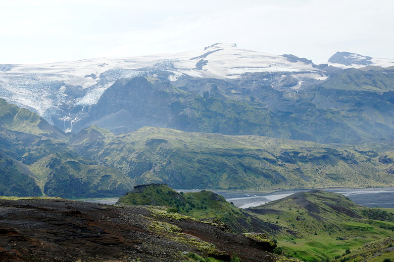
views of the Krossa river valley and the Eyjafjallajökull glacier above it.
A waterfall formed off the edge of one part of the glacier.
Hard to believe, but I'm guessing the views from Valahnúkur are even better.
Markarfljot river valley
Valahnúkur
Eyjafjallajökull glacier

Krossa river valley and Eyjafjallajökull
Krossa river valley and Eyjafjallajökull
Valahnúkur overlooking the Kross river valley
Krossa river valley and Eyjafjallajökull
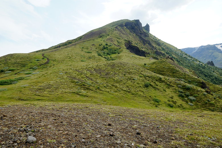
Valahnúkur
|