|
It was a bright sunny but cool fall morning as we prepped in the parking lot.
The visitor centers and mine were closed because of COVID-19, but the park was open
for hiking.
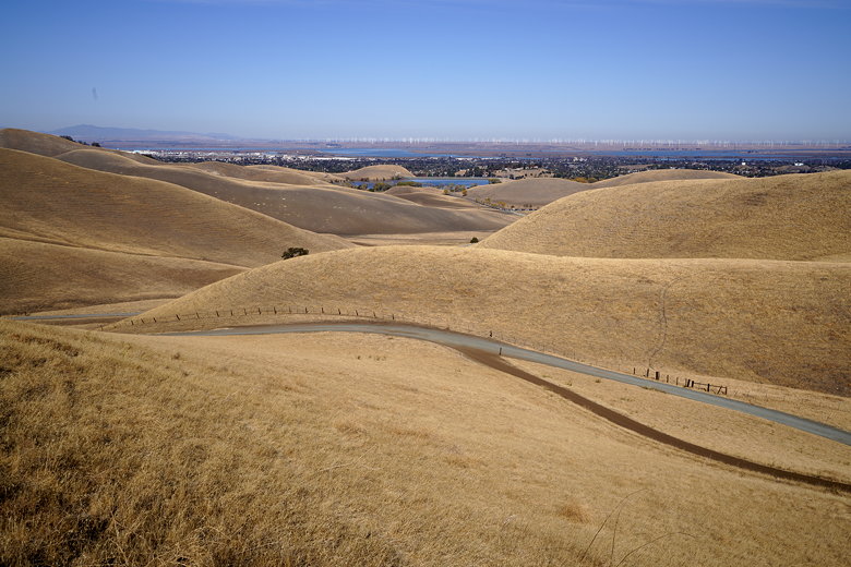
We started off from the parking lot and then almost immediately turned left onto the
Stewartville Trail. It's a wide dirt fire road with little shade. You definitely
don't want to be here in the dead of summer. But here in the fall the temperatures
were pleasant. The hills were golden, but will turn green in the spring.
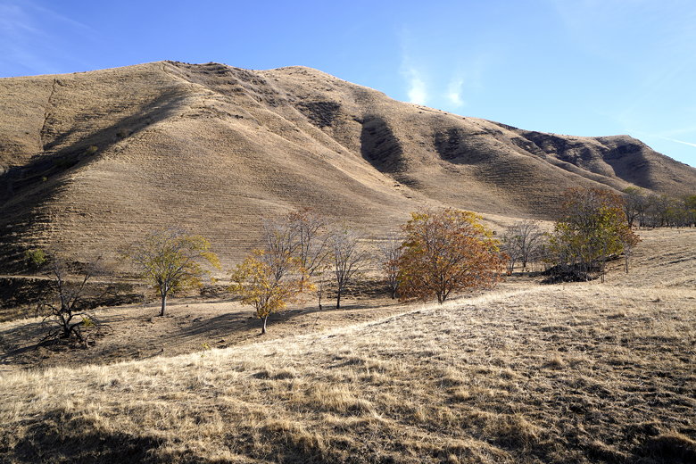
View from the start of the Stewartville Trail
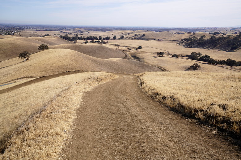
The trail starts climbing from the start, and we soon reached an intersection and
the start of the loop section of our hike. To the left was the Ridge Trail, and to
our right was the continuation of the Stewartville Trail. We could have taken either,
but we decided to continue on the Stewartville Trail.
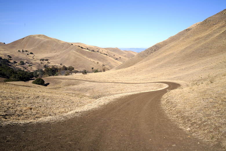
Looking back down the Stewartville Trail
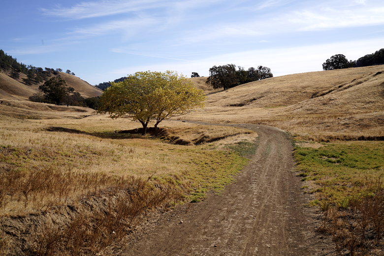
Tree next to the Stewartville Trail
There's shortly a narrow side trail to the left - the Miners Trail. You could take
it, or continue on the Stewartville Trail - they both end up in the same place, but
the Miners Trail is slightly shorter. We continued on the Stewartville Trail as it
started a descent.
The trail levels off for a bit at the bottom, and passes the Stewartville Backpack
Camp. Yes, you can do a short backpacking trip into the park, although the
camp is currently closed due to COVID-19.
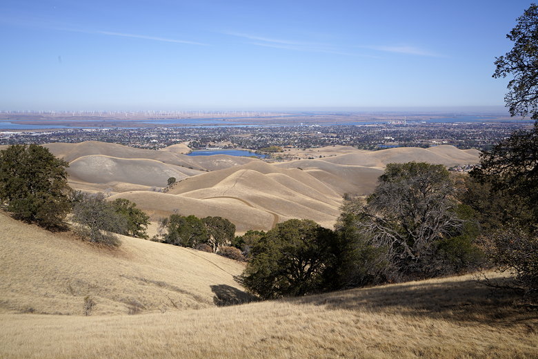
We continued along the mostly flat trail now, but it soon started climbing again.
We mistakenly missed the turn for the Ridge Trail, but shortly retraced our steps
a couple minutes and started up the steep Ridge Trail. As we climbed, we got
better and better views looking to the north. We could see what I'm guessing is
Contra Loma reservoir, Antioch, Suisun Bay, and the windmills of Montezuma Hills.
Mining remnants
Looking north from the Ridge Trail
Looking back (east) along the Ridge Trail
After a tough climb, the trail levels off and then descends to the intersection where
we had started our loop. We now returned toward the parking lot on the Stewartville
Trail. However, before we got there, we turned left and then right toward the
Rose Hill Cemetery. It's a short but tough little climb up to the cemetery.
Looking north from further up the Ridge Trail
The park used to be the site of coal mining, with Stewartville, Somersville, and Nortonville
Townsites. Over 200 residents of those old towns are buried at Rose Hill Cemetery, dating
from the latter half of the 1800s. Many of the headstones remain, despite
some vandalism.
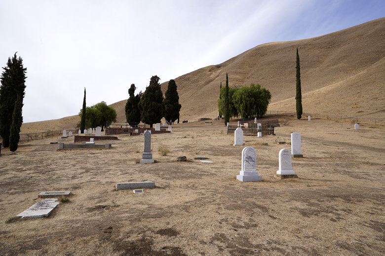
Rose Hill Cemetery
After touring the area, we returned to the now-full parking lot. If you arrive late and
have to park in the main lot near the visitor center, it's about 0.8 miles from there
to the secondary lot.
| 

