|
I knew parking at Sunol is sometimes a challenge, so we tried to get there a bit
earlier than usual. We arrived around 9:15am. Already, there wasn't parking at
the visitor's center or at the trailhead parking. But there was plenty of parking
down the road, a few minutes walk away.
Yesterday it had been pouring rain, perhaps a final rain before the dry season,
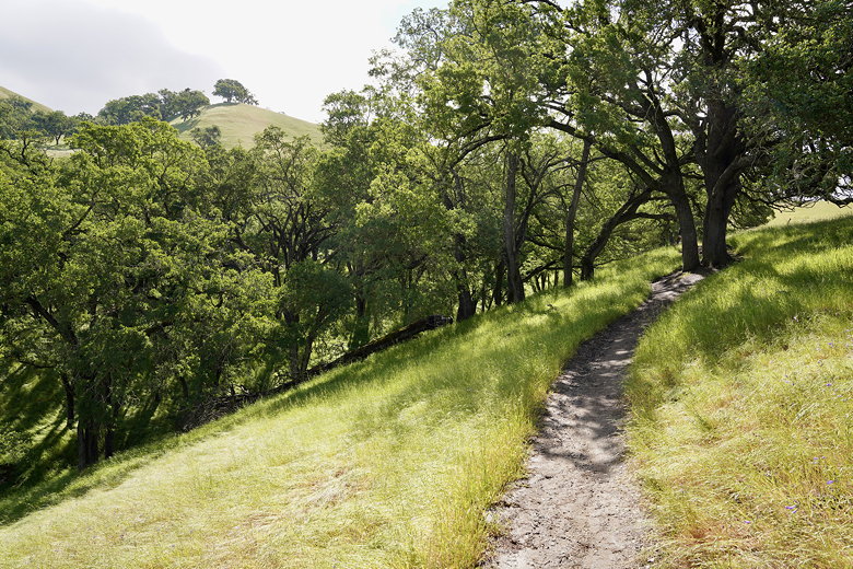
but today it was clear and sunny. We crossed the bridge and turned right onto
Canyon View Trail. This parallels Indian Joe Creek. It's a wide trail but at
some point we stopped paying attention and ended up on a narrow overgrown
"trail" that stayed next to the creek. After a few minutes we realized we'd
missed a turn and back-tracked, then continued up the Canyon View Trail. There
had been a line of rocks and a sign pointing the way, so it should have been
obvious if we had been paying attention.
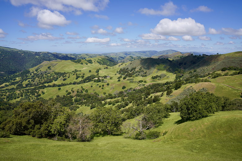
The trail now starts climbing, a bit steeply at times. We could look to our
right and look down at the creek and parking lot below. Rolling green hills
spread out in most directions. In another month they'll probably be brown.
We turned left onto the McCorkle Trail.
As we continued to climb, we started to encounter cows, some of them close to or even
on the trail itself. It was easy enough to navigate around them, though.
View from the McCorkle Trail

View from the McCorkle Trail

View from the McCorkle Trail
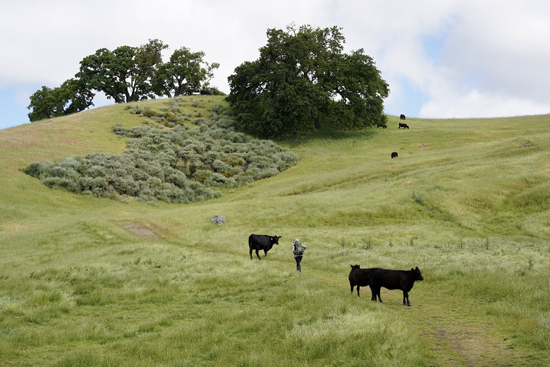
Cows on the McCorkle Trail

Avoiding the cows
Cows on the McCorkle Trail
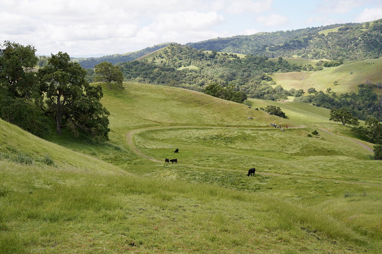
After a short snack break we turned left to continue on the McCorkle Trail. Many
of the trails in the park are wide dirt roads, though there are a few narrow trails.
This trail was one of the wide ones. As we climbed some more we could now see
Calaveras Reservoir behind us to the southwest. We then reached an intersection
with a small pond. A large group of hikers was there, looking down at a swarm of
ants on the ground. One of the group asked if anyone had a magnifying glass. It
didn't dawn on me until a minute later what he meant.

Calaveras Reservoir

Pond at the top

Cow staring at us
We turned left and and then left again onto Cave Rocks Road, where we stopped at
a bench for another short snack break. This bench provides great views of the area.
After our break we continued on Cave Rocks Road, then turned right onto Eagle View
Trail. This is a narrow trail that crosses a small stream.
At the next intersection we turned left onto Vista Grande and shortly took a
side trail to another bench with a view. We stopped here for a while, admiring
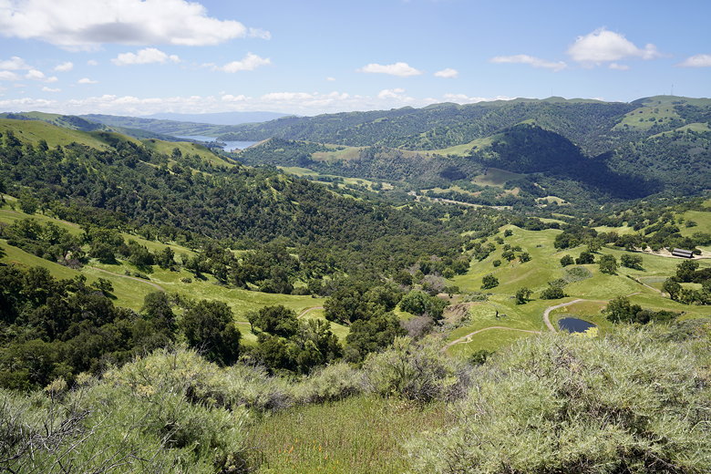
the view and also watching the raptors flying below. From here we could clearly
see Calaveras Reservoir to the south, the parking lots below, the transmission
towers between Monument Peak and Mission Peak to the west, and what was probably
Fremont to the northwest.
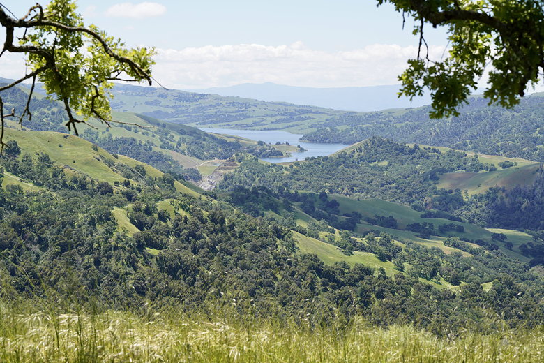
View from the bench

Stream on the Eagle View trail
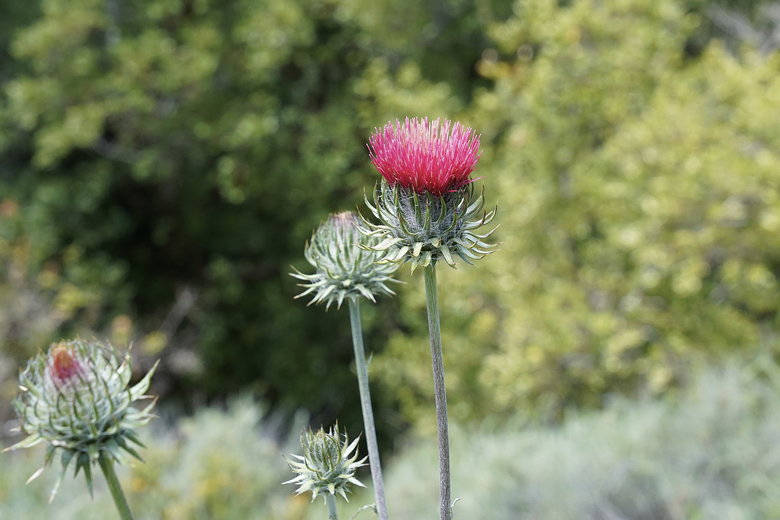
Thistle on the Eagle View trail
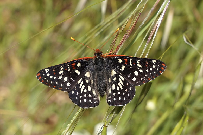
Butterfly on the Eagle View trail
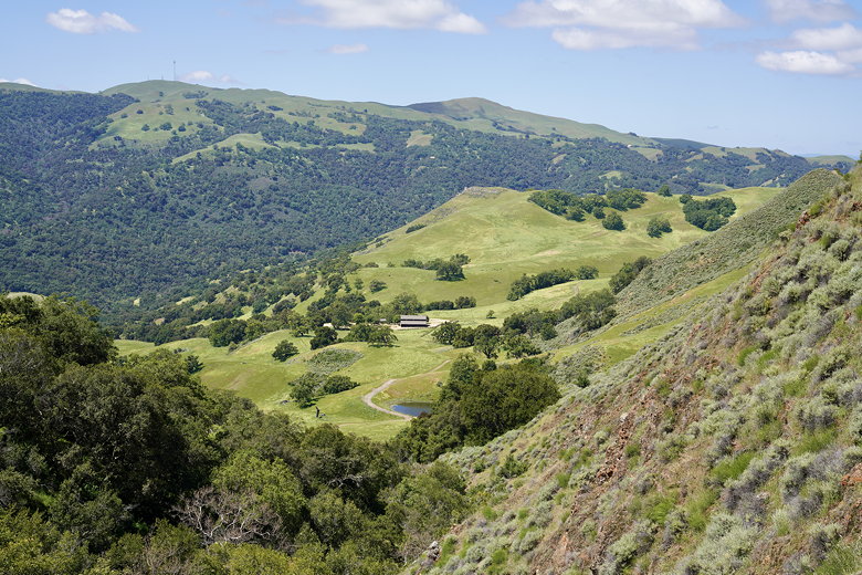
View from the Eagle View trail
View from the Eagle View trail
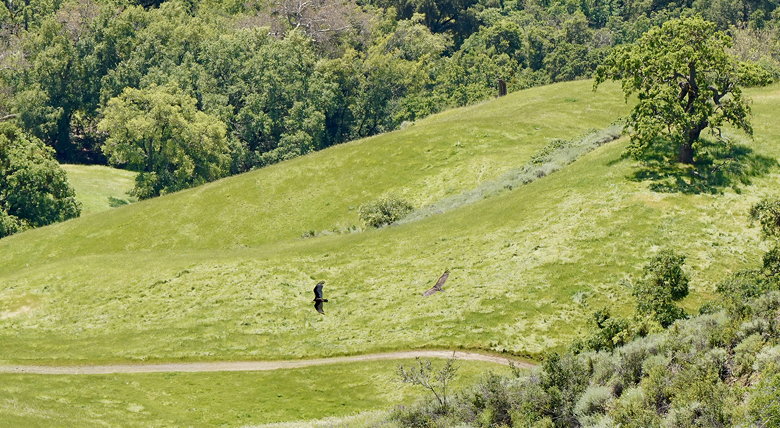
Two raptors as seen from the bench
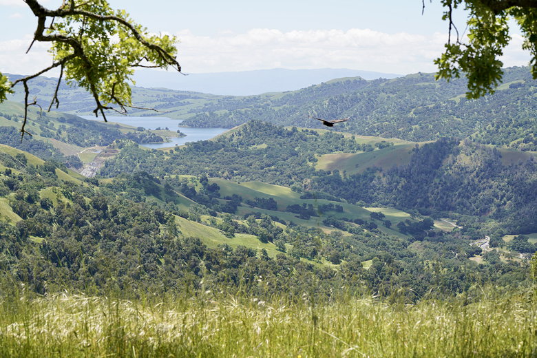
Raptor and Calaveras Reservoir

Raptor
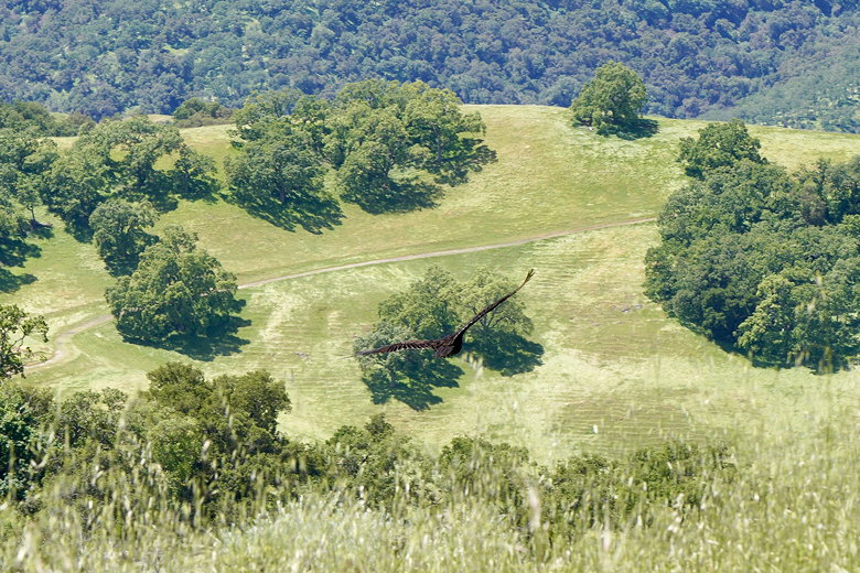
Raptor
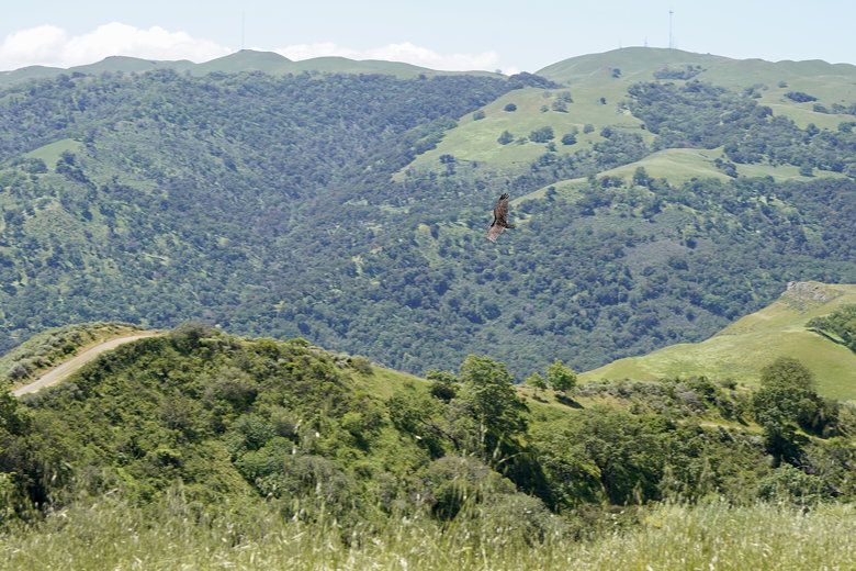
Raptor
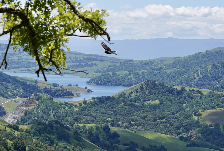
Raptor and Calaveras Reservoir
Calaveras Reservoir view from the bench
After our break we continued on Vista Grande as it started to descend.
At the next intersection we turned left onto Hayfield and then left again onto
Cave Rocks Road. After passing some solar panels (which seemed out of place),
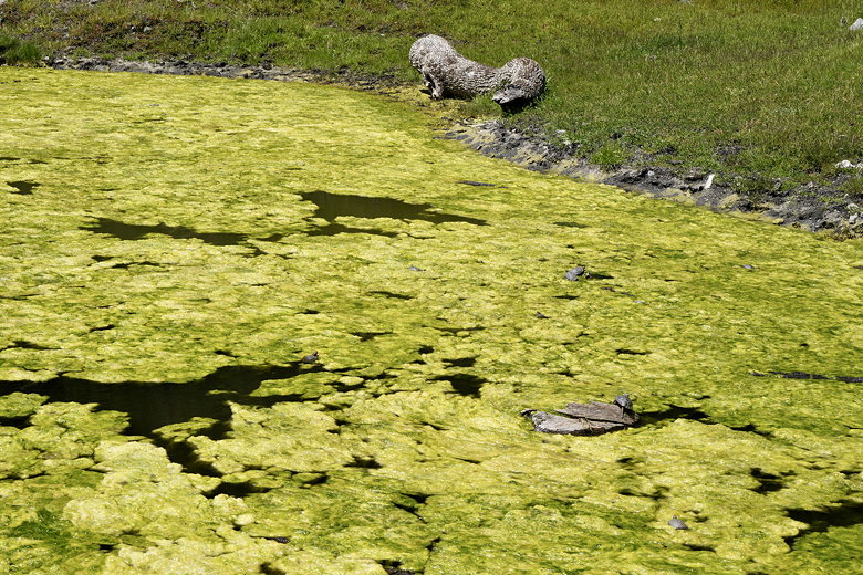
we reached a pond partly covered in algae. There were 4 others there looking at
something in the water. We found out there were lots of turtles in the pond,
sunning themselves amidst the algae. There were also lots of tadpoles swimming
in the water.
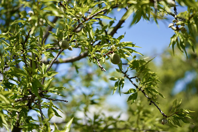
Almond tree next to the trail
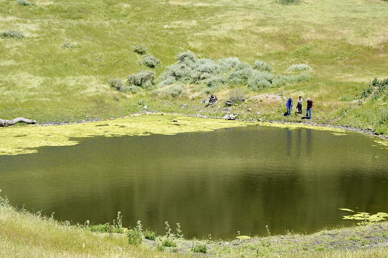
Pond full of turtles

Turtle
Algae pond and turtles
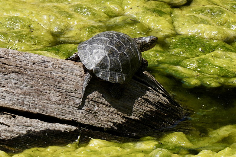
Turtle on driftwood
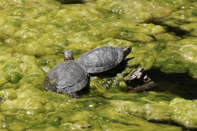
Two turtles
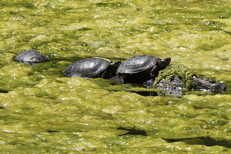
Three turtles

Turtle crawling out of the pond
After stopping to watch and photograph the turtles, we continued on Cave Rocks
Road and soon turned right onto the Indian Joe Creek Trail. This trail
descends, very steeply at times, and roughly parallels the creek. It also crosses
it a few times. It was easily rock-hopped and isn't very wide anyway.
Eventually we rejoined the Canyon View Trail, then turned left to cross the bridge
that we'd crossed at the beginning of the hike. Note: I hiked some of the same trails back
in 1996, though I didn't have GPS back then so I don't know exactly which trails
we took then. Also, that was in October so the hills were brown. We didn't see any
turtles on that hike, though we did see cows.
| 

